Constitution Avenue
Encyclopedia

Washington, D.C.
Washington, D.C., formally the District of Columbia and commonly referred to as Washington, "the District", or simply D.C., is the capital of the United States. On July 16, 1790, the United States Congress approved the creation of a permanent national capital as permitted by the U.S. Constitution....
, Constitution Avenue is a major east-west street running just north of the United States Capitol
United States Capitol
The United States Capitol is the meeting place of the United States Congress, the legislature of the federal government of the United States. Located in Washington, D.C., it sits atop Capitol Hill at the eastern end of the National Mall...
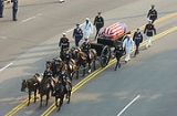
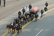
in the city's Northwest and Northeast quadrants. The avenue carries heavy commuter traffic on weekdays and heavy tourist traffic on the weekends; it is also an important parade route.
Washington City Canal

Pennsylvania Avenue
Pennsylvania Avenue is a street in Washington, D.C. that joins the White House and the United States Capitol. Called "America's Main Street", it is the location of official parades and processions, as well as protest marches...
was once the Washington City Canal
Washington City Canal
The Washington City Canal operated from 1815 until the mid-1850s in Washington, D.C. The canal connected the Anacostia River, called the "Eastern Branch" at that time, to Tiber Creek, the Potomac River, and later the Chesapeake and Ohio Canal...
.
Construction on the canal
Canal
Canals are man-made channels for water. There are two types of canal:#Waterways: navigable transportation canals used for carrying ships and boats shipping goods and conveying people, further subdivided into two kinds:...
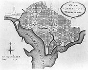
, which was part of Pierre (Peter) Charles L'Enfant's original plan for the city, began substantially in 1810. Tiber Creek
Tiber Creek
Tiber Creek or Tyber Creek was a tributary of the Potomac River in Washington, D.C.Originally known as Goose Creek, it was renamed after Rome's Tiber River as the lands southeast of then Georgetown, Maryland, were selected for the City of Washington, the new capital of the United States...
was transformed into the northern portion of the City Canal, which ran along what is today Constitution Avenue, eventually working its way towards the U.S. Capitol and southward to the Anacostia River
Anacostia River
The Anacostia River is a river in the Mid Atlantic region of the United States. It flows from Prince George's County in Maryland into Washington, D.C., where it joins with the Washington Channel to empty into the Potomac River at Buzzard Point. It is approximately long...
. The canal began operation in 1815.
It is believed that early city plans called for an extensive network of canals snaking through the Northeast corridor of the United States
United States
The United States of America is a federal constitutional republic comprising fifty states and a federal district...
. By the 1850s, the canal had fallen into disuse, and in the 1870s, the city began to convert the Tiber Creek portion of the canal to an underground tunnel
Tunnel
A tunnel is an underground passageway, completely enclosed except for openings for egress, commonly at each end.A tunnel may be for foot or vehicular road traffic, for rail traffic, or for a canal. Some tunnels are aqueducts to supply water for consumption or for hydroelectric stations or are sewers...
. It had become common for Washington residents to throw their garbage into it, and the unsanitary conditions became a health concern. Additionally, plans for an extensive canal system were abandoned around this time in favor of a railroad system that would connect Washington to the West
Western United States
.The Western United States, commonly referred to as the American West or simply "the West," traditionally refers to the region comprising the westernmost states of the United States. Because the U.S. expanded westward after its founding, the meaning of the West has evolved over time...
. These canal plans were not successful. After the Baltimore and Ohio Railroad
Baltimore and Ohio Railroad
The Baltimore and Ohio Railroad was one of the oldest railroads in the United States and the first common carrier railroad. It came into being mostly because the city of Baltimore wanted to compete with the newly constructed Erie Canal and another canal being proposed by Pennsylvania, which...
built tracks into the city, city officials abandoned their plans for their own rail system. Other portions of the canal were also paved over.
Original street name
In Washington's Cartesian-coordinate-basedCartesian coordinate system
A Cartesian coordinate system specifies each point uniquely in a plane by a pair of numerical coordinates, which are the signed distances from the point to two fixed perpendicular directed lines, measured in the same unit of length...
street system
Street name
A street name or odonym is an identifying name given to a street. The street name usually forms part of the address...
, Constitution Avenue was originally known as North B Street. If it had stayed in the city's lettered street system, it would today be known as B Street NW and NE. The street on the other side of the Anacostia River
Anacostia River
The Anacostia River is a river in the Mid Atlantic region of the United States. It flows from Prince George's County in Maryland into Washington, D.C., where it joins with the Washington Channel to empty into the Potomac River at Buzzard Point. It is approximately long...
corresponding to Constitution Avenue is called Blaine Street NE. B Street NW was regraded, repaved, and substantially widened between 1926 and 1927 after Congress passed a $75 million construction bill for the District of Columbia. The new street was renamed Constitution Avenue in February 1931.
Route numbers
Sections of Constitution Avenue are designated U.S. Route 1U.S. Route 1
U.S. Route 1 is a major north–south U.S. Highway that serves the East Coast of the United States. It runs 2,377 miles from Fort Kent, Maine at the Canadian border south to Key West, Florida. U.S. 1 generally parallels Interstate 95, though it is significantly farther west between...
, U.S. Route 50
U.S. Route 50
U.S. Route 50 is a major east–west route of the U.S. Highway system, stretching just over from Ocean City, Maryland on the Atlantic Ocean to West Sacramento, California. Until 1972, when it was replaced by Interstate Highways west of the Sacramento area, it extended to San Francisco, near...
, or both. Specifically, U.S. 50 runs along the road from its west end to Sixth Street NW (eastbound) and Ninth Street NW (westbound). U.S. 1 northbound uses the eastbound lanes of Constitution Avenue from 14th Street NW
14th Street Northwest and Southwest (Washington, D.C.)
Fourteenth Street is a street in Northwest and Southwest Washington, D.C., located 1¼ mi. west of the U.S. Capitol. It runs from the 14th Street Bridge north to Eastern Avenue....
to Sixth Street NW; southbound U.S. 1 used to run west from Ninth Street NW to 15th Street NW but now continues straight through the Ninth Street Tunnel to I-395
Interstate 395 (District of Columbia-Virginia)
Interstate 395 in Washington, D.C., and Virginia is a 13 mile long spur route that begins at a junction with Interstate 95 in Springfield, Virginia and ends in northwest Washington, D.C. It passes underneath the National Mall near the United States Capitol and ends at a junction with U.S...
.
Termini
The western terminus of Constitution Avenue is the Theodore Roosevelt BridgeTheodore Roosevelt Bridge
The Theodore Roosevelt Bridge is located in Washington, D.C. It carries Interstate 66 and U.S. Highway 50 over the Potomac River near the Kennedy Center, connecting the Rosslyn area of Arlington, Virginia, with Washington...
; thus, Constitution Avenue connects the city's ceremonial core with Interstate 66
Interstate 66
Interstate 66 is an Interstate Highway in the eastern United States. As indicated by its even route number, it runs in an east–west direction. Its western terminus is at Middletown, Virginia, at an intersection with Interstate 81; its eastern terminus is in Washington, D.C., at an...
. The eastern terminus is at 21st Street NE, just short of Robert F. Kennedy Memorial Stadium
Robert F. Kennedy Memorial Stadium
Robert F. Kennedy Memorial Stadium is a multi-purpose stadium, in Washington, D.C., United States, and the current home of MLS's D.C. United....
. Through traffic is diverted via North Carolina Avenue and C Street to the Whitney Young Memorial Bridge
Whitney Young Memorial Bridge
The Whitney Young Memorial Bridge is a bridge that carries East Capitol Street across the Anacostia River in Washington, D.C. Finished in 1955, it was originally called the East Capitol Street Bridge. It was renamed for civil rights activist Whitney Young in early 1974...
.
Locations of interest along the Avenue

National Mall
The National Mall is an open-area national park in downtown Washington, D.C., the capital of the United States. The National Mall is a unit of the National Park Service , and is administered by the National Mall and Memorial Parks unit...
from the Federal Triangle
Federal Triangle
The Federal Triangle is a triangular area in Washington, D.C. formed by 15th Street NW, Constitution Avenue NW, Pennsylvania Avenue NW, and E Street NW. Federal Triangle is occupied by 10 large city and federal office buildings, all of which are part of the Pennsylvania Avenue National Historic...
. The avenue is lined on its north side by the headquarters of several federal agencies, and on the south side by several Smithsonian
Smithsonian Institution
The Smithsonian Institution is an educational and research institute and associated museum complex, administered and funded by the government of the United States and by funds from its endowment, contributions, and profits from its retail operations, concessions, licensing activities, and magazines...
museums, the National Gallery of Art
National Gallery of Art
The National Gallery of Art and its Sculpture Garden is a national art museum, located on the National Mall between 3rd and 9th Streets at Constitution Avenue NW, in Washington, DC...
, Vietnam Veterans Memorial
Vietnam Veterans Memorial
The Vietnam Veterans Memorial is a national memorial in Washington, D.C. It honors U.S. service members of the U.S. armed forces who fought in the Vietnam War, service members who died in service in Vietnam/South East Asia, and those service members who were unaccounted for during the War.Its...
, Constitution Gardens
Constitution Gardens
Constitution Gardens is a park area in Washington, D.C., United States, located within the boundaries of the National Mall. The park is bounded on the west by the Vietnam Veterans Memorial, on the east by 17th St NW, on the north by Constitution Avenue, and on the south by the Reflecting Pool...
, and the Lincoln Memorial
Lincoln Memorial
The Lincoln Memorial is an American memorial built to honor the 16th President of the United States, Abraham Lincoln. It is located on the National Mall in Washington, D.C. The architect was Henry Bacon, the sculptor of the main statue was Daniel Chester French, and the painter of the interior...
. Other locations of interest include the Embassy of Canada, Organization of American States
Organization of American States
The Organization of American States is a regional international organization, headquartered in Washington, D.C., United States...
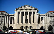
, National Academy of Sciences
United States National Academy of Sciences
The National Academy of Sciences is a corporation in the United States whose members serve pro bono as "advisers to the nation on science, engineering, and medicine." As a national academy, new members of the organization are elected annually by current members, based on their distinguished and...
, and National Science Foundation
National Science Foundation
The National Science Foundation is a United States government agency that supports fundamental research and education in all the non-medical fields of science and engineering. Its medical counterpart is the National Institutes of Health...
. The relocated U.S. Capitol Gatehouses and Gateposts
U.S. Capitol Gatehouses and Gateposts
The U.S. Capitol Gatehouses and Gateposts — designed circa 1827 by celebrated architect Charles Bulfinch — originally stood on the grounds of the United States Capitol in Washington, D.C....
are at Constitution and 15th Street. In Northeast, the avenue passes through the Capitol Hill
Capitol Hill, Washington, D.C.
Capitol Hill, aside from being a metonym for the United States Congress, is the largest historic residential neighborhood in Washington D.C., stretching easterly in front of the United States Capitol along wide avenues...
and Lincoln Park neighborhoods.
National Highway System
Between Louisiana Avenue and Interstate 66, Constitution Avenue is part of the National Highway SystemNational Highway System (United States)
The National Highway System is a network of strategic highways within the United States, including the Interstate Highway System and other roads serving major airports, ports, rail or truck terminals, railway stations, pipeline terminals and other strategic transport facilities.Individual states...
.
Current Status
Starting April 11, 2011, Constitution Avenue between 15th and 23rd Streets, N.W., will undergo at 9 month, $10.3 million rebuilding, including replacement of the underlying concrete slabs, and asphalt surface over it. Curbs, crosswalks, lights, and sidewalks will also be replaced. Exceptions will be made, allowing the Avenue to remain open during major events including the White House Easter Egg Roll, Rolling ThunderRolling Thunder
Rolling Thunder Inc. is a class 501 non-profit organization which is dedicated to the search for American military personnel who are prisoners of war "POW"/missing in action "MIA". Rolling Thunder was established in 1987 and incorporated in 1995. All Rolling Thunder members are non-paid including...
, July 4, the Marine Corps Marathon
Marine Corps Marathon
The Marine Corps Marathon is an annual marathon held in Arlington, Virginia and Washington, DC. The mission of the MCM is to promote physical fitness, generate community goodwill and showcase the organizational skills of the United States Marine Corps....
, the National Christmas Tree Lighting, and on national holidays. (source: Washington Post article, March 21, 2011).

