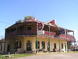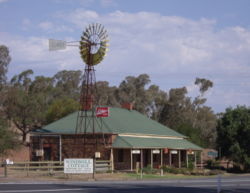
Coolac, New South Wales
Encyclopedia
Coolac is a village in the Riverina
region of New South Wales
, Australia
in Gundagai Shire
. At the 2006 census
, Coolac had a population of 386 people.
The place name Coolac is derived from the local Aboriginal
name for a plant which was abundant in the area and also from the Aboriginal word meaning "native bear".
Coolac Post Office opened on 1 June 1870.
The 11 kilometre section of the Hume Highway
at Coolac was the last two-lane section of highway between Sydney and the Sturt Highway interchange. Since 1986, plans had been drawn-up for the Coolac bypass, with a review of environmental factors report completed in 1997 but construction did not commence until May 2007 with the project opening in August 2009 - Under AusLink
.
In August 2009 the Coolac bypass was officially opened.
 The satirical Bald Archy art competition (named from the more prestigious Archibald Prize
) began in Coolac at the Coolac Festival of Fun, launched by Peter Batey. The home of this competition is now the Museum of the Riverina
in Wagga Wagga and it also travels to Sydney
and Melbourne
for exhibition once Maude the Cockatoo, who is the official judge, selects the winning entries each year.
assemblage. The distinctive rock assemblage over a 130 hectare site provides insights into events in the continental evolution of eastern Australia. The rocks here were part of the oceanic crust
and mantle
, normally not exposed on the Earth's surface. The rock from the mantle is called Coolac Serpentinite
.
Riverina
The Riverina is an agricultural region of south-western New South Wales , Australia. The Riverina is distinguished from other Australian regions by the combination of flat plains, warm to hot climate and an ample supply of water for irrigation. This combination has allowed the Riverina to develop...
region of New South Wales
New South Wales
New South Wales is a state of :Australia, located in the east of the country. It is bordered by Queensland, Victoria and South Australia to the north, south and west respectively. To the east, the state is bordered by the Tasman Sea, which forms part of the Pacific Ocean. New South Wales...
, Australia
Australia
Australia , officially the Commonwealth of Australia, is a country in the Southern Hemisphere comprising the mainland of the Australian continent, the island of Tasmania, and numerous smaller islands in the Indian and Pacific Oceans. It is the world's sixth-largest country by total area...
in Gundagai Shire
Gundagai Shire Council
Gundagai Shire is a local government area in the Riverina region of New South Wales, Australia, on the Hume Highway. Gundagai was declared a Municipality in 1889, and Adjungbilly Shire Council created in 1906 to administer the district...
. At the 2006 census
Census in Australia
The Australian census is administered once every five years by the Australian Bureau of Statistics. The most recent census was conducted on 9 August 2011; the next will be conducted in 2016. Prior to the introduction of regular censuses in 1961, they had also been run in 1901, 1911, 1921, 1933,...
, Coolac had a population of 386 people.
The place name Coolac is derived from the local Aboriginal
Indigenous Australians
Indigenous Australians are the original inhabitants of the Australian continent and nearby islands. The Aboriginal Indigenous Australians migrated from the Indian continent around 75,000 to 100,000 years ago....
name for a plant which was abundant in the area and also from the Aboriginal word meaning "native bear".
Coolac Post Office opened on 1 June 1870.
The 11 kilometre section of the Hume Highway
Hume Highway
The Hume Highway/Hume Freeway is one of Australia's major inter-city highways, running for 880 km between Sydney and Melbourne. It is part of the Auslink National Network and is a vital link for road freight to transport goods to and from the two cities as well as serving Albury-Wodonga and...
at Coolac was the last two-lane section of highway between Sydney and the Sturt Highway interchange. Since 1986, plans had been drawn-up for the Coolac bypass, with a review of environmental factors report completed in 1997 but construction did not commence until May 2007 with the project opening in August 2009 - Under AusLink
AusLink
AusLink was an Australian Government land transport funding program, established in June 2004 and administered by the Department of Transport and Regional Services. In 2009 it was replaced with the Nation Building Program under the Nation Building Program Act 2009...
.
In August 2009 the Coolac bypass was officially opened.

Archibald Prize
The Archibald Prize is regarded as the most important portraiture prize in Australia. It was first awarded in 1921 after a bequest from J. F. Archibald, the editor of The Bulletin who died in 1919...
) began in Coolac at the Coolac Festival of Fun, launched by Peter Batey. The home of this competition is now the Museum of the Riverina
Museum of the Riverina
The Museum of the Riverina is a local history museum in Wagga Wagga, New South Wales, Australia. The Riverina is the region in south-western New South Wales in which Wagga Wagga is located. The museum was established by Wagga Wagga and District Historical Society in 1967 The Museum of the Riverina...
in Wagga Wagga and it also travels to Sydney
Sydney
Sydney is the most populous city in Australia and the state capital of New South Wales. Sydney is located on Australia's south-east coast of the Tasman Sea. As of June 2010, the greater metropolitan area had an approximate population of 4.6 million people...
and Melbourne
Melbourne
Melbourne is the capital and most populous city in the state of Victoria, and the second most populous city in Australia. The Melbourne City Centre is the hub of the greater metropolitan area and the Census statistical division—of which "Melbourne" is the common name. As of June 2009, the greater...
for exhibition once Maude the Cockatoo, who is the official judge, selects the winning entries each year.
Coolac Geological Site
The Coolac Geological Site 4km north-east of Coolac, is the best known example in Australia of a substantial ophioliteOphiolites
An ophiolite is a section of the Earth's oceanic crust and the underlying upper mantle that has been uplifted and exposed above sea level and often emplaced onto continental crustal rocks...
assemblage. The distinctive rock assemblage over a 130 hectare site provides insights into events in the continental evolution of eastern Australia. The rocks here were part of the oceanic crust
Oceanic crust
Oceanic crust is the part of Earth's lithosphere that surfaces in the ocean basins. Oceanic crust is primarily composed of mafic rocks, or sima, which is rich in iron and magnesium...
and mantle
Mantle (geology)
The mantle is a part of a terrestrial planet or other rocky body large enough to have differentiation by density. The interior of the Earth, similar to the other terrestrial planets, is chemically divided into layers. The mantle is a highly viscous layer between the crust and the outer core....
, normally not exposed on the Earth's surface. The rock from the mantle is called Coolac Serpentinite
Serpentinite
Serpentinite is a rock composed of one or more serpentine group minerals. Minerals in this group are formed by serpentinization, a hydration and metamorphic transformation of ultramafic rock from the Earth's mantle...
.

