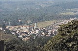
Cotia
Encyclopedia
Cotia is a city in the state of São Paulo
in Brazil
. The population in 2006 was 179,685. The city is at an altitude of 853 m, its density is 554.77/km² and the area is 324 km². Cotia is linked with the Rodovia Raposo Tavares
highway.
and his companions arrived in the city. The "Sítio do Mandú" and "Sítio do Padre Inácio" (Mandu's Ranch and Priest Inácio's Ranch) were some of the first rural houses to be built there. Nowadays, they are preserved by the "Instituto Brasileiro de Patrimônio Cultural. Cotia was declared an independent municipality on April 2, 1856. According to the 1980 demographic census, the city had a population of over 62 thousand people.
, and has a terrain made of valleys and mountains, reaching a maximum altitude of 1,074 meters above sea level
The city has the Cotia River
as its main river.
The city has a densely populated urban area, but the less developed areas to the west attract people interested in ecotourism
.
São Paulo (state)
São Paulo is a state in Brazil. It is the major industrial and economic powerhouse of the Brazilian economy. Named after Saint Paul, São Paulo has the largest population, industrial complex, and economic production in the country. It is the richest state in Brazil...
in Brazil
Brazil
Brazil , officially the Federative Republic of Brazil , is the largest country in South America. It is the world's fifth largest country, both by geographical area and by population with over 192 million people...
. The population in 2006 was 179,685. The city is at an altitude of 853 m, its density is 554.77/km² and the area is 324 km². Cotia is linked with the Rodovia Raposo Tavares
Rodovia Raposo Tavares
Rodovia Raposo Tavares is the longest highway in the state of São Paulo, Brazil, with 664 km.The highway starts in the city of São Paulo and continues westward, serving the main cities of Cotia, Vargem Grande Paulista, São Roque, Sorocaba, Itapetininga, Angatuba, Ourinhos, Assis, Presidente...
highway.
History
Cotia was founded in 1580, and was an active village during the "bandeiras" expeditions. In 1626, Raposo TavaresRaposo Tavares
Raposo Tavares is a district in the city of São Paulo, Brazil....
and his companions arrived in the city. The "Sítio do Mandú" and "Sítio do Padre Inácio" (Mandu's Ranch and Priest Inácio's Ranch) were some of the first rural houses to be built there. Nowadays, they are preserved by the "Instituto Brasileiro de Patrimônio Cultural. Cotia was declared an independent municipality on April 2, 1856. According to the 1980 demographic census, the city had a population of over 62 thousand people.
Geography
The city is located west of São PauloSão Paulo
São Paulo is the largest city in Brazil, the largest city in the southern hemisphere and South America, and the world's seventh largest city by population. The metropolis is anchor to the São Paulo metropolitan area, ranked as the second-most populous metropolitan area in the Americas and among...
, and has a terrain made of valleys and mountains, reaching a maximum altitude of 1,074 meters above sea level
The city has the Cotia River
Cotia River
The Cotia River is a river of São Paulo state in southeastern Brazil.-References:*...
as its main river.
The city has a densely populated urban area, but the less developed areas to the west attract people interested in ecotourism
Ecotourism
Ecotourism is a form of tourism visiting fragile, pristine, and usually protected areas, intended as a low impact and often small scale alternative to standard commercial tourism...
.
Population history
| Year | Population | Density |
|---|---|---|
| 2003 | 161,782 | 399.22/km² |
| 2004 | 170,206 | 535.33/km² |
| 2006 | 179,685 | 554.77/km² |

