Crianlarich
Encyclopedia
Crianlarich is a village in the Stirling district and registration county of Perthshire
, Scotland
, about six miles north-east of the head of Loch Lomond
. The village's name derives from the Gaelic for "low pass", relating to its geographical location.
The village is served by Crianlarich railway station
.
Crianlarich has been a major crossroads for north and westbound journeys in Scotland since mediaeval
times. In the 1750s, two military roads
met in the village; in the 19th century, it became a railway junction on what is now the West Highland Line
; in the 20th century it became the meeting point of the major A82
and A85
roads. As such, it is designated a primary destination in Scotland, signposted from as far as Glasgow
in the south, Perth
in the east, Oban
in the west and Fort William
in the north.
The village bills itself "the gateway to the Highlands
", a not uncommon claim - for example, Pitlochry
and Dunoon
also do so.
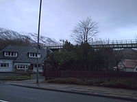
The village lies in the glen of Strath Fillan at the north western extent of the Trossachs
, lying in the shadow of several Munro
peaks, notably Ben More
, but also Stob Binnein
and Cruach Ardrain
. Thus Crianlarich is very popular with hillwalkers. Also the village lies halfway along the long distance footpath, the West Highland Way
.
Its location makes Crianlarich a popular stop for tourists and there are a variety of types of overnight accommodation including guesthouses, B&Bs a SYHA Youth Hostel and an hotel.
In 2001, the village had a population of 185 http://www.stirling.gov.uk/stirling_at_a_glance.pdf.


Perthshire
Perthshire, officially the County of Perth , is a registration county in central Scotland. It extends from Strathmore in the east, to the Pass of Drumochter in the north, Rannoch Moor and Ben Lui in the west, and Aberfoyle in the south...
, Scotland
Scotland
Scotland is a country that is part of the United Kingdom. Occupying the northern third of the island of Great Britain, it shares a border with England to the south and is bounded by the North Sea to the east, the Atlantic Ocean to the north and west, and the North Channel and Irish Sea to the...
, about six miles north-east of the head of Loch Lomond
Loch Lomond
Loch Lomond is a freshwater Scottish loch, lying on the Highland Boundary Fault. It is the largest lake in Great Britain by surface area. The lake contains many islands, including Inchmurrin, the largest fresh-water island in the British Isles, although the lake itself is smaller than many Irish...
. The village's name derives from the Gaelic for "low pass", relating to its geographical location.
The village is served by Crianlarich railway station
Crianlarich railway station
Crianlarich railway station is a railway station serving the village of Crianlarich in Scotland. It is located on the West Highland Line. The routes to Fort William/Mallaig and Oban diverge after this station...
.
Crianlarich has been a major crossroads for north and westbound journeys in Scotland since mediaeval
Middle Ages
The Middle Ages is a periodization of European history from the 5th century to the 15th century. The Middle Ages follows the fall of the Western Roman Empire in 476 and precedes the Early Modern Era. It is the middle period of a three-period division of Western history: Classic, Medieval and Modern...
times. In the 1750s, two military roads
Old military roads of Scotland
A network of military roads was constructed in the Scottish Highlands during the middle part of the 18th century as part of an attempt by the British Government to bring order to a part of the country which had risen up in the Jacobite rebellion of 1715....
met in the village; in the 19th century, it became a railway junction on what is now the West Highland Line
West Highland Line
The West Highland Line is considered the most scenic railway line in Britain, linking the ports of Mallaig and Oban on the west coast of Scotland to Glasgow. The line was voted the top rail journey in the world by readers of independent travel magazine Wanderlust in 2009, ahead of the iconic...
; in the 20th century it became the meeting point of the major A82
A82 road
The A82 is a trunk road in Scotland. It is the principal route from Lowland Scotland to the western Scottish Highlands, running from Glasgow to Inverness, going by Loch Lomond, Glen Coe and Fort William. It is the second longest primary A-road in Scotland after the A9, which is the other...
and A85
A85 road
The A85 is a major road in Scotland. It runs east from Oban along the south bank of Loch Etive, through Lochawe and Tyndrum, Crianlarich, Lochearnhead, St Fillans and Crieff before passing through Perth, where it crosses the River Tay via Perth Bridge. Its name between the latter two locations is...
roads. As such, it is designated a primary destination in Scotland, signposted from as far as Glasgow
Glasgow
Glasgow is the largest city in Scotland and third most populous in the United Kingdom. The city is situated on the River Clyde in the country's west central lowlands...
in the south, Perth
Perth, Scotland
Perth is a town and former city and royal burgh in central Scotland. Located on the banks of the River Tay, it is the administrative centre of Perth and Kinross council area and the historic county town of Perthshire...
in the east, Oban
Oban
Oban Oban Oban ( is a resort town within the Argyll and Bute council area of Scotland. It has a total resident population of 8,120. Despite its small size, it is the largest town between Helensburgh and Fort William and during the tourist season the town can be crowded by up to 25,000 people. Oban...
in the west and Fort William
Fort William, Scotland
Fort William is the second largest settlement in the highlands of Scotland and the largest town: only the city of Inverness is larger.Fort William is a major tourist centre with Glen Coe just to the south, Aonach Mòr to the north and Glenfinnan to the west, on the Road to the Isles...
in the north.
The village bills itself "the gateway to the Highlands
Scottish Highlands
The Highlands is an historic region of Scotland. The area is sometimes referred to as the "Scottish Highlands". It was culturally distinguishable from the Lowlands from the later Middle Ages into the modern period, when Lowland Scots replaced Scottish Gaelic throughout most of the Lowlands...
", a not uncommon claim - for example, Pitlochry
Pitlochry
Pitlochry , is a burgh in the council area of Perth and Kinross, Scotland, lying on the River Tummel. Its population according to the 2001 census was 2,564....
and Dunoon
Dunoon
Dunoon is a resort town situated on the Cowal Peninsula in Argyll, Scotland. It sits on the Firth of Clyde to the south of Holy Loch and to the west of Gourock.-Waterfront:...
also do so.
The village lies in the glen of Strath Fillan at the north western extent of the Trossachs
Trossachs
The Trossachs itself is a small woodland glen in the Stirling council area of Scotland. It lies between Ben A'an to the north and Ben Venue to the south, with Loch Katrine to the west and Loch Achray to the east. However, the name is used generally to refer to the wider area of wooded glens and...
, lying in the shadow of several Munro
Munro
A Munro is a mountain in Scotland with a height over . They are named after Sir Hugh Munro, 4th Baronet , who produced the first list of such hills, known as Munros Tables, in 1891. A Munro top is a summit over 3,000 ft which is not regarded as a separate mountain...
peaks, notably Ben More
Ben More (Crianlarich)
Ben More is a mountain in the southern Highlands of Scotland, near Crianlarich. It is the highest of the so-called Crianlarich Hills to the south-east of the village, and there is no higher land in the British Isles south of Ben More...
, but also Stob Binnein
Stob Binnein
Stob Binnein is a mountain in the southern Highlands of Scotland, near Crianlarich. It forms a twin-peak with Ben More, from which it is separated by the Bealach-eadar-dha Beinn, meaning pass between two hills....
and Cruach Ardrain
Cruach Ardrain
Cruach Ardrain is a Munro mountain located in the southern highlands of Scotland in the Stirling Council area, five kilometres south east of Crianlarich.- Overview :...
. Thus Crianlarich is very popular with hillwalkers. Also the village lies halfway along the long distance footpath, the West Highland Way
West Highland Way
The West Highland Way is a linear long distance footpath in Scotland, with the official status of Long Distance Route. It is 154.5km long, running from Milngavie north of Glasgow to Fort William in the Scottish Highlands, with an element of hill walking in the route...
.
Its location makes Crianlarich a popular stop for tourists and there are a variety of types of overnight accommodation including guesthouses, B&Bs a SYHA Youth Hostel and an hotel.
In 2001, the village had a population of 185 http://www.stirling.gov.uk/stirling_at_a_glance.pdf.
External links
- Crianlarich on Undiscovered Scotland
- Crianlarich local community website
- Crianlarich is in the Church of ScotlandChurch of ScotlandThe Church of Scotland, known informally by its Scots language name, the Kirk, is a Presbyterian church, decisively shaped by the Scottish Reformation....
Parish of Strathfillan


