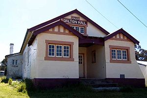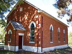
Dalton, New South Wales
Encyclopedia
Dalton is a small inland country town in the Southern Tablelands
of New South Wales
, Australia in Upper Lachlan Shire. Its claim to fame is that it is reputed to have the nation's highest rate of earthquakes and tremor
s.
Dalton is north of the Hume Highway
that joins Sydney and Melbourne, between Goulburn
and Yass
in southern New South Wales, 255 kilometres (158.5 mi) southwest of Sydney and 79 kilometres (49.1 mi) northwest of the national capital, Canberra
. Nearby towns are Cullerin
, Gundaroo
, Gunning
, Yass, and Murrumbateman
.

industry, notably for the Merino
breed. The dry-land farming supports both summer and winter wheat, and some other cereal crops, but agriculture also extends to cattle production for meat.
Like many Australian towns, its economy and social life has fallen into some degree of lethargy, and this has begun to show. The wide streets are generally well maintained; it still has a viable hotel (pub) and several small shops and a petrol station, and the churches are maintained. However, there is a sense that the youth of the town leave for the bigger towns and cities, and that the vibrancy of Dalton's heyday of the early 20th century has gone.
There is a recent move to have bed and breakfast
accommodation on farms to offer a "farm experience" to city dwellers.

Several amateur geologists in Dalton and the surrounding region have seismic
recorders that automatically send data to Geosciences Australia.
A 5.5 magnitude Richter scale earthquake occurred on 1 January 1949 in the Dalton-Gunning region. It was felt in Canberra.
Southern Tablelands
The Southern Tablelands is a geographic area of the State of New South Wales, Australia. This area is located west of the Great Dividing Range.The area is characterised by flat country which has generally been extensively cleared and used for grazing purposes...
of New South Wales
New South Wales
New South Wales is a state of :Australia, located in the east of the country. It is bordered by Queensland, Victoria and South Australia to the north, south and west respectively. To the east, the state is bordered by the Tasman Sea, which forms part of the Pacific Ocean. New South Wales...
, Australia in Upper Lachlan Shire. Its claim to fame is that it is reputed to have the nation's highest rate of earthquakes and tremor
Tremor
A tremor is an involuntary, somewhat rhythmic, muscle contraction and relaxation involving to-and-fro movements of one or more body parts. It is the most common of all involuntary movements and can affect the hands, arms, eyes, face, head, vocal folds, trunk, and legs. Most tremors occur in the...
s.
Dalton is north of the Hume Highway
Hume Highway
The Hume Highway/Hume Freeway is one of Australia's major inter-city highways, running for 880 km between Sydney and Melbourne. It is part of the Auslink National Network and is a vital link for road freight to transport goods to and from the two cities as well as serving Albury-Wodonga and...
that joins Sydney and Melbourne, between Goulburn
Goulburn, New South Wales
Goulburn is a provincial city in the Southern Tablelands of New South Wales, Australia in Goulburn Mulwaree Council Local Government Area. It is located south-west of Sydney on the Hume Highway and above sea-level. On Census night 2006, Goulburn had a population of 20,127 people...
and Yass
Yass, New South Wales
Yass is a town in the Southern Tablelands of New South Wales, Australia in Yass Valley Shire. The name appears to have been derived from an Aboriginal word, "Yarrh" , said to mean 'running water'....
in southern New South Wales, 255 kilometres (158.5 mi) southwest of Sydney and 79 kilometres (49.1 mi) northwest of the national capital, Canberra
Canberra
Canberra is the capital city of Australia. With a population of over 345,000, it is Australia's largest inland city and the eighth-largest city overall. The city is located at the northern end of the Australian Capital Territory , south-west of Sydney, and north-east of Melbourne...
. Nearby towns are Cullerin
Cullerin, New South Wales
Cullerin is a small township in the Southern Tablelands of New South Wales, Australia in Upper Lachlan Shire. It is located on the Old Hume Highway and Main South railway line in southern New South Wales, Australia. The railway station opened in 1880 and closed in 1973.- Transport :Cullerin is at...
, Gundaroo
Gundaroo, New South Wales
Gundaroo is a small village in the Southern Tablelands of New South Wales, Australia and in Yass Valley Council. It is situated to the east of the Yass River, about north of Sutton, about west of the Lake George range. At the 2006 census, Gundaroo had a population of 331.The explorers Charles...
, Gunning
Gunning, New South Wales
Gunning is a town on the Old Hume Highway, between Goulburn and Yass in the Southern Tablelands of New South Wales, Australia, about 260 km south-west of Sydney and 75 km north of the national capital, Canberra. On Census night 2006, Gunning had a population of 487 people...
, Yass, and Murrumbateman
Murrumbateman, New South Wales
Murrumbateman is a small village in the Southern Tablelands of New South Wales, Australia. It is on the Barton Highway, approximately 30 kilometres north-west of Canberra, and is part of the Yass Valley Shire. At the 2006 census, Murrumbateman had a population of 1,758 people.Some of the...
.

Economy
The Monaro region is renowned for its sheep woolWool
Wool is the textile fiber obtained from sheep and certain other animals, including cashmere from goats, mohair from goats, qiviut from muskoxen, vicuña, alpaca, camel from animals in the camel family, and angora from rabbits....
industry, notably for the Merino
Merino
The Merino is an economically influential breed of sheep prized for its wool. Merinos are regarded as having some of the finest and softest wool of any sheep...
breed. The dry-land farming supports both summer and winter wheat, and some other cereal crops, but agriculture also extends to cattle production for meat.
Like many Australian towns, its economy and social life has fallen into some degree of lethargy, and this has begun to show. The wide streets are generally well maintained; it still has a viable hotel (pub) and several small shops and a petrol station, and the churches are maintained. However, there is a sense that the youth of the town leave for the bigger towns and cities, and that the vibrancy of Dalton's heyday of the early 20th century has gone.
There is a recent move to have bed and breakfast
Bed and breakfast
A bed and breakfast is a small lodging establishment that offers overnight accommodation and breakfast, but usually does not offer other meals. Since the 1980s, the meaning of the term has also extended to include accommodations that are also known as "self-catering" establishments...
accommodation on farms to offer a "farm experience" to city dwellers.

Geology and Earthquakes
The underlying rock strata of the region from Dalton to Lake George some 40 km east is geologically active, with the lake formed along a fault system running north-south. Water is believed by some to drain from the lake and reappear in the Yass River, leading to speculation that the groundwater lubricates the geological activity along the faults.Several amateur geologists in Dalton and the surrounding region have seismic
Seismology
Seismology is the scientific study of earthquakes and the propagation of elastic waves through the Earth or through other planet-like bodies. The field also includes studies of earthquake effects, such as tsunamis as well as diverse seismic sources such as volcanic, tectonic, oceanic,...
recorders that automatically send data to Geosciences Australia.
A 5.5 magnitude Richter scale earthquake occurred on 1 January 1949 in the Dalton-Gunning region. It was felt in Canberra.

