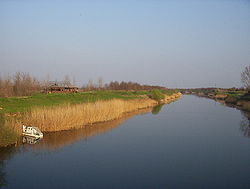
Danube-Tisa-Danube Canal
Encyclopedia

Danube
The Danube is a river in the Central Europe and the Europe's second longest river after the Volga. It is classified as an international waterway....
–Tisa
Tisá
Tisá is a village and municipality in Ústí nad Labem District in the Ústí nad Labem Region of the Czech Republic.The municipality covers an area of , and has a population of 786 ....
-Danube Canal
Canal
Canals are man-made channels for water. There are two types of canal:#Waterways: navigable transportation canals used for carrying ships and boats shipping goods and conveying people, further subdivided into two kinds:...
(DTD) is a unique hydro-engineering system for flood control and hydrotechnical, amelioration forestry, water supply, waste water evacuation, navigation, tourism, fishing, hunting. It covers the northern part of Serbia
Serbia
Serbia , officially the Republic of Serbia , is a landlocked country located at the crossroads of Central and Southeast Europe, covering the southern part of the Carpathian basin and the central part of the Balkans...
- the territory of Vojvodina
Vojvodina
Vojvodina, officially called Autonomous Province of Vojvodina is an autonomous province of Serbia. Its capital and largest city is Novi Sad...
(Bačka
Backa
Bačka is a geographical area within the Pannonian plain bordered by the river Danube to the west and south, and by the river Tisza to the east of which confluence is located near Titel...
and Banat
Banat
The Banat is a geographical and historical region in Central Europe currently divided between three countries: the eastern part lies in western Romania , the western part in northeastern Serbia , and a small...
regions), with the total area of about 12,700 km².
The total length of the dug main canals is 929 km, including new and old canals and streams which were completely or partially reconstructed and thus included in the new system. In the basic canal network there are 51 structures - 24 gates, 16 locks
Lock (water transport)
A lock is a device for raising and lowering boats between stretches of water of different levels on river and canal waterways. The distinguishing feature of a lock is a fixed chamber in which the water level can be varied; whereas in a caisson lock, a boat lift, or on a canal inclined plane, it is...
, 5 safety gates, 6 pumping stations, and 180 bridges. There are 14 goods ports on the canals. On the new canals of the water system the Danube-the Tisa-the Danube there were built: 84 bridges - 62 carriageway, 19 railway and 3 pedestrian ones. One of the most important structures within this water system is the dam on the river Tisa near Novi Bečej
Novi Becej
Novi Bečej , is a town and municipality in Central Banat District of Vojvodina, Serbia. The town has a population of 14,406, while Novi Bečej municipality has 26,881 inhabitants.-Name:Its name means "new Bečej"...
which regulates the water regime in the basic canal network in Banat, for irrigation of about 3,000 km².
External links
- Interactive map of Danube, Sava and Tisa rivers - includes DTD canal

