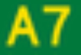
Dawson Highway
Encyclopedia
The Dawson Highway is a state highway
in Queensland
, Australia
. It runs for approximately 400 km between Gladstone
and Springsure
where it terminates. It becomes the Gregory Highway
north of Springsure.
Many of the towns along the Dawson Highway are coal
-mining establishments.
Highway
A highway is any public road. In American English, the term is common and almost always designates major roads. In British English, the term designates any road open to the public. Any interconnected set of highways can be variously referred to as a "highway system", a "highway network", or a...
in Queensland
Queensland
Queensland is a state of Australia, occupying the north-eastern section of the mainland continent. It is bordered by the Northern Territory, South Australia and New South Wales to the west, south-west and south respectively. To the east, Queensland is bordered by the Coral Sea and Pacific Ocean...
, Australia
Australia
Australia , officially the Commonwealth of Australia, is a country in the Southern Hemisphere comprising the mainland of the Australian continent, the island of Tasmania, and numerous smaller islands in the Indian and Pacific Oceans. It is the world's sixth-largest country by total area...
. It runs for approximately 400 km between Gladstone
Gladstone, Queensland
- Education :Gladstone has several primary schools, three high schools, and one university campus, Central Queensland University. It is also home to CQIT Gladstone Campus.- Recreation :...
and Springsure
Springsure, Queensland
Springsure is a small town in Queensland, 66 km south of Emerald on the Gregory Highway. It is 765 km northwest of Brisbane. At the 2006 census, Springsure had a population of 829.-History:...
where it terminates. It becomes the Gregory Highway
Gregory Highway
The Gregory Highway is a state highway in Queensland that serves the major coal-mining centres of Central Queensland. The highway was named after Augustus Gregory, an early explorer....
north of Springsure.
Many of the towns along the Dawson Highway are coal
Coal
Coal is a combustible black or brownish-black sedimentary rock usually occurring in rock strata in layers or veins called coal beds or coal seams. The harder forms, such as anthracite coal, can be regarded as metamorphic rock because of later exposure to elevated temperature and pressure...
-mining establishments.
List of towns along the Dawson Highway
- GladstoneGladstone, Queensland- Education :Gladstone has several primary schools, three high schools, and one university campus, Central Queensland University. It is also home to CQIT Gladstone Campus.- Recreation :...
- CalliopeCalliope, QueenslandCalliope is a town located in Central Queensland, Australia. It is located near the junction of the Bruce Highway and the Dawson Highway, 20 kilometres SSW of the port city of Gladstone...
- BiloelaBiloela, QueenslandBiloela is a rural town in Central Queensland, Australia. It is situated inland from the port city of Gladstone at the junction of the Burnett and Dawson highways...
- BananaBanana, QueenslandBanana is a small town located in Central Queensland, Australia, in the Banana Shire, a Local Government Area. Banana is located at the intersection of the Dawson and Leichhardt highways, 46 kilometres west of the shire's administrative centre, Biloela. At the 2006 census, Banana had a population...
- MouraMoura, QueenslandMoura is a small town servicing the surrounding coal mining and rural activities. The town was first established in 1936 as a farming centre near the existing Moura Station.The town of Moura is located in Central Queensland, Australia...
- RollestonRolleston, QueenslandRolleston is a small town on the Comet River in Central Queensland. It is located in the Central Highlands Regional Council local government area, west of Gladstone and northwest of Brisbane. Springsure, the nearest town lies south-east. Rolleston lies on the junction of the Carnarvon, Gregory...
- SpringsureSpringsure, QueenslandSpringsure is a small town in Queensland, 66 km south of Emerald on the Gregory Highway. It is 765 km northwest of Brisbane. At the 2006 census, Springsure had a population of 829.-History:...
See also
- Highways in AustraliaHighways in AustraliaThis is a list of highways in Australia, listed alphabetically along with each highway's route number and location. Note that some highways service more than one state or territory.-Route numbering systems:...
- List of highways in Queensland

