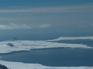
Debelt Glacier
Encyclopedia

Varna Peninsula
Varna Peninsula is a roughly rectangular predominantly ice-covered peninsula forming the northeast extremity of Livingston Island in the South Shetland Islands, Antarctica...
, Livingston Island
Livingston Island (South Shetland Islands)
Livingston Island is an Antarctic island in the South Shetland Islands, Western Antarctica lying between Greenwich Island and Snow Islands...
draining the southeastern slopes of Vidin Heights
Vidin Heights
Vidin Heights are predominantly ice-covered heights rising to 604 m on Varna Peninsula, eastern Livingston Island in the South Shetland Islands, Antarctica. The feature is approximately 8 km long from the north end of Leslie Gap east-northeastwards to Inott Point and 9.6 km...
into Moon Bay
Moon Bay
Moon Bay is a 7 mi wide bay, which recedes 4 mi between Edinburgh Hill and Renier Point, on the east side of Livingston Island, in the South Shetland Islands, Antarctica. Half Moon Island is situated in the bay. Moon Bay was known to sealers in the area as early as 1821. Recharted by...
between Edinburgh Hill
Edinburgh Hill
Edinburgh Hill is a narrow point projecting 650 m from the east coast of Varna Peninsula, Livingston Island in the South Shetland Islands, Antarctica into McFarlane Strait and ending up in a conspicuous rocky hill of elevation 180 m. The point forms the northwest side of the entrance to Moon Bay...
and Helis Nunatak
Helis Nunatak
Helis Nunatak is a crown-shaped rocky peak of elevation 340 m in Vidin Heights on Varna Peninsula, Livingston Island in the South Shetland Islands, Western Antarctica...
. The glacier extends three km in an east-west direction, and 1.5 km in north-south direction.
62°31′55"S 60°03′46"W (62.5319° S; 60.0628° W)
Bulgarian topographic survey Tangra 2004/05
Tangra 2004/05
The Tangra 2004/05 Expedition was commissioned by the Antarctic Place-names Commission at the Ministry of Foreign Affairs of Bulgaria, managed by the Manfred Wörner Foundation, and supported by the Bulgarian Antarctic Institute, the Institute of Mathematics and Informatics at the Bulgarian Academy...
and mapping in 2005 and 2009.
Named after the settlement of Debelt
Debelt
Debelt is a village in Sredets municipality in Burgas Province in southeastern Bulgaria, about 25 kilometers from Burgas. It has a population of 1,574 and an altitude of 46 meters. The village was founded around the 2nd century by the Roman emperor Vespasian. Then called Deultum, it was the only...
in Southeastern Bulgaria
Bulgaria
Bulgaria , officially the Republic of Bulgaria , is a parliamentary democracy within a unitary constitutional republic in Southeast Europe. The country borders Romania to the north, Serbia and Macedonia to the west, Greece and Turkey to the south, as well as the Black Sea to the east...
, successor of the ancient town of Deultum.
Registered in the SCAR
Scientific Committee on Antarctic Research
The Scientific Committee on Antarctic Research is an interdisciplinary body of the International Council for Science . It was established in February 1958 to continue the international coordination of Antarctic scientific activities that had begun during the International Geophysical Year of 1957-58...
Composite Antarctic Gazetteer.
Maps
- L.L. Ivanov et al. Antarctica: Livingston Island and Greenwich Island, South Shetland Islands. Scale 1:100000 topographic map. Sofia: Antarctic Place-names Commission of Bulgaria, 2005.
- L.L. Ivanov. Antarctica: Livingston Island and Greenwich, Robert, Snow and Smith Islands. Scale 1:120000 topographic map. Troyan: Manfred Wörner Foundation, 2009. ISBN 978-954-92032-6-4

