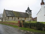
Defford
Encyclopedia
Defford is a small village
in the county of Worcestershire
, England
, located between the towns of Pershore
and Upton-upon-Severn
.
Defford also has a primary school, Defford cum Besford First School,
and three pubs.
Defford is home to one of the radio telescopes that make up the Jodrell Bank
MERLIN
(Multi-Element Radio Linked Interferometer Network) radio telescope
array linking six observing stations that together form a powerful telescope with an effective aperture of over 217 kilometres.
The Village Hall Management Committee (VHMC) are currently (March 2011) building a new village hall on a greenfield site some 50 yards to the south west of the old hall, adjacent to the car park.Site Plan New Hall elevations
and for a few months the airfield was used as a satellite station by the Wellington bomber raining unit based in Pershore.
A small grass airstrip remains on the now disused airfield that has been used as a location for telecommunications installations. The site is now owned and used by the West Mercia Constabulary, but the central part of the airfield still houses a Satellite Communications facility now operated by QinetiQ
.
Village
A village is a clustered human settlement or community, larger than a hamlet with the population ranging from a few hundred to a few thousand , Though often located in rural areas, the term urban village is also applied to certain urban neighbourhoods, such as the West Village in Manhattan, New...
in the county of Worcestershire
Worcestershire
Worcestershire is a non-metropolitan county, established in antiquity, located in the West Midlands region of England. For Eurostat purposes it is a NUTS 3 region and is one of three counties that comprise the "Herefordshire, Worcestershire and Warwickshire" NUTS 2 region...
, England
England
England is a country that is part of the United Kingdom. It shares land borders with Scotland to the north and Wales to the west; the Irish Sea is to the north west, the Celtic Sea to the south west, with the North Sea to the east and the English Channel to the south separating it from continental...
, located between the towns of Pershore
Pershore
Pershore is a market town in Worcestershire, England, on the banks of the River Avon. Pershore is in the Wychavon district and is part of the West Worcestershire parliamentary constituency. At the 2001 census the population was 7,304...
and Upton-upon-Severn
Upton-upon-Severn
Upton-upon-Severn is a small town and civil parish in the Malvern Hills District of Worcestershire, England, on the River Severn. According to the national census 2001 it had a population of 2,859. Located from Malvern, the bridge at Upton is the only one across the river Severn between Worcester...
.
Defford also has a primary school, Defford cum Besford First School,
and three pubs.
Defford is home to one of the radio telescopes that make up the Jodrell Bank
Jodrell Bank
The Jodrell Bank Observatory is a British observatory that hosts a number of radio telescopes, and is part of the Jodrell Bank Centre for Astrophysics at the University of Manchester...
MERLIN
MERLIN
The Multi-Element Radio Linked Interferometer Network is an interferometer array of radio telescopes spread across England. The array is run from Jodrell Bank Observatory in Cheshire by the University of Manchester on behalf of STFC as a National Facility.The array consists of up to seven radio...
(Multi-Element Radio Linked Interferometer Network) radio telescope
Radio telescope
A radio telescope is a form of directional radio antenna used in radio astronomy. The same types of antennas are also used in tracking and collecting data from satellites and space probes...
array linking six observing stations that together form a powerful telescope with an effective aperture of over 217 kilometres.
Defford Village Hall
The village hall is owned and run by a charity, the Defford Village Hall Trust, and managed by a committee of trustees .The Village Hall Management Committee (VHMC) are currently (March 2011) building a new village hall on a greenfield site some 50 yards to the south west of the old hall, adjacent to the car park.Site Plan New Hall elevations
Defford airfield
In 1941 during Word War II, a Royal Airforce base was constructed mainly for the flying experiments for radar that was being developed in nearby MalvernMalvern, Worcestershire
Malvern is a town and civil parish in Worcestershire, England, governed by Malvern Town Council. As of the 2001 census it has a population of 28,749, and includes the historical settlement and commercial centre of Great Malvern on the steep eastern flank of the Malvern Hills, and the former...
and for a few months the airfield was used as a satellite station by the Wellington bomber raining unit based in Pershore.
A small grass airstrip remains on the now disused airfield that has been used as a location for telecommunications installations. The site is now owned and used by the West Mercia Constabulary, but the central part of the airfield still houses a Satellite Communications facility now operated by QinetiQ
QinetiQ
Qinetiq is a British global defence technology company, formed from the greater part of the former UK government agency, Defence Evaluation and Research Agency , when it was split up in June 2001...
.

