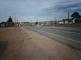
Divide, Colorado
Encyclopedia
Divide is a census-designated place
and a U.S. Post Office
in Teller County
, Colorado
, United States
. The population as of the 2010 Census
was 127.
Divide sits on the north slope of Pikes Peak
on U.S. Highway 24. Ute Pass
is immediately west of town. The Divide Post Office has the ZIP Code
80814.
Divide is a growing, planned community. Divide is planned in three areas: the town center, rural residential land parcels, and larger rural land parcels.
, the original surveyor of the area; settlers in the 1880s shortened the name to Divide. Divide was so named because water run-off
s divide to the north, south, east and west of its location.
(The highways overlap east to Woodland Park
).
Census-designated place
A census-designated place is a concentration of population identified by the United States Census Bureau for statistical purposes. CDPs are delineated for each decennial census as the statistical counterparts of incorporated places such as cities, towns and villages...
and a U.S. Post Office
United States Postal Service
The United States Postal Service is an independent agency of the United States government responsible for providing postal service in the United States...
in Teller County
Teller County, Colorado
Teller County is the 22nd most populous of the 64 counties of the State of Colorado of the United States. The county population was 20,555 at U.S. Census 2000. The county seat is Cripple Creek, and the most populous city is Woodland Park...
, Colorado
Colorado
Colorado is a U.S. state that encompasses much of the Rocky Mountains as well as the northeastern portion of the Colorado Plateau and the western edge of the Great Plains...
, United States
United States
The United States of America is a federal constitutional republic comprising fifty states and a federal district...
. The population as of the 2010 Census
United States Census, 2010
The Twenty-third United States Census, known as Census 2010 or the 2010 Census, is the current national census of the United States. National Census Day was April 1, 2010 and is the reference date used in enumerating individuals...
was 127.
Divide sits on the north slope of Pikes Peak
Pikes Peak
Pikes Peak is a mountain in the Front Range of the Rocky Mountains, west of Colorado Springs, Colorado, in El Paso County in the United States of America....
on U.S. Highway 24. Ute Pass
Ute Pass
Ute Pass is a mountain pass west of Colorado Springs, near Divide.The climate is arid, so many plants that grow here are adapted to low water usage. The pass at one time was used by stage coach and equestrian traffic. It is steep on the east side. The pass is traversed by U.S. Highway 24....
is immediately west of town. The Divide Post Office has the ZIP Code
ZIP Code
ZIP codes are a system of postal codes used by the United States Postal Service since 1963. The term ZIP, an acronym for Zone Improvement Plan, is properly written in capital letters and was chosen to suggest that the mail travels more efficiently, and therefore more quickly, when senders use the...
80814.
Divide is a growing, planned community. Divide is planned in three areas: the town center, rural residential land parcels, and larger rural land parcels.
History
Divide was originally called Hayden's Divide after geologist Ferdinand Vandeveer HaydenFerdinand Vandeveer Hayden
Dr. Ferdinand Vandeveer Hayden was an American geologist noted for his pioneering surveying expeditions of the Rocky Mountains in the late 19th century. He was also a physician who served with the Union Army during the Civil War.-Early life:Ferdinand Hayden was born in Westfield, Massachusetts...
, the original surveyor of the area; settlers in the 1880s shortened the name to Divide. Divide was so named because water run-off
Surface runoff
Surface runoff is the water flow that occurs when soil is infiltrated to full capacity and excess water from rain, meltwater, or other sources flows over the land. This is a major component of the water cycle. Runoff that occurs on surfaces before reaching a channel is also called a nonpoint source...
s divide to the north, south, east and west of its location.
Geography
Divide is located at 38°56′31"N 105°09′28"W (38.942054,-105.157871), at the western intersection of U.S. Highway 24 and State Highway 67Colorado State Highway 67
State Highway 67 is a long state highway encompassing five distinct segments in south-central Colorado. The route runs north from Wetmore to Sedalia, Colorado, traversing the former route of the Florence and Cripple Creek Railroad through Phantom Canyon as a county road and carrying part of the...
(The highways overlap east to Woodland Park
Woodland Park, Colorado
The City of Woodland Park is a Home Rule Municipality that is the most populous city in Teller County, Colorado, United States and is immediately west of El Paso County and the unincorporated community of Crystola. Many residents in this bedroom community, which is surrounded by the one-million...
).
See also
- Colorado Springs Metropolitan Statistical AreaColorado Springs Metropolitan Statistical AreaThe Colorado Springs Metropolitan Statistical Area is a United States Census Bureau defined Metropolitan Statistical Area located in the Colorado Springs region of the State of Colorado. The Census Bureau estimates that the population was 647,758 in 2010, a 20.48% increase since 2000. The...
- Front Range Urban CorridorFront Range Urban CorridorThe Front Range Urban Corridor is an oblong region of urban population located along the eastern face of the Southern Rocky Mountains in the U.S. states of Colorado and Wyoming. The corridor derives its name from the Front Range, the mountain range that defines the west central boundary of the...
- List of cities and towns in Colorado

