Dospat Dam
Encyclopedia

Rhodope Mountains
The Rhodopes are a mountain range in Southeastern Europe, with over 83% of its area in southern Bulgaria and the remainder in Greece. Its highest peak, Golyam Perelik , is the seventh highest Bulgarian mountain...
, Bulgaria
Bulgaria
Bulgaria , officially the Republic of Bulgaria , is a parliamentary democracy within a unitary constitutional republic in Southeast Europe. The country borders Romania to the north, Serbia and Macedonia to the west, Greece and Turkey to the south, as well as the Black Sea to the east...
. The reservoir (formed by a dam
Dam
A dam is a barrier that impounds water or underground streams. Dams generally serve the primary purpose of retaining water, while other structures such as floodgates or levees are used to manage or prevent water flow into specific land regions. Hydropower and pumped-storage hydroelectricity are...
in the town of Dospat
Dospat
Dospat is a town in the very south of Bulgaria, part of Smolyan Province, situated in the Rhodope Mountains, close to Dospat Dam. It is the administrative centre of the homonymous Dospat Municipality...
, 82 km (51 mi) west of Smolyan
Smolyan
Smolyan is a town and ski resort in the very south of Bulgaria not far from the border with Greece. It is the administrative and industrial centre of the homonymous Smolyan Province...
) stretches nearly 19 km (11.8 mi) northwest to the city of Sarnitsa
Sarnitsa
Sarnitsa is a small town in the Pazardzhik Province, southern Bulgaria. it has 3 607 inhabitants. It gained its town status in 16 September 2003 and is part of the Velingrad municipality, located deep in the Rhodope mountains among remote virgin forests...
. At 1200 m (3,937 ft) above the sea level, it is one of the highest dams in Bulgaria in terms of altitude, and, with its 22 square kilometre of water area, the second largest in capacity. It is fed by the Dospat River
Dospat River
The Dospat is a river in the Western Rhodope Mountains, the most important tributary of the Mesta.It takes its source from Bulgaria, from the 1643-metre-high Rozov vrah and flows southeast until Dospat Dam, after which it makes a turn southwest to continue generally to the south and flow into the...
.
The dam, which creates the lake, is built for hydroelectricity generation
Hydroelectricity
Hydroelectricity is the term referring to electricity generated by hydropower; the production of electrical power through the use of the gravitational force of falling or flowing water. It is the most widely used form of renewable energy...
. There is no HPP (hydroelectric power plant) installed at the dam but rather the water is taken to the Teshel HPP and then further down the Devin
Devin, Bulgaria
Devin is a town in Smolyan Province in the far south of Bulgaria. It is the administrative centre of the homonymous Devin Municipality. As of December 2009, the town has a population of 7,054 inhabitants.-Location and geography:...
HPP and the Vacha River with its HPPs, dams and reservoirs (Tsankov Kamak HPP, Vacha Reservoir, Krichim Reservoir, Vacha II HPP, Krichim
Krichim
Krichim is a town in southern Bulgaria, located in the southwestern part of Plovdiv Province close to Perushtitsa. It lies at the foot of the Rhodopes' northern slopes in the plains of Thrace, 20 km southwest of Plovdiv. The river Vacha, an important tributary of the Maritsa, runs through the...
HPP and Vacha I HPP). Besides that, a minimum of 0.15 m3/s is constantly released for sanitation of the Dospat River
Dospat River
The Dospat is a river in the Western Rhodope Mountains, the most important tributary of the Mesta.It takes its source from Bulgaria, from the 1643-metre-high Rozov vrah and flows southeast until Dospat Dam, after which it makes a turn southwest to continue generally to the south and flow into the...
riverbed
Stream bed
A stream bed is the channel bottom of a stream, river or creek; the physical confine of the normal water flow. The lateral confines or channel margins, during all but flood stage, are known as the stream banks or river banks. In fact, a flood occurs when a stream overflows its banks and flows onto...
where the average input to the reservoir is 7.9 m3/s.
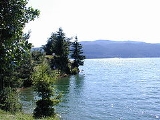
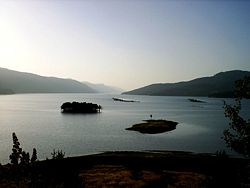
The flora and fauna around the reservoir are diverse and the geography offers breathtaking sights. Old coniferous forests surround the lake. On the northern bank where the town of Sarnitsa
Sarnitsa
Sarnitsa is a small town in the Pazardzhik Province, southern Bulgaria. it has 3 607 inhabitants. It gained its town status in 16 September 2003 and is part of the Velingrad municipality, located deep in the Rhodope mountains among remote virgin forests...
and Krushata neighborhood are located. The terrain is hilly, with meadows and arable land available, used for grazing, potato growing and other agricultural activities. Parallel to the south bank are steep slopes covered in spruce and this bank is where most holiday cabins and hotels are located.
The reservoir is rich in fish. It is stocked with perch
European perch
The European perch, Perca fluviatilis, is a predatory species of perch found in Europe and Asia. In some areas it is known as the redfin perch or English perch, and it is often known simply as perch. The species is a popular quarry for anglers and has been widely introduced beyond its native area,...
, trout (rainbow
Rainbow trout
The rainbow trout is a species of salmonid native to tributaries of the Pacific Ocean in Asia and North America. The steelhead is a sea run rainbow trout usually returning to freshwater to spawn after 2 to 3 years at sea. In other words, rainbow trout and steelhead trout are the same species....
, brown
Brown trout
The brown trout and the sea trout are fish of the same species....
, brook
Brook trout
The brook trout, Salvelinus fontinalis, is a species of fish in the salmon family of order Salmoniformes. In many parts of its range, it is known as the speckled trout or squaretail. A potamodromous population in Lake Superior are known as coaster trout or, simply, as coasters...
), carp
Carp
Carp are various species of oily freshwater fish of the family Cyprinidae, a very large group of fish native to Europe and Asia. The cypriniformes are traditionally grouped with the Characiformes, Siluriformes and Gymnotiformes to create the superorder Ostariophysi, since these groups have certain...
, European chub
European chub
The European chub , sometimes called the round chub, fat chub, chevin, pollard or simply "the" chub, is a freshwater fish of the family Cyprinidae...
, common rudd, common roach, pumpkinseed
Pumpkinseed
The pumpkinseed sunfish is a freshwater fish of the sunfish family of order Perciformes. It is also referred to as "pond perch", "common sunfish", "punkys", and "sunny".-Range and distribution:...
, wels catfish
Wels catfish
The wels catfish , also called sheatfish, is a large catfish found in wide areas of central, southern, and eastern Europe, and near the Baltic and Caspian Seas. It is a scaleless fresh and brackish water fish recognizable by its broad, flat head and wide mouth...
, Danube Bleak
Danube Bleak
The Danube Bleak is a species of ray-finned fish in the Cyprinidae family.It is found in Iran, Austria, Bosnia and Herzegovina, Bulgaria, Croatia, Germany, Hungary, Italy, Romania, Serbia, Slovenia, Turkmenistan, and Uzbekistan.-Source:* World Conservation Monitoring Centre 1996. . Downloaded...
and various members of Carassius
Carassius
Carassius is a genus in the ray-finned fish family Cyprinidae. The species in this genus are commonly known as Crucian carps, though this term often specifically refers to C. carassius. The most well known is the goldfish , which was bred from the Prussian carp...
. Trout are reared in cages within the reservoir. Most types of fishing
Fishing
Fishing is the activity of trying to catch wild fish. Fish are normally caught in the wild. Techniques for catching fish include hand gathering, spearing, netting, angling and trapping....
are practiced: spinning with lures
Fishing lure
A fishing lure is an object attached to the end of a fishing line which is designed to resemble and move like the prey of a fish. The purpose of the lure is to use movement, vibration, and colour to catch the fish's attention so it bites the hook...
, fly fishing
Fly fishing
Fly fishing is an angling method in which an artificial 'fly' is used to catch fish. The fly is cast using a fly rod, reel, and specialized weighted line. Casting a nearly weightless fly or 'lure' requires casting techniques significantly different from other forms of casting...
, and others.
In the surrounding areas there are a number of other large dams, including Vacha, Golyam Beglik
Golyam Beglik
Golyam Beglik is a dam near the central parts of the Rhodope Mountains, Bulgaria. It was formerly officially called the Vasil Kolarov reservoir in honour of Vasil Kolarov, a communist political leader of the People's Republic of Bulgaria....
, Batak
Batak Dam
The Batak Reservoir is located in the Rhodope Mountains and is the third largest in Bulgaria. It attracts many tourists and fishermen, and the resort Tsigov Chark was built on its shore. The lake is situated just above the historic town of the same name....
and Shiroka Polyana
Shiroka Polyana
Shiroka Polyana is a reservoir lake situated in the Western Rhodopes mountains in Bulgaria.The lake is situated 30 km south of Batak, on the road to Dospat. It is located 1500 meters above sea level amidst a forest of old pine trees. Different legends are told about the lake.The shape of...
. The area offers great opportunities for recreation and tourism.
Accessibility is, however, rather poor. Four main mountain roads link the reservoir to the rest of the world. One from Batak
Batak, Bulgaria
Batak is a town in Pazardzhik Province, Southern Bulgaria, not far from the town of Peshtera. It is the administrative centre of the homonymous Batak Municipality. As of December 2009, the town has a population of 3,498 inhabitants.- Geography :...
, a second from Velingrad
Velingrad
Velingrad is a town in Pazardzhik Province, Southern Bulgaria, located at the western end of Chepino Valley, part of the Rhodope Mountains. It is the administrative center of the homonymous Velingrad Municipality and one of the most popular Bulgarian balneological resorts...
to Sarnitsa
Sarnitsa
Sarnitsa is a small town in the Pazardzhik Province, southern Bulgaria. it has 3 607 inhabitants. It gained its town status in 16 September 2003 and is part of the Velingrad municipality, located deep in the Rhodope mountains among remote virgin forests...
, a third from Devin
Devin, Bulgaria
Devin is a town in Smolyan Province in the far south of Bulgaria. It is the administrative centre of the homonymous Devin Municipality. As of December 2009, the town has a population of 7,054 inhabitants.-Location and geography:...
and a fourth from Gotse Delchev
Gotse Delchev (town)
Gotse Delchev , is a town in Blagoevgrad Province of Bulgaria with a population of 23,573.In 1951 the town was renamed after the Bulgarian revolutionary Georgi Nikolov Delchev. It had hitherto been called Nevrokop ....
to the town of Dospat. The one from Batak
Batak, Bulgaria
Batak is a town in Pazardzhik Province, Southern Bulgaria, not far from the town of Peshtera. It is the administrative centre of the homonymous Batak Municipality. As of December 2009, the town has a population of 3,498 inhabitants.- Geography :...
allows accessibility to some of the other Rhodope dams along its length. It forks into two roads; one leading to the town of Dospat and the other to Sarnitsa. This road to Sarnitsa is in places very rutted and may prove a challenge to navigate. Along the south bank there runs a rough dirt track from Sarnitsa to Dospat but this is only used to access the holiday spots.

