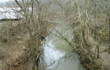
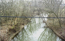
.gif)
Duck Creek (Ohio)
Encyclopedia


Tributary
A tributary or affluent is a stream or river that flows into a main stem river or a lake. A tributary does not flow directly into a sea or ocean...
of the Ohio River
Ohio River
The Ohio River is the largest tributary, by volume, of the Mississippi River. At the confluence, the Ohio is even bigger than the Mississippi and, thus, is hydrologically the main stream of the whole river system, including the Allegheny River further upstream...
, approximately 30 mi (50 km) long, in southeastern Ohio
Ohio
Ohio is a Midwestern state in the United States. The 34th largest state by area in the U.S.,it is the 7th‑most populous with over 11.5 million residents, containing several major American cities and seven metropolitan areas with populations of 500,000 or more.The state's capital is Columbus...
in the United States
United States
The United States of America is a federal constitutional republic comprising fifty states and a federal district...
. Via the Ohio River, it is part of the Mississippi River
Mississippi River
The Mississippi River is the largest river system in North America. Flowing entirely in the United States, this river rises in western Minnesota and meanders slowly southwards for to the Mississippi River Delta at the Gulf of Mexico. With its many tributaries, the Mississippi's watershed drains...
watershed
Drainage basin
A drainage basin is an extent or an area of land where surface water from rain and melting snow or ice converges to a single point, usually the exit of the basin, where the waters join another waterbody, such as a river, lake, reservoir, estuary, wetland, sea, or ocean...
. It drains an area of the Unglaciated Allegheny Plateau
Unglaciated Allegheny Plateau
The Unglaciated Allegheny Plateau is located in an arc around southeastern Ohio into western Pennsylvania and West Virginia. This area is a dissected plateau, characterized by sandstone, shale, and many coal seams...
, between the watersheds of the Muskingum
Muskingum River
The Muskingum River is a tributary of the Ohio River, approximately 111 miles long, in southeastern Ohio in the United States. An important commercial route in the 19th century, it flows generally southward through the eastern hill country of Ohio...
and Little Muskingum
Little Muskingum River
The Little Muskingum River is a tributary of the Ohio River, approximately 65 mi long, in southeast Ohio in the United States.It rises in the hill country of Monroe County, approximately 5 mi northwest of the Ohio River and 8 mi southeast of Woodsfield...
Rivers.
Course
Duck Creek is formed in the hill country of northern Washington CountyWashington County, Ohio
Washington County is a county located in the state of Ohio. As of the 2010 census, the population was 61,778. Its county seat is Marietta. The county, the oldest in the state, is named for George Washington. Washington County is included in the Parkersburg-Marietta-Vienna, West Virginia-Ohio...
at the community of Warner, just west of Lower Salem
Lower Salem, Ohio
Lower Salem is a village in Washington County, Ohio, United States. The population was 109 at the 2000 census.-Geography:Lower Salem is located at ....
and approximately 15 mi (24 km) north of Marietta
Marietta, Ohio
Marietta is a city in and the county seat of Washington County, Ohio, United States. During 1788, pioneers to the Ohio Country established Marietta as the first permanent American settlement of the new United States in the Northwest Territory. Marietta is located in southeastern Ohio at the mouth...
, by the confluence of East Fork Duck Creek and West Fork Duck Creek. The East Fork, approximately 20 mi (30 km) long, rises in western Monroe County
Monroe County, Ohio
Monroe County is a county located in the state of Ohio. As of the 2010 census, the population was 14,642. Its county seat is Woodsfield and is named for James Monroe, Secretary of State when the county was formed and later President of the United States....
and flows generally southwardly through eastern Noble
Noble County, Ohio
Noble County is a county located in the state of Ohio. As of the 2010 census, the population was 14,645. Its county seat is Caldwell. Noble County is named for Rep. Warren P. Noble of the Ohio House of Representatives, who was an early settler there.-History:...
and northern Washington Counties. The West Fork, approximately 30 mi (50 km) long, rises in southeastern Guernsey County
Guernsey County, Ohio
Guernsey County is a county located in the state of Ohio. As of 2010, the population was 40,087. Its county seat is Cambridge and is named for the Isle of Guernsey in the English Channel, from which many of the county's early settlers came....
and flows generally south-southeastwardly through central Noble and northern Washington Counties, past the towns of Belle Valley
Belle Valley, Ohio
Belle Valley is a village in Noble County, Ohio, United States. The population was 263 at the 2000 census.-History:The Village of Belle Valley was incorporated in 1905, but was actually beginning to form around the mid-19th century...
, Caldwell
Caldwell, Ohio
Caldwell is a village located along the West Fork of Duck Creek in Noble County, Ohio, United States. The population was 1,956 at the 2000 census...
, Dexter City
Dexter City, Ohio
Dexter City is a village in Noble County, Ohio, United States, along the West Fork of Duck Creek. The population was 166 at the 2000 census.-Geography:According to the United States Census Bureau, the village has a total area of , all of it land....
and Macksburg
Macksburg, Ohio
Macksburg is a village in Washington County, Ohio, United States, along the West Fork of Duck Creek. The population was 202 at the 2000 census.-Geography:Macksburg is located at ....
; it is the larger of the two headwaters streams. From Warner, Duck Creek flows generally southwardly in a highly meander
Meander
A meander in general is a bend in a sinuous watercourse. A meander is formed when the moving water in a stream erodes the outer banks and widens its valley. A stream of any volume may assume a meandering course, alternately eroding sediments from the outside of a bend and depositing them on the...
ing course and joins the Ohio River at Marietta
Marietta, Ohio
Marietta is a city in and the county seat of Washington County, Ohio, United States. During 1788, pioneers to the Ohio Country established Marietta as the first permanent American settlement of the new United States in the Northwest Territory. Marietta is located in southeastern Ohio at the mouth...
, about 3 mi (5 km) east of its downtown.

