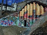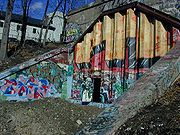
East Side Railroad Tunnel
Encyclopedia

East Side, Providence, Rhode Island
The East Side is a collection of neighborhoods in Providence, Rhode Island on the eponymous eastern part of the city. It officially comprises the neighborhoods of Blackstone, Hope , Mount Hope, College Hill , Wayland, and Fox Point.The area is separated from East Providence, Rhode Island to the...
of Providence, Rhode Island
Providence, Rhode Island
Providence is the capital and most populous city of Rhode Island and was one of the first cities established in the United States. Located in Providence County, it is the third largest city in the New England region...
. It was opened on November 16, 1908 at a cost of $2 million. It runs 5080 feet (1,548.4 m), under College Hill
College Hill, Providence, Rhode Island
College Hill is a neighborhood in Providence, Rhode Island, and one of six neighborhoods comprising the East Side of Providence and part of College Hill Historic District. It is roughly bounded by North Main Street to the west, Power Street to the south, Governor Street and Arlington Avenue to...
, from Gano Street to Benefit Street and is currently abandoned and sealed, but a project has been suggested to reuse it for either rail or bus use.
Construction
The tunnel was first envisioned in 1903 as a more direct connection to the old Union StationUnion Station (Providence)
Union Station describes two distinct defunct train stations in Providence, Rhode Island.The original Union Station was Providence's first, opening in 1847 to accommodate the needs of the newly thriving city. It was considered "a brilliant example of Romanesque architecture" in its time, and the...
, in the center of Providence
Providence, Rhode Island
Providence is the capital and most populous city of Rhode Island and was one of the first cities established in the United States. Located in Providence County, it is the third largest city in the New England region...
. Construction on the tunnel started in May 1906. One crew worked east from the Benefit Street entrance, and one worked west from the Gano Street entrance. The crews met on April 6, 1908 beneath Cooke St, one day earlier than expected, and their alignments were off by only 3/8". A total of nearly 200000 cubic yards (152,911 m³) of material was excavated. The tunnel was opened on November 15, 1908.
The project also included the Crook Point Bascule Bridge
Crook Point Bascule Bridge
The Crook Point Bascule Bridge is a defunct Scherzer rolling lift railway bridge which spans the Seekonk River, connecting the city of Providence, Rhode Island, to the suburb of East Providence...
over the Seekonk River
Seekonk River
The Seekonk River is a tidal extension of the Providence River in the U.S. state of Rhode Island. It flows approximately 8 km . Most historical scholars agree that the name is derived from two Native American words, sucki and honc...
. The entire cost of the project, including the bridge, the tunnel, and the approach to Union Station, was $2 million.
The tunnel allowed the closing of the Fox Point railroad station, which had served the city for 73 years.
Portals
The east portal is in Gano Street Park near the intersection of Gano Street and Amy Street. The west portal is adjacent to a parking lot, about 500 feet north of the west portal of the East Side Trolley TunnelEast Side Trolley Tunnel
The East Side Trolley Tunnel is a tunnel in Providence, Rhode Island, originally built for trolley use in 1914. In 1948 the tracks were removed and the tunnel was paved for use by buses and trackless trolleys. The trackless trolley system in Providence was dismantled in the mid-1950s...
. The closest intersection is North Main Street and Thomas Street.
Operation
Originally the tunnel had two tracks, electrified for the heavy electric passenger trains to Bristol, Rhode Island and Fall River, Massachusetts. These trains ran until 1934, when the electrification was removed and the route became used primarily for freight trains with the occasional passenger train from Providence and points south to Narragansett Race Track during the racing season. In the 1950s the south track was removed due to dwindling frequency of the freight trains. The ownership of the tunnel was transferred to the state of Rhode IslandRhode Island
The state of Rhode Island and Providence Plantations, more commonly referred to as Rhode Island , is a state in the New England region of the United States. It is the smallest U.S. state by area...
in 1981. The last train passed through shortly after that.
May 1st 1993
On May 1, 1993 a group of students gathered at the western end of the tunnel below Benefit Street, to celebrate Beltain-May DayMay Day
May Day on May 1 is an ancient northern hemisphere spring festival and usually a public holiday; it is also a traditional spring holiday in many cultures....
. The students had fires, wore masks, and beat drums until early in the morning. College security officers tried to break up the party. The students claimed the officers had no jurisdiction
Jurisdiction
Jurisdiction is the practical authority granted to a formally constituted legal body or to a political leader to deal with and make pronouncements on legal matters and, by implication, to administer justice within a defined area of responsibility...
in the tunnel. A fight broke out between one of the security officers and a student who refused to stop drumming.
The police were called, and by the time they had arrived the party had grown even larger. The police tried to break up the party with tear gas, but the students responded by throwing rocks and bricks. The police finally broke up the party by forming a riot line, and surrounding the students.
The following day the police claimed that they had found "satanic rituals", and the tunnel was soon covered with corrugated steel
Corrugated galvanised iron
Corrugated galvanised iron is a building material composed of sheets of hot-dip galvanised mild steel, cold-rolled to produce a linear corrugated pattern in them...
, with small doors at ether end. These doors were later welded shut.
Specifications
The tunnel is 5080 feet (1,548.4 m) long, 22 in 3 in (6.78 m) high above top of rail, and 30 feet (9.1 m) wide. The roof is made of reinforced concrete.Crook Point Proposal
A proposal to develop Crook Point, a stretch of shoreline from the Interstate 195Interstate 195 (Rhode Island-Massachusetts)
Interstate 195 is an Interstate Highway running a combined 40.1 miles in the U.S. states of Massachusetts and Rhode Island. It travels from a junction with Interstate 95 in Providence, Rhode Island east to a junction with Interstate 495 and Route 25 in Wareham, Massachusetts...
bridge (Washington Bridge) to the Henderson Bridge, was made by Brown University
Brown University
Brown University is a private, Ivy League university located in Providence, Rhode Island, United States. Founded in 1764 prior to American independence from the British Empire as the College in the English Colony of Rhode Island and Providence Plantations early in the reign of King George III ,...
graduate and lawyer Robert Manchester. The proposal includes 400 housing units, 1,400 parking units and green open space. The plan would include a bus or tram running across the bridge and through the tunnel to bring people downtown. There might also be a stop between the two ends of the line at Thayer Street
Thayer Street
Thayer Street in Providence, Rhode Island is a popular destination for students of the area's nearby schools of Brown University, Moses Brown School, Wheeler School, RISD, Providence College, Johnson & Wales University, and Rhode Island College....
, owing to Brown University's proximity and the shopping on Thayer Street.
External links
- "The East Side Railroad Tunnel" from Art in Ruins
- Providence, Rhode Island - East Side Tunnel
- "Burrowing development" from the College Hill Independent.
- Map of tunnel route

