Eastern District, American Samoa
Encyclopedia

American Samoa
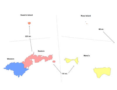
American Samoa is an unincorporated territory of the United States located in the South Pacific Ocean, southeast of the sovereign state of Samoa...
. It consists of the eastern portion of Tutuila
Tutuila
Tutuila is the largest and the main island of American Samoa in the archipelago of Samoan Islands. It is the third largest island in the Samoan Islands chain of the Central Pacific located roughly northeast of Brisbane, Australia and over northeast of Fiji. It contains a large, natural harbor,...
, American Samoa's largest island, plus the island of Aunu'u
Aunu'u
Aunu'u is a small volcanic island off the southeastern shore of Tutuila in American Samoa. It has a land area of and a 2000 census population of 476 persons. Politically it is a part of the Eastern District, one of the primary divisions of American Samoa....
. The district has a land area of 67.027 km² (25.879 sq mi) and a 2000 census
United States Census, 2000
The Twenty-second United States Census, known as Census 2000 and conducted by the Census Bureau, determined the resident population of the United States on April 1, 2000, to be 281,421,906, an increase of 13.2% over the 248,709,873 persons enumerated during the 1990 Census...
population of 23,441. It contains 34 villages plus a portion of Nu'uuli village. Among these are Pago Pago, Fagatogo, and Utulei.

