Edleston
Encyclopedia

Cheshire East
Cheshire East is a unitary authority area with borough status in the ceremonial county of Cheshire, England.The borough was established in April 2009 as part of the 2009 structural changes to local government in England, by virtue of an order under the Local Government and Public Involvement in...
and the ceremonial county of Cheshire
Cheshire
Cheshire is a ceremonial county in North West England. Cheshire's county town is the city of Chester, although its largest town is Warrington. Other major towns include Widnes, Congleton, Crewe, Ellesmere Port, Runcorn, Macclesfield, Winsford, Northwich, and Wilmslow...
, England
England
England is a country that is part of the United Kingdom. It shares land borders with Scotland to the north and Wales to the west; the Irish Sea is to the north west, the Celtic Sea to the south west, with the North Sea to the east and the English Channel to the south separating it from continental...
, which lies immediately to the south west of Nantwich
Nantwich
Nantwich is a market town and civil parish in the Borough of Cheshire East and the ceremonial county of Cheshire, England. The town gives its name to the parliamentary constituency of Crewe and Nantwich...
. For administrative purposes, it is combined with adjacent civil parishes of Acton
Acton, Cheshire
Acton is a small village and civil parish lying immediately west of the town of Nantwich in the unitary authority of Cheshire East and the ceremonial county of...
and Henhull
Henhull
Henhull is a civil parish in the unitary authority of Cheshire East and the ceremonial county of Cheshire, England, which lies to the north west of Nantwich. For administrative purposes, it is combined with adjacent civil parishes of Acton and Edleston to form a total area of 765 hectares...
to form a total area of 765 hectares (1890 acres). The parish is predominantly rural with scattered farms and houses and no settlements. Nearby villages include Acton and Ravensmoor
Ravensmoor
Ravensmoor is a village in the unitary authority of Cheshire East and the ceremonial county of Cheshire, England, located at . It is split between the civil parishes of Baddiley and Burland...
.
According to the 2001 census, the parish had a population of 53.
History
The Nantwich and Market Drayton Railway, constructed in 1863, ran southwards towards AudlemAudlem
Audlem is a large village and civil parish located in the unitary authority of Cheshire East and the ceremonial county of Cheshire in the north west of England, approximately south of Nantwich. Close to the border with the neighbouring county of Shropshire, the village is eight miles east of...
at the east of the parish; it is now dismantled.
The parish of Edleston formerly had population figures of 88 (1801), 99 (1851), 74 (1901) and 58 (1951).

Geography and transport
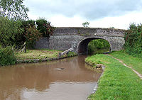
The Shropshire Union CanalShropshire Union Canal
The Shropshire Union Canal is a navigable canal in England; the Llangollen and Montgomery canals are the modern names of branches of the Shropshire Union system and lie partially in Wales....
runs north–south through the parish and the River Weaver
River Weaver
The River Weaver is a river, navigable in its lower reaches, running in a curving route anti-clockwise across west Cheshire, northern England. Improvements to the river to make it navigable were authorised in 1720 and the work, which included eleven locks, was completed in 1732...
runs along its eastern boundary. Edleston Brook runs east–west across the parish. The Welsh Marches Railway
Welsh Marches Line
The Welsh Marches Line , known historically as the North and West Route, is the railway line running from Newport in south-east Wales to Shrewsbury in the West Midlands region of England by way of Abergavenny, Hereford and Craven Arms, and thence to Crewe via Whitchurch...
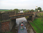
runs from the north east to the south west, crossing the canal immediately adjacent to Edleston Bridge.
Marsh Lane runs along the northern boundary of the parish; it crosses the Shropshire Union Canal at the grade-II-listed Marsh Lane Bridge, which dates from 1826 and was designed by Thomas Telford
Thomas Telford
Thomas Telford FRS, FRSE was a Scottish civil engineer, architect and stonemason, and a noted road, bridge and canal builder.-Early career:...
. The A530
A530 road
The A530 road is a road linking the A525 east of Whitchurch, Shropshire, England with the A559 east of Northwich, in Cheshire. The road follows the route:*A525*Nantwich*Crewe*Middlewich*A559...
lies immediately to the south. The Crewe and Nantwich Circular Walk
Crewe and Nantwich Circular Walk
The Crewe and Nantwich Circular Walk is a long-distance walkers' path in the Cheshire East area of Cheshire, England. As the name suggests, the walk forms a circuit around the towns of Crewe and Nantwich...
runs through the parish.


