El Dorado, California
Encyclopedia

El Dorado Hills, California
El Dorado Hills is an unincorporated census-designated place located in El Dorado County, California, east of the state capital of Sacramento. The population was 42,108 at the 2010 census, up from 18,016 at the 2000 census...
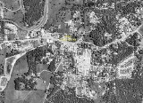
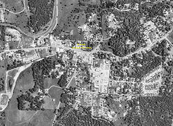
, is an unincorporated community
Unincorporated area
In law, an unincorporated area is a region of land that is not a part of any municipality.To "incorporate" in this context means to form a municipal corporation, a city, town, or village with its own government. An unincorporated community is usually not subject to or taxed by a municipal government...
in El Dorado County
El Dorado County, California
El Dorado County is a county located in the historic Gold Country in the Sierra Nevada Mountains and foothills of the U.S. state of California. The 2010 population was 181,058. The El Dorado county seat is in Placerville....
, California
California
California is a state located on the West Coast of the United States. It is by far the most populous U.S. state, and the third-largest by land area...
. It is located 4 miles (6.4 km) southwest of Placerville
Placerville, California
Placerville is the county seat of El Dorado County, California. The population was 10,389 at the 2010 census, up from 9,610 at the 2000 census. It is part of the Sacramento–Arden-Arcade–Roseville Metropolitan Statistical Area.-Geography:...
, at an elevation of 1608 feet (490 m). The population was 4,096 at the 2000 census. The town is registered as California Historical Landmark
California Historical Landmark
California Historical Landmarks are buildings, structures, sites, or places in the state of California that have been determined to have statewide historical significance by meeting at least one of the criteria listed below:...
#486. The ZIP code
ZIP Code
ZIP codes are a system of postal codes used by the United States Postal Service since 1963. The term ZIP, an acronym for Zone Improvement Plan, is properly written in capital letters and was chosen to suggest that the mail travels more efficiently, and therefore more quickly, when senders use the...
is 95623. The community is inside area code 530
Area code 530
North American area code 530 is a California telephone area code that covers Auburn, Chico, Colfax, Davis, Grass Valley, Marysville, Oroville, Placerville, Redding, Red Bluff, Susanville, Truckee, Woodland, Yuba City and South Lake Tahoe....
.
History
El Dorado, "The Gilded One", was first known as Mud Springs from the boggy quagmire the cattle and horses made of a nearby watering place. Originally an important camp on the old Carson Trail, by 1849-50 it had become the center of a mining district and the crossroads for freight and stagecoachStagecoach
A stagecoach is a type of covered wagon for passengers and goods, strongly sprung and drawn by four horses, usually four-in-hand. Widely used before the introduction of railway transport, it made regular trips between stages or stations, which were places of rest provided for stagecoach travelers...
lines. At the height of the rush its large gold production supported a population of several thousand. It was incorporated as the town of El Dorado in 1856.
The first post office in Mud Spring was opened in 1851, the name was changed to El Dorado in 1855. The town incorporated in 1855 and disincorporated in 1857.
Politics
In the state legislatureCalifornia State Legislature
The California State Legislature is the state legislature of the U.S. state of California. It is a bicameral body consisting of the lower house, the California State Assembly, with 80 members, and the upper house, the California State Senate, with 40 members...
El Dorado is located in the 1st Senate
California State Senate
The California State Senate is the upper house of the California State Legislature. There are 40 state senators. The state legislature meets in the California State Capitol in Sacramento. The Lieutenant Governor is the ex officio President of the Senate and may break a tied vote...
District, represented by Republican
Republican Party (United States)
The Republican Party is one of the two major contemporary political parties in the United States, along with the Democratic Party. Founded by anti-slavery expansion activists in 1854, it is often called the GOP . The party's platform generally reflects American conservatism in the U.S...
Dave Cox
Dave Cox
David E. Cox was an American politician from Holdenville, Oklahoma. A Republican, he served as a California State Senator, representing the 1st district from December 2004 until his death in July 2010, and also served as an California State Assemblyman for the six years immediately before his...
, and in the 4th Assembly
California State Assembly
The California State Assembly is the lower house of the California State Legislature. There are 80 members in the Assembly, representing an approximately equal number of constituents, with each district having a population of at least 420,000...
District, represented by Republican Ted Gaines
Ted Gaines
Edward M. Gaines is a California State Senator, representing the 1st Senate district. He won a January 4, 2011, special election to replace the late Dave Cox and took office two days later...
. Federally, El Dorado is located in California's 4th congressional district
California's 4th congressional district
California's 4th congressional district is a congressional district located in the U.S. state of California. It covers the northeastern corner of California along Route 395, encompassing El Dorado, Placer, Nevada, Sierra, Plumas, Lassen, and Modoc counties, as well as parts of Butte County...
, which has a Cook PVI
Cook Partisan Voting Index
The Cook Partisan Voting Index , sometimes referred to as simply the Partisan Voting Index , is a measurement of how strongly an American congressional district or state leans toward one political party compared to the nation as a whole...
of R +11 and is represented by Republican Tom McClintock
Tom McClintock
Thomas Miller McClintock II is the U.S. Representative for , serving since 2009. He is a member of the Republican Party. He is a former Assemblyman and state Senator...
.

