Elhovo Gap
Encyclopedia
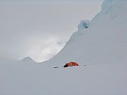
Elhovo Gap is a 420 m high saddle extending 1 km in westsouthwest-eastnortheast direction from Gleaner Heights
to Leslie Hill
, Livingston Island in the South Shetland Islands
, Antarctica which forms part of the overland route between Bowles Ridge
and Vidin Heights
. The saddle is named after the Bulgarian town of Elhovo
, in association with the artificial Christmas tree
(‘elha’ in Bulgarian) brought by the Tangra 2004/05 Survey
team (Lyubomir Ivanov and Doychin Vasilev
) to their bivouac at Leslie Hill occupied 24 December - 28 December 2004, making in the process the first crossing of Elhovo Gap.
 The gap is located at 62°34′22"S 60°13′00"W (Bulgaria
n topographic survey Tangra 2004/05
and mapping in 2005 and 2009).
Gleaner Heights
Gleaner Heights is a series of elevations extending southwest from Leslie Hill in the eastern part of Livingston Island in the South Shetland Islands, Antarctica...
to Leslie Hill
Leslie Hill, Livingston Island
Leslie Hill is a hill lying northward of Bowles Ridge and south of Vidin Heights in the eastern part of Livingston Island in the South Shetland Islands, Antarctica...
, Livingston Island in the South Shetland Islands
South Shetland Islands
The South Shetland Islands are a group of Antarctic islands, lying about north of the Antarctic Peninsula, with a total area of . By the Antarctic Treaty of 1959, the Islands' sovereignty is neither recognized nor disputed by the signatories and they are free for use by any signatory for...
, Antarctica which forms part of the overland route between Bowles Ridge
Bowles Ridge
Bowles Ridge is the central ridge of eastern Livingston Island. The ridge extends 6.5 km in the east-west direction and is 1.5 km wide. The summit of the ridge is Mount Bowles which rises to 822m and is located 9.77 km northwest of Great Needle Peak, 6.08 km north by west of...
and Vidin Heights
Vidin Heights
Vidin Heights are predominantly ice-covered heights rising to 604 m on Varna Peninsula, eastern Livingston Island in the South Shetland Islands, Antarctica. The feature is approximately 8 km long from the north end of Leslie Gap east-northeastwards to Inott Point and 9.6 km...
. The saddle is named after the Bulgarian town of Elhovo
Elhovo
Elhovo is a Bulgarian town in Yambol Province, located on the left bank of Tundzha river, between Strandzha and Sakar mountains. It is the administrative centre of the homonymous Elhovo Municipality...
, in association with the artificial Christmas tree
Artificial Christmas tree
Artificial Christmas trees are artificial pine and fir trees manufactured for the specific purpose of use as a Christmas tree. The earliest artificial Christmas trees were wooden, tree-shaped pyramids or feather trees, both developed by Germans...
(‘elha’ in Bulgarian) brought by the Tangra 2004/05 Survey
Tangra 2004/05
The Tangra 2004/05 Expedition was commissioned by the Antarctic Place-names Commission at the Ministry of Foreign Affairs of Bulgaria, managed by the Manfred Wörner Foundation, and supported by the Bulgarian Antarctic Institute, the Institute of Mathematics and Informatics at the Bulgarian Academy...
team (Lyubomir Ivanov and Doychin Vasilev
Doychin Vasilev
Doychin Vasilev is a Bulgarian alpinist and cinematographer who has climbed five Himalayan 8,000 m peaks: Dhaulagiri , Mount Everest , Makalu , and Shishapangma and Cho Oyu . President of Alpine Club Vihren, Sofia...
) to their bivouac at Leslie Hill occupied 24 December - 28 December 2004, making in the process the first crossing of Elhovo Gap.
Location

Bulgaria
Bulgaria , officially the Republic of Bulgaria , is a parliamentary democracy within a unitary constitutional republic in Southeast Europe. The country borders Romania to the north, Serbia and Macedonia to the west, Greece and Turkey to the south, as well as the Black Sea to the east...
n topographic survey Tangra 2004/05
Tangra 2004/05
The Tangra 2004/05 Expedition was commissioned by the Antarctic Place-names Commission at the Ministry of Foreign Affairs of Bulgaria, managed by the Manfred Wörner Foundation, and supported by the Bulgarian Antarctic Institute, the Institute of Mathematics and Informatics at the Bulgarian Academy...
and mapping in 2005 and 2009).
Map
- L.L. Ivanov. Antarctica: Livingston Island and Greenwich, Robert, Snow and Smith Islands. Scale 1:120000 topographic map. Troyan: Manfred Wörner Foundation, 2009. ISBN 978-954-92032-6-4

