Ewaninga Rock Carvings Conservation Reserve
Encyclopedia


Claypan
In geology, a claypan is a dense, compact, slowly permeable layer in the subsoil having a much higher clay content than the overlying material, from which it is separated by a sharply defined boundary. Claypans are usually hard when dry, and plastic and sticky when wet. They limit or slow the...
about 35 km south of Alice Springs, Northern Territory
Alice Springs, Northern Territory
Alice Springs is the second largest town in the Northern Territory of Australia. Popularly known as "the Alice" or simply "Alice", Alice Springs is situated in the geographic centre of Australia near the southern border of the Northern Territory...
, Australia
Australia
Australia , officially the Commonwealth of Australia, is a country in the Southern Hemisphere comprising the mainland of the Australian continent, the island of Tasmania, and numerous smaller islands in the Indian and Pacific Oceans. It is the world's sixth-largest country by total area...
. The site was gazetted on 20 November 1996.
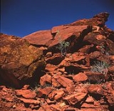
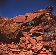
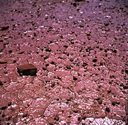
The claypan is a slightly concave surface approximately 100m across. It retains water after even light rain, thus attracting many birds and animals. The claypan and surrounding outcrops are also a significant archaeological site.
The Reserve contains many prehistoric abraded and pecked engraving
Engraving
Engraving is the practice of incising a design on to a hard, usually flat surface, by cutting grooves into it. The result may be a decorated object in itself, as when silver, gold, steel, or glass are engraved, or may provide an intaglio printing plate, of copper or another metal, for printing...
s that provide an outstanding example of central Australian rock art
Rock art
Rock art is a term used in archaeology for any human-made markings made on natural stone. They can be divided into:*Petroglyphs - carvings into stone surfaces*Pictographs - rock and cave paintings...
.
The main feature of the area is a set of about 1000 petroglyphs, distributed among the rock outcrops to the south and south-east of the claypan. Most of the petroglyphs are non-representational, consisting of circles, lines and other geometric motifs, though there are some examples of animal tracks. The motifs have been compared with those found elsewhere in Central Australia and Tasmania.
Aspects of the petroglyphs such as their motifs and degree of weathering
Weathering
Weathering is the breaking down of rocks, soils and minerals as well as artificial materials through contact with the Earth's atmosphere, biota and waters...
suggest an age as great as 30000 years, although a more precise age is unknown. Flood describes the petroglyphs as Panaramitee-style, which, based on dating of other Paranamitee sites, could give a date as early as 40000 years ago.
An Indigenous Land Use Agreement (ILUA) was signed by the Central Land Council and the Northern Territory Government on 30 November 2005 for the purpose of granting the Park as Aboriginal land under the Aboriginal Land Rights (Northern Territory) Act 1976 (Cth) (ALRA).
The site is considered a significant link to the activities of the early (Arrente
Arrernte people
The Arrernte people , known in English as the Aranda or Arunta, are those Indigenous Australians who are the original custodians of Arrernte lands in the central area of Australia around Mparntwe or Alice Springs in the Northern Territory. The Arrernte tribe has lived there for more than 20,000 years...
) people of the region. Permission to access the site has been granted by the Arrente custodians.
In December 2004, laser-scanned 3D images of the petroglyphs were included in the exhibition "Extremes–Great Deserts of the Southern Hemisphere" by the National Museum of Australia
National Museum of Australia
The National Museum of Australia was formally established by the National Museum of Australia Act 1980. The National Museum preserves and interprets Australia's social history, exploring the key issues, people and events that have shaped the nation....
.

