Finlay River
Encyclopedia
The Finlay River is a 402 km long river in north-central British Columbia
flowing north and thence south from Thutade Lake
in the Omineca Mountains
to Williston Lake
, the impounded waters of the Peace River
formed by the completion of the W.A.C. Bennett Dam in 1968. Prior to this, the Finlay joined with the Parsnip River
to form the Peace. The headwaters of the Finlay at Thutade Lake are considered the ultimate source of the Mackenzie River
. Deserters Canyon
is located just north of Williston Lake.
The Finlay drains an area of 43,000 square kilometres and discharges at a mean rate of 600 cubic metres per second. Major tributaries of the Finlay include the Ospika
, Ingenika, Warneford, Fox, Toodoggone
, and Firesteel Rivers (the Ospika now enters Lake Williston directly, however). Located in a remote part of the province
, there are no population centres along the river, however, there is a small First Nations
community, Fort Ware
, located at the junction of the Finlay and Warneford. Tatlatui Provincial Park
protects the area of the Tatlatui Range
, where Thutade Lake is located.
 The Finlay River is named for the explorer John Finlay, who travelled a short way up the river in 1797. The first European to journey its length to its source was the fur trade
r and explorer Samuel Black
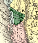
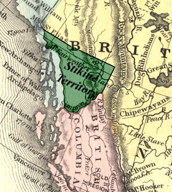
in 1824. The river was the eastern half of the northern boundary of the Colony of British Columbia
at the time of its creation in 1858, north of which was the North-Western Territory
; the western half of the boundary was the Nass River
and from 1862 to 1863 it was briefly the southern boundary of the Stickeen Territories
(Stikine Territory) which had been formed from the North-Western Territory in response to the Peace and Stikine Gold Rush
es and which was amalgamated with the Colony of British Columbia in the following year.
British Columbia
British Columbia is the westernmost of Canada's provinces and is known for its natural beauty, as reflected in its Latin motto, Splendor sine occasu . Its name was chosen by Queen Victoria in 1858...
flowing north and thence south from Thutade Lake
Thutade Lake
Thutade Lake is located in the Omineca Mountains of the Northern Interior of British Columbia, Canada. About 40 km in length, and no more than about 2 km wide, the lake is primarily significant as the ultimate source of the Mackenzie River. The lake is at the head of the Finlay River,...
in the Omineca Mountains
Omineca Mountains
The Omineca Mountains, also known as "the Ominecas", are a group of remote mountain ranges in north-central British Columbia, Canada. They are bounded by the Finlay River on the north, the Rocky Mountain Trench on the east, the Nation River on the south, and the upper reaches of the Omineca River...
to Williston Lake
Williston Lake
Williston Lake is a reservoir created by the W. A. C. Bennett Dam and is located in the Northern Interior of British Columbia, Canada.-Geography:...
, the impounded waters of the Peace River
Peace River (Canada)
The Peace River is a river in Canada that originates in the Rocky Mountains of northern British Columbia and flows to the northeast through northern Alberta. The Peace River flows into the Slave River, a tributary of the Mackenzie River. The Mackenzie is the 12th longest river in the world,...
formed by the completion of the W.A.C. Bennett Dam in 1968. Prior to this, the Finlay joined with the Parsnip River
Parsnip River
The Parsnip River is a 240 km long river in central British Columbia, Canada. It flows generally north-westward from the Parsnip Glacier in the Hart Ranges to the Parsnip Reach of Williston Lake, formed by the impounding of the waters of the Peace River by the W.A.C. Bennett Dam in 1968...
to form the Peace. The headwaters of the Finlay at Thutade Lake are considered the ultimate source of the Mackenzie River
Mackenzie River
The Mackenzie River is the largest river system in Canada. It flows through a vast, isolated region of forest and tundra entirely within the country's Northwest Territories, although its many tributaries reach into four other Canadian provinces and territories...
. Deserters Canyon
Deserters Canyon
Deserters Canyon is a canyon on the Finlay River in the Northern Interior of British Columbia, Canada. It is located just upstream from the head of the Finlay Arm of Lake Williston, the reservoir created by WAC Bennett Dam on the lower Peace River....
is located just north of Williston Lake.
The Finlay drains an area of 43,000 square kilometres and discharges at a mean rate of 600 cubic metres per second. Major tributaries of the Finlay include the Ospika
Ospika River
The Ospika River is a river in the Northern Interior of British Columbia, Canada, rising in the Northern Rocky Mountains to the north of Lake Williston and flowing south to join that lake in the lower end of its Finlay Reach. Before the creation of that lake by the building of WAC Bennett Dam, it...
, Ingenika, Warneford, Fox, Toodoggone
Toodoggone River
The Toodoggone River is a tributary of the Finlay River in the Northern Interior of British Columbia, Canada, flowing east into the upper reaches of the Finlay just south of the Fishing Lakes...
, and Firesteel Rivers (the Ospika now enters Lake Williston directly, however). Located in a remote part of the province
Province
A province is a territorial unit, almost always an administrative division, within a country or state.-Etymology:The English word "province" is attested since about 1330 and derives from the 13th-century Old French "province," which itself comes from the Latin word "provincia," which referred to...
, there are no population centres along the river, however, there is a small First Nations
First Nations
First Nations is a term that collectively refers to various Aboriginal peoples in Canada who are neither Inuit nor Métis. There are currently over 630 recognised First Nations governments or bands spread across Canada, roughly half of which are in the provinces of Ontario and British Columbia. The...
community, Fort Ware
Fort Ware, British Columbia
Fort Ware, is the former name of the community of Kwadacha. Referred to by locals simply as Ware it is an aboriginal community in northern British Columbia, Canada, located in the Rocky Mountain Trench at the confluence of the Finlay and Warneford Rivers, in the Rocky Mountain Trench upstream from...
, located at the junction of the Finlay and Warneford. Tatlatui Provincial Park
Tatlatui Provincial Park
Tatlatui Provincial Park is a provincial park in British Columbia, Canada, located at the southern end of the Spatsizi Plateau and around the headwaters of the Firesteel River, part of the Finlay-Peace River basin and therefore in the Arctic drainage...
protects the area of the Tatlatui Range
Tatlatui Range
The Tatlatui Range is a large and very alpine mountain range on the east flank of the upper Skeena River in northern British Columbia, Canada. It has an area of 2307 km2 and is a subrange of the Omineca Mountains which in turn form part of the Interior Mountains...
, where Thutade Lake is located.

Fur trade
The fur trade is a worldwide industry dealing in the acquisition and sale of animal fur. Since the establishment of world market for in the early modern period furs of boreal, polar and cold temperate mammalian animals have been the most valued...
r and explorer Samuel Black
Samuel Black
Samuel Black was a Canadian fur trader and explorer noted for his exploration of the Finlay River and its tributaries in present-day north-central British Columbia, which helped to open up the Muskwa, Omineca, and Stikine areas to the fur trade; as well for his role as Chief factor of the Hudson's...
in 1824. The river was the eastern half of the northern boundary of the Colony of British Columbia
Colony of British Columbia
The Colony of British Columbia was a crown colony in British North America from 1858 until 1866. At its creation, it physically constituted approximately half the present day Canadian province of British Columbia, since it did not include the Colony of Vancouver Island, the vast and still largely...
at the time of its creation in 1858, north of which was the North-Western Territory
North-Western Territory
The North-Western Territory was a region of British North America until 1870. Named for where it lay in relation to Rupert's Land, the territory at its greatest extent covered what is now Yukon, mainland Northwest Territories, northwestern mainland Nunavut, northwestern Saskatchewan, northern...
; the western half of the boundary was the Nass River
Nass River
The Nass River is a river in northern British Columbia, Canada. It flows from the Coast Mountains southwest to Nass Bay, a sidewater of Portland Inlet, which connects to the North Pacific Ocean via the Dixon Entrance...
and from 1862 to 1863 it was briefly the southern boundary of the Stickeen Territories
Stikine Territory
The Stickeen Territories , also colloquially rendered as Stickeen Territory, Stikine Territory, and Stikeen Territory, was a territory of British North America whose brief existence began July 19, 1862, and concluded July of the following year. The region was split from the North-Western...
(Stikine Territory) which had been formed from the North-Western Territory in response to the Peace and Stikine Gold Rush
Stikine Gold Rush
The Stikine Gold Rush was a minor but important gold rush in the Stikine Country of northwestern British Columbia, Canada. The rush's discoverer was Alexander "Buck" Choquette, who staked a claim at Choquette Bar in 1861, just downstream from the confluence of the Stikine and Anuk Rivers, at...
es and which was amalgamated with the Colony of British Columbia in the following year.
Tributaries
- Firesteel River
- Toodoggone RiverToodoggone RiverThe Toodoggone River is a tributary of the Finlay River in the Northern Interior of British Columbia, Canada, flowing east into the upper reaches of the Finlay just south of the Fishing Lakes...
- Fox River
- Kwadacha River
- Paul River
- Akie River
- Ingenika River
- Davis River
- Mesilinka River
- Osilinka River

