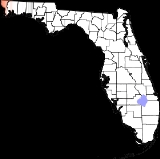
Florida Panhandle
Overview
Florida
Florida is a state in the southeastern United States, located on the nation's Atlantic and Gulf coasts. It is bordered to the west by the Gulf of Mexico, to the north by Alabama and Georgia and to the east by the Atlantic Ocean. With a population of 18,801,310 as measured by the 2010 census, it...
, is a strip of land roughly 200 miles long and 50 to 100 miles wide (320 km by 80 to 160 km), lying between Alabama
Alabama
Alabama is a state located in the southeastern region of the United States. It is bordered by Tennessee to the north, Georgia to the east, Florida and the Gulf of Mexico to the south, and Mississippi to the west. Alabama ranks 30th in total land area and ranks second in the size of its inland...
on the north and the west, Georgia
Georgia (U.S. state)
Georgia is a state located in the southeastern United States. It was established in 1732, the last of the original Thirteen Colonies. The state is named after King George II of Great Britain. Georgia was the fourth state to ratify the United States Constitution, on January 2, 1788...
also on the north, and the Gulf of Mexico
Gulf of Mexico
The Gulf of Mexico is a partially landlocked ocean basin largely surrounded by the North American continent and the island of Cuba. It is bounded on the northeast, north and northwest by the Gulf Coast of the United States, on the southwest and south by Mexico, and on the southeast by Cuba. In...
to the south. Its eastern boundary is arbitrarily defined. The terms West Florida and Northwest Florida are today generally synonymous with the Panhandle, although historically West Florida
West Florida
West Florida was a region on the north shore of the Gulf of Mexico, which underwent several boundary and sovereignty changes during its history. West Florida was first established in 1763 by the British government; as its name suggests it largely consisted of the western portion of the region...
was the name of a British colony (1763-1783), later a Spanish colony (1783-1821), both of which included modern-day Florida west of the Apalachicola River
Apalachicola River
The Apalachicola River is a river, approximately 112 mi long in the State of Florida. This river's large watershed, known as the ACF River Basin for short, drains an area of approximately into the Gulf of Mexico. The distance to its farthest headstream in northeast Georgia is approximately 500...
as well as portions of what are now Alabama
Alabama
Alabama is a state located in the southeastern region of the United States. It is bordered by Tennessee to the north, Georgia to the east, Florida and the Gulf of Mexico to the south, and Mississippi to the west. Alabama ranks 30th in total land area and ranks second in the size of its inland...
, Mississippi
Mississippi
Mississippi is a U.S. state located in the Southern United States. Jackson is the state capital and largest city. The name of the state derives from the Mississippi River, which flows along its western boundary, whose name comes from the Ojibwe word misi-ziibi...
, and Louisiana
Florida Parishes
The Florida Parishes , also known as the North Shore region, are eight parishes in the southeastern part of the U.S. state of Louisiana, which were part of West Florida in the 18th and early 19th centuries. Unlike much of Louisiana, this region was not part of the Louisiana Purchase, as it had been...
.
As is the case with the other eight U.S.

