
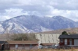
Fort Hall, Idaho
Encyclopedia
Fort Hall is a census-designated place
(CDP) in the southeastern part of the U.S. state
of Idaho
, split between northern Bannock County
and southern Bingham County
. It is located on the Fort Hall Indian Reservation
along the Snake River
north of Pocatello
, near the site of the original Fort Hall
in the Oregon Country
. The population was 3,201 at the 2010 census.
The Bannock County portion of Fort Hall is part of the 'Pocatello, Idaho Metropolitan Statistical Area
', while the Bingham County portion is part of the 'Blackfoot, Idaho
Micropolitan Statistical Area'.
According to the United States Census Bureau
, the CDP has a total area of 35.2 square miles (91.2 km²), all of it land.
of 2000, there were 3,193 people, 969 households, and 781 families residing in the CDP. The population density
was 90.8 people per square mile (35.1/km²). There were 1,088 housing units at an average density of 30.9/sq mi (11.9/km²). The racial makeup of the CDP was 30.22% White, 0.03% African American, 65.39% Native American, 0.31% Asian, 0.03% Pacific Islander, 2.25% from other races
, and 1.75% from two or more races. Hispanic or Latino of any race were 7.61% of the population.
There were 969 households out of which 42.2% had children under the age of 18 living with them, 49.6% were married couples
living together, 22.5% had a female householder with no husband present, and 19.3% were non-families. 16.3% of all households were made up of individuals and 4.4% had someone living alone who was 65 years of age or older. The average household size was 3.26 and the average family size was 3.63.
In the CDP the population was spread out with 34.7% under the age of 18, 11.3% from 18 to 24, 28.2% from 25 to 44, 18.5% from 45 to 64, and 7.3% who were 65 years of age or older. The median age was 28 years. For every 100 females there were 94.7 males. For every 100 females age 18 and over, there were 92.3 males.
The median income for a household in the CDP was $30,313, and the median income for a family was $32,256. Males had a median income of $27,310 versus $21,544 for females. The per capita income
for the CDP was $10,563. About 22.6% of families and 27.2% of the population were below the poverty line, including 32.5% of those under age 18 and 26.9% of those age 65 or over.
Census-designated place
A census-designated place is a concentration of population identified by the United States Census Bureau for statistical purposes. CDPs are delineated for each decennial census as the statistical counterparts of incorporated places such as cities, towns and villages...
(CDP) in the southeastern part of the U.S. state
U.S. state
A U.S. state is any one of the 50 federated states of the United States of America that share sovereignty with the federal government. Because of this shared sovereignty, an American is a citizen both of the federal entity and of his or her state of domicile. Four states use the official title of...
of Idaho
Idaho
Idaho is a state in the Rocky Mountain area of the United States. The state's largest city and capital is Boise. Residents are called "Idahoans". Idaho was admitted to the Union on July 3, 1890, as the 43rd state....
, split between northern Bannock County
Bannock County, Idaho
Bannock County is a county located in the southeastern part of the U.S. state of Idaho. It was established in 1893 and named after the local Bannock tribe. It is part of the Pocatello, Idaho Metropolitan Statistical Area, which encompasses all of Bannock and Power counties. As of the 2000 Census...
and southern Bingham County
Bingham County, Idaho
Bingham County is a county located in the U.S. state of Idaho. As of the 2000 Census the county had a population of 41,735 . The county seat and largest city is Blackfoot. Bingham County comprises the Blackfoot, ID, Micropolitan Statistical Area.Bingham County was created January 13, 1885, and...
. It is located on the Fort Hall Indian Reservation
Fort Hall Indian Reservation
The Fort Hall Indian Reservation is an Indian reservation of the federally recognized Shoshone-Bannock Tribes in the U.S. state of Idaho. It is located in southeastern Idaho on the Snake River Plain north of Pocatello, and comprises 814.874 sq mi of land area in four counties: Bingham, Power,...
along the Snake River
Snake River
The Snake is a major river of the greater Pacific Northwest in the United States. At long, it is the largest tributary of the Columbia River, the largest North American river that empties into the Pacific Ocean...
north of Pocatello
Pocatello, Idaho
Pocatello is the county seat and largest city of Bannock County, with a small portion on the Fort Hall Indian Reservation in neighboring Power County, in the southeastern part of the U.S. state of Idaho. It is the principal city of the Pocatello metropolitan area, which encompasses all of Bannock...
, near the site of the original Fort Hall
Fort Hall
Fort Hall, sitting athwart the end of the common stretch shared by the three far west emigrant trails was a 19th century outpost in the eastern Oregon Country, which eventually became part of the present-day United States, and is located in southeastern Idaho near Fort Hall, Idaho...
in the Oregon Country
Oregon Country
The Oregon Country was a predominantly American term referring to a disputed ownership region of the Pacific Northwest of North America. The region was occupied by British and French Canadian fur traders from before 1810, and American settlers from the mid-1830s, with its coastal areas north from...
. The population was 3,201 at the 2010 census.
The Bannock County portion of Fort Hall is part of the 'Pocatello, Idaho Metropolitan Statistical Area
Pocatello metropolitan area
The Pocatello Metropolitan Statistical Area, as defined by the United States Census Bureau, is an area consisting of two counties in eastern Idaho, anchored by the city of Pocatello...
', while the Bingham County portion is part of the 'Blackfoot, Idaho
Blackfoot, Idaho
Blackfoot is a city in Bingham County, Idaho, United States. The population was 10,419 at the 2000 census. The city is the county seat of Bingham County. Blackfoot is self-designated the "Potato Capital of the World", because it claims to have the largest potato industry in the world...
Micropolitan Statistical Area'.
Geography
Fort Hall is located at 43°1′7"N 112°26′54"W (43.018506, -112.448301).According to the United States Census Bureau
United States Census Bureau
The United States Census Bureau is the government agency that is responsible for the United States Census. It also gathers other national demographic and economic data...
, the CDP has a total area of 35.2 square miles (91.2 km²), all of it land.
Demographics
As of the censusCensus
A census is the procedure of systematically acquiring and recording information about the members of a given population. It is a regularly occurring and official count of a particular population. The term is used mostly in connection with national population and housing censuses; other common...
of 2000, there were 3,193 people, 969 households, and 781 families residing in the CDP. The population density
Population density
Population density is a measurement of population per unit area or unit volume. It is frequently applied to living organisms, and particularly to humans...
was 90.8 people per square mile (35.1/km²). There were 1,088 housing units at an average density of 30.9/sq mi (11.9/km²). The racial makeup of the CDP was 30.22% White, 0.03% African American, 65.39% Native American, 0.31% Asian, 0.03% Pacific Islander, 2.25% from other races
Race (United States Census)
Race and ethnicity in the United States Census, as defined by the Federal Office of Management and Budget and the United States Census Bureau, are self-identification data items in which residents choose the race or races with which they most closely identify, and indicate whether or not they are...
, and 1.75% from two or more races. Hispanic or Latino of any race were 7.61% of the population.
There were 969 households out of which 42.2% had children under the age of 18 living with them, 49.6% were married couples
Marriage
Marriage is a social union or legal contract between people that creates kinship. It is an institution in which interpersonal relationships, usually intimate and sexual, are acknowledged in a variety of ways, depending on the culture or subculture in which it is found...
living together, 22.5% had a female householder with no husband present, and 19.3% were non-families. 16.3% of all households were made up of individuals and 4.4% had someone living alone who was 65 years of age or older. The average household size was 3.26 and the average family size was 3.63.
In the CDP the population was spread out with 34.7% under the age of 18, 11.3% from 18 to 24, 28.2% from 25 to 44, 18.5% from 45 to 64, and 7.3% who were 65 years of age or older. The median age was 28 years. For every 100 females there were 94.7 males. For every 100 females age 18 and over, there were 92.3 males.
The median income for a household in the CDP was $30,313, and the median income for a family was $32,256. Males had a median income of $27,310 versus $21,544 for females. The per capita income
Per capita income
Per capita income or income per person is a measure of mean income within an economic aggregate, such as a country or city. It is calculated by taking a measure of all sources of income in the aggregate and dividing it by the total population...
for the CDP was $10,563. About 22.6% of families and 27.2% of the population were below the poverty line, including 32.5% of those under age 18 and 26.9% of those age 65 or over.