French Meadows Reservoir
Encyclopedia
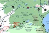
French Meadows Reservoir is a manmade lake
36 miles (57.9 km) northeast of Foresthill, California
United States. on the Middle Fork of the American River
. The reservoir is 2.9 miles (4.7 km) long, 0.6 mile (0.965604 km) wide, with 7.3 miles (11.7 km) of shoreline.
Tahoe National Forest
manages the recreational facilities which include five campgrounds, two group campgrounds and two paved boat launch ramps. Activities at the lake include powerboating
, kayaking
, canoeing
, fishing, picniking and hiking
.
The reservoir is entirely within a state game refuge
so no firearms, pellet guns or archery weapons are allowed.
The elevation of the lake is 5263 feet (1,604.2 m) and is nine miles (14 km) from the crest of the Sierra Nevada Mountain Range.
is rock-fill with earth core. The capacity of the reservoir is 125601 acre.ft of water. French Meadows Reservoir is part of the Middle Fork Project for power generation and its water is diverted to the powerhouse on Hell Hole Reservoir
by an underground tunnel. Releases from French Meadows Reservoir to the powerhouse began one year later, December 13, 1965. The project is operated by the Placer County Water Agency.
Lake
A lake is a body of relatively still fresh or salt water of considerable size, localized in a basin, that is surrounded by land. Lakes are inland and not part of the ocean and therefore are distinct from lagoons, and are larger and deeper than ponds. Lakes can be contrasted with rivers or streams,...
36 miles (57.9 km) northeast of Foresthill, California
Foresthill, California
Foresthill is a census-designated place in Placer County, California, United States. It is part of the Sacramento–Arden-Arcade–Roseville Metropolitan Statistical Area...
United States. on the Middle Fork of the American River
American River
The American River is a California watercourse noted as the site of Sutter's Mill, northwest of Placerville, California, where gold was found in 1848, leading to the California Gold Rush...
. The reservoir is 2.9 miles (4.7 km) long, 0.6 mile (0.965604 km) wide, with 7.3 miles (11.7 km) of shoreline.
Tahoe National Forest
Tahoe National Forest
Tahoe National Forest is a U.S. National Forest located in the state of California, northwest of Lake Tahoe. It includes the peak of Sierra Buttes, near Sierra City, which has views of Mount Lassen and Mount Shasta. It is located in parts of six counties. In descending order of forestland area...
manages the recreational facilities which include five campgrounds, two group campgrounds and two paved boat launch ramps. Activities at the lake include powerboating
Powerboating
Power boating describes activities performed in a motorized boat. Generally, a power boat has a high power-to-weight ratio and a hull design that allows for easy planing, which allows for higher speed and improved handling. Also, the shape of the actual boat is usually very streamlined, which...
, kayaking
Kayaking
Kayaking is the use of a kayak for moving across water. Kayaking and canoeing are also known as paddling. Kayaking is distinguished from canoeing by the sitting position of the paddler and the number of blades on the paddle...
, canoeing
Canoeing
Canoeing is an outdoor activity that involves a special kind of canoe.Open canoes may be 'poled' , sailed, 'lined and tracked' or even 'gunnel-bobbed'....
, fishing, picniking and hiking
Hiking
Hiking is an outdoor activity which consists of walking in natural environments, often in mountainous or other scenic terrain. People often hike on hiking trails. It is such a popular activity that there are numerous hiking organizations worldwide. The health benefits of different types of hiking...
.
The reservoir is entirely within a state game refuge
Wildlife refuge
A wildlife refuge, also called a wildlife sanctuary, may be a naturally occurring sanctuary, such as an island, that provides protection for species from hunting, predation or competition, or it may refer to a protected area, a geographic territory within which wildlife is protected...
so no firearms, pellet guns or archery weapons are allowed.
The elevation of the lake is 5263 feet (1,604.2 m) and is nine miles (14 km) from the crest of the Sierra Nevada Mountain Range.
History
The reservoir was built in December 1964 with the construction on the Middle Fork of the American River of the L.L. Anderson dam. The damDam
A dam is a barrier that impounds water or underground streams. Dams generally serve the primary purpose of retaining water, while other structures such as floodgates or levees are used to manage or prevent water flow into specific land regions. Hydropower and pumped-storage hydroelectricity are...
is rock-fill with earth core. The capacity of the reservoir is 125601 acre.ft of water. French Meadows Reservoir is part of the Middle Fork Project for power generation and its water is diverted to the powerhouse on Hell Hole Reservoir
Hell Hole Reservoir
Hell Hole reservoir is an artificial, crescent-shaped lake in the Sierra Nevada mountain range west of Lake Tahoe in California. The lake is about long when at full capacity....
by an underground tunnel. Releases from French Meadows Reservoir to the powerhouse began one year later, December 13, 1965. The project is operated by the Placer County Water Agency.

