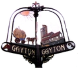
Gayton, Norfolk
Encyclopedia
Gayton is a small village
in the west of the English
county of Norfolk
. It is 7.3 miles east of the town of King's Lynn
, and 10.1 miles north-west of the town of Swaffham
. The Gaywood River
has its source just north of the village at Derby Fen. The village sides astride of the B1145
Kings Lynn to Mundesley
road that dissects North Norfolk
west to east.
The village has a primary school, Gayton Church of England First School, which caters for pupils from 5 to 8. The church in Gayton is St Nicholas church.http://www.acny.org.uk/venue.php?V=4729 There are two pubs in the village, The Rampant Horse and The Crown. The village also has a butchers shop and petrol station combining convenience shop/post office.
The village has a windmill
and is twinned with nearby Middleton
.
Village
A village is a clustered human settlement or community, larger than a hamlet with the population ranging from a few hundred to a few thousand , Though often located in rural areas, the term urban village is also applied to certain urban neighbourhoods, such as the West Village in Manhattan, New...
in the west of the English
England
England is a country that is part of the United Kingdom. It shares land borders with Scotland to the north and Wales to the west; the Irish Sea is to the north west, the Celtic Sea to the south west, with the North Sea to the east and the English Channel to the south separating it from continental...
county of Norfolk
Norfolk
Norfolk is a low-lying county in the East of England. It has borders with Lincolnshire to the west, Cambridgeshire to the west and southwest and Suffolk to the south. Its northern and eastern boundaries are the North Sea coast and to the north-west the county is bordered by The Wash. The county...
. It is 7.3 miles east of the town of King's Lynn
King's Lynn
King's Lynn is a sea port and market town in the ceremonial county of Norfolk in the East of England. It is situated north of London and west of Norwich. The population of the town is 42,800....
, and 10.1 miles north-west of the town of Swaffham
Swaffham
Swaffham is a market town and civil parish in the English county of Norfolk. The town is situated east of King's Lynn and west of Norwich.The civil parish has an area of and in the 2001 census had a population of 6,935 in 3,130 households...
. The Gaywood River
Gaywood River
Gaywood River is a tributary of the River Great Ouse in the west of the county of Norfolk. Its source is 11 metres above sea level, northwest of the village of Gayton in Derby Fen, Map Reference TF 705 209...
has its source just north of the village at Derby Fen. The village sides astride of the B1145
B1145 road
The B1145 runs for about through the county of Norfolk, England, between King’s Lynn and Mundesley. The road is an alternative route to the A47 between Kings Lynn and Norwich by way of the A1067 from Bawdeswell onwards.-History:...
Kings Lynn to Mundesley
Mundesley
Mundesley is a coastal village and a civil parish in the English county of Norfolk. The village is 20.3 miles north-north east of Norwich, 7.3 miles south east of Cromer and 136 miles north east of London. The village lies 5.6 miles north-north east of the town of North Walsham. The nearest...
road that dissects North Norfolk
North Norfolk
North Norfolk is a local government district in Norfolk, United Kingdom. Its council is based in Cromer. The council headquarters can be found approximately out of the town of Cromer on the Holt Road.-History:...
west to east.
The village has a primary school, Gayton Church of England First School, which caters for pupils from 5 to 8. The church in Gayton is St Nicholas church.http://www.acny.org.uk/venue.php?V=4729 There are two pubs in the village, The Rampant Horse and The Crown. The village also has a butchers shop and petrol station combining convenience shop/post office.
The village has a windmill
Gayton Windmill, Norfolk
For the Gayton Windmill now in Merseyside see Gayton Windmill, CheshireGayton Mill is a Grade II listed tower mill at Gayton, Norfolk, England which has been truncated and converted to holiday accommodation.-History:...
and is twinned with nearby Middleton
Middleton, Norfolk
Middleton is a civil parish in the English county of Norfolk.It covers an area of and had a population of 1,516 in 621 households as of the 2001 census.For the purposes of local government, it falls within the district of King's Lynn and West Norfolk....
.
_(sidea).jpg) |

