Georg Braun
Encyclopedia

Geographer
A geographer is a scholar whose area of study is geography, the study of Earth's natural environment and human society.Although geographers are historically known as people who make maps, map making is actually the field of study of cartography, a subset of geography...
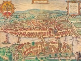
. From 1572 to 1617 he edited the Civitates orbis terrarum, which contains 546 prospects, bird's-eye views, and maps of cities from all around the world.
Braun was born and died in Cologne
Cologne
Cologne is Germany's fourth-largest city , and is the largest city both in the Germany Federal State of North Rhine-Westphalia and within the Rhine-Ruhr Metropolitan Area, one of the major European metropolitan areas with more than ten million inhabitants.Cologne is located on both sides of the...
. His principal profession was as a Catholic cleric, however, and he spent thirty-seven years as canon
Canon (priest)
A canon is a priest or minister who is a member of certain bodies of the Christian clergy subject to an ecclesiastical rule ....
and dean
Dean (religion)
A dean, in a church context, is a cleric holding certain positions of authority within a religious hierarchy. The title is used mainly in the Anglican Communion and the Roman Catholic Church.-Anglican Communion:...
at the church, St. Maria ad Gradus
St. Maria ad Gradus
St. Maria ad Gradus is the name of a former church located East of the Cathedral of Cologne, Germany, situated between the cathedral and the Rhine....
, in Cologne.
The six-volume work was inspired by Sebastian Münster
Sebastian Münster
Sebastian Münster , was a German cartographer, cosmographer, and a Hebrew scholar.- Life :Münster was born at Ingelheim near Mainz, the son of Andreas Munster. He completed his studies at the Eberhard-Karls-Universität Tübingen in 1518. His graduate adviser was Johannes Stöffler.He was appointed to...
's Cosmographia
Cosmographia (Sebastian Münster)
The Cosmographia by Sebastian Münster from 1544 is the earliest German description of the world. It had numerous editions in different languages including Latin, French , Italian, English, and even Czech. The last German edition was published in 1628, long after his death...
. In form and layout it resembles the 1570 Theatrum orbis terrarum
Theatrum Orbis Terrarum
Theatrum Orbis Terrarum is considered to be the first true modern atlas. Written by Abraham Ortelius and originally printed on May 20, 1570, in Antwerp, it consisted of a collection of uniform map sheets and sustaining text bound to form a book for which copper printing plates were specifically...
by Abraham Ortelius
Abraham Ortelius
thumb|250px|Abraham Ortelius by [[Peter Paul Rubens]]Abraham Ortelius thumb|250px|Abraham Ortelius by [[Peter Paul Rubens]]Abraham Ortelius (Abraham Ortels) thumb|250px|Abraham Ortelius by [[Peter Paul Rubens]]Abraham Ortelius (Abraham Ortels) (April 14, 1527 – June 28,exile in England to take...
, as Ortelius was interested in a complementary companion for the Theatrum.
The Braun publication set new standards in cartography for over 100 years. Frans Hogenberg (1535–1590, from Munich) created the tables for volumes I through IV, and Simon van den Neuwel created those for volumes V and VI. Other contributors were Georg Hoefnagel, cartographer Daniel Freese, and Heinrich Rantzau
Heinrich Rantzau
Heinrich Rantzau or Ranzow was a German humanist writer and statesman, a prolific astrologer and an associate of Tycho Brahe. He was son of Johan Rantzau....
. Also, works by Jacob van Deventer
Jacob van Deventer (cartographer)
Jacob Roelofs van Deventer was a Dutch cartographer of the Renaissance. He is today best known for his work in systematically cartographing all Dutch towns and cities of his time.- Biography :...
, Sebastian Münster
Sebastian Münster
Sebastian Münster , was a German cartographer, cosmographer, and a Hebrew scholar.- Life :Münster was born at Ingelheim near Mainz, the son of Andreas Munster. He completed his studies at the Eberhard-Karls-Universität Tübingen in 1518. His graduate adviser was Johannes Stöffler.He was appointed to...
, and Johannes Stumpf were used. Mainly, European cities are depicted in the publication, however, Casablanca
Casablanca
Casablanca is a city in western Morocco, located on the Atlantic Ocean. It is the capital of the Grand Casablanca region.Casablanca is Morocco's largest city as well as its chief port. It is also the biggest city in the Maghreb. The 2004 census recorded a population of 2,949,805 in the prefecture...
and Mexico City
Mexico City
Mexico City is the Federal District , capital of Mexico and seat of the federal powers of the Mexican Union. It is a federal entity within Mexico which is not part of any one of the 31 Mexican states but belongs to the federation as a whole...
are also included in volume I.
Georg Braun was the principal editor of the work, he acquired the tables, hired the artists, and wrote the texts. He died as an octogenarian in 1622, as the only survivor of the original team to witness the publication of volume VI in 1617.
Sources
- James Elliot, The City in Maps: Urban Mapping to 1900, 1987, British Library London, ISBN 0712301348 http://books.google.com/books?id=RoAWHgAACAAJ
- Ronald Vere Tooley, Tooley's Dictionary of Mapmakers, 1979, ISBN 0845117017 http://books.google.com/books?id=J73sAAAACAAJ
- Leo BagrowLeo BagrowLeo Bagrow , born Lev Semenovich Bagrow, was a historian of cartography and the founder of the journal Imago Mundi.-External Links:* at , Harvard University...
, Abraham OrteliusAbraham Orteliusthumb|250px|Abraham Ortelius by [[Peter Paul Rubens]]Abraham Ortelius thumb|250px|Abraham Ortelius by [[Peter Paul Rubens]]Abraham Ortelius (Abraham Ortels) thumb|250px|Abraham Ortelius by [[Peter Paul Rubens]]Abraham Ortelius (Abraham Ortels) (April 14, 1527 – June 28,exile in England to take...
: A. Ortelii Catalogus Cartographorum, J. Perthes, 1928 http://books.google.com/books?id=UcKyKAAACAAJ
External links
-
- Wolfgang Bruhn: Alte deutsche Städtebilder : 24 farb. Blätter / Georg Braun ; Franz Hogenberg, J. Asmus , Leipzig, 1938 http://dispatch.opac.ddb.de/DB=4.1/SET=8/TTL=1/SHW?FRST=4
- Georg Braun, Franz Hogenberg: Old European Cities: 16th century city maps and texts, with a description by Ruthardt Oehme of early map-making techniques, London, Thames and Hudson, 1965 http://dispatch.opac.ddb.de/DB=4.1/SET=7/TTL=11/SHW?FRST=12
- Civitates orbis terrarum (description and high-res scans)
- Civitates orbis terrarum - Braun and Hogenberg

