Girsby
Encyclopedia
Girsby is a village
and civil parish in the district of Hambleton
in North Yorkshire
, England
. The village lies on high ground on the eastern bank of the River Tees
.
Historically the village was a township
in the ancient parish of Sockburn
, a parish divided by the River Tees between the North Riding of Yorkshire
(which included Girsby) and County Durham
(which included the township of Sockburn). Girsby became a separate civil parish in 1866.
The settlement has fallen into disrepair, many of the remaining buildings are derelict
, there are barely enough houses to constitute a hamlet
.
The small and secluded 'Girsby All Saints Church' overlooks the meandering Tees from its elevated position. The views from this vantage point are most enjoyable at sunset.
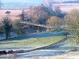
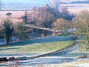
 A private farmers track leads down to a rarely used bridge over the Tees. A public bridle path crosses the bridge linking Girsby with the nearby village of Neasham
on the opposite bank of the river. A plaque on the bridge is inscribed;
Bridle Bridge,
Erected by Theophania Blackett 1870,
Thomas Dyke Esq Civil Engineer.
This engineer from Newcastle owned lots of land in this area, he erected the church at Girsby after the ruins of Sockburn church where no longer visitable, the church was built for the equivalent price today of £14.67
The name bridle may refer to the historic right of way called bridleway.
Village
A village is a clustered human settlement or community, larger than a hamlet with the population ranging from a few hundred to a few thousand , Though often located in rural areas, the term urban village is also applied to certain urban neighbourhoods, such as the West Village in Manhattan, New...
and civil parish in the district of Hambleton
Hambleton
Hambleton is a local government district of North Yorkshire, England. The main town and administrative centre is Northallerton, and includes the market towns and major villages of Bedale, Thirsk, Great Ayton, Stokesley and Easingwold....
in North Yorkshire
North Yorkshire
North Yorkshire is a non-metropolitan or shire county located in the Yorkshire and the Humber region of England, and a ceremonial county primarily in that region but partly in North East England. Created in 1974 by the Local Government Act 1972 it covers an area of , making it the largest...
, England
England
England is a country that is part of the United Kingdom. It shares land borders with Scotland to the north and Wales to the west; the Irish Sea is to the north west, the Celtic Sea to the south west, with the North Sea to the east and the English Channel to the south separating it from continental...
. The village lies on high ground on the eastern bank of the River Tees
River Tees
The River Tees is in Northern England. It rises on the eastern slope of Cross Fell in the North Pennines, and flows eastwards for 85 miles to reach the North Sea between Hartlepool and Redcar.-Geography:...
.
Historically the village was a township
Township (England)
In England, a township is a local division or district of a large parish containing a village or small town usually having its own church...
in the ancient parish of Sockburn
Sockburn
Sockburn is a village and civil parish in County Durham, in England. It is situated at the bottom of a loop of the River Tees, south of Darlington, known locally as the Sockburn Peninsula. Today, there is not much there apart from an early nineteenth-century mansion, a ruined church and a farmhouse...
, a parish divided by the River Tees between the North Riding of Yorkshire
North Riding of Yorkshire
The North Riding of Yorkshire was one of the three historic subdivisions of the English county of Yorkshire, alongside the East and West Ridings. From the Restoration it was used as a Lieutenancy area. The three ridings were treated as three counties for many purposes, such as having separate...
(which included Girsby) and County Durham
County Durham
County Durham is a ceremonial county and unitary district in north east England. The county town is Durham. The largest settlement in the ceremonial county is the town of Darlington...
(which included the township of Sockburn). Girsby became a separate civil parish in 1866.
The settlement has fallen into disrepair, many of the remaining buildings are derelict
Abandonment
The term abandonment has a multitude of uses, legal and extra-legal. This "signpost article" provides a guide to the various legal and quasi-legal uses of the word and includes links to articles that deal with each of the distinct concepts at greater length...
, there are barely enough houses to constitute a hamlet
Hamlet (place)
A hamlet is usually a rural settlement which is too small to be considered a village, though sometimes the word is used for a different sort of community. Historically, when a hamlet became large enough to justify building a church, it was then classified as a village...
.
The small and secluded 'Girsby All Saints Church' overlooks the meandering Tees from its elevated position. The views from this vantage point are most enjoyable at sunset.

Neasham
Neasham is a village approximately four miles to the south east of Darlington in County Durham, England and has more than 1,000 years of history. The village sits on the banks of the river Tees which, at that point, marks the border between the counties of Durham and North Yorkshire...
on the opposite bank of the river. A plaque on the bridge is inscribed;
Bridle Bridge,
Erected by Theophania Blackett 1870,
Thomas Dyke Esq Civil Engineer.
This engineer from Newcastle owned lots of land in this area, he erected the church at Girsby after the ruins of Sockburn church where no longer visitable, the church was built for the equivalent price today of £14.67
The name bridle may refer to the historic right of way called bridleway.

