
Grade I listed buildings in Suffolk Coastal
Encyclopedia
There are 60 Grade I listed buildings in Suffolk Coastal
Suffolk Coastal
Suffolk Coastal is a local government district in Suffolk, England. Its council is based in Woodbridge. Other towns include Felixstowe.The district was formed on 1 April 1974, under the Local Government Act 1972, as a merger of the municipal borough of Aldeburgh, along with Felixstowe,...
, a non-metropolitan district
Non-metropolitan district
Non-metropolitan districts, or colloquially shire districts, are a type of local government district in England. As created, they are sub-divisions of non-metropolitan counties in a so-called "two-tier" arrangement...
in the county of Suffolk
Suffolk
Suffolk is a non-metropolitan county of historic origin in East Anglia, England. It has borders with Norfolk to the north, Cambridgeshire to the west and Essex to the south. The North Sea lies to the east...
in England.
In the United Kingdom, the term listed building refers to a building or other structure officially designated as being of "exceptional architectural or historic special interest"; Grade I structures are those considered to be "buildings of "exceptional interest, sometimes considered to be internationally important. Just 2.5% of listed buildings are Grade I." The total number of listed buildings in England is 372,905. Listing was begun by a provision in the Town and Country Planning Act 1947. Listing a building imposes severe restrictions on what the owner might wish to change or modify in the structure or its fittings. In England, the authority for listing under the Planning (Listed Buildings and Conservation Areas) Act 1990
Planning (Listed Buildings and Conservation Areas) Act 1990
The Planning Act 1990 is an Act of Parliament of the United Kingdom that altered the laws on granting of planning permission for building works, notably including those of the listed building system in England and Wales....
rests with English Heritage
English Heritage
English Heritage . is an executive non-departmental public body of the British Government sponsored by the Department for Culture, Media and Sport...
, a non-departmental public body
Non-departmental public body
In the United Kingdom, a non-departmental public body —often referred to as a quango—is a classification applied by the Cabinet Office, Treasury, Scottish Government and Northern Ireland Executive to certain types of public bodies...
sponsored by the Department for Culture, Media and Sport
Department for Culture, Media and Sport
The Department for Culture, Media and Sport is a department of the United Kingdom government, with responsibility for culture and sport in England, and some aspects of the media throughout the whole UK, such as broadcasting and internet....
.
Suffolk Coastal is a local government district with its administrative headquarters at Woodbridge
Woodbridge, Suffolk
Woodbridge is a town in Suffolk, East Anglia, England. It is in the East of England, not far from the coast. It lies along the River Deben, with a population of about 7,480. The town is served by Woodbridge railway station on the Ipswich-Lowestoft East Suffolk Line. Woodbridge is twinned with...
, while the main town in the district is Felixstowe
Felixstowe
Felixstowe is a seaside town on the North Sea coast of Suffolk, England. The town gives its name to the nearby Port of Felixstowe, which is the largest container port in the United Kingdom and is owned by Hutchinson Ports UK...
, which is also Britain's busiest container port
Port of Felixstowe
The Port of Felixstowe, in Felixstowe, Suffolk is the UK's busiest container port, dealing with 35% of the country's container cargo. It was developed following the abandonment of a project for a deep-water harbour at Maplin Sands. In 2005, it was ranked as the 28th busiest container port in the...
. The other towns in the district are Framlingham
Framlingham
Framlingham is a market town and civil parish in the Suffolk Coastal District of Suffolk, England. Commonly referred to as "Fram" by the locals, it is of Anglo-Saxon origin and is mentioned in the Domesday Book. It has a population of 3,114 at the 2001 census...
, Leiston
Leiston
Leiston is a town in eastern Suffolk, England. It is situated near Saxmundham and Aldeburgh, about from the North Sea coast and is northeast of Ipswich and northeast from London...
, Orford
Orford, Suffolk
Orford is a small town in Suffolk, England, within the Suffolk Coast and Heaths AONB.Like many Suffolk coastal towns it was of some importance as a port and fishing village in the Middle Ages. It still has a fine mediaeval castle, built to dominate the River Ore.The main geographical feature of the...
, Saxmundham
Saxmundham
Saxmundham is a small market town in Suffolk, England. It is set in the valley of the River Fromus, a tributary of the River Alde, approximately northeast of Ipswich and west of the coast at Sizewell. The town is bypassed by the A12 and is served by Saxmundham railway station on the East Suffolk...
and Walton
Walton, Suffolk
Walton is a small village in Suffolk, between the rivers Orwell and Deben. It is often confused as being part of Felixstowe, although it is a separate village and is mentioned in the Domesday Book...
. The number of inhabitants of the area is 124,400 with a density of 140 inhabitants per km². There are 117 civil parishes in Suffolk Coastal.
| Name | Image | Date completed | Location | Notes | Ref(s) |
|---|---|---|---|---|---|
| Moot Hall | 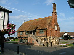 |
1520 | Aldeburgh Aldeburgh Aldeburgh is a coastal town in Suffolk, East Anglia, England. Located on the River Alde, the town is notable for its Blue Flag shingle beach and fisherman huts where freshly caught fish are sold daily, and the Aldeburgh Yacht Club... |
||
| Church of St John the Baptist | 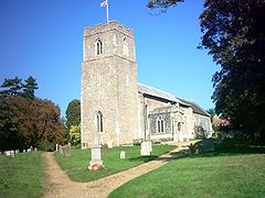 |
13th-century | Badingham Badingham Badingham is a village and civil parish in the Suffolk Coastal district of Suffolk in eastern England. In 2007 it had an estimated population of 470.... |
||
| Church of the Holy Trinity |  |
15th-century | Blythburgh Blythburgh Blythburgh is a small English village in an area known as the Sandlings, part of the Suffolk heritage coast. Located close to an area of flooded marshland and mud-flats, in 2007 its population was estimated to be 300. Blythburgh is best known for its church, Holy Trinity, internationally known as... |
||
| Church of St Andrew | 14th-century | Bramfield Bramfield, Suffolk Bramfield is a small village in the county of Suffolk, England. The village is found off the A12 road, one of the main arterial routes through the county.... |
|||
| Church of St Andrew: Tower | 12th-century | Bramfield Bramfield, Suffolk Bramfield is a small village in the county of Suffolk, England. The village is found off the A12 road, one of the main arterial routes through the county.... |
|||
| Church of All Saints | 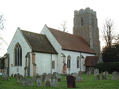 |
14th-century | Brandeston Brandeston Brandeston is a village in Suffolk, England on the River Deben. 'Brandeston Hall'the largest building in the village, is now the preparatory department of nearby Framlingham College... |
||
| Church of St Edmund | 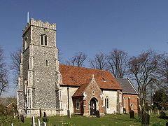 |
15th-century | Bromeswell Bromeswell Bromeswell is a village and civil parish in the Suffolk Coastal district of Suffolk, England about 2 miles east of Woodbridge.Bromeswell shows many of the characteristics of a traditional English village. It is one of the most secluded, beautiful spots in Suffolk... |
||
| Church of St Peter | 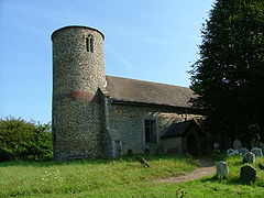 |
13th-century | Bruisyard Bruisyard Bruisyard is a village in the valley of the River Alde in the county of Suffolk, England. The village has a population of ~175. The village sign depicts Saint Clare of the Order of the Poor Clares who had an abbey in Bruisyard until the dissolution of the monasteries under Henry VIII... |
||
| Butley Abbey | 14th-century | Butley Butley, Suffolk Butley is a village and civil parish in the English county of Suffolk.Butley lies east of the town of Woodbridge on the B1084 road. Administratively, Butley forms part of the Suffolk Coastal district; from 1934 to 1974 it had been part of the former Deben Rural District.- External links :**... |
|||
| Church of St Peter | 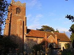 |
13th-century | Charsfield Charsfield Charsfield is a small Suffolk village of approximately 250 residents, from Wickham Market, miles from Woodbridge and miles from Ipswich and is located near the villages of Debach and Dallinghoo... |
||
| Church of St Mary | 14th-century | Chediston Chediston Chediston is a village and a civil parish on the B1123 road, in the Suffolk Coastal District, in the English county of Suffolk. It is 2 miles W. of Halesworth, its post town. Chediston has a church... |
|||
| Church of St Michael | 12th-century | Cookley Cookley, Suffolk Cookley is a village and a civil parish in the Suffolk Coastal district, in the county of Suffolk, England. Nearby settlements include the town of Halesworth and the village of Walpole. It has a church called Church of St Michael.- External links :*... |
|||
| Church of St Mary | 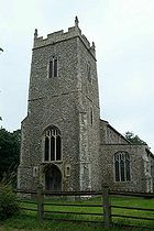 |
15th-century | Cratfield Cratfield Cratfield is a village in northern Suffolk, England.Neighbouring villages include Laxfield, Metfield, Cookley, Huntingfield, Heveningham. The nearest town, Halesworth, is approximately 5 miles away. Southwold is a popular, nearby coastal town. The market town of Framlingham is also close... |
||
| Church of All Saints | 15th-century | Darsham Darsham Darsham is a village in Suffolk, England. It is located approximately north east of Saxmundham. The village is bypassed by the A12 and is served by Darsham railway station, which is approximately one mile away from the village centre, on the Ipswich-Lowestoft East Suffolk Line.The name of the... |
|||
| Church of St Mary | 14th-century | Dennington Dennington For the town in Victoria, Australia, see Dennington, VictoriaDennington is a small village in Suffolk, England, just north of Framlingham along the A1120 Bypass.-External links:* - village's local newspaper website... |
|||
| Church of St Mary | 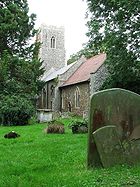 |
15th-century | Earl Soham Earl Soham Earl Soham is a small settlement in Suffolk, England. It is on the A1120 road and is west of the town of Framlingham.- History :The manor of Earl Soham once belonged to the Earls of Norfolk, the Bigod family , who also owned nearby Framlingham Castle.Edward 1st granted Roger Bigod permission to... |
||
| Church of All Saints | 13th-century | Easton Easton, Suffolk The former estate village of Easton in England is situated on the River Deben around three miles south of Framlingham. Following the end of the World War 1 the British government imposed super taxes on the rich to help defray the cost of the war... |
|||
| Church of All Saints | 14th-century | Eyke Eyke Eyke is a village and a civil parish in the Suffolk Coastal District, in the English county of Suffolk. It is located on the A1152 road near the town of Woodbridge. Eyke has a primary school, a place of worship and a pub.- References :... |
|||
| Landguard Fort Landguard Fort Built just outside Felixstowe, Suffolk, at the mouth of the River Orwell, Landguard Fort was designed to guard the entrance to Harwich. The first fortifications from 1540 were a few earthworks and blockhouse, but it was James I of England who ordered the construction of a square fort with bulwarks... |
1711 | Felixstowe Felixstowe Felixstowe is a seaside town on the North Sea coast of Suffolk, England. The town gives its name to the nearby Port of Felixstowe, which is the largest container port in the United Kingdom and is owned by Hutchinson Ports UK... |
|||
| Framlingham Castle Framlingham Castle Framlingham Castle is a castle in the market town of Framlingham in Suffolk in England. An early motte and bailey or ringwork Norman castle was built on the Framlingham site by 1148, but this was destroyed by Henry II of England in the aftermath of the revolt of 1173-4... |
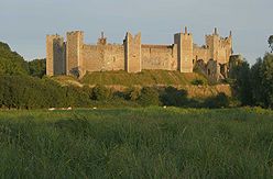 |
1200 | Framlingham Framlingham Framlingham is a market town and civil parish in the Suffolk Coastal District of Suffolk, England. Commonly referred to as "Fram" by the locals, it is of Anglo-Saxon origin and is mentioned in the Domesday Book. It has a population of 3,114 at the 2001 census... |
||
| Framlingham Castle Poor-House | 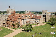 |
1729 | Framlingham Framlingham Framlingham is a market town and civil parish in the Suffolk Coastal District of Suffolk, England. Commonly referred to as "Fram" by the locals, it is of Anglo-Saxon origin and is mentioned in the Domesday Book. It has a population of 3,114 at the 2001 census... |
||
| Church of St Michael | 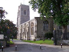 |
16th-century | Framlingham Framlingham Framlingham is a market town and civil parish in the Suffolk Coastal District of Suffolk, England. Commonly referred to as "Fram" by the locals, it is of Anglo-Saxon origin and is mentioned in the Domesday Book. It has a population of 3,114 at the 2001 census... |
||
| Church of All Saints | 15th-century | Great Glemham Great Glemham Great Glemham is a village and a civil parish in the Suffolk Coastal District, in the English county of Suffolk. It is a few miles away from the A12 road. Great Glemham has a pub and two places of worship. It is located between the towns of Framlingham and Saxmundham.- References :*... |
|||
| Church of St Mary | 13th-century | Grundisburgh Grundisburgh Grundisburgh is a village of more than 1,530 residents situated in the English county of Suffolk. It is in the Suffolk Coastal district, six miles north-east from Ipswich and four miles north-west of Woodbridge located on the B1079. Flowing through the village are the rivers Lark and Gull... |
|||
| Church of All Saints | 14th-century | Hacheston Hacheston Hacheston is a village and a civil parish in the Suffolk Coastal District, in the English county of Suffolk. It is located on the B1116 road between the towns of Wickham Market and Framlingham. Hacheston has a church and a village hall; it once had a railway station called Hacheston Halt railway... |
|||
| Church of St Margaret |  |
15th-century | Heveningham Heveningham Heveningham is a village and civil parish in the Suffolk Coastal district of Suffolk in eastern England. Located four miles south-west of Halesworth, in 2005 it had a population of 120.... |
||
| Heveningham Hall Heveningham Hall Heveningham Hall is a Grade I listed building in Heveningham, Suffolk that was built in 1780. The east wing was gutted by fire in June 1984.The hall and grounds were bought in 1994 by Foxtons-founder Jon Hunt and his wife for use as a family home... |
1780 | Heveningham Heveningham Heveningham is a village and civil parish in the Suffolk Coastal district of Suffolk in eastern England. Located four miles south-west of Halesworth, in 2005 it had a population of 120.... |
|||
| Heveningham Hall Orangery | 1790 | Heveningham Heveningham Heveningham is a village and civil parish in the Suffolk Coastal district of Suffolk in eastern England. Located four miles south-west of Halesworth, in 2005 it had a population of 120.... |
|||
| Church of St Mary | 15th-century | Huntingfield Huntingfield, Suffolk Huntingfield is a village near the B1117 road, in the Suffolk Coastal district, in the county of Suffolk, England close to the source of the river Blyth. Nearby settlements include the town of Halesworth and the villages of Walpole, Heveningham and Cookley.... |
|||
| Church of St Mary & St Peter | 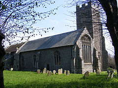 |
15th-century | Kelsale Kelsale Kelsale is a village in Suffolk, England. It is located approximately 1 mile north of Saxmundham town centre at the junction of the B1121 and the A12.... |
||
| Church of St Andrew | 14th-century | Kettleburgh Kettleburgh Kettleburgh is a small village in the Suffolk Coastal district, in the county of Suffolk. Kettleburgh has a church called St Andrews church and a pub. It is near the small towns of Wickham Market and Framlingham.- References :* *... |
|||
| St Mary's Abbey Leiston Abbey Leiston Abbey, in Suffolk, England, was formerly known as St Mary's Abbey. It was founded in 1182 at Minsmere by Ranulf de Glanville, Lord Chief Justice to Henry II... |
1382 | Leiston Leiston Leiston is a town in eastern Suffolk, England. It is situated near Saxmundham and Aldeburgh, about from the North Sea coast and is northeast of Ipswich and northeast from London... |
|||
| Church of St Peter | 1500 c. | Levington Levington Levington is a small village in the Suffolk Coastal District, in the county of Suffolk. Levington has a church called St Peters Church and a pub. It is near the large town of Ipswich and the village of Nacton. A viking ship was once found in Levington.... |
|||
| Church of St Margaret | 16th-century | Linstead Parva Linstead Parva Linstead Parva is a small village and civil parish in the Suffolk Coastal district of Suffolk in eastern England. In 2005 its population was 90, making it larger than neighbouring Linstead Magna. It shares a parish council with Linstead Magna and nearby Chediston.-External links:*... |
|||
| Church of St Andrew | 15th-century | Little Glemham Little Glemham Little Glemham is a small village on the A12 road , in the Suffolk Coastal District, in the county of Suffolk. Nearby settlements include the town of Wickham Market and the village of Marlesford. Little Glemham has a church called St Andrew Church, a pub and a hall called Glemham Hall. The... |
|||
| Little Glemham Hall | 1717 | Little Glemham Little Glemham Little Glemham is a small village on the A12 road , in the Suffolk Coastal District, in the county of Suffolk. Nearby settlements include the town of Wickham Market and the village of Marlesford. Little Glemham has a church called St Andrew Church, a pub and a hall called Glemham Hall. The... |
|||
| Church of St Andrew | 15th-century | Marlesford Marlesford Marlesford is a village and a civil parish in the Suffolk Coastal District, in the English county of Suffolk.- Location :It is about 2 miles away from the small town of Wickham Market. Marlesford has a place of worship and a pub. The area of the village that is on the A12 road is due to be... |
|||
| Church of St Mary | 14th-century | Newbourne Newbourne Newbourne is a village and civil parish in the Suffolk Coastal region of Suffolk, England. It lies on the peninsula between the River Orwell and the River Deben, to the east of Ipswich and south of Woodbridge.- Etymology :... |
|||
| Orford Castle Orford Castle Orford Castle is a castle in the village of Orford, Suffolk, England, located 12 miles northeast of Ipswich, with views over the Orford Ness. It was built between 1165 and 1173 by Henry II of England to consolidate royal power in the region. The well-preserved keep, described by historian R... |
1167 | Orford Orford, Suffolk Orford is a small town in Suffolk, England, within the Suffolk Coast and Heaths AONB.Like many Suffolk coastal towns it was of some importance as a port and fishing village in the Middle Ages. It still has a fine mediaeval castle, built to dominate the River Ore.The main geographical feature of the... |
|||
| Church of St Bartholomew | 14th-century | Orford Orford, Suffolk Orford is a small town in Suffolk, England, within the Suffolk Coast and Heaths AONB.Like many Suffolk coastal towns it was of some importance as a port and fishing village in the Middle Ages. It still has a fine mediaeval castle, built to dominate the River Ore.The main geographical feature of the... |
|||
| Otley Hall | 16th-century | Otley Otley, Suffolk Otley is a village located in the county of Suffolk, England, about eight miles north of Ipswich. The village is home to Otley Hall, a 16th century, Grade I listed house which was historically the seat of the family of Bartholomew Gosnold, and Otley College, offering vocationally focused courses... |
|||
| Church of St Mary | 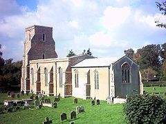 |
14th-century | Parham Parham, Suffolk Parham is a village and civil parish in the Suffolk Coastal district of Suffolk in eastern England. Located seven miles north of Woodbridge, in 2005 it had a population of 300.Parham Airfield Museum is located nearby.-External links:*... |
||
| Church of St Gregory the Great | 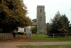 |
14th-century | Rendlesham |
||
| Church of All Saints | 15th-century | Saxtead Saxtead Saxtead is a small village in the Suffolk Coastal District, in the county of Suffolk. Saxtead gives its name to the settlements of Saxtead Green and Saxtead Little Green and the windmill Saxtead Green Windmill. Saxtead is located on the A1120 road in between the town of Stowmarket and the village... |
|||
| Church of St Peter | 15th-century | Sibton Sibton Sibton is a village and a civil parish on the A1120 road, in the Suffolk Coastal District, in the English county of Suffolk. It is near the towns of Saxmundham and Halesworth, the village of Peasenhall and the hamlet of Sibton Green... |
|||
| Church of St Peter | 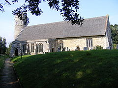 |
12th-century | Theberton Theberton Theberton is a village in Suffolk, England. It is located northeast of Saxmundham, its post town. Located within the village is a National school for both sexes and Theberton Hall... |
||
| Church of St Peter | 12th-century | Thorington Thorington Thorington is a village and a civil parish in the in the hundred of Blything, in the Suffolk Coastal District, in the English county of Suffolk. For transport there is the A12 road nearby. Nearby settlements include the town of Halesworth and the villages of Wenhaston and Blackheath... |
|||
| Church of St Martin | 15th-century | Tuddenham St Martin |
|||
| Church of St Peter | 16th-century | Ubbeston Ubbeston Ubbeston is a village and a civil parish in the Suffolk Coastal district, in the county of Suffolk, England. Nearby settlements include the town of Halesworth, the village of Heveningham and the hamlet of Ubbeston Green.... |
|||
| Church of St Mary | 15th-century | Ufford Ufford, Suffolk Ufford is a village and civil parish in Suffolk, England. At the time of the 2001 census, the parish's population was 808 people.-External links:*... |
|||
| Church of St Andrew | 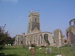 |
15th-century | Walberswick Walberswick Walberswick is a village on the Suffolk coast in England, across the River Blyth from Southwold. Coastal erosion and the shifting of the mouth of the River Blyth meant that the neighbouring town of Dunwich was lost as a port in the last years of the 13th century... |
||
| Church of St John the Baptist | 14th-century | Wantisden Wantisden Wantisden is a small village and civil parish in the Suffolk Coastal district of Suffolk in eastern England. Largely consisting of a single farm and ancient woodland , most of its 30 residents live on the farm estate. It shares a parish council with nearby Levington.-External links:*... |
|||
| Church of St Peter | 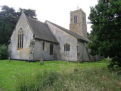 |
14th-century | Wenhaston Wenhaston Wenhaston is a small village of 818 people situated to the south of the River Blyth in northeastern Suffolk, England. Roman coins, pottery and building materials unearthed in local fields indicate the existence of a settlement at Wenhaston from the 1st century AD, and indeed this was probably a... |
||
| Church of St Mary Magdalene | 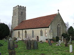 |
1300 c. | Westerfield Westerfield Westerfield is a village in Suffolk, England.It is located approximately two miles north of the centre of Ipswich. The village is served by Westerfield railway station on the Ipswich-Lowestoft East Suffolk Line.... |
||
| Church of St Mary | 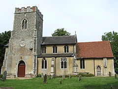 |
14th-century | Witnesham Witnesham Witnesham is a village situated roughly to the north of Ipswich, Suffolk. The main road from Ipswich that links the village to the town is the B1077, Westerfield Road.... |
||
| The Shire Hall & Corn Exchange | 1575 c. | Woodbridge Woodbridge, Suffolk Woodbridge is a town in Suffolk, East Anglia, England. It is in the East of England, not far from the coast. It lies along the River Deben, with a population of about 7,480. The town is served by Woodbridge railway station on the Ipswich-Lowestoft East Suffolk Line. Woodbridge is twinned with... |
|||
| The Old Bell & Steelyard Inn | 1550 | Woodbridge Woodbridge, Suffolk Woodbridge is a town in Suffolk, East Anglia, England. It is in the East of England, not far from the coast. It lies along the River Deben, with a population of about 7,480. The town is served by Woodbridge railway station on the Ipswich-Lowestoft East Suffolk Line. Woodbridge is twinned with... |
|||
| Tide Mill | .jpg) |
17th-century | Woodbridge Woodbridge, Suffolk Woodbridge is a town in Suffolk, East Anglia, England. It is in the East of England, not far from the coast. It lies along the River Deben, with a population of about 7,480. The town is served by Woodbridge railway station on the Ipswich-Lowestoft East Suffolk Line. Woodbridge is twinned with... |
||
| Church of St Mary | 15th-century | Woodbridge Woodbridge, Suffolk Woodbridge is a town in Suffolk, East Anglia, England. It is in the East of England, not far from the coast. It lies along the River Deben, with a population of about 7,480. The town is served by Woodbridge railway station on the Ipswich-Lowestoft East Suffolk Line. Woodbridge is twinned with... |
|||
| Cockfield Hall Cockfield Hall Cockfield Hall in Yoxford in Suffolk is a Grade I listed private house standing in of historic parkland, dating from the 16th century. It was built by the Spring family, wealthy cloth merchants and later baronets of Pakenham.... |
1613 | Yoxford Yoxford Yoxford is a village in the east of Suffolk, England close to the Heritage Coast, Minsmere Reserve , Aldeburgh and Southwold.-Location and features:... |
|||

