Grays Point, New South Wales
Encyclopedia

Suburb
The word suburb mostly refers to a residential area, either existing as part of a city or as a separate residential community within commuting distance of a city . Some suburbs have a degree of administrative autonomy, and most have lower population density than inner city neighborhoods...
in southern
Southern Sydney
This article refers to an area the same as a combination of St George and SutherlandSouthern Sydney is a general term which is used to describe the southern metropolitan area of Sydney, in the state of New South Wales, Australia....
Sydney
Sydney
Sydney is the most populous city in Australia and the state capital of New South Wales. Sydney is located on Australia's south-east coast of the Tasman Sea. As of June 2010, the greater metropolitan area had an approximate population of 4.6 million people...
, in the state of New South Wales
New South Wales
New South Wales is a state of :Australia, located in the east of the country. It is bordered by Queensland, Victoria and South Australia to the north, south and west respectively. To the east, the state is bordered by the Tasman Sea, which forms part of the Pacific Ocean. New South Wales...
, Australia
Australia
Australia , officially the Commonwealth of Australia, is a country in the Southern Hemisphere comprising the mainland of the Australian continent, the island of Tasmania, and numerous smaller islands in the Indian and Pacific Oceans. It is the world's sixth-largest country by total area...
. Grays Point is located 29 kilometres south of the Sydney central business district
Sydney central business district
The Sydney central business district is the main commercial centre of Sydney, New South Wales, Australia. It extends southwards for about 3 kilometres from Sydney Cove, the point of first European settlement. Its north–south axis runs from Circular Quay in the north to Central railway station in...
, in the local government area of the Sutherland Shire
Sutherland Shire
The Sutherland Shire is a Local Government Area in the Southern Sydney region of Sydney, Australia. Geographically, it is the area to the south of Botany Bay and the Georges River...
.
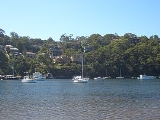
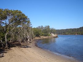
Grays Point is a small suburb with picturesque views of the Port Hacking
Port Hacking
Port Hacking is an Australian estuary, located in Southern Sydney, New South Wales and fed by the Hacking River and several smaller creeks, including Bundeena Creek and The Basin. It is a ria, a river basin which has become submerged by the sea...
estuary. Grays Point is adjacent to the Royal National Park
Royal National Park
Royal National Park is a national park in New South Wales, Australia, 29 km south of Sydney CBD.Founded by Sir John Robertson, Acting Premier of New South Wales, and formally proclaimed on 26 April 1879, it is the world's second oldest purposed national park, the first usage of the term...
and the suburbs of Gymea Bay
Gymea Bay, New South Wales
Gymea Bay is a suburb in southern Sydney, in the state of New South Wales, Australia. Gymea Bay is located 27 kilometres south of the Sydney central business district, in the local government area of the Sutherland Shire...
and Kirrawee
Kirrawee, New South Wales
Kirrawee is a suburb in southern Sydney, in the state of New South Wales, Australia. Kirrawee is located 25 kilometres south of the Sydney central business district in the Sutherland Shire. Kirrawee lies between Sutherland, to the west and Gymea and Grays Point, to the east...
. There is only one road available for vehicular access however multiple walking and mountain bike tracks link it with locations such as Audley
Audley, New South Wales
Audley is a locality on the outskirts of southern Sydney, in the state of New South Wales, Australia. It is located in the Royal National Park and is part of the Sutherland Shire....
in the Royal National Park
Royal National Park
Royal National Park is a national park in New South Wales, Australia, 29 km south of Sydney CBD.Founded by Sir John Robertson, Acting Premier of New South Wales, and formally proclaimed on 26 April 1879, it is the world's second oldest purposed national park, the first usage of the term...
, Engadine
Engadine, New South Wales
Engadine is a suburb in southern Sydney, in the state of New South Wales, Australia. Engadine is located south of the Sydney central business district, in the local government area of the Sutherland Shire...
and Heathcote
Heathcote, New South Wales
Heathcote is a suburb, in southern Sydney, in the state of New South Wales, Australia. Heathcote is located 36 km south of the Sydney central business district in the Sutherland Shire....
. There is a small shallow boat ramp located at Swallow Rock Reserve for launching trailer boats, canoes and kayaks.
Swallow Rock is a wetland area. A large variety of wildlife resides in Grays Point, including possums, sugar glider
Sugar Glider
The sugar glider is a small gliding possum originating from the marsupial family.The sugar glider is native to eastern and northern mainland Australia and is also native to New Guinea and the Bismarck Archipelago.- Habitat :Sugar gliders can be found all throughout the northern and eastern parts of...
s, Mopoke owls
Southern Boobook
The Southern Boobook , also called the Mopoke, Morepork, Ruru or Tasmanian Spotted Owl, is a small brown owl found throughout New Zealand, Tasmania, across most of mainland Australia and in Timor, southern New Guinea and nearby islands.The bird has almost 20 alternative common names, most of which...
, deer
Deer
Deer are the ruminant mammals forming the family Cervidae. Species in the Cervidae family include white-tailed deer, elk, moose, red deer, reindeer, fallow deer, roe deer and chital. Male deer of all species and female reindeer grow and shed new antlers each year...
(an introduced species), wallabies
Wallaby
A wallaby is any of about thirty species of macropod . It is an informal designation generally used for any macropod that is smaller than a kangaroo or wallaroo that has not been given some other name.-Overview:...
, magpies and kookaburra
Kookaburra
Kookaburras are terrestrial kingfishers native to Australia and New Guinea. They are large to very large, with a total length of . The name is a loanword from Wiradjuri guuguubarra, and is onomatopoeic of its call...
s.
History
The origin of the Grays Point name is unclear. It has been suggested that it was either named after Samuel William Gray, who owned land on the point or John Edward Gray, who was a well-known resident ranger in the Royal National Park in the 1880s.Commercial area
Grays Point is largely residential, with a small group of shops located at Grays Point Road, near the intersection of Swallow Rock Drive. A Fish & Chip shop, a hairdresser, a restaurant, a Bottle Shop, a Corner Store that also acts as the Post Office, fishing bait can be purchased here. Most of its denizens rely on the rest of the Sutherland ShireSutherland Shire
The Sutherland Shire is a Local Government Area in the Southern Sydney region of Sydney, Australia. Geographically, it is the area to the south of Botany Bay and the Georges River...
for their services.

