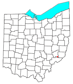
Harriettsville, Ohio
Encyclopedia

Unincorporated area
In law, an unincorporated area is a region of land that is not a part of any municipality.To "incorporate" in this context means to form a municipal corporation, a city, town, or village with its own government. An unincorporated community is usually not subject to or taxed by a municipal government...
in western Elk Township
Elk Township, Noble County, Ohio
Elk Township is one of the fifteen townships of Noble County, Ohio, United States. The 2000 census found 305 people in the township.-Geography:Located in the southeastern corner of the county, it borders the following townships:...
, Noble County
Noble County, Ohio
Noble County is a county located in the state of Ohio. As of the 2010 census, the population was 14,645. Its county seat is Caldwell. Noble County is named for Rep. Warren P. Noble of the Ohio House of Representatives, who was an early settler there.-History:...
, Ohio
Ohio
Ohio is a Midwestern state in the United States. The 34th largest state by area in the U.S.,it is the 7th‑most populous with over 11.5 million residents, containing several major American cities and seven metropolitan areas with populations of 500,000 or more.The state's capital is Columbus...
, United States
United States
The United States of America is a federal constitutional republic comprising fifty states and a federal district...
. It lies along State Route 145
Ohio State Route 145
State Route 145 is a long north–south state highway in the southeastern quadrant of the U.S. state of Ohio. The western terminus of SR 145 is at a T-intersection with SR 821 in Lower Salem...
at its intersection with County Road 46. The East Fork of Duck Creek, a subsidiary of the Ohio River
Ohio River
The Ohio River is the largest tributary, by volume, of the Mississippi River. At the confluence, the Ohio is even bigger than the Mississippi and, thus, is hydrologically the main stream of the whole river system, including the Allegheny River further upstream...
that meets the river near Marietta
Marietta, Ohio
Marietta is a city in and the county seat of Washington County, Ohio, United States. During 1788, pioneers to the Ohio Country established Marietta as the first permanent American settlement of the new United States in the Northwest Territory. Marietta is located in southeastern Ohio at the mouth...
, runs along State Route 145 past the community. It lies 8 miles (13 km) northeast of Lower Salem
Lower Salem, Ohio
Lower Salem is a village in Washington County, Ohio, United States. The population was 109 at the 2000 census.-Geography:Lower Salem is located at ....
by road, and 13 miles (21 km) directly southeast of Caldwell
Caldwell, Ohio
Caldwell is a village located along the West Fork of Duck Creek in Noble County, Ohio, United States. The population was 1,956 at the 2000 census...
, the county seat
County seat
A county seat is an administrative center, or seat of government, for a county or civil parish. The term is primarily used in the United States....
of Noble County.

