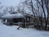
Holiday Park, Saskatoon
Encyclopedia
| City of Saskatoon Neighbourhoods | |
|---|---|
| Holiday Park | |
| Confederation Suburban Development Area | |
 |
|
| Population: | 1,400 |
| Average Family Income: | $44,889 |
| Average Household Size: | 2.4 |
| Homeownership: | 62.6% |
| Average Home Selling Price: | $87,297 |
| Municipal Ward: | 2 |
| Statistics c2005 - | |
Holiday Park is a geographical section or subdivision
Subdivision (land)
Subdivision is the act of dividing land into pieces that are easier to sell or otherwise develop, usually via a plat. The former single piece as a whole is then known in the United States as a subdivision...
of the Confederation Suburban Development Area, Saskatoon
Saskatoon
Saskatoon is a city in central Saskatchewan, Canada, on the South Saskatchewan River. Residents of the city of Saskatoon are called Saskatonians. The city is surrounded by the Rural Municipality of Corman Park No. 344....
, which has a distinct existence recognized by the municipality. Located within Saskatoon's Ward 2, Alderman Owen Fortosky represents the area's interests at City Hall. Holiday Park has an official neighborhood association which sets out leisure activities, and provides community members a forum to discuss community issues such as neighborhood watch, block parent programs, etc. This neighborhood is surrounded by a plethora of amenities. To the south is Holiday Park golf course commanding a Championship 18 hole and executive 9 hole course. It is used year round providing Snow golf and well groomed cross country ski trails in the winter months. To the north is the Riversdale Tennis Club and Riversdale pool an outdoor swimming pool with water slide features. To the east is the Gordie Howe Management Area with Gordie Howe Bowl, Baseball Diamonds, Speed Skating Oval. Along the west the Meewasin Valley Authority provides walking and biking trails along the South Saskatchewan River. Canoists, water skiers, and kayakers have a wonderful time enjoying the convenience of the Saskatchewan River. Holiday Park's population of 1,400 is a bit larger than the 1,365 at Grosvenor Park.
Circle Drive Extension
The completion of Circle DriveCircle Drive
Circle Drive is a major road constructed as a ring road in Saskatoon, Saskatchewan, Canada. The northeastern portion of the road is part of the Yellowhead Highway.-History:...
will see it uniting with Circle Drive on the east side of Saskatoon via the South Circle Drive Bridge, which will run parallel to the train tracks.
History
The Saskatoon Tuberculosis SanitoriumSaskatoon Sanatorium
The Saskatoon Sanatorium was a Tuberculosis Sanatorium established in 1925 by the Saskatchewan Anti-Tuberculosis League as the second Sanatorium in the province in Wellington Park south or the Saskatoon neighborhood of Holiday Park, Saskatoon, Saskatchewan, Canada...
was opened April 15, 1925
June 27, 1962 was the officially opening of the Holiday Park Golf Course.
The Bowerman House
Bowerman House
The Bowerman House is a designated Municipal Heritage Property located in the Holiday Park, neighborhood of Saskatoon, Saskatchewan, Canada. The home is of a crafts-man “Western Stick” style...
was a hunting lodge constructed by Allen Bowerman, and later used as physician housing for The Saskatoon Sanatorium
Education
- St. John School
- Saskatoon French School / l'École Française de Saskatoon
Area Parks
- Boughton Park 6.07 acres (24,564.4 m²)
- Holiday Park 8.62 acres (34,883.9 m²)
- Victoria Park 4.98 acres (20,153.4 m²)
Layout
The northern boundary extends no further than 11th Street, and the southern edge overlooks the scenic vista of the Holiday Park Golf Course. Avenue P South through to the South Saskatchewan RiverSouth Saskatchewan River
The South Saskatchewan River is a major river in Canada that flows through the provinces of Alberta and Saskatchewan....
are the western and eastern boundaries respectively. The roads are laid out in a grid fashion, the streets south of 11th Street are named: Dudley, Shuyler, and Wellington Streets, followed by Embassy Drive. The avenues are labelled alphabetically with the alphabet. Spadina Crescent cruises along the South Saskatchewan River
South Saskatchewan River
The South Saskatchewan River is a major river in Canada that flows through the provinces of Alberta and Saskatchewan....
and incrementing westward through the alphabet.
Shopping
There is local shopping available at the convenience stores located at Avenue L South and 11th Street such as a Lew's Grocers, and White's Pharmacy, as well the 11th Street arterial district begins at Avenue P South.Life
City of Saskatoon · Departments · Community Services · Community ...Location
Coordinates: 52.110833"N 106°41'9"W| North: King George | ||
| West: Gordie Howe Management Area | Holiday Park | East: South Saskatchewan River South Saskatchewan River The South Saskatchewan River is a major river in Canada that flows through the provinces of Alberta and Saskatchewan.... | Buena Vista |
| South: Gordie Howe Management Area |

