Home Reef
Encyclopedia
Home Reef is an ephemeral
island
built by a submarine volcano
whose top has repeatedly breached the surface and was subsequently eroded by wave action again. It is located in the South Pacific, south of Late Island
and southwest of Vava'u
along the Tofua volcanic arc in Tonga
.
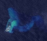
After island-building eruptions in 1852, 1857, and 1984, Home Reef once again rose above sea level in August 2006. It emerged after a volcanic eruption started on 8 August which also spewed large amounts of floating pumice into Tongan waters and swept across to Fiji
about 350 km (217.5 mi) to the west of where the new island formed.
In October 2006 it reached almost the same size as it did in 1984 when it was about 0.5 by 1.5 km (0.3 by 0.9 miles). The island was first seen by the crew of a yacht, who recorded its emergence in their blog. The eruptions produced extensive rafts of pumice
, which drifted northeast from the new island. The pumice raft
s and new island were imaged by the Aqua
satellite in August 2006. Images also revealed the presence of several small, hot crater lake
s on the newly formed island.
Ephemeral
Ephemeral things are transitory, existing only briefly. Typically the term is used to describe objects found in nature, although it can describe a wide range of things....
island
Island
An island or isle is any piece of sub-continental land that is surrounded by water. Very small islands such as emergent land features on atolls can be called islets, cays or keys. An island in a river or lake may be called an eyot , or holm...
built by a submarine volcano
Submarine volcano
Submarine volcanoes are underwater fissures in the Earth's surface from which magma can erupt. They are estimated to account for 75% of annual magma output. The vast majority are located near areas of tectonic plate movement, known as ocean ridges...
whose top has repeatedly breached the surface and was subsequently eroded by wave action again. It is located in the South Pacific, south of Late Island
Late (Tonga)
Late Island is an uninhabited volcanic island southwest of Vavau in the kingdom of Tonga.The small, 6-km-wide circular island of Late, lying along the Tofua volcanic arc about 55 km WSW of the island of Vavau, contains a 400-m-wide, 150-m-deep summit crater with an ephemeral lake...
and southwest of Vava'u
Vava'u
Vavau is an island chain of one large island and 40 smaller ones in Tonga. According to tradition Maui fished both Tongatapu and Vavau but put a little more effort into the former. Vavau rises 204 meters above sea level...
along the Tofua volcanic arc in Tonga
Tonga
Tonga, officially the Kingdom of Tonga , is a state and an archipelago in the South Pacific Ocean, comprising 176 islands scattered over of ocean in the South Pacific...
.
After island-building eruptions in 1852, 1857, and 1984, Home Reef once again rose above sea level in August 2006. It emerged after a volcanic eruption started on 8 August which also spewed large amounts of floating pumice into Tongan waters and swept across to Fiji
Fiji
Fiji , officially the Republic of Fiji , is an island nation in Melanesia in the South Pacific Ocean about northeast of New Zealand's North Island...
about 350 km (217.5 mi) to the west of where the new island formed.
In October 2006 it reached almost the same size as it did in 1984 when it was about 0.5 by 1.5 km (0.3 by 0.9 miles). The island was first seen by the crew of a yacht, who recorded its emergence in their blog. The eruptions produced extensive rafts of pumice
Pumice
Pumice is a textural term for a volcanic rock that is a solidified frothy lava typically created when super-heated, highly pressurized rock is violently ejected from a volcano. It can be formed when lava and water are mixed. This unusual formation is due to the simultaneous actions of rapid...
, which drifted northeast from the new island. The pumice raft
Pumice raft
A pumice raft is a floating raft of pumice occasionally created by ocean-based volcanic activity.Volcanic activity in the South Pacific near Tonga on August 12, 2006 caused the emergence of a new island...
s and new island were imaged by the Aqua
Aqua (satellite)
Aqua is a multi-national NASA scientific research satellite in orbit around the Earth, studying the precipitation, evaporation, and cycling of water. It is the second major component of the Earth Observing System preceded by Terra and followed by Aura .The name "Aqua" comes from the Latin word...
satellite in August 2006. Images also revealed the presence of several small, hot crater lake
Crater lake
A crater lake is a lake that forms in a volcanic crater or caldera, such as a maar; less commonly and with lower association to the term a lake may form in an impact crater caused by a meteorite. Sometimes lakes which form inside calderas are called caldera lakes, but often this distinction is not...
s on the newly formed island.

