Hoogeveen
Encyclopedia
Hoogeveen is a municipality
and a town
in the northeastern Netherlands
.

, Fluitenberg, Hoogeveen and Noordscheschut, which still have the canals which used to be throughout the town. Other villages of the town are Hollandscheveld
, Nieuw Moscou, Nieuweroord, Nieuwlande
, Pesse, Stuifzand and Tiendeveen
.
land from farmers of the district with the plan to harvest its peat. One old map of the area called it Locus Deserta Atque ob Multos Paludes Invia, a deserted and impenetrable place of many swamps. Hoogeveen itself was established in 1636 by Peter Joostens Warmont and Johan van der Meer.
Its coat of arms
, granted 10 November 1819, is white, with a pile of peat covered in straw in the center and beehives
on each side, representing the town's first two major industries.
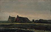
 Vincent van Gogh
visited the area in the fall of 1883.
In the second half of the 1960s, Hoogeveen was the fastest growing town in the Netherlands. Its rapid growth during that period led its city council to fill most of the town's canal
s, canals dug in the area's early days when it was a prime source of peat.
Access to the town is provided by the A28 (Utrecht
- Groningen
) highway, the N/A37 (Hoogeveen - Germany
), and the Western Cities - Groningen railway
.
The then recognized oldest person in the world, Hendrikje van Andel-Schipper
, lived in Hoogeveen until her death in August 2005.
Hoogeveen also has a small airport
that attracts some tourism. Since 1997 the Hoogeveen Chess Tournament is organized.
with: Martin
, Slovakia
Municipality
A municipality is essentially an urban administrative division having corporate status and usually powers of self-government. It can also be used to mean the governing body of a municipality. A municipality is a general-purpose administrative subdivision, as opposed to a special-purpose district...
and a town
Town
A town is a human settlement larger than a village but smaller than a city. The size a settlement must be in order to be called a "town" varies considerably in different parts of the world, so that, for example, many American "small towns" seem to British people to be no more than villages, while...
in the northeastern Netherlands
Netherlands
The Netherlands is a constituent country of the Kingdom of the Netherlands, located mainly in North-West Europe and with several islands in the Caribbean. Mainland Netherlands borders the North Sea to the north and west, Belgium to the south, and Germany to the east, and shares maritime borders...
.

Population centres
ElimElim (Drenthe)
Elim is a village in Drenthe and it is part of the Hoogeveen municipality. The population of Elim and rural area is about 2500.- The history of Elim :...
, Fluitenberg, Hoogeveen and Noordscheschut, which still have the canals which used to be throughout the town. Other villages of the town are Hollandscheveld
Hollandscheveld
Hollandscheveld is a village in the municipality of Hoogeveen, the Netherlands. It was founded in the 17th century after the Hollandsche Compagnie bought the land to harvest its peat. It was initially named Hollandsche Veld which was later combined into just Hollandscheveld...
, Nieuw Moscou, Nieuweroord, Nieuwlande
Nieuwlande
Nieuwlande is a small Dutch village. The population, as of 1 January 2004, is 1,250. It is located in the north-eastern province of Drenthe. In the Drents dialect, the town is called Neilaande. The town is situated in the municipality of Hoogeveen....
, Pesse, Stuifzand and Tiendeveen
Tiendeveen
Tiendeveen is a tiny village in the Netherlands in Hoogeveen with a population of about 2900 . Tiendeveen takes its name from the Dutch word for peat, "veen", which is collected there, just as in Hoogeveen and Witteveen....
.
Hoogeveen
It dates its history to 20 December 1625, when Roelof van Echten bought a large tract of peatPeat
Peat is an accumulation of partially decayed vegetation matter or histosol. Peat forms in wetland bogs, moors, muskegs, pocosins, mires, and peat swamp forests. Peat is harvested as an important source of fuel in certain parts of the world...
land from farmers of the district with the plan to harvest its peat. One old map of the area called it Locus Deserta Atque ob Multos Paludes Invia, a deserted and impenetrable place of many swamps. Hoogeveen itself was established in 1636 by Peter Joostens Warmont and Johan van der Meer.
Its coat of arms
Coat of arms
A coat of arms is a unique heraldic design on a shield or escutcheon or on a surcoat or tabard used to cover and protect armour and to identify the wearer. Thus the term is often stated as "coat-armour", because it was anciently displayed on the front of a coat of cloth...
, granted 10 November 1819, is white, with a pile of peat covered in straw in the center and beehives
Beehive (beekeeping)
A beehive is an enclosed structure in which some honey bee species of the subgenus Apis live and raise their young. Natural beehives are naturally occurring structures occupied by honeybee colonies, while domesticated honeybees live in man-made beehives, often in an apiary. These man-made...
on each side, representing the town's first two major industries.

Vincent van Gogh
Vincent Willem van Gogh , and used Brabant dialect in his writing; it is therefore likely that he himself pronounced his name with a Brabant accent: , with a voiced V and palatalized G and gh. In France, where much of his work was produced, it is...
visited the area in the fall of 1883.
In the second half of the 1960s, Hoogeveen was the fastest growing town in the Netherlands. Its rapid growth during that period led its city council to fill most of the town's canal
Canal
Canals are man-made channels for water. There are two types of canal:#Waterways: navigable transportation canals used for carrying ships and boats shipping goods and conveying people, further subdivided into two kinds:...
s, canals dug in the area's early days when it was a prime source of peat.
Access to the town is provided by the A28 (Utrecht
Utrecht (province)
Utrecht is the smallest province of the Netherlands in terms of area, and is located in the centre of the country. It is bordered by the Eemmeer in the north, Gelderland in the east, the river Rhine in the south, South Holland in the west, and North Holland in the northwest...
- Groningen
Groningen (province)
Groningen [] is the northeasternmost province of the Netherlands. In the east it borders the German state of Niedersachsen , in the south Drenthe, in the west Friesland and in the north the Wadden Sea...
) highway, the N/A37 (Hoogeveen - Germany
Germany
Germany , officially the Federal Republic of Germany , is a federal parliamentary republic in Europe. The country consists of 16 states while the capital and largest city is Berlin. Germany covers an area of 357,021 km2 and has a largely temperate seasonal climate...
), and the Western Cities - Groningen railway
Train routes in the Netherlands
This list of train routes in the Netherlands focuses on the routes taken by trains travelling on railway lines in the Netherlands. A list including all stops on the train routes can be found at Dutch railway services...
.
The then recognized oldest person in the world, Hendrikje van Andel-Schipper
Hendrikje van Andel-Schipper
Hendrikje "Henny" van Andel-Schipper was the oldest person ever in the history of the Netherlands , and from 29 May 2004 was thought to be the oldest recognized person in the world until her death Hendrikje "Henny" van Andel-Schipper (née Schipper) (29 June 1890 – 30 August 2005) was the...
, lived in Hoogeveen until her death in August 2005.
Hoogeveen also has a small airport
Hoogeveen Airport
Hoogeveen Airport is a small general aviation airfield located northeast of Hoogeveen, a town in the northeastern Netherlands. There are several flying clubs and flying schools located at the airport. It has one grass runway with a length of .- References :*...
that attracts some tourism. Since 1997 the Hoogeveen Chess Tournament is organized.
Twin towns — Sister cities
Hoogeveen is twinnedTown twinning
Twin towns and sister cities are two of many terms used to describe the cooperative agreements between towns, cities, and even counties in geographically and politically distinct areas to promote cultural and commercial ties.- Terminology :...
with: Martin
Martin, Slovakia
Martin is a city in northern Slovakia, situated on the Turiec river, between the Malá Fatra and Veľká Fatra mountains, near the city of Žilina. The population numbers approximately 58,000, which makes it the eighth largest city in Slovakia...
, Slovakia
Slovakia
The Slovak Republic is a landlocked state in Central Europe. It has a population of over five million and an area of about . Slovakia is bordered by the Czech Republic and Austria to the west, Poland to the north, Ukraine to the east and Hungary to the south...

