Hope Islands National Park
Encyclopedia
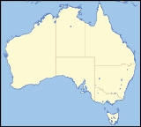
Hope Islands National Park is a national park in Queensland
(Australia
) 1,521 km north-west of Brisbane
. The park consists of four islands: East Hope and West Hope, Snapper Island and Struck Island.
Access is via private vessel or by permitted commercial operators.
The Hope islands were named by Lt James Cook
in June 1770 just after his HM Bark Endeavour
struck the nearby Endeavour Reef
.
Queensland
Queensland is a state of Australia, occupying the north-eastern section of the mainland continent. It is bordered by the Northern Territory, South Australia and New South Wales to the west, south-west and south respectively. To the east, Queensland is bordered by the Coral Sea and Pacific Ocean...
(Australia
Australia
Australia , officially the Commonwealth of Australia, is a country in the Southern Hemisphere comprising the mainland of the Australian continent, the island of Tasmania, and numerous smaller islands in the Indian and Pacific Oceans. It is the world's sixth-largest country by total area...
) 1,521 km north-west of Brisbane
Brisbane
Brisbane is the capital and most populous city in the Australian state of Queensland and the third most populous city in Australia. Brisbane's metropolitan area has a population of over 2 million, and the South East Queensland urban conurbation, centred around Brisbane, encompasses a population of...
. The park consists of four islands: East Hope and West Hope, Snapper Island and Struck Island.
- The Hope islands are situated approximately 37 km south-east of CooktownCooktown, QueenslandCooktown is a small town located at the mouth of the Endeavour River, on Cape York Peninsula in Far North Queensland where James Cook beached his ship, the Endeavour, for repairs in 1770. At the 2006 census, Cooktown had a population of 1,336...
and about 8 km offshore - Struck Island is a rocky outcrop just off Thornton Beach and south of Cape Tribulation
- Snapper island is about two km long and is at the mouth of the Daintree RiverDaintree RiverThe Daintree River runs through the Daintree Rainforest in the Cape Tribulation region of Queensland in northern Australia. It is located about 100 kilometres northwest of Cairns in far north tropical Queensland and drains an area of 2,125 square kilometres. The river, along with the Daintree...
. It is about 20 km north of Port DouglasPort Douglas, QueenslandPort Douglas is a town in Far North Queensland, Australia, approximately north of Cairns. Its permanent population was 948 residents in 2006. The town's population can often double, however, with the influx of tourists during the peak tourism season May–September. The town is named in honour of...
Access is via private vessel or by permitted commercial operators.
The Hope islands were named by Lt James Cook
James Cook
Captain James Cook, FRS, RN was a British explorer, navigator and cartographer who ultimately rose to the rank of captain in the Royal Navy...
in June 1770 just after his HM Bark Endeavour
HM Bark Endeavour
HMS Endeavour, also known as HM Bark Endeavour, was a British Royal Navy research vessel commanded by Lieutenant James Cook on his first voyage of discovery, to Australia and New Zealand from 1769 to 1771....
struck the nearby Endeavour Reef
Endeavour Reef
Endeavour Reef is a coral reef within the Great Barrier Reef. The reef is about long and runs in an east-west direction. The center of the reef is located at . It is about south-east of the Hope Islands in the Hope Islands National Park and off the mainland.It was encountered by Lieutenant...
.

