Hutton's Unconformity
Encyclopedia
Hutton's Unconformity is any of various famous geological sites in Scotland
. These are places identified by 18th-century Scottish geologist
James Hutton
as an unconformity
, which provided evidence for his Plutonist
theories of uniformitarianism
and about the age of the Earth
.
in 1785. Later that year Hutton read an abstract of Concerning the System of the Earth, its Duration and Stability to a Society meeting, and had it printed and circulated privately.
In it, he outlined his theory that the "solid parts of the present land appear in general, to have been composed of the productions of the sea, and of other materials similar to those now found upon the shores." From this he deduced that the land was a composition which had been formed by the operation of second causes in an earlier world composed of sea and land, with tides, currents, and "such operations at the bottom of the sea as now take place" so that "while the present land was forming at the bottom of the ocean, the former land maintained plants and animals; at least the sea was then inhabited by animals, in a similar manner as it is at present", and that most, if not all, of the land had been produced by natural operations involving the consolidation of masses of loose materials collected at the bottom of the sea, followed by the elevation of the consolidated masses to their present position.
 Angular unconformities
had been noted by earlier geologists who interpreted them in terms of Neptunism
as "primary formations", so Hutton wanted to examine such formations himself to look for support for his theory of Plutonism
. On a trip to the Isle of Arran
in 1787 he found his first example of an unconformity to the north of Newton Point near Lochranza
, but the limited view did not give the information he needed. It occurs where vertically oriented Cambrian
Dalradian
schist
s are overlain by more recent Carboniferous
Old Red Sandstone
with an obvious difference in dip
between the two rock
layers
, but he incorrectly thought that the strata were conformable at a depth below the exposed outcrop.
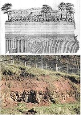
Later in 1787 Hutton noted what is now known as the Hutton Unconformity at Inchbonny, Jedburgh
, in layers of sedimentary rock
. He later wrote of how he "rejoiced at my good fortune in stumbling upon an object so interesting in the natural history of the earth, and which I had been long looking for in vain." That year, he found the same sequence in Teviotdale.

 In the Spring of 1788 he set off with John Playfair
to the Berwickshire
coast and found more examples of this sequence in the valleys of the Tour and Pease Burns near Cockburnspath
. They then took a boat trip from Dunglass Burn east along the coast with the geologist Sir James Hall of Dunglass
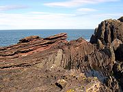
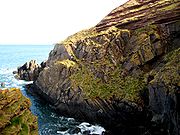
. They found the sequence in the cliff below St. Helens, then just to the east at Siccar Point
found what Hutton called "a beautiful picture of this junction washed bare by the sea". Continuing along the coast, they made more discoveries including sections of the vertical beds showing strong ripple marks which gave Hutton "great satisfaction" as a confirmation of his supposition that these bed had been laid horizontally in water.
Playfair wrote:
At Siccar Point, layers of Lower Silurian
greywacke
laid down in a deep sea environment around 425 million years ago have been tilted vertically, then overlaid by strata of Upper Devonian
sandstones which were deposited on a broad coastal plain subject to periodical flooding by the sea, around 345 million years ago.
Scotland
Scotland is a country that is part of the United Kingdom. Occupying the northern third of the island of Great Britain, it shares a border with England to the south and is bounded by the North Sea to the east, the Atlantic Ocean to the north and west, and the North Channel and Irish Sea to the...
. These are places identified by 18th-century Scottish geologist
Geologist
A geologist is a scientist who studies the solid and liquid matter that constitutes the Earth as well as the processes and history that has shaped it. Geologists usually engage in studying geology. Geologists, studying more of an applied science than a theoretical one, must approach Geology using...
James Hutton
James Hutton
James Hutton was a Scottish physician, geologist, naturalist, chemical manufacturer and experimental agriculturalist. He is considered the father of modern geology...
as an unconformity
Unconformity
An unconformity is a buried erosion surface separating two rock masses or strata of different ages, indicating that sediment deposition was not continuous. In general, the older layer was exposed to erosion for an interval of time before deposition of the younger, but the term is used to describe...
, which provided evidence for his Plutonist
Plutonism
Plutonism is the geologic theory that the rocks forming the Earth were formed in fire by volcanic activity, with a continuing gradual process of weathering and erosion wearing away rocks, which were then deposited on the sea bed, re-formed into layers of sedimentary rock by heat and pressure, and...
theories of uniformitarianism
Uniformitarianism (science)
In the philosophy of naturalism, the uniformitarianism assumption is that the same natural laws and processes that operate in the universe now, have always operated in the universe in the past and apply everywhere in the universe. It has included the gradualistic concept that "the present is the...
and about the age of the Earth
Age of the Earth
The age of the Earth is 4.54 billion years This age is based on evidence from radiometric age dating of meteorite material and is consistent with the ages of the oldest-known terrestrial and lunar samples...
.
Theory of rock formations
Hutton hit on a variety of ideas to explain the rock formations he saw around him, and after some 25 years of work, his Theory of the Earth; or an Investigation of the Laws observable in the Composition, Dissolution, and Restoration of Land upon the Globe was read to meetings of the Royal Society of EdinburghRoyal Society of Edinburgh
The Royal Society of Edinburgh is Scotland's national academy of science and letters. It is a registered charity, operating on a wholly independent and non-party-political basis and providing public benefit throughout Scotland...
in 1785. Later that year Hutton read an abstract of Concerning the System of the Earth, its Duration and Stability to a Society meeting, and had it printed and circulated privately.
In it, he outlined his theory that the "solid parts of the present land appear in general, to have been composed of the productions of the sea, and of other materials similar to those now found upon the shores." From this he deduced that the land was a composition which had been formed by the operation of second causes in an earlier world composed of sea and land, with tides, currents, and "such operations at the bottom of the sea as now take place" so that "while the present land was forming at the bottom of the ocean, the former land maintained plants and animals; at least the sea was then inhabited by animals, in a similar manner as it is at present", and that most, if not all, of the land had been produced by natural operations involving the consolidation of masses of loose materials collected at the bottom of the sea, followed by the elevation of the consolidated masses to their present position.
Hutton's unconformities

Unconformity
An unconformity is a buried erosion surface separating two rock masses or strata of different ages, indicating that sediment deposition was not continuous. In general, the older layer was exposed to erosion for an interval of time before deposition of the younger, but the term is used to describe...
had been noted by earlier geologists who interpreted them in terms of Neptunism
Neptunism
Neptunism is a discredited and obsolete scientific theory of geology proposed by Abraham Gottlob Werner in the late 18th century that proposed rocks formed from the crystallisation of minerals in the early Earth's oceans....
as "primary formations", so Hutton wanted to examine such formations himself to look for support for his theory of Plutonism
Plutonism
Plutonism is the geologic theory that the rocks forming the Earth were formed in fire by volcanic activity, with a continuing gradual process of weathering and erosion wearing away rocks, which were then deposited on the sea bed, re-formed into layers of sedimentary rock by heat and pressure, and...
. On a trip to the Isle of Arran
Isle of Arran
Arran or the Isle of Arran is the largest island in the Firth of Clyde, Scotland, and with an area of is the seventh largest Scottish island. It is in the unitary council area of North Ayrshire and the 2001 census had a resident population of 5,058...
in 1787 he found his first example of an unconformity to the north of Newton Point near Lochranza
Lochranza
Lochranza is a village located on the Isle of Arran in the Firth of Clyde, Scotland. The population, somewhat in decline, is around 200 people....
, but the limited view did not give the information he needed. It occurs where vertically oriented Cambrian
Cambrian
The Cambrian is the first geological period of the Paleozoic Era, lasting from Mya ; it is succeeded by the Ordovician. Its subdivisions, and indeed its base, are somewhat in flux. The period was established by Adam Sedgwick, who named it after Cambria, the Latin name for Wales, where Britain's...
Dalradian
Dalradian
Dalradian in geology describes a series of metamorphic rocks, typically developed in the high ground which lies southeast of the Great Glen of Scotland...
schist
Schist
The schists constitute a group of medium-grade metamorphic rocks, chiefly notable for the preponderance of lamellar minerals such as micas, chlorite, talc, hornblende, graphite, and others. Quartz often occurs in drawn-out grains to such an extent that a particular form called quartz schist is...
s are overlain by more recent Carboniferous
Carboniferous
The Carboniferous is a geologic period and system that extends from the end of the Devonian Period, about 359.2 ± 2.5 Mya , to the beginning of the Permian Period, about 299.0 ± 0.8 Mya . The name is derived from the Latin word for coal, carbo. Carboniferous means "coal-bearing"...
Old Red Sandstone
Old Red Sandstone
The Old Red Sandstone is a British rock formation of considerable importance to early paleontology. For convenience the short version of the term, 'ORS' is often used in literature on the subject.-Sedimentology:...
with an obvious difference in dip
Strike and dip
Strike and dip refer to the orientation or attitude of a geologic feature. The strike line of a bed, fault, or other planar feature is a line representing the intersection of that feature with a horizontal plane. On a geologic map, this is represented with a short straight line segment oriented...
between the two rock
Rock (geology)
In geology, rock or stone is a naturally occurring solid aggregate of minerals and/or mineraloids.The Earth's outer solid layer, the lithosphere, is made of rock. In general rocks are of three types, namely, igneous, sedimentary, and metamorphic...
layers
Stratum
In geology and related fields, a stratum is a layer of sedimentary rock or soil with internally consistent characteristics that distinguish it from other layers...
, but he incorrectly thought that the strata were conformable at a depth below the exposed outcrop.
Later in 1787 Hutton noted what is now known as the Hutton Unconformity at Inchbonny, Jedburgh
Jedburgh
Jedburgh is a town and former royal burgh in the Scottish Borders and historically in Roxburghshire.-Location:Jedburgh lies on the Jed Water, a tributary of the River Teviot, it is only ten miles from the border with England and is dominated by the substantial ruins of Jedburgh Abbey...
, in layers of sedimentary rock
Sedimentary rock
Sedimentary rock are types of rock that are formed by the deposition of material at the Earth's surface and within bodies of water. Sedimentation is the collective name for processes that cause mineral and/or organic particles to settle and accumulate or minerals to precipitate from a solution....
. He later wrote of how he "rejoiced at my good fortune in stumbling upon an object so interesting in the natural history of the earth, and which I had been long looking for in vain." That year, he found the same sequence in Teviotdale.


John Playfair
John Playfair FRSE, FRS was a Scottish scientist and mathematician, and a professor of natural philosophy at the University of Edinburgh. He is perhaps best known for his book Illustrations of the Huttonian Theory of the Earth , which summarized the work of James Hutton...
to the Berwickshire
Berwickshire
Berwickshire or the County of Berwick is a registration county, a committee area of the Scottish Borders Council, and a lieutenancy area of Scotland, on the border with England. The town after which it is named—Berwick-upon-Tweed—was lost by Scotland to England in 1482...
coast and found more examples of this sequence in the valleys of the Tour and Pease Burns near Cockburnspath
Cockburnspath
Cockburnspath is a village in the Scottish Borders area of Scotland. It lies near the North Sea coast between Berwick-upon-Tweed and Edinburgh. It is at the eastern extremity of the Southern Upland Way, a long-distance footpath from the west to east coast of Scotland, and it is also the terminus...
. They then took a boat trip from Dunglass Burn east along the coast with the geologist Sir James Hall of Dunglass
Dunglass
Dunglass is a location in East Lothian, Scotland, lying east of the Lammermuir Hills on the North Sea coast. It has a 15th century Dunglass Collegiate Church, now in the care of Historic Scotland...
. They found the sequence in the cliff below St. Helens, then just to the east at Siccar Point
Siccar Point
Siccar Point is a rocky promontory in the county of Berwickshire on the east coast of Scotland.It is famous in the history of geology for Hutton's Unconformity found in 1788, which James Hutton regarded as conclusive proof of his uniformitarian theory of geological development.-History:Siccar...
found what Hutton called "a beautiful picture of this junction washed bare by the sea". Continuing along the coast, they made more discoveries including sections of the vertical beds showing strong ripple marks which gave Hutton "great satisfaction" as a confirmation of his supposition that these bed had been laid horizontally in water.
Playfair wrote:
At Siccar Point, layers of Lower Silurian
Silurian
The Silurian is a geologic period and system that extends from the end of the Ordovician Period, about 443.7 ± 1.5 Mya , to the beginning of the Devonian Period, about 416.0 ± 2.8 Mya . As with other geologic periods, the rock beds that define the period's start and end are well identified, but the...
greywacke
Greywacke
Greywacke or Graywacke is a variety of sandstone generally characterized by its hardness, dark color, and poorly sorted angular grains of quartz, feldspar, and small rock fragments or lithic fragments set in a compact, clay-fine matrix. It is a texturally immature sedimentary rock generally found...
laid down in a deep sea environment around 425 million years ago have been tilted vertically, then overlaid by strata of Upper Devonian
Devonian
The Devonian is a geologic period and system of the Paleozoic Era spanning from the end of the Silurian Period, about 416.0 ± 2.8 Mya , to the beginning of the Carboniferous Period, about 359.2 ± 2.5 Mya...
sandstones which were deposited on a broad coastal plain subject to periodical flooding by the sea, around 345 million years ago.

