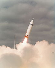
ICBM address
Encyclopedia

Slang
Slang is the use of informal words and expressions that are not considered standard in the speaker's language or dialect but are considered more acceptable when used socially. Slang is often to be found in areas of the lexicon that refer to things considered taboo...
for one's longitude
Longitude
Longitude is a geographic coordinate that specifies the east-west position of a point on the Earth's surface. It is an angular measurement, usually expressed in degrees, minutes and seconds, and denoted by the Greek letter lambda ....
and latitude
Latitude
In geography, the latitude of a location on the Earth is the angular distance of that location south or north of the Equator. The latitude is an angle, and is usually measured in degrees . The equator has a latitude of 0°, the North pole has a latitude of 90° north , and the South pole has a...
(preferably to seconds-of-arc accuracy) when placed in a signature
Signature block
A signature block is a block of text automatically appended at the bottom of an e-mail message, Usenet article, or forum post. This has the effect of "signing off" the message and in a reply message of indicating that no more response follows...
or another publicly available file.
Origin
The form that used to register a site with the UsenetUsenet
Usenet is a worldwide distributed Internet discussion system. It developed from the general purpose UUCP architecture of the same name.Duke University graduate students Tom Truscott and Jim Ellis conceived the idea in 1979 and it was established in 1980...
map
Map
A map is a visual representation of an area—a symbolic depiction highlighting relationships between elements of that space such as objects, regions, and themes....
ping project, before Internet
Internet
The Internet is a global system of interconnected computer networks that use the standard Internet protocol suite to serve billions of users worldwide...
connectivity became commonplace for Usenet sites, included a field for longitude
Longitude
Longitude is a geographic coordinate that specifies the east-west position of a point on the Earth's surface. It is an angular measurement, usually expressed in degrees, minutes and seconds, and denoted by the Greek letter lambda ....
and latitude
Latitude
In geography, the latitude of a location on the Earth is the angular distance of that location south or north of the Equator. The latitude is an angle, and is usually measured in degrees . The equator has a latitude of 0°, the North pole has a latitude of 90° north , and the South pole has a...
, preferably to seconds-of-arc accuracy. This was actually used for generating geographically-correct maps of Usenet
Usenet
Usenet is a worldwide distributed Internet discussion system. It developed from the general purpose UUCP architecture of the same name.Duke University graduate students Tom Truscott and Jim Ellis conceived the idea in 1979 and it was established in 1980...
links on a plotter; however, it became traditional to refer to this as one's ICBM address or missile address, and some people include it in their sig block
Signature block
A signature block is a block of text automatically appended at the bottom of an e-mail message, Usenet article, or forum post. This has the effect of "signing off" the message and in a reply message of indicating that no more response follows...
with that name (but a real missile address would include target elevation).
A typical tag might read "ICBM Address: 36.8274040 N, 108.0204086 W".
Modern use
Today, using the ICBM method of coordinates is one method of geotaggingGeoTagging
Geotagging is the process of adding geographical identification metadata to various media such as a geotagged photograph or video, websites, SMS messages, QR Codes or RSS feeds and is a form of geospatial metadata...
webpages or other online material. Some projects like GeoURL.org and A2B parse ICBM address included in webpages via meta tags, which can then be used to map out sites added to its database
Database
A database is an organized collection of data for one or more purposes, usually in digital form. The data are typically organized to model relevant aspects of reality , in a way that supports processes requiring this information...
.

