
Interstate 71
Encyclopedia
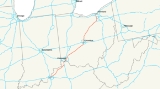
Interstate 71 is an Interstate Highway in the Great Lakes/Midwestern and Southeastern region of the United States
. Its southern terminus is at an interchange with Interstate 64
and Interstate 65
(the Kennedy Interchange
) in Louisville, Kentucky
. Its northern terminus is at an interchange with Interstate 90
in Cleveland, Ohio
. I-71 runs concurrently with Interstate 75
from a point about twenty miles (30 km) south of Cincinnati, Ohio
into downtown Cincinnati. Almost three quarters of the route lies east of I-75, thereby putting it out of its proper place in the Interstate grid.
While I-71 is designated a north–south highway, it is a major east–west route for cross-country traffic. It links I-80
and I-90
to I-70
, and ultimately (via I-65
) links to I-40
.
|KY || 97.42 || 156.78
|-
|OH || 248.15 || 399.36
|-
|Total || 345.57 || 556.14
|}
, I-71 begins east of Downtown Louisville
at the Kennedy Interchange
, where it meets I-64 and I-65. This interchange is sometimes called "Spaghetti Junction
". From Louisville, it roughly follows the Ohio River
in a diagonal path toward Northern Kentucky. Between Louisville and Cincinnati, I-71 is largely a two-lane highway, except for a couple of miles in Sparta
in which it runs three lanes each way. I-71 merges with Interstate 75
near Walton
and intersects Interstate 275
, the Cincinnati beltway. After passing through Covington
, the freeway crosses the Ohio River
via the lower level of the Brent Spence Bridge
and continues into Cincinnati.
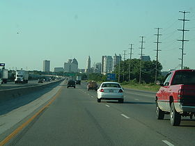
, I-71 splits immediately from I-75 and heads due east onto Fort Washington Way
, where it continues through downtown Cincinnati concurrently with US-50 for less than a mile. Just east of downtown, US-50 splits from I-71 and continues east; I-71 bends north and receives Interstate 471
, a spur from southeast of the city. I-71 then heads in a general northeast direction through urban Cincinnati and into its surrounding suburbs. After another interchange with the Interstate 275
beltway, the freeway leaves the metropolitan area and heads towards Columbus
. It continues northeast until it reaches South Lebanon, Ohio
, where it begins cutting east across the flat plains of southwest Ohio. The freeway crosses the Little Miami River on the Jeremiah Morrow Bridge
, which is a continuous truss bridge
and the tallest bridge in Ohio at 239 feet above the river. I-71 heads towards Columbus then intersects with the bypass I-270
before heading north into urban Columbus, where it junctions I-70
and exits out of Columbus. The highway continues north until near Delaware
, where it again turns northeast. Beginning its path to Cleveland
, I-71 enters the rolling farm country on the edges of the Allegheny Plateau
. It continues in this fashion to Lodi
/Westfield Center
and its junction with I-76
. Heading north to Medina
, it meets the terminus of I-271. The highway then continues north into urban Cuyahoga County
and Cleveland's suburbs, intersecting the Ohio Turnpike
/I-80. Passing Cleveland Hopkins International Airport
, I-71 meets I-480
and enters Cleveland's west side, continuing on to downtown. It junctions with State Route 176 and terminates at Interstate 90
on the Innerbelt
.
extending southwest to northeast across the state. It was planned to run from Cincinnati to Conneaut
and connect with an extension built across the panhandle of Pennsylvania
to the New York State Thruway
. As the highway was being planned, the Federal Aid Highway Act of 1956 was enacted, and the project was converted from a toll road to a freeway. It was designated as State Route 1, since the Interstate Highway numbering system had not yet been implemented. Portions of the freeway began to be completed and opened in 1959 with the new Interstate Highway funding, and they were marked as State Route 1 as well as with their new Interstate Highway number. Since large gaps existed along the corridor where no freeway had yet been completed, existing two-lane or four-lane highways were also designated as State Route 1 in order to complete the route.
 In 1960, State Route 1 followed Central Ave. in Cincinnati, to John Street, to Lincoln Park Drive (now Ezzard Charles Drive), to Freeman Avenue, to Western Avenue, to Spring Grove Avenue, to Colerain Avenue to Interstate 75
(at what is now the I-75/I-74 interchange); Interstate 75 from current I-74 interchange to West Carrollton
; U.S. Highway 25 (Dixie Drive) from West Carrollton to Interstate 70
; Interstate 70 from Dixie Drive to near Enon (current I-70/OH-4 split); State Route 4 from near Enon
to Springfield
; U.S. Highway 40 from Springfield to Columbus
; Broad St. (US 40) in Columbus, to 4th Street, to Summit/3rd Street (US 23), to Hudson Street, to Interstate 71; I-71 from Columbus to just east of Medina
(the only portion of Interstate 71 complete at the time); State Route 18 from near Medina to Montrose
; U.S. Highway 21 from Montrose to Brecksville
; State Route 82 from Brecksville to Aurora; (an alternate State Route 1 ran from Twinsburg
southeast along State Route 14 to Streetsboro
and then on State Route 43 to Aurora, in order to connect Highway 1 to the Ohio Turnpike;) State Route 306 from Aurora to State Route 84;
State Route 84 from State Route 306 to just west of what was then State Route 44; due south to Interstate 90
along what is now a section of State Route 44; and finally Interstate 90 to the Pennsylvania state line.
In Columbus, the portion of Interstate 71 that bounds Worthington's eastern edge was originally called the North Freeway. Costing US$13.8 million, it was constructed south from Route 161, arriving at 11th Avenue by August 1961. It took another year to construct the portion between 11th Avenue and 5th Avenue, mainly due to the need to construct a massive underpass under the Pennsylvania Railroad's
Grogan Yard. Today, only two tracks cross the viaduct, and the rest of the structure supports a large, weedy field. By August 1962, the freeway had reached Fifth Avenue, and it reached downtown in November 1962.
The Highway 1 signage was removed in 1966 as the Interstate Highway numbers adequately marked the route and the state highway numbering was superfluous. The present day route of what was once planned as State Route 1 is Interstate 71 from Cincinnati to just northeast of Medina, Interstate 271 for its entire length from northeast of Medina
to Willoughby Hills
, and Interstate 90 from Willoughby Hills to the Pennsylvania state line at Conneaut.
Upon its completion, I-71 replaced State Route 3 as the primary highway link between Cincinnati, Columbus, and Cleveland.
Recently, the interchange at milepost 121 north of Columbus was reconstructed to allow access to the eastern extension of Gemini Place. Before that, it was a simple diamond interchange with Polaris Parkway (Ohio State Route 750).
Sports rivalries involving cities on I-71
United States
The United States of America is a federal constitutional republic comprising fifty states and a federal district...
. Its southern terminus is at an interchange with Interstate 64
Interstate 64
Interstate 64 is an Interstate Highway in the Midwestern and Southeastern United States. Its western terminus is at I-70, U.S. 40, and U.S. 61 in Wentzville, Missouri. Its eastern terminus is at an interchange with I-264 and I-664 at Bowers Hill in Chesapeake, Virginia. As I-64 is concurrent with...
and Interstate 65
Interstate 65
Interstate 65 is a major Interstate Highway in the United States. The southern terminus is located at an intersection with Interstate 10 in Mobile, Alabama, and its northern terminus is at an interchange with Interstate 90 , U.S. Route 12, and U.S...
(the Kennedy Interchange
Kennedy Interchange
The Kennedy Interchange, unofficially, though universally, referred to as Spaghetti Junction, is the intersection of Interstates 64, 65 and 71 at the northeastern edge of downtown Louisville, Kentucky, USA. It is named for the John F...
) in Louisville, Kentucky
Louisville, Kentucky
Louisville is the largest city in the U.S. state of Kentucky, and the county seat of Jefferson County. Since 2003, the city's borders have been coterminous with those of the county because of a city-county merger. The city's population at the 2010 census was 741,096...
. Its northern terminus is at an interchange with Interstate 90
Interstate 90
Interstate 90 is the longest Interstate Highway in the United States at . It is the northernmost coast-to-coast interstate, and parallels US 20 for the most part. Its western terminus is in Seattle, at Edgar Martinez Drive S. near Safeco Field and CenturyLink Field, and its eastern terminus is in...
in Cleveland, Ohio
Cleveland, Ohio
Cleveland is a city in the U.S. state of Ohio and is the county seat of Cuyahoga County, the most populous county in the state. The city is located in northeastern Ohio on the southern shore of Lake Erie, approximately west of the Pennsylvania border...
. I-71 runs concurrently with Interstate 75
Interstate 75
Interstate 75 is a major north–south Interstate Highway in the Great Lakes and Southeastern regions of the United States. It travels from State Road 826 and State Road 924 in Hialeah, Florida to Sault Ste. Marie, Michigan, at the Ontario, Canada, border...
from a point about twenty miles (30 km) south of Cincinnati, Ohio
Cincinnati, Ohio
Cincinnati is a city in the U.S. state of Ohio. Cincinnati is the county seat of Hamilton County. Settled in 1788, the city is located to north of the Ohio River at the Ohio-Kentucky border, near Indiana. The population within city limits is 296,943 according to the 2010 census, making it Ohio's...
into downtown Cincinnati. Almost three quarters of the route lies east of I-75, thereby putting it out of its proper place in the Interstate grid.
While I-71 is designated a north–south highway, it is a major east–west route for cross-country traffic. It links I-80
Interstate 80
Interstate 80 is the second-longest Interstate Highway in the United States, following Interstate 90. It is a transcontinental artery running from downtown San Francisco, California to Teaneck, New Jersey in the New York City Metropolitan Area...
and I-90
Interstate 90
Interstate 90 is the longest Interstate Highway in the United States at . It is the northernmost coast-to-coast interstate, and parallels US 20 for the most part. Its western terminus is in Seattle, at Edgar Martinez Drive S. near Safeco Field and CenturyLink Field, and its eastern terminus is in...
to I-70
Interstate 70
Interstate 70 is an Interstate Highway in the United States that runs from Interstate 15 near Cove Fort, Utah, to a Park and Ride near Baltimore, Maryland. It was the first Interstate Highway project in the United States. I-70 approximately traces the path of U.S. Route 40 east of the Rocky...
, and ultimately (via I-65
Interstate 65
Interstate 65 is a major Interstate Highway in the United States. The southern terminus is located at an intersection with Interstate 10 in Mobile, Alabama, and its northern terminus is at an interchange with Interstate 90 , U.S. Route 12, and U.S...
) links to I-40
Interstate 40
Interstate 40 is the third-longest major east–west Interstate Highway in the United States, after I-90 and I-80. Its western end is at Interstate 15 in Barstow, California; its eastern end is at a concurrency of U.S. Route 117 and North Carolina Highway 132 in Wilmington, North Carolina...
.
Route description
|-|KY || 97.42 || 156.78
|-
|OH || 248.15 || 399.36
|-
|Total || 345.57 || 556.14
|}
Kentucky
In KentuckyKentucky
The Commonwealth of Kentucky is a state located in the East Central United States of America. As classified by the United States Census Bureau, Kentucky is a Southern state, more specifically in the East South Central region. Kentucky is one of four U.S. states constituted as a commonwealth...
, I-71 begins east of Downtown Louisville
Downtown Louisville
Downtown Louisville is the largest central business district in the Commonwealth of Kentucky and the urban hub of the Louisville, Kentucky Metropolitan Area. Its boundaries are the Ohio River to the north, Hancock Street to the east, York and Jacob Streets to the south, and 9th Street to the west...
at the Kennedy Interchange
Kennedy Interchange
The Kennedy Interchange, unofficially, though universally, referred to as Spaghetti Junction, is the intersection of Interstates 64, 65 and 71 at the northeastern edge of downtown Louisville, Kentucky, USA. It is named for the John F...
, where it meets I-64 and I-65. This interchange is sometimes called "Spaghetti Junction
Spaghetti Junction
"Spaghetti Junction" is a nickname sometimes given to a complicated or massively intertwined road traffic interchange that resembles a plate of spaghetti. The term is believed to have been coined by a journalist at the Birmingham Evening Mail in the 1970s to refer to the Gravelly Hill Interchange...
". From Louisville, it roughly follows the Ohio River
Ohio River
The Ohio River is the largest tributary, by volume, of the Mississippi River. At the confluence, the Ohio is even bigger than the Mississippi and, thus, is hydrologically the main stream of the whole river system, including the Allegheny River further upstream...
in a diagonal path toward Northern Kentucky. Between Louisville and Cincinnati, I-71 is largely a two-lane highway, except for a couple of miles in Sparta
Sparta, Kentucky
Sparta is a city in Gallatin and Owen Counties in the U.S. state of Kentucky. The population was 230 at the 2000 census.Sparta is home to Kentucky Speedway.-Geography:Sparta is located at ....
in which it runs three lanes each way. I-71 merges with Interstate 75
Interstate 75
Interstate 75 is a major north–south Interstate Highway in the Great Lakes and Southeastern regions of the United States. It travels from State Road 826 and State Road 924 in Hialeah, Florida to Sault Ste. Marie, Michigan, at the Ontario, Canada, border...
near Walton
Walton, Kentucky
Walton is a city in Boone and Kenton Counties in the U.S. state of Kentucky. The population was 3,635 in the 2010 Census.-Tourism:Nearby Florence offers thoroughbred racing at Turfway Park....
and intersects Interstate 275
Interstate 275 (Ohio)
Interstate 275 is an loop in Ohio, Indiana, and Kentucky that forms a complete beltway around the Cincinnati, Ohio area. It is the only auxiliary interstate that enters three states, including one state that the parent route does not enter . It is the longest loop interstate highway in the United...
, the Cincinnati beltway. After passing through Covington
Covington, Kentucky
-Demographics:As of the census of 2000, there were 43,370 people, 18,257 households, and 10,132 families residing in the city. The population density was 3,301.3 people per square mile . There were 20,448 housing units at an average density of 1,556.5 per square mile...
, the freeway crosses the Ohio River
Ohio River
The Ohio River is the largest tributary, by volume, of the Mississippi River. At the confluence, the Ohio is even bigger than the Mississippi and, thus, is hydrologically the main stream of the whole river system, including the Allegheny River further upstream...
via the lower level of the Brent Spence Bridge
Brent Spence Bridge
The Brent Spence Bridge is a double decker cantilever truss bridge that carries Interstates 71 and 75 across the Ohio River between Covington, Kentucky and Cincinnati, Ohio. The top deck carries southbound traffic while the bottom deck carries northbound traffic. It is arguably the most important...
and continues into Cincinnati.
Ohio
In CincinnatiCincinnati, Ohio
Cincinnati is a city in the U.S. state of Ohio. Cincinnati is the county seat of Hamilton County. Settled in 1788, the city is located to north of the Ohio River at the Ohio-Kentucky border, near Indiana. The population within city limits is 296,943 according to the 2010 census, making it Ohio's...
, I-71 splits immediately from I-75 and heads due east onto Fort Washington Way
Fort Washington Way
Fort Washington Way is a one-mile section of freeway in downtown Cincinnati, Ohio. Running east-west in a trench, it carries Interstate 71 and US-50, first built between 1958 and 1961. It is named for a former fort which once stood nearby....
, where it continues through downtown Cincinnati concurrently with US-50 for less than a mile. Just east of downtown, US-50 splits from I-71 and continues east; I-71 bends north and receives Interstate 471
Interstate 471
Interstate 471 is a long United States Interstate Highway, linking Interstate 71 in downtown Cincinnati, Ohio to Interstate 275 in Highland Heights, Kentucky. South of I-275, the expressway continues south to U.S...
, a spur from southeast of the city. I-71 then heads in a general northeast direction through urban Cincinnati and into its surrounding suburbs. After another interchange with the Interstate 275
Interstate 275 (Ohio)
Interstate 275 is an loop in Ohio, Indiana, and Kentucky that forms a complete beltway around the Cincinnati, Ohio area. It is the only auxiliary interstate that enters three states, including one state that the parent route does not enter . It is the longest loop interstate highway in the United...
beltway, the freeway leaves the metropolitan area and heads towards Columbus
Columbus, Ohio
Columbus is the capital of and the largest city in the U.S. state of Ohio. The broader metropolitan area encompasses several counties and is the third largest in Ohio behind those of Cleveland and Cincinnati. Columbus is the third largest city in the American Midwest, and the fifteenth largest city...
. It continues northeast until it reaches South Lebanon, Ohio
South Lebanon, Ohio
South Lebanon is a village located in Union and Hamilton Townships in central Warren County in the southwestern part of the U.S. state of Ohio. As of the 2000 census, the village population was 2,538, down from 2,696 in 1990...
, where it begins cutting east across the flat plains of southwest Ohio. The freeway crosses the Little Miami River on the Jeremiah Morrow Bridge
Jeremiah Morrow Bridge
The Jeremiah Morrow Bridge is a pair of parallel continuous truss bridges which span the Little Miami River gorge between Fort Ancient and Oregonia, Ohio. The bridges are named for Governor Jeremiah Morrow....
, which is a continuous truss bridge
Continuous truss bridge
A continuous truss bridge is a truss bridge which extends without hinges or joints across three or more supports. A continuous truss bridge may use less material than a series of simple trusses because a continuous truss distributes live loads across all the spans; in a series of simple trusses,...
and the tallest bridge in Ohio at 239 feet above the river. I-71 heads towards Columbus then intersects with the bypass I-270
Interstate 270 (Ohio)
Interstate 270 is the beltway loop freeway in the Columbus metropolitan area, commonly known locally as "The Outerbelt," or the "Jack Nicklaus Freeway." The "western" terminus of I-270, at least in terms of the zero-milepost, is at the junction with I-71 east of Grove City, Ohio...
before heading north into urban Columbus, where it junctions I-70
Interstate 70
Interstate 70 is an Interstate Highway in the United States that runs from Interstate 15 near Cove Fort, Utah, to a Park and Ride near Baltimore, Maryland. It was the first Interstate Highway project in the United States. I-70 approximately traces the path of U.S. Route 40 east of the Rocky...
and exits out of Columbus. The highway continues north until near Delaware
Delaware, Ohio
The City of Delaware is a city in and the county seat of Delaware County in the United States state of Ohio. Delaware was founded in 1808 and was incorporated in 1816. It is located near the center of Ohio, is about north of Columbus, and is part of the Columbus, Ohio Metropolitan Area...
, where it again turns northeast. Beginning its path to Cleveland
Cleveland, Ohio
Cleveland is a city in the U.S. state of Ohio and is the county seat of Cuyahoga County, the most populous county in the state. The city is located in northeastern Ohio on the southern shore of Lake Erie, approximately west of the Pennsylvania border...
, I-71 enters the rolling farm country on the edges of the Allegheny Plateau
Allegheny Plateau
The Allegheny Plateau is a large dissected plateau area in western and central New York, northern and western Pennsylvania, northern and western West Virginia, and eastern Ohio...
. It continues in this fashion to Lodi
Lodi, Ohio
Lodi is a village in Medina County, Ohio, United States. The population was 3,061 at the 2000 census.- History :Founded in 1811, Lodi is the oldest settlement in Medina County. It was originally called Harrisville, in honor of the family that founded it. It was later renamed to Lodi, the Indian...
/Westfield Center
Westfield Center, Ohio
Westfield Center is a village in Medina County, Ohio, United States. The population was 1,054 at the 2000 census. It was founded in 1826. When it was given a Post Office, the name "Le Roy" was assigned. The two names were used interchangeably until it was incorporated in 1914 as Le Roy, Ohio. In...
and its junction with I-76
Interstate 76 (east)
Interstate 76 is an Interstate Highway in the United States, running 435 miles from an interchange with Interstate 71 west of Akron, Ohio, east to Interstate 295 near Camden, New Jersey....
. Heading north to Medina
Medina, Ohio
In the city the population was spread out with 29.9% under the age of 18, 7.2% from 18 to 24, 33.8% from 25 to 44, 18.8% from 45 to 64, and 10.2% who were 65 years of age or older. The median age was 33 years. For every 100 females there were 92.1 males...
, it meets the terminus of I-271. The highway then continues north into urban Cuyahoga County
Cuyahoga County, Ohio
Cuyahoga County is a county located in the state of Ohio, United States. It is the most populous county in Ohio; as of the 2010 census, the population was 1,280,122. Its county seat is Cleveland. Cuyahoga County is part of Greater Cleveland, a metropolitan area, and Northeast Ohio, a...
and Cleveland's suburbs, intersecting the Ohio Turnpike
Ohio Turnpike
The Ohio Turnpike, officially the James W. Shocknessy Ohio Turnpike, is a -long, limited-access toll highway in the U.S. state of Ohio, serving as a primary corridor to Chicago and Pittsburgh...
/I-80. Passing Cleveland Hopkins International Airport
Cleveland Hopkins International Airport
Cleveland Hopkins International Airport is a public airport located nine miles southwest of the central business district of Cleveland, a city in Cuyahoga County, Ohio, United States. The airport lies just within the city limits of Cleveland...
, I-71 meets I-480
Interstate 480 (Ohio)
Interstate 480 is a loop highway that connects the Ohio Turnpike with suburban Cleveland, Ohio. The highway is officially designated the Outerbelt South Freeway, but it is rarely referred to by that name....
and enters Cleveland's west side, continuing on to downtown. It junctions with State Route 176 and terminates at Interstate 90
Interstate 90
Interstate 90 is the longest Interstate Highway in the United States at . It is the northernmost coast-to-coast interstate, and parallels US 20 for the most part. Its western terminus is in Seattle, at Edgar Martinez Drive S. near Safeco Field and CenturyLink Field, and its eastern terminus is in...
on the Innerbelt
Innerbelt Freeway
An Innerbelt Freeway is a set of freeway facilities arranged in a loop that serves the interior of a major city, primarily as a traffic reliever for downtown commuters...
.
Ohio
Much of Interstate 71 in Ohio was intended to be State Route 1. State Route 1 was originally planned in the 1950s as a second Ohio TurnpikeOhio Turnpike
The Ohio Turnpike, officially the James W. Shocknessy Ohio Turnpike, is a -long, limited-access toll highway in the U.S. state of Ohio, serving as a primary corridor to Chicago and Pittsburgh...
extending southwest to northeast across the state. It was planned to run from Cincinnati to Conneaut
Conneaut, Ohio
As of the census of 2000, there were 12,485 people, 5,038 households, and 3,410 families residing in the city. The population density was 473.4 people per square mile . There were 5,710 housing units at an average density of 216.5 per square mile...
and connect with an extension built across the panhandle of Pennsylvania
Pennsylvania
The Commonwealth of Pennsylvania is a U.S. state that is located in the Northeastern and Mid-Atlantic regions of the United States. The state borders Delaware and Maryland to the south, West Virginia to the southwest, Ohio to the west, New York and Ontario, Canada, to the north, and New Jersey to...
to the New York State Thruway
New York State Thruway
The New York State Thruway is a system of limited-access highways located within the state of New York in the United States. The system, known officially as the Governor Thomas E. Dewey Thruway for former New York Governor Thomas E. Dewey, is operated by the New York State Thruway Authority and...
. As the highway was being planned, the Federal Aid Highway Act of 1956 was enacted, and the project was converted from a toll road to a freeway. It was designated as State Route 1, since the Interstate Highway numbering system had not yet been implemented. Portions of the freeway began to be completed and opened in 1959 with the new Interstate Highway funding, and they were marked as State Route 1 as well as with their new Interstate Highway number. Since large gaps existed along the corridor where no freeway had yet been completed, existing two-lane or four-lane highways were also designated as State Route 1 in order to complete the route.
Interstate 75
Interstate 75 is a major north–south Interstate Highway in the Great Lakes and Southeastern regions of the United States. It travels from State Road 826 and State Road 924 in Hialeah, Florida to Sault Ste. Marie, Michigan, at the Ontario, Canada, border...
(at what is now the I-75/I-74 interchange); Interstate 75 from current I-74 interchange to West Carrollton
West Carrollton, Ohio
West Carrollton is a city in Montgomery County, Ohio, United States. The population was 13,143 at the 2010 census. It is part of the Dayton Metropolitan Statistical Area....
; U.S. Highway 25 (Dixie Drive) from West Carrollton to Interstate 70
Interstate 70
Interstate 70 is an Interstate Highway in the United States that runs from Interstate 15 near Cove Fort, Utah, to a Park and Ride near Baltimore, Maryland. It was the first Interstate Highway project in the United States. I-70 approximately traces the path of U.S. Route 40 east of the Rocky...
; Interstate 70 from Dixie Drive to near Enon (current I-70/OH-4 split); State Route 4 from near Enon
Enon, Ohio
Enon is a village in Clark County, Ohio, United States. The population was 2,638 at the 2000 census. It is part of the Springfield, Ohio Metropolitan Statistical Area.Enon is the headquarters of the Speedway SuperAmerica gas station chain....
to Springfield
Springfield, Ohio
Springfield is a city in the U.S. state of Ohio and the county seat of Clark County. The municipality is located in southwestern Ohio and is situated on the Mad River, Buck Creek and Beaver Creek, approximately west of Columbus and northeast of Dayton. Springfield is home to Wittenberg...
; U.S. Highway 40 from Springfield to Columbus
Columbus, Ohio
Columbus is the capital of and the largest city in the U.S. state of Ohio. The broader metropolitan area encompasses several counties and is the third largest in Ohio behind those of Cleveland and Cincinnati. Columbus is the third largest city in the American Midwest, and the fifteenth largest city...
; Broad St. (US 40) in Columbus, to 4th Street, to Summit/3rd Street (US 23), to Hudson Street, to Interstate 71; I-71 from Columbus to just east of Medina
Medina, Ohio
In the city the population was spread out with 29.9% under the age of 18, 7.2% from 18 to 24, 33.8% from 25 to 44, 18.8% from 45 to 64, and 10.2% who were 65 years of age or older. The median age was 33 years. For every 100 females there were 92.1 males...
(the only portion of Interstate 71 complete at the time); State Route 18 from near Medina to Montrose
Montrose, Ohio
Montrose is an area on the border between the Bath and Copley Townships of Summit County, Ohio, United States. It is an area of restaurants, stores, and businesses located along a stretch of State Route 18 near Interstate 77...
; U.S. Highway 21 from Montrose to Brecksville
Brecksville, Ohio
-External links:* * *...
; State Route 82 from Brecksville to Aurora; (an alternate State Route 1 ran from Twinsburg
Twinsburg, Ohio
As of the census of 2000, there were 17,006 people, 6,641 households, and 4,695 families residing in the city. The population density was 1,366.7 people per square mile . There were 6,871 housing units at an average density of 552.2 per square mile...
southeast along State Route 14 to Streetsboro
Streetsboro, Ohio
Streetsboro is a city in Portage County, Ohio, United States. It is formed from the former township of Streetsboro, which was formed from the Connecticut Western Reserve. It is nearly co-extant with the former Streetsboro Township; the village of Sugar Bush Knolls was also formed in part from a...
and then on State Route 43 to Aurora, in order to connect Highway 1 to the Ohio Turnpike;) State Route 306 from Aurora to State Route 84;
State Route 84 from State Route 306 to just west of what was then State Route 44; due south to Interstate 90
Interstate 90
Interstate 90 is the longest Interstate Highway in the United States at . It is the northernmost coast-to-coast interstate, and parallels US 20 for the most part. Its western terminus is in Seattle, at Edgar Martinez Drive S. near Safeco Field and CenturyLink Field, and its eastern terminus is in...
along what is now a section of State Route 44; and finally Interstate 90 to the Pennsylvania state line.
In Columbus, the portion of Interstate 71 that bounds Worthington's eastern edge was originally called the North Freeway. Costing US$13.8 million, it was constructed south from Route 161, arriving at 11th Avenue by August 1961. It took another year to construct the portion between 11th Avenue and 5th Avenue, mainly due to the need to construct a massive underpass under the Pennsylvania Railroad's
Pennsylvania Railroad
The Pennsylvania Railroad was an American Class I railroad, founded in 1846. Commonly referred to as the "Pennsy", the PRR was headquartered in Philadelphia, Pennsylvania....
Grogan Yard. Today, only two tracks cross the viaduct, and the rest of the structure supports a large, weedy field. By August 1962, the freeway had reached Fifth Avenue, and it reached downtown in November 1962.
The Highway 1 signage was removed in 1966 as the Interstate Highway numbers adequately marked the route and the state highway numbering was superfluous. The present day route of what was once planned as State Route 1 is Interstate 71 from Cincinnati to just northeast of Medina, Interstate 271 for its entire length from northeast of Medina
Medina, Ohio
In the city the population was spread out with 29.9% under the age of 18, 7.2% from 18 to 24, 33.8% from 25 to 44, 18.8% from 45 to 64, and 10.2% who were 65 years of age or older. The median age was 33 years. For every 100 females there were 92.1 males...
to Willoughby Hills
Willoughby Hills, Ohio
Willoughby Hills is a city in Lake County, Ohio, United States. The population was 8,595 at the 2000 census.-Geography:Willoughby Hills is located at ....
, and Interstate 90 from Willoughby Hills to the Pennsylvania state line at Conneaut.
Upon its completion, I-71 replaced State Route 3 as the primary highway link between Cincinnati, Columbus, and Cleveland.
Recently, the interchange at milepost 121 north of Columbus was reconstructed to allow access to the eastern extension of Gemini Place. Before that, it was a simple diamond interchange with Polaris Parkway (Ohio State Route 750).
Exit list
| State | County | Location | Mile | # Exit number An exit number is a number assigned to a road junction, usually an exit from a freeway. It is usually marked on the same sign as the destinations of the exit, as well as a sign in the gore.... |
Destinations | Notes |
|---|---|---|---|---|---|---|
| Kentucky Kentucky The Commonwealth of Kentucky is a state located in the East Central United States of America. As classified by the United States Census Bureau, Kentucky is a Southern state, more specifically in the East South Central region. Kentucky is one of four U.S. states constituted as a commonwealth... |
Jefferson Jefferson County, Kentucky As of the census of 2000, there were 693,604 people, 287,012 households, and 183,113 families residing in the county. The population density was . There were 305,835 housing units at an average density of... |
Louisville Louisville, Kentucky Louisville is the largest city in the U.S. state of Kentucky, and the county seat of Jefferson County. Since 2003, the city's borders have been coterminous with those of the county because of a city-county merger. The city's population at the 2010 census was 741,096... |
0.000 | – Nashville Nashville, Tennessee Nashville is the capital of the U.S. state of Tennessee and the county seat of Davidson County. It is located on the Cumberland River in Davidson County, in the north-central part of the state. The city is a center for the health care, publishing, banking and transportation industries, and is home... , Indianapolis Indianapolis, Indiana Indianapolis is the capital of the U.S. state of Indiana, and the county seat of Marion County, Indiana. As of the 2010 United States Census, the city's population is 839,489. It is by far Indiana's largest city and, as of the 2010 U.S... |
Southbound exit and northbound entrance | |
| 0.000 | 1 | – St. Louis St. Louis, Missouri St. Louis is an independent city on the eastern border of Missouri, United States. With a population of 319,294, it was the 58th-largest U.S. city at the 2010 U.S. Census. The Greater St... |
Southbound exit and northbound entrance | |||
| 0.000 | Northbound exit and southbound entrance | |||||
| 1.724 | 2 | Zorn Avenue | ||||
| Indian Hills Indian Hills, Kentucky Indian Hills is a city in Jefferson County, Kentucky, United States, along the Ohio River. The population was 2,882 at the 2000 census.Indian Hills and with the neighboring cities of Mockingbird Valley and Glenview have been considered the most prosperous suburbs of Louisville since the mid-20th... |
4.966 | 5 | ||||
| Louisville Louisville, Kentucky Louisville is the largest city in the U.S. state of Kentucky, and the county seat of Jefferson County. Since 2003, the city's borders have been coterminous with those of the county because of a city-county merger. The city's population at the 2010 census was 741,096... |
9.063 | 9 | Signed as exits 9A (south) and 9B (north) | |||
| Oldham Oldham County, Kentucky As of the census of 2000, there were 46,178 people, 14,856 households, and 12,196 families residing in the county. The population density was . There were 15,541 housing units at an average density of... |
14.488 | 14 | ||||
| 17.478 | 17 | |||||
| 18.507 | 18 | |||||
| La Grange La Grange, Kentucky As of the census of 2000, there were 5,676 people, 2,216 households, and 1,502 families residing in the city. The population density was 1,514.8 people per square mile . There were 2,330 housing units at an average density of 621.8 per square mile... |
21.869 | 22 | ||||
| Henry Henry County, Kentucky As of the census of 2000, there were 15,060 people, 5,844 households, and 4,330 families residing in the county. The population density was . There were 6,381 housing units at an average density of... |
27.840 | 28 | ||||
| Campbellsburg Campbellsburg, Kentucky Campbellsburg is a city in Henry County, Kentucky, United States. The population was 705 at the 2000 census.-Geography:Campbellsburg is located at .... |
33.505 | 34 | ||||
| Carroll Carroll County, Kentucky Carroll County is a county located in the U.S. state of Kentucky and located at the confluence of the Kentucky and Ohio rivers. It was formed in 1838 and named for Charles Carroll of Carrollton, the last living signer of the Declaration of Independence. The population was 10,155 at the 2000 census... |
42.802 | 43 | ||||
| 44.312 | 44 | |||||
| Gallatin Gallatin County, Kentucky Gallatin County is a county located in the U.S. state of Kentucky along the Ohio River, which at its formation was the main transportation route. It was formed in 1799. As of 2000, the population was 7,870. Its county seat is Warsaw... |
54.980 | 55 | – Vevay Vevay, Indiana Vevay is a town in and the county seat of Jefferson Township, Switzerland County, Indiana, United States, along the Ohio River. The population was 1,683 at the 2010 census.-History:... |
Serves Kentucky Speedway Kentucky Speedway Kentucky Speedway is a tri-oval speedway in Sparta, Kentucky, which has hosted ARCA, NASCAR and Indy Racing League racing annually since it opened in 2000. The track is currently owned and operated by Speedway Motorsports, Inc. and Jerry Carroll, who, along with four other investors, owned... |
||
| 56.673 | 57 | Serves Kentucky Speedway Kentucky Speedway Kentucky Speedway is a tri-oval speedway in Sparta, Kentucky, which has hosted ARCA, NASCAR and Indy Racing League racing annually since it opened in 2000. The track is currently owned and operated by Speedway Motorsports, Inc. and Jerry Carroll, who, along with four other investors, owned... |
||||
| Glencoe Glencoe, Kentucky Glencoe is a city in Gallatin County, Kentucky, United States. The population was 251 at the 2000 census.-Geography:Glencoe is located at .According to the United States Census Bureau, the city has a total area of , all of it land.... |
61.774 | 62 | ||||
| Boone Boone County, Kentucky Boone County is a county located in the U.S. state of Kentucky. It was formed in 1798. The population was 118,811 in the 2010 Census. Its county seat is Burlington. The county is named for frontiersman Daniel Boone... |
72.195 | 72 | ||||
| 77.724 | 77 | South end of I-75 overlap | ||||
| 79.556 | 175 | |||||
| Florence Florence, Kentucky Florence is a city in Boone County, Kentucky, United States. The population was 29,951 at the 2010 census.-History:The Florence area was originally known as Crossroads, because of the convergence of several roads from Burlington and Union at Ridge Road... |
82.275 | 178 | ||||
| 84.298 | 180 | |||||
| 84.694 | 180A | Mall Road (KY 3157) | Southbound exit and northbound entrance; serves Florence Mall Florence Mall Florence Mall is an enclosed shopping mall in Florence, Kentucky, USA. The mall, opened in 1976, comprises more than 100 stores, including four anchor stores as well as a food court... |
|||
| 85.449 | 181 | |||||
| 86.652 | 182 | |||||
| Kenton Kenton County, Kentucky Kenton County is a county located in the Commonwealth of Kentucky, United States. It was formed in 1840. In 2010, the population was 159,720. It is the third most populous county in Kentucky behind Jefferson County and Fayette County. Its county seats are Covington and Independence... |
Erlanger Erlanger, Kentucky Erlanger is a city in Kenton County, Kentucky, United States. The population was 16,676 at the 2000 census.- Geography :Erlanger is located at .... |
87.967 | 184 | Signed as exits 184A (east) and 184B (west) southbound | ||
| 88.900 | 185 | |||||
| Fort Mitchell Fort Mitchell, Kentucky As of the census of 2010, there were 8,207 people, 3,530 households, and 2,033 families residing in the city. The population density was 2,581.8 people per square mile . There were 3,744 housing units at an average density of 1,195.0 per square mile... |
90.539 | 186 | ||||
| 91.913 | 188 | |||||
| Fort Wright Fort Wright, Kentucky Fort Wright is a city in Kenton County, Kentucky, United States. The population was 5,723 at the 2010 census.-Geography:Fort Wright is located at .... |
92.870 | 189 | ||||
| Covington Covington, Kentucky -Demographics:As of the census of 2000, there were 43,370 people, 18,257 households, and 10,132 families residing in the city. The population density was 3,301.3 people per square mile . There were 20,448 housing units at an average density of 1,556.5 per square mile... |
94.707- 94.858 |
191 | 12th Street (KY 1120), Pike Street (US 25 / US 42 / US 127) – Covington Covington, Kentucky -Demographics:As of the census of 2000, there were 43,370 people, 18,257 households, and 10,132 families residing in the city. The population density was 3,301.3 people per square mile . There were 20,448 housing units at an average density of 1,556.5 per square mile... |
|||
| 95.414- 95.507 |
192 | 5th Street (KY 8) – Covington Covington, Kentucky -Demographics:As of the census of 2000, there were 43,370 people, 18,257 households, and 10,132 families residing in the city. The population density was 3,301.3 people per square mile . There were 20,448 housing units at an average density of 1,556.5 per square mile... , Newport Newport, Kentucky Newport is a city in Campbell County, Kentucky, United States, at the confluence of the Ohio and Licking rivers. The population was 15,273 at the 2010 census. Historically, it was one of four county seats of Campbell County. Newport is part of the Greater Cincinnati, Ohio Metro Area which... |
||||
| Brent Spence Bridge Brent Spence Bridge The Brent Spence Bridge is a double decker cantilever truss bridge that carries Interstates 71 and 75 across the Ohio River between Covington, Kentucky and Cincinnati, Ohio. The top deck carries southbound traffic while the bottom deck carries northbound traffic. It is arguably the most important... over the Ohio River Ohio River The Ohio River is the largest tributary, by volume, of the Mississippi River. At the confluence, the Ohio is even bigger than the Mississippi and, thus, is hydrologically the main stream of the whole river system, including the Allegheny River further upstream... (state line) |
||||||
| Ohio Ohio Ohio is a Midwestern state in the United States. The 34th largest state by area in the U.S.,it is the 7th‑most populous with over 11.5 million residents, containing several major American cities and seven metropolitan areas with populations of 500,000 or more.The state's capital is Columbus... |
Hamilton Hamilton County, Ohio As of 2000, there were 845,303 people, 346,790 households, and 212,582 families residing in the county. The population density was 2,075 people per square mile . There were 373,393 housing units at an average density of 917 per square mile... |
Cincinnati Cincinnati, Ohio Cincinnati is a city in the U.S. state of Ohio. Cincinnati is the county seat of Hamilton County. Settled in 1788, the city is located to north of the Ohio River at the Ohio-Kentucky border, near Indiana. The population within city limits is 296,943 according to the 2010 census, making it Ohio's... |
0.22- 0.50 |
1A | North end of I-75 overlap; south end of US 50 overlap | |
| 1 | Second Street, Third Street – Downtown Cincinnati, Riverfront | |||||
| 1.11 | North end of US 50 overlap; northbound exit and southbound entrance Lytle Tunnel Lytle Tunnel The Lytle Tunnel is a vehicular tunnel that carries Interstate 71 under the historic Lytle Park in Cincinnati, Ohio, United States. It is a six-lane tunnel with three tubes. There is a two lane southbound tube, a three lane northbound tube, and a one lane southbound tube that separates from the... - Sharp turn 40 MPH (70 km/h) in both directions |
|||||
| 1.99 | 1J | – Newport Newport, Kentucky Newport is a city in Campbell County, Kentucky, United States, at the confluence of the Ohio and Licking rivers. The population was 15,273 at the 2010 census. Historically, it was one of four county seats of Campbell County. Newport is part of the Greater Cincinnati, Ohio Metro Area which... |
Southbound exit and northbound entrance | |||
| 2.33- 2.48 |
2 | |||||
| 3.33 | 3 | William Howard Taft Road | Southbound exit and northbound entrance | |||
| 4.46- 6.03 |
5 | Montgomery Road (US 22 / SR 3), Dana Avenue | ||||
| Norwood Norwood, Ohio Norwood is the second most populous city in Hamilton County, Ohio, United States. The city is an enclave of the larger city of Cincinnati. The population was 21,675 at the 2000 census. Originally settled as an early suburb of Cincinnati in the wooded countryside north of the city, the area is... |
6.75- 6.96 |
6 | ||||
| Cincinnati Cincinnati, Ohio Cincinnati is a city in the U.S. state of Ohio. Cincinnati is the county seat of Hamilton County. Settled in 1788, the city is located to north of the Ohio River at the Ohio-Kentucky border, near Indiana. The population within city limits is 296,943 according to the 2010 census, making it Ohio's... |
8.04 | 8A | Ridge Avenue south | Northbound exit and southbound entrance | ||
| 8.04 | 8B | Signed as exit 7 southbound | ||||
| 8.51 | 8C | Ridge Avenue north | Northbound exit and southbound entrance | |||
| 8.75 | 8 | Kennedy Avenue, Ridge Avenue | Southbound exit and northbound entrance | |||
| 9.91- 9.92 |
9 | Red Bank Road – Fairfax Fairfax, Ohio Fairfax is a village in Hamilton County, Ohio, United States. The population was 1,938 at the 2000 census.-Geography:Fairfax is located at .... |
||||
| Silverton Silverton, Ohio Silverton is a city in Hamilton County, Ohio, United States. The city was formed out of Columbia and Sycamore Townships, but withdrew from both and formed a paper township... |
10.68 | 10 | Stewart Road | Northbound exit and southbound entrance | ||
| 11.81 | 11 | Kenwood Road | Northbound exit and southbound entrance | |||
| 12.44 | 12 | |||||
| Montgomery Montgomery, Ohio Montgomery is a city in Hamilton County, Ohio, United States settled in 1796. The town was a coach stop on the Cincinnati-Zanesville Road, later known as the Montgomery Pike with an Inn, two taverns, a grist mill and a carding mill to process its agricultural products... |
14.13 | 14 | ||||
| 15.80 | 15 | Pfeiffer Road | ||||
| 17.51- 17.54 |
17 | Signed as exits 17A (east) and 17B (west) southbound | ||||
| 19.88- 19.97 |
19 | Mason Montgomery Road, Fields Ertel Road | ||||
| Warren Warren County, Ohio Warren County is a county located in the state of Ohio, United States. The population was 212,693 at the 2010 census. Its county seat is Lebanon. Warren County was erected May 1, 1803, from Hamilton County, and named for Dr... |
||||||
| Mason Mason, Ohio Mason is an affluent city in southwestern Warren County, Ohio, United States, 22 miles away from Cincinnati . As of the 2010 census, Mason's population was 30,712. Mason has experienced fast growth, with its historic Main Street remaining at the center of the community... |
23.53 | 24 | Western Row Road, Kings Island Drive | Northbound exit and southbound entrance | ||
| 25.30 | 25 | |||||
| 28.33 | 28 | |||||
| 32.56 | 32 | |||||
| 36.74 | 36 | Wilmington Road | ||||
| Clinton Clinton County, Ohio Clinton County is a county located in the state of Ohio, United States. As of the 2010 census, the population was 42,040. The 2008 Census Population Estimate places the figure at 43,200. It is named for former U.S. Vice-President George Clinton... |
45.11 | 45 | ||||
| 50.74- 50.75 |
50 | |||||
| Greene Greene County, Ohio Greene County is a county located in the state of Ohio, United States. The population was 161,573 in the 2010 Census. Its county seat is Xenia, and it was named for General Nathanael Greene, an officer in the Revolutionary War. Greene County was established on March 24, 1803.Greene County is part... |
58.01 | 58 | ||||
| Fayette Fayette County, Ohio As of the census of 2000, there were 28,433 people, 11,054 households, and 7,837 families residing in the county. The population density was 70 people per square mile . There were 11,904 housing units at an average density of 29 per square mile... |
Octa Octa, Ohio Octa is a village in Fayette County, Ohio, United States, along Rattlesnake Creek. The population was 83 at the 2000 census.-Geography:Octa is located at .... |
65.33 | 65 | |||
| Jeffersonville Jeffersonville, Ohio Jeffersonville is a village in Fayette County, Ohio, United States. The population was 1,288 at the 2000 census.Jeffersonville was the birthplace of Grayson L... |
69.49 | 69 | ||||
| 75.03 | 75 | |||||
| Madison Madison County, Ohio As of the census of 2000, there were 40,213 people, 13,672 households, and 10,035 families residing in the county. The population density was 86 people per square mile . There were 14,399 housing units at an average density of 31 per square mile... |
84.27 | 84 | ||||
| Franklin Franklin County, Ohio Franklin County is a county located in the state of Ohio, United States. In 2010 the population was 1,163,414, making it the second largest county in Ohio and the 34th largest county in population in the United States. Franklin County is also the largest in the eight-county Columbus, Ohio... |
94.15 | 94 | ||||
| 97.16 | 97 | |||||
| Grove City Grove City, Ohio As of the census of 2000, there were 27,075 people, 10,265 households, and 7,544 families residing in the city. The population density was 1,941.2 people per square mile . There were 10,712 housing units at an average density of 768.0 per square mile... |
100.60 | 100 | Stringtown Road – Grove City Grove City, Ohio As of the census of 2000, there were 27,075 people, 10,265 households, and 7,544 families residing in the city. The population density was 1,941.2 people per square mile . There were 10,712 housing units at an average density of 768.0 per square mile... |
|||
| 101.68 | 101 | , Wheeling Wheeling, West Virginia Wheeling is a city in Ohio and Marshall counties in the U.S. state of West Virginia; it is the county seat of Ohio County. Wheeling is the principal city of the Wheeling Metropolitan Statistical Area... |
Signed as exits 101A (east) and 101B (west) northbound | |||
| Columbus Columbus, Ohio Columbus is the capital of and the largest city in the U.S. state of Ohio. The broader metropolitan area encompasses several counties and is the third largest in Ohio behind those of Cleveland and Cincinnati. Columbus is the third largest city in the American Midwest, and the fifteenth largest city... |
103.86 | 104 | ||||
| 105.43 | 105 | Greenlawn Avenue | ||||
| 106 | 106A | South end of I-70 overlap | ||||
| 106 | 99B | |||||
| 107.07- 107.17 |
100A | No northbound entrance; southbound exit is via exit 100B | ||||
| 107.41 | 100B | |||||
| 107.90- 108.10 |
107 | – Wheeling Wheeling, West Virginia Wheeling is a city in Ohio and Marshall counties in the U.S. state of West Virginia; it is the county seat of Ohio County. Wheeling is the principal city of the Wheeling Metropolitan Statistical Area... |
North end of I-70 overlap | |||
| 108.20 | 108A | Main Street | No northbound exit | |||
| 108.63 | 108B | |||||
| 108.93 | Downtown C/D Roads | Southbound exit and northbound entrance (under construction) | ||||
| 109.38 | Leonard Ave | Northbound exit only | ||||
| 109.16- 109.61 |
109A | Signed as exits 109A (west) and 109B (east, combined with Leonard Avenue exit) northbound | ||||
| 110.16 | 110A | Fifth Avenue | No northbound exit | |||
| 110.68 | 110B | 11th Avenue | ||||
| 111.15 | 111 | 17th Avenue | ||||
| 112.33 | 112 | Hudson Street | ||||
| 112.98 | 113 | Weber Road | ||||
| 113.46 | 114 | North Broadway | ||||
| 114.53 | 115 | Cooke Road | ||||
| 115.58 | 116 | Morse Road, Sinclair Road | ||||
| 117.53 | 117 | |||||
| 119.21- 119.23 |
119 | , Wheeling Wheeling, West Virginia Wheeling is a city in Ohio and Marshall counties in the U.S. state of West Virginia; it is the county seat of Ohio County. Wheeling is the principal city of the Wheeling Metropolitan Statistical Area... |
Signed as exits 119A (east) and 119B (west) southbound | |||
| Delaware Delaware County, Ohio Delaware County is a fast-growing suburban county in the state of Ohio, United States, within the Columbus, Ohio Metropolitan Statistical Area. According to the United States Census Bureau's 2004 population estimates, Delaware County's population of 142,503 made it the fastest growing county in... |
121.45- 121.92 |
121 | ||||
| 130.64 | 131 | |||||
| Morrow Morrow County, Ohio Morrow County is a county located in the state of Ohio, United States. Shawnee people used the area for hunting purposes before white settlers arrived in the early 19th century. Morrow County was organized in 1848 from parts of four neighboring counties and named for Jeremiah Morrow, Governor of... |
140.15 | 140 | ||||
| 151.09 | 151 | |||||
| Richland Richland County, Ohio Richland County is a county located in the state of Ohio, United States. As of the 2010 census, the population was 124,475. It is included in the Mansfield, Ohio, Metropolitan Statistical Area as well as the Mansfield–Bucyrus Combined Statistical Area.... |
Bellville Bellville, Ohio Bellville is a village in Richland County in the U.S. state of Ohio. It is part of the Mansfield, Ohio Metropolitan Statistical Area. The population was 1,773 at the 2000 census.-Geography:... |
165.25 | 165 | |||
| Mansfield Mansfield, Ohio Mansfield is a city in the U.S. state of Ohio and the county seat of Richland County. The municipality is located in north-central Ohio in the western foothills of the Allegheny Plateau, approximately southwest of Cleveland and northeast of Columbus.... |
168.81 | 169 | ||||
| 172.97 | 173 | |||||
| 176.91 | 176 | |||||
| Ashland Ashland County, Ohio Ashland County is a county located in the state of Ohio, United States, and was formed in 1846 from parts of Huron, Lorain, Richland and Wayne Counties. As of the 2010 census, the population was 53,139. Its county seat is Ashland... |
186.71 | 186 | ||||
| Wayne Wayne County, Ohio Wayne County is a county located in the state of Ohio, United States, and is named for General "Mad" Anthony Wayne. As of the 2010 census, the population was 114,520. Its county seat is Wooster.... |
196.31 | 196 | Northbound exit and southbound entrance | |||
| 197.92 | 198 | |||||
| Medina | Lodi | 203.89 | 204 | |||
| Seville | 209.51 | 209 | ||||
| Medina Twp. | 218.86 | 218 | ||||
| Medina Twp. | 220.71 | 220 | – Erie Erie, Pennsylvania Erie is a city located in northwestern Pennsylvania in the United States. Named for the lake and the Native American tribe that resided along its southern shore, Erie is the state's fourth-largest city , with a population of 102,000... |
Northbound exit and southbound entrance | ||
| Medina Twp. | 222.91 | 222 | ||||
| Brunswick Brunswick, Ohio Brunswick is the largest city in Medina County, Ohio, United States. The population was 34,255 at the 2010 census. It is part of the Cleveland Metropolitan Area.-Geography:Brunswick is located at .... |
226.03 | 226 | ||||
| Cuyahoga Cuyahoga County, Ohio Cuyahoga County is a county located in the state of Ohio, United States. It is the most populous county in Ohio; as of the 2010 census, the population was 1,280,122. Its county seat is Cleveland. Cuyahoga County is part of Greater Cleveland, a metropolitan area, and Northeast Ohio, a... |
Strongsville Strongsville, Ohio As of the census of 2000, there were 43,858 people, 16,209 households, and 12,383 families residing in the city. The population density was 1,779.6 people per square mile . There were 16,863 housing units at an average density of 684.2 per square mile... |
231.26 | 231 | Signed as exits 231A (east) and 231B (west) southbound | ||
| 233.06 | 233 | |||||
| Middleburg Heights Middleburg Heights, Ohio -History:The first European settlers to the area that became Middleburg Township, Ohio were originally from Waterbury, Connecticut.-External links:* * and from The Encyclopedia of Cleveland History... |
234.21 | 234 | ||||
| 235.37 | 235 | Bagley Road – Berea Berea, Ohio - History :The first European settlers were originally from Connecticut. Berea fell within Connecticut's Western Reserve and was surveyed and divided into townships and ranges by one Gideon Granger, a gentleman who served as Postmaster General under President Thomas Jefferson... , Middleburg Heights Middleburg Heights, Ohio -History:The first European settlers to the area that became Middleburg Township, Ohio were originally from Waterbury, Connecticut.-External links:* * and from The Encyclopedia of Cleveland History... |
||||
| Brook Park Brook Park, Ohio -External links:*... |
237.53 | 237 | Snow Road, Engle Road – Cleveland Hopkins International Airport Cleveland Hopkins International Airport Cleveland Hopkins International Airport is a public airport located nine miles southwest of the central business district of Cleveland, a city in Cuyahoga County, Ohio, United States. The airport lies just within the city limits of Cleveland... |
Signed as exits 237A (east) and 237B (west) southbound | ||
| 238.77 | 238 | Northbound exit and southbound entrance | ||||
| Cleveland Cleveland, Ohio Cleveland is a city in the U.S. state of Ohio and is the county seat of Cuyahoga County, the most populous county in the state. The city is located in northeastern Ohio on the southern shore of Lake Erie, approximately west of the Pennsylvania border... |
||||||
| 239.26 | 238 | Southbound exit and northbound entrance | ||||
| 240.57 | 240 | West 150th Street | ||||
| 241.85 | 242A | West 130th Street | Signed as exit 242 southbound | |||
| 242.41 | 242B | Bellaire Road | Northbound exit and southbound entrance | |||
| Linndale Linndale, Ohio Linndale is a village in Cuyahoga County, Ohio, United States. It borders the cities of Cleveland and Brooklyn. As of the 2010 census, the village population was 179.-Geography:Linndale is located at .... |
||||||
| Cleveland Cleveland, Ohio Cleveland is a city in the U.S. state of Ohio and is the county seat of Cuyahoga County, the most populous county in the state. The city is located in northeastern Ohio on the southern shore of Lake Erie, approximately west of the Pennsylvania border... |
244.5 | 244 | Denison Avenue, West 65th Street | Northbound exit and southbound entrance | ||
| 245.48- 246.20 |
245 | |||||
| 246.6 | 246 | Southbound exit and northbound entrance | ||||
| 246.98 | 247A | West 14th Street, Clark Avenue | Northbound exit and southbound entrance | |||
| 247.56 | 247B | Northbound exit and southbound entrance | ||||
| 247.56 | 247B | Northbound exit and southbound entrance | ||||
| 247.81 | Northbound exit and southbound entrance | |||||
Auxiliary routes
- I-471Interstate 471Interstate 471 is a long United States Interstate Highway, linking Interstate 71 in downtown Cincinnati, Ohio to Interstate 275 in Highland Heights, Kentucky. South of I-275, the expressway continues south to U.S...
- links downtown Cincinnati with Interstate 275Interstate 275 (Ohio)Interstate 275 is an loop in Ohio, Indiana, and Kentucky that forms a complete beltway around the Cincinnati, Ohio area. It is the only auxiliary interstate that enters three states, including one state that the parent route does not enter . It is the longest loop interstate highway in the United... - I-271Interstate 271Interstate 271 is an auxiliary interstate highway in the suburbs of Cleveland and Akron in the U.S. state of Ohio. The highway is officially designated the "Cleveland Outerbelt East", but rarely referred to by that name.-Route description:...
- provides access to Cleveland's eastern suburbs and enables travelers on Interstate 71 to access Interstate 90 east without going through Cleveland proper.
See also
- Carrollton bus disasterCarrollton bus disasterThe Carrollton, Kentucky bus collision was one of the deadliest bus disasters in United States history.About 11:00 p.m. EDT on Saturday May 14, 1988, Larry Mahoney, a drunk driver in a pickup truck traveling in the wrong direction on an interstate highway in a rural, unincorporated area of Carroll...
, a drunk-driving tragedy involving a school busSchool busA school bus is a type of bus designed and manufactured for student transport: carrying children and teenagers to and from school and school events...
that occurred on I-71
Sports rivalries involving cities on I-71
- The I-71 RivalryBattle of Ohio (NFL)In the National Football League, the Battle of Ohio refers to games played between the Cleveland Browns and the Cincinnati Bengals. This rivalry has produced 2 of the 8 highest scoring games in NFL history...
: Cincinnati BengalsCincinnati BengalsThe Cincinnati Bengals are a professional football team based in Cincinnati, Ohio. They are members of the AFC's North Division in the National Football League . The Bengals began play in 1968 as an expansion team in the American Football League , and joined the NFL in 1970 in the AFL-NFL...
–Cleveland BrownsCleveland BrownsThe Cleveland Browns are a professional football team based in Cleveland, Ohio. They are currently members of the North Division of the American Football Conference in the National Football League...
(NFL) - The Keg of NailsThe Keg of NailsThe Keg of Nails is a traveling trophy in college football, awarded to the winner of the Universities of Louisville and Cincinnati since 1929....
: Cincinnati BearcatsCincinnati Bearcats footballThe Cincinnati Bearcats football program represents the University of Cincinnati in a college football. They compete at the NCAA Division I Football Bowl Subdivision level as members of the Big East Conference. The Bearcat football program is one of the nation's oldest, having fielded a team as...
–Louisville CardinalsLouisville Cardinals footballThe Louisville Cardinals football team represents the University of Louisville in college football as a member of the Big East Conference. Howard Schnellenberger started the program's rise to relevancy after winning the Miami Hurricanes' first national championship...
(NCAA Football)
External links
- I-71 on Cincinnati-Transit.net
- Interstate-guide.com: Interstate 71
- Historic photo; 1963 aerial view of I-71 construction between 17th and 5th avenues in Columbus, Ohio
- Historic photo; gasoline tanker crash and fire collapses Cleveland Avenue overpass in Columbus, Ohio 6/28/1966
- Historic photo; rebuilding the Cleveland Avenue overpass after it is was destroyed by a gasoline tanker fire in 1966