Ipelské Predmostie
Encyclopedia

Village
A village is a clustered human settlement or community, larger than a hamlet with the population ranging from a few hundred to a few thousand , Though often located in rural areas, the term urban village is also applied to certain urban neighbourhoods, such as the West Village in Manhattan, New...
and municipality
Municipality
A municipality is essentially an urban administrative division having corporate status and usually powers of self-government. It can also be used to mean the governing body of a municipality. A municipality is a general-purpose administrative subdivision, as opposed to a special-purpose district...
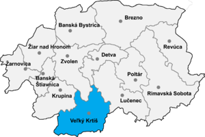
in the Veľký Krtíš District
Velký Krtíš District
Veľký Krtíš District is a district inthe Banská Bystrica Region of central Slovakia. Until 1918, the district was split between the Hungarian counties of Hont and Nógrád.-Municipalities:*Balog nad Ipľom*Bátorová*Brusník...
of the Banská Bystrica Region
Banská Bystrica Region
The Banská Bystrica Region is one of the Slovak regions in the country of Slovakia in Europe.-Geography:It is located in the central part of Slovakia and has an area of 9,455 km². The region is prevailingly mountains, with several ranges within the area. The highest of them are the Low Tatras...
of southern Slovakia
Slovakia
The Slovak Republic is a landlocked state in Central Europe. It has a population of over five million and an area of about . Slovakia is bordered by the Czech Republic and Austria to the west, Poland to the north, Ukraine to the east and Hungary to the south...
.
History
In historical recordsHistory
History is the discovery, collection, organization, and presentation of information about past events. History can also mean the period of time after writing was invented. Scholars who write about history are called historians...
, the village was first mentioned in 1252 (Hydweg) when King Bela IV gave it to Count Myko. Before, it belonged to Hont
Hont
Hont is the name of a historic administrative county of the Kingdom of Hungary and then shortly of Czechoslovakia...
. In castle. In 1438 it belonged to feudatory György Palóczy and, after to Esztergom
Esztergom
Esztergom , is a city in northern Hungary, 46 km north-west of the capital Budapest. It lies in Komárom-Esztergom county, on the right bank of the river Danube, which forms the border with Slovakia there....
Archbishopric. In 1570 it was pilleged by Turks
Ottoman Empire
The Ottoman EmpireIt was usually referred to as the "Ottoman Empire", the "Turkish Empire", the "Ottoman Caliphate" or more commonly "Turkey" by its contemporaries...
. A map of 1825 shows Hidveg, in the district of Honth (now Hont) was in Hungary and then became part of the Austro/Hungarian Empire, ruled by Emperor Franz Joseph. After WWI borders were redrawn and Hidveg became part of Czechoslovakia. (Passports dated 1920 show Hidveg as part of Czechoslovakia.) A treaty returned Hidveg to Hungary from 1940 to 1945. After 1945 the borders were again changed and Hidveg once again was part of Czechoslovakia. It is now renamed and in Slovakia.
External links
- http://www.statistics.sk/mosmis/eng/run.html
- http://www.e-obce.sk/obec/ipelskepredmostie/ipelske-predmostie.html

