Isabella Plains, Australian Capital Territory
Encyclopedia
Isabella Plains is a suburb in the Canberra
, Australia
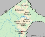
district of Tuggeranong
. The postcode is 2905. The suburb is indirectly named after Isabella Maria Brisbane (1821–1849), who was the daughter of Thomas Brisbane
the colonial Governor of New South Wales
when the area was first explored by white settlers in 1823. Joseph Wild was employed by Brigade Major John Ovens and Captain Mark Currie to guide them to the Murrumbidgee River
. They travelled south along the river and named the area now known as Tuggeranong "Isabella's Plain". This name was adopted, with a slight change of spelling, for the name of the new suburb. It was gazetted on 5 August 1975. Streets are named after New South Wales parish names.
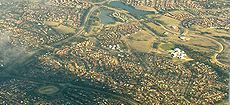
It is next to the suburbs of Monash, Bonython, Richardson and Calwell. It is bounded by Isabella Drive, Drakeford Drive, Johnson Drive and Ashley Drive. Located in the suburb are a small group of shops, MacKillop Catholic College, Isabella Plains Primary School, the Tuggeranong automatic weather station and Isabella Plains neighbourhood oval.
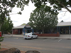
 A small shopping centre is located on the corner of Ellerston Avenue and Galloway Street. This includes a small supermarket, a hairdresser, a Chinese restaurant, a pathology clinic, a chemist and a takeaway shop.
There is also an Isabella Plains Neighbourhood house, and a small doctors surgery opposite and to the right of the shops.
(b) Non-government schools
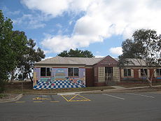
 An early childhood centre exists next to Isabella Plains Primary School on Ellerston Avenue, offering day care and children's health services. Since 2009 this has been run by C&K. After school care is also available through Isabella Plains Primary School.
A Neighbourhood Centre shares a car park with the shops. This centre is available for general hire by the community and hosts, among other things, several daytime playgroups for mothers with young children in connection with the ACT Playgroups Association.

underlies the suburb. These rocks are from the Silurian
period. But it is overlaid by alluvium in the low lying parts.
Canberra
Canberra is the capital city of Australia. With a population of over 345,000, it is Australia's largest inland city and the eighth-largest city overall. The city is located at the northern end of the Australian Capital Territory , south-west of Sydney, and north-east of Melbourne...
, Australia
Australia
Australia , officially the Commonwealth of Australia, is a country in the Southern Hemisphere comprising the mainland of the Australian continent, the island of Tasmania, and numerous smaller islands in the Indian and Pacific Oceans. It is the world's sixth-largest country by total area...
district of Tuggeranong
Tuggeranong
Tuggeranong is the southernmost town centre of Canberra, the capital city of Australia. It comprises 19 suburbs with a total of 31,819 dwellings, housing 87,119 people of the 324,034 people in the Australian Capital Territory . The district occupies 117 square kilometres to the east of the...
. The postcode is 2905. The suburb is indirectly named after Isabella Maria Brisbane (1821–1849), who was the daughter of Thomas Brisbane
Thomas Brisbane
Major-General Sir Thomas Makdougall Brisbane, 1st Baronet GCH, GCB, FRS, FRSE was a British soldier, colonial Governor and astronomer.-Early life:...
the colonial Governor of New South Wales
Governors of New South Wales
The Governor of New South Wales is the state viceregal representative of the Australian monarch, Queen Elizabeth II, who is equally shared with 15 other sovereign nations in a form of personal union, as well as with the eleven other jurisdictions of Australia, and resides predominantly in her...
when the area was first explored by white settlers in 1823. Joseph Wild was employed by Brigade Major John Ovens and Captain Mark Currie to guide them to the Murrumbidgee River
Murrumbidgee River
The Murrumbidgee River is a major river in the state of New South Wales, Australia, and the Australian Capital Territory . A major tributary of the Murray River, the Murrumbidgee flows in a west-northwesterly direction from the foot of Peppercorn Hill in the Fiery Range of the Snowy Mountains,...
. They travelled south along the river and named the area now known as Tuggeranong "Isabella's Plain". This name was adopted, with a slight change of spelling, for the name of the new suburb. It was gazetted on 5 August 1975. Streets are named after New South Wales parish names.
It is next to the suburbs of Monash, Bonython, Richardson and Calwell. It is bounded by Isabella Drive, Drakeford Drive, Johnson Drive and Ashley Drive. Located in the suburb are a small group of shops, MacKillop Catholic College, Isabella Plains Primary School, the Tuggeranong automatic weather station and Isabella Plains neighbourhood oval.
Shops

There is also an Isabella Plains Neighbourhood house, and a small doctors surgery opposite and to the right of the shops.
Schools
(a) Government schools- Isabella Plains Primary School, a P-2 school
- Isabella Plains Pre-school
(b) Non-government schools
- MacKillop Catholic CollegeMacKillop Catholic CollegeSt Mary MacKillop College, formerly known as MacKillop Catholic College, is a Catholic high school in the Australian capital of Canberra, with two campuses in the Tuggeranong Valley. The school is the result of an amalgamation of Padua High School and St. Peter's College in 1998. It is the second...
Community facilities

A Neighbourhood Centre shares a car park with the shops. This centre is available for general hire by the community and hosts, among other things, several daytime playgroups for mothers with young children in connection with the ACT Playgroups Association.

Churches
- Brindabella Baptist Church, meeting at MacKillop Catholic College.
- Tuggeranong Presbyterian Church, meeting at Isabella Plains Public School.
- Isabella Plains is in the Catholic parish of Corpus Christi which has its church in Gowrie.
Geology
Deakin Volcanics green grey and purple rhyodaciteRhyodacite
Rhyodacite is an extrusive volcanic rock intermediate in composition between dacite and rhyolite. It is the extrusive equivalent of granodiorite. Phenocrysts of sodium rich plagioclase, sanidine, quartz, and biotite or hornblende are typically set in an aphanitic to glassy light to intermediate...
underlies the suburb. These rocks are from the Silurian
Silurian
The Silurian is a geologic period and system that extends from the end of the Ordovician Period, about 443.7 ± 1.5 Mya , to the beginning of the Devonian Period, about 416.0 ± 2.8 Mya . As with other geologic periods, the rock beds that define the period's start and end are well identified, but the...
period. But it is overlaid by alluvium in the low lying parts.
External links
- Allhomes Isabella Plains Information
- http://www.ga.gov.au/bin/gazm01?placename=Isabella+Plains&placetype=R&state=ACT

