
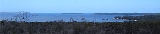
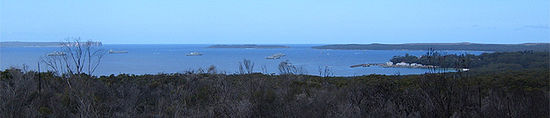
Jervis Bay
Encyclopedia
New South Wales
New South Wales is a state of :Australia, located in the east of the country. It is bordered by Queensland, Victoria and South Australia to the north, south and west respectively. To the east, the state is bordered by the Tasman Sea, which forms part of the Pacific Ocean. New South Wales...
, the Jervis Bay Territory
Jervis Bay Territory
The Jervis Bay Territory is a territory of the Commonwealth of Australia. It was surrendered by the state of New South Wales to the Commonwealth Government in 1915 so that the Federal capital at Canberra would have "access to the sea"....
, and a detached enclave
Enclave and exclave
In political geography, an enclave is a territory whose geographical boundaries lie entirely within the boundaries of another territory.An exclave, on the other hand, is a territory legally or politically attached to another territory with which it is not physically contiguous.These are two...
of the Australian Capital Territory
Australian Capital Territory
The Australian Capital Territory, often abbreviated ACT, is the capital territory of the Commonwealth of Australia and is the smallest self-governing internal territory...
. HMAS Creswell
HMAS Creswell
HMAS Creswell is a shore establishment of the Royal Australian Navy, a part of the Australian Defence Force, and consists of the Royal Australian Naval College , The RAN School of Survivability and Ship's Safety, Kalkara Flight, the Beecroft Weapons Range and an administrative support...
is located between Jervis Bay Village and Greenpatch
Greenpatch, Jervis Bay Territory
Greenpatch is a town located in the Jervis Bay Territory in Australia and forms part of the Jervis Bay Village Council. It is claimed to possess Australia's whitest sand.-Geography:...
in the Jervis Bay Territory
Jervis Bay Territory
The Jervis Bay Territory is a territory of the Commonwealth of Australia. It was surrendered by the state of New South Wales to the Commonwealth Government in 1915 so that the Federal capital at Canberra would have "access to the sea"....
.
History
Jervis Bay is named after the BritishRoyal Navy
The Royal Navy is the naval warfare service branch of the British Armed Forces. Founded in the 16th century, it is the oldest service branch and is known as the Senior Service...
Admiral
Admiralty
The Admiralty was formerly the authority in the Kingdom of England, and later in the United Kingdom, responsible for the command of the Royal Navy...
Sir John Jervis, 1st Earl of St Vincent
John Jervis, 1st Earl of St Vincent
Admiral of the Fleet John Jervis, 1st Earl of St Vincent GCB, PC was an admiral in the Royal Navy and Member of Parliament in the United Kingdom...
; it was named in 1791 by Lt Richard Bowen
Richard Bowen
Richard Bowen was an officer of the Royal Navy who served during the American War of Independence and the French Revolutionary Wars...
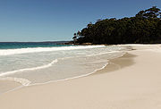
. George Bass also entered the Bay when he surveyed the South East coast of Australia in 1797. Jervis was believed to have pronounced his name /ˈdʒɑrvɨs/, but many residents of Jervis Bay (including his descendants) pronounce it [ˈdʒɜːvəs]. Jervis Bay has been officially recorded as having the whitest sand in the world.
In the late 1960s Australia's first and only nuclear power plant
Jervis Bay Nuclear Power Plant
Jervis Bay Nuclear Power Plant was a proposed nuclear power reactor in the Jervis Bay Territory on the south coast of New South Wales. It would have been Australia's first nuclear power plant, and was the only proposal to have received serious consideration...
was proposed for the area, and a site was prepared. However, the project did not proceed.
Geography
Jervis Bay has to the south GreenpatchGreenpatch, Jervis Bay Territory
Greenpatch is a town located in the Jervis Bay Territory in Australia and forms part of the Jervis Bay Village Council. It is claimed to possess Australia's whitest sand.-Geography:...
; Hyams Beach
Hyams Beach, New South Wales
Hyams Beach is a small seaside village in the Shoalhaven, New South Wales, Australia, on the shores of Jervis Bay. The village, roughly 3 hours drive south of Sydney, is bordered by 3 beaches, Chinaman's Beach to the north, Hyams Beach and Seaman's Beach to the south...
, and Bowen Island (Australia) in the Jervis Bay Territory
Jervis Bay Territory
The Jervis Bay Territory is a territory of the Commonwealth of Australia. It was surrendered by the state of New South Wales to the Commonwealth Government in 1915 so that the Federal capital at Canberra would have "access to the sea"....
. In New South Wales
New South Wales
New South Wales is a state of :Australia, located in the east of the country. It is bordered by Queensland, Victoria and South Australia to the north, south and west respectively. To the east, the state is bordered by the Tasman Sea, which forms part of the Pacific Ocean. New South Wales...
, it has Vincentia
Vincentia, New South Wales
Vincentia is a town in New South Wales, Australia in the City of Shoalhaven, on the shores of Jervis Bay. It is roughly 25 km south-east of Nowra, and approximately 200 km south of Sydney. In 2006, the population of the State Suburb of Vincentia was 2,875....
to the west; Callala Beach, Callala Bay
Callala Bay, New South Wales
Callala Bay is a small town on the South Coast of New South Wales, Australia in the City of Shoalhaven. It is situated on the northern shore of Jervis Bay about 20 minutes drive from Nowra and 10 minutes from Culburra Beach...
and Hare Bay to the north, and the Beecroft Peninsula
Beecroft Peninsula
Beecroft Peninsula is a peninsula located to the north and east of Jervis Bay in south-eastern Australia. The peninsula forms the northern headland of Jervis Bay....
with bays like Perpendicular Bay. Parts of the Beecroft Peninsula and most of the northern headland of the bay (including Longnose Point) are in the Australian Capital Territory
Australian Capital Territory
The Australian Capital Territory, often abbreviated ACT, is the capital territory of the Commonwealth of Australia and is the smallest self-governing internal territory...
, with the exception of the Point Perpendicular
Point Perpendicular
Point Perpendicular is a point at the southern tip of the Beecroft Peninsula and at the northern entry to Jervis Bay, in New South Wales, Australia...
lighthouse
Lighthouse
A lighthouse is a tower, building, or other type of structure designed to emit light from a system of lamps and lenses or, in older times, from a fire, and used as an aid to navigation for maritime pilots at sea or on inland waterways....
and grounds, which form an enclave of New South Wales within the ACT section of the Beecroft Peninsula. To the south of the peninsula
Peninsula
A peninsula is a piece of land that is bordered by water on three sides but connected to mainland. In many Germanic and Celtic languages and also in Baltic, Slavic and Hungarian, peninsulas are called "half-islands"....
is Point Perpendicular which is a bombing range
Bombing range
A bombing range is an area used for testing explosive ordnance and practicing to accurately direct them to the target. Bombing ranges are used for munitions that either explode or produce too much destruction to use at a shooting range, such as kinetic energy penetrators or very large caliber...
for the Royal Australian Navy
Royal Australian Navy
The Royal Australian Navy is the naval branch of the Australian Defence Force. Following the Federation of Australia in 1901, the ships and resources of the separate colonial navies were integrated into a national force: the Commonwealth Naval Forces...
. The bay is noted for slab stones which were caused by an ancient tsunami
Tsunami
A tsunami is a series of water waves caused by the displacement of a large volume of a body of water, typically an ocean or a large lake...
.
Environment
Some 158 km2 of the land on both sides of the bay has been identified by BirdLife InternationalBirdLife International
BirdLife International is a global Partnership of conservation organisations that strives to conserve birds, their habitats and global biodiversity, working with people towards sustainability in the use of natural resources...
as an Important Bird Area
Important Bird Area
An Important Bird Area is an area recognized as being globally important habitat for the conservation of bird populations. Currently there are about 10,000 IBAs worldwide. The program was developed and sites are identified by BirdLife International...
(IBA) because the coastal heathland
Heath
-Habitats:* Heath or heathland, low-growing woody vegetation, mostly consisting of heathers and related species* Heaths in the British National Vegetation Classification system...
supports the largest sub-population of the endangered Eastern Bristlebird
Eastern Bristlebird
The Eastern Bristlebird is a species of bird in the Bristlebird family Dasyornithidae. It is endemic to Australia. Its natural habitats are temperate forests, temperate shrubland, and temperate grassland...
, isolated from other sub-populations.
Recreation
Jervis Bay is a well known recreational fishing and scuba diving
Scuba diving
Scuba diving is a form of underwater diving in which a diver uses a scuba set to breathe underwater....
destination, with tour operators departing from Huskisson and amateurs using boat ramps at bayside towns and camp sites. Popular diving sites include: The Labyrinths, Gorgonian Wall, Point Perpendicular
Point Perpendicular
Point Perpendicular is a point at the southern tip of the Beecroft Peninsula and at the northern entry to Jervis Bay, in New South Wales, Australia...
, a Fairey Firefly
Fairey Firefly
The Fairey Firefly was a British Second World War-era carrier-borne fighter aircraft and anti-submarine aircraft of the Fleet Air Arm ....
aeroplane, scallop
Scallop
A scallop is a marine bivalve mollusk of the family Pectinidae. Scallops are a cosmopolitan family, found in all of the world's oceans. Many scallops are highly prized as a food source...
beds, Middle Ground, Ten Fathom Reef, and Bowen Island.
Jervis Bay is also known for Whale Watching, placed such that the migration, both north and south can be observed as they pass the entrance to the Bay, frequently entering the bay to rest. The majority of whales sighted at Jervis Bay are the Humpback whales, which migrate along the east coast from June to November, however other species on occasions such as Southern Right Whales, False Killer Whales, Orcas, Minke whales and on one occasion the Blue Whale
Blue Whale
The blue whale is a marine mammal belonging to the suborder of baleen whales . At in length and or more in weight, it is the largest known animal to have ever existed....
are seen.
Tourism
Tourism in Jervis Bay is one of the most important avenues of income for many of the local residents, with many businesses orienting themselves toward tourism in and around Jervis Bay. Tourist information for Jervis Bay is provided by two local not-for-profit community-based volunteer association Tourism Jervis Bay and Jervis Bay Tourism Inc.The local Council managed Visitors Information Centres are located at Nowra and Ulladulla.
The Jervis Bay Visitors Information Centre is at the Lady Denman Heritage Centre, within the museum buildings. It contains a wealth of knowledge for any visitor to the area.
New South Wales
- Callala BayCallala Bay, New South WalesCallala Bay is a small town on the South Coast of New South Wales, Australia in the City of Shoalhaven. It is situated on the northern shore of Jervis Bay about 20 minutes drive from Nowra and 10 minutes from Culburra Beach...
- Callala Beach
- Myola
- HuskissonHuskisson, New South WalesHuskisson is a town in New South Wales, Australia in the City of Shoalhaven, on the shores of Jervis Bay. It is 24 km south-east of Nowra.Situated alongside Currambene Creek which serves also as an anchorage and fishing port...
- VincentiaVincentia, New South WalesVincentia is a town in New South Wales, Australia in the City of Shoalhaven, on the shores of Jervis Bay. It is roughly 25 km south-east of Nowra, and approximately 200 km south of Sydney. In 2006, the population of the State Suburb of Vincentia was 2,875....
- Hyams BeachHyams Beach, New South WalesHyams Beach is a small seaside village in the Shoalhaven, New South Wales, Australia, on the shores of Jervis Bay. The village, roughly 3 hours drive south of Sydney, is bordered by 3 beaches, Chinaman's Beach to the north, Hyams Beach and Seaman's Beach to the south...
See also
- Jervis Bay TerritoryJervis Bay TerritoryThe Jervis Bay Territory is a territory of the Commonwealth of Australia. It was surrendered by the state of New South Wales to the Commonwealth Government in 1915 so that the Federal capital at Canberra would have "access to the sea"....
- Australian Capital TerritoryAustralian Capital TerritoryThe Australian Capital Territory, often abbreviated ACT, is the capital territory of the Commonwealth of Australia and is the smallest self-governing internal territory...
- Booderee National ParkBooderee National Park and Botanic GardensBooderee National Park and Botanic Gardens are located in the Jervis Bay Territory of Australia. The reserve is composed of two sections:* the Bherwerre Peninsula, on the southern foreshore of Jervis Bay, Bowen Island and the waters of the south of the bay...
- Beecroft PeninsulaBeecroft PeninsulaBeecroft Peninsula is a peninsula located to the north and east of Jervis Bay in south-eastern Australia. The peninsula forms the northern headland of Jervis Bay....
- New South Wales Jervis Bay National ParkNew South Wales Jervis Bay National ParkNew South Wales Jervis Bay is a national park in New South Wales , 129 km southwest of Sydney.-Fact sheet:*Area: 12 km²*Coordinates: *Date of establishment: 15 March 1995...
- HMS Jervis Bay