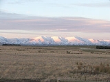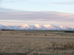
Kakanui Range
Encyclopedia

Oamaru
Oamaru , the largest town in North Otago, in the South Island of New Zealand, is the main town in the Waitaki District. It is 80 kilometres south of Timaru and 120 kilometres north of Dunedin, on the Pacific coast, and State Highway 1 and the railway Main South Line connects it to both...
in the South Island
South Island
The South Island is the larger of the two major islands of New Zealand, the other being the more populous North Island. It is bordered to the north by Cook Strait, to the west by the Tasman Sea, to the south and east by the Pacific Ocean...
of New Zealand
New Zealand
New Zealand is an island country in the south-western Pacific Ocean comprising two main landmasses and numerous smaller islands. The country is situated some east of Australia across the Tasman Sea, and roughly south of the Pacific island nations of New Caledonia, Fiji, and Tonga...
. The range forms a boundary between the valley of the Waitaki River
Waitaki River
The Waitaki River is a large river in the South Island of New Zealand, some 110 km long. It is the major river of the Mackenzie Basin.It is a braided river which flows through Lake Benmore, Lake Aviemore and Lake Waitaki. These are ultimately fed by three large glacial lakes, Pukaki, Tekapo,...
to the north and the high plateau known as the Maniototo
Maniototo
The Maniototo Plain, usually simply known as The Maniototo, is an elevated inland region in Otago, New Zealand. The region roughly surrounds the upper reaches of the Taieri River and the Manuherikia River. It is bounded by the Kakanui Range to the north and the Rock and Pillar Range to the southeast...
to the southwest. The highest point in the Kakanuis is Mt. Pisgah, at 1643 m (5394 ft).
The Kakanui Range is crossed by road at Dansey Pass
Dansey Pass
Danseys Pass is a mountain pass located in the Kakanui Mountains, between Central Otago and North Otago, in the South Island of New Zealand....
, which has a saddle at 935 m (3070 ft).
The southwestern slopes of the Kakanui Range were a major goldfield during the Central Otago goldrush of the 1860s. Relics from this goldrush can be found at Kyeburn and Naseby
Naseby, New Zealand
Naseby is a small town, formerly a borough, in the Maniototo area of Central Otago, New Zealand. It is named after a village in Northamptonshire, England....
.

