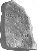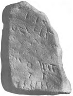
Kilmadock
Encyclopedia

Parish
A parish is a territorial unit historically under the pastoral care and clerical jurisdiction of one parish priest, who might be assisted in his pastoral duties by a curate or curates - also priests but not the parish priest - from a more or less central parish church with its associated organization...
, containing the settlements of Doune
Doune
Doune is a burgh in the district of Stirling, Scotland, on the River Teith. Doune's postal address places the town in Perthshire, although geographically it lies within the District of Stirling, and administratively Doune is under the control of Stirling Council...
, Deanston
Deanston
Deanston is a village in the district of Stirling,Scotland, on the south bank of the River Teith, formerly of West Perthshire. It is a part of the parish of Kilmadock....
, Buchany, Drumvaich, and Delvorich, is situated in Stirling council area
Stirling (council area)
Stirling is one of the 32 unitary local government council areas of Scotland, and has a population of about 87,000 . It was created under the Local Government etc Act 1994 with the boundaries of the Stirling district of the former Central local government region, and it covers most of the former...
, Scotland
Scotland
Scotland is a country that is part of the United Kingdom. Occupying the northern third of the island of Great Britain, it shares a border with England to the south and is bounded by the North Sea to the east, the Atlantic Ocean to the north and west, and the North Channel and Irish Sea to the...
, and is on the southern border of the former county of Perthshire
Perthshire
Perthshire, officially the County of Perth , is a registration county in central Scotland. It extends from Strathmore in the east, to the Pass of Drumochter in the north, Rannoch Moor and Ben Lui in the west, and Aberfoyle in the south...
. Its length is 10 miles (16.1 km), its breadth from 2–8 mi (3.2–12.9 km), and with an area of 24521 acres (99 km²).
The River Forth
River Forth
The River Forth , long, is the major river draining the eastern part of the central belt of Scotland.The Forth rises in Loch Ard in the Trossachs, a mountainous area some west of Stirling...
runs along its southern boundary, and the River Teith
River Teith
The River Teith in Scotland flows from the north-west into the River Forth near Drip north-west of Stirling.- Etymology :The name comes from the Scottish Gaelic Uisge Theavich, which translates into English as the "pleasant river".- Course :...
runs east-south-eastward through the centre. A flat tract of considerable breadth lies along the Forth Valley, flanked on each side by a hill-ridge. The valley is traversed by the Teith, and an upland tract, part of the Braes of Doune, ascends to the summit of Uaighmore on the northern boundary.

