Kostinbrod Pass
Encyclopedia

Doyran Heights
Doyran Heights are the heights rising to 3560 m in the east foothills of Vinson Massif and Craddock Massif in Sentinel Range, Ellsworth Mountains in Antarctica, extending 30.8 km in north-south direction and 16.5 km in east-west direction...
from Flowers Hills
Flowers Hills
Flowers Hills is a group of hills, 20 nautical miles long and with peaks of 1,240 and 1,390 m, lying south of the terminus of Dater Glacier and extending along the east edge of the Sentinel Range, Ellsworth Mountains. First mapped by United States Geological Survey from surveys and U.S. Navy air...
in Sentinel Range
Sentinel Range
The Sentinel Range is a major mountain range situated northward of Minnesota Glacier and forming the northern half of the Ellsworth Mountains in Antarctica. The range trends NNW-SSE for about and is 24 to 48 km wide...
, Ellsworth Mountains
Ellsworth Mountains
The Ellsworth Mountains are the highest mountain ranges in Antarctica, forming a long and wide chain of mountains in a north to south configuration on the western margin of the Ronne Ice Shelf. They are bisected by Minnesota Glacier to form the northern Sentinel Range and the southern Heritage...
in Antarctica.
The pass is named after the town of Kostinbrod
Kostinbrod
Kostinbrod is a town in western Bulgaria. It is located 15 km west of the capital city of Sofia. It is located on two important transport corridors: Lom — Sofia — Thessaloniki and Sofia — Belgrade...
in Western Bulgaria.
Location
Kostinbrod Pass is centred at 78°25′59"S 84°28′19"W, which is 6.16 km northeast of Mount HavenerMount Havener
Mount Havener is a mountain rising to 2,800 m directly at the head of Guerrero Glacier, in Doyran Heights, the Sentinel Range, Ellsworth Mountains in Antarctica. First mapped by United States Geological Survey from surveys and U.S. Navy air photos, 1957-59. Named by Advisory Committee on...
, 9.53 km south of Dickey Peak
Dickey Peak
Dickey Peak is a peak in the northwest part of Flowers Hills in the Sentinel Range, Ellsworth Mountains. First mapped by United States Geological Survey from surveys and U.S. Navy air photos, 1957-59. Named by Advisory Committee on Antarctic Names for Clifford R. Dickey, Jr., electronics...
and 7.32 km west-northwest of Gubesh Peak
Gubesh Peak
Gubesh Peak is the peak rising to 1240 m in Flowers Hills, Sentinel Range in Ellsworth Mountains, Antarctica. It surmounts Rutford Ice Stream to the east and a wide ice-filled valley to the west....
. US mapping in 1961, updated in 1988.
Maps
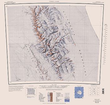
- Vinson Massif. Scale 1:250 000 topographic map. Reston, Virginia: US Geological Survey, 1988.

