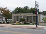
Kouts, Indiana
Encyclopedia
Kouts is a town in Pleasant Township
, Porter County
, Indiana
. The population was 2,090 at the 2010 census. Since 2000, Kouts has had a population growth of 23.09 percent. Bernhardt Kautz moved here from Pennsylvania, before the arrival of the railroads and established a farm where the town now sits. With the arrival of the Chicago and St. Louis Railroad in 1865, Kautz and his brother-in-law, H.A. Wright laid out the town and established a store. Known as Kouts Station, the town grew slowly until the Chicago and Erie Railroad intersected the line in Kouts. Soon, Kouts became the social and economic center of the township.
According to the United States Census Bureau
, the town has a total area of 1.1 square miles (2.8 km²), all of it land.
, and 0.24% from two or more races. Hispanic
(2000 U.S. Census Bureau)
Pleasant Township, Porter County, Indiana
Pleasant Township is one of twelve townships in Porter County, Indiana. As of the 2000 census, its population was 3,759.-Education:The township is served by the East Porter County School Corporation. Its high school is Kouts High School located in Kouts....
, Porter County
Porter County, Indiana
Porter County is a county located in the U.S. state of Indiana. As of 2010, the population was 164,343. Much of the population growth has to do with the expansion of the Chicago Metropolitan Area eastward into Indiana. The county seat is Valparaiso...
, Indiana
Indiana
Indiana is a US state, admitted to the United States as the 19th on December 11, 1816. It is located in the Midwestern United States and Great Lakes Region. With 6,483,802 residents, the state is ranked 15th in population and 16th in population density. Indiana is ranked 38th in land area and is...
. The population was 2,090 at the 2010 census. Since 2000, Kouts has had a population growth of 23.09 percent. Bernhardt Kautz moved here from Pennsylvania, before the arrival of the railroads and established a farm where the town now sits. With the arrival of the Chicago and St. Louis Railroad in 1865, Kautz and his brother-in-law, H.A. Wright laid out the town and established a store. Known as Kouts Station, the town grew slowly until the Chicago and Erie Railroad intersected the line in Kouts. Soon, Kouts became the social and economic center of the township.
Geography
Kouts is located at 41°18′56"N 87°1′39"W (41.315434, -87.027536).According to the United States Census Bureau
United States Census Bureau
The United States Census Bureau is the government agency that is responsible for the United States Census. It also gathers other national demographic and economic data...
, the town has a total area of 1.1 square miles (2.8 km²), all of it land.
Transportation
- State Route 8 goes west to HebronHebron, IndianaHebron is a town in Boone Township, Porter County, Indiana, United States. The population was 3,724 at the 2010 census.-Geography:Hebron is located at ....
and east through LaCrosseLaCrosse, IndianaLaCrosse is a town in LaPorte County, Indiana, United States. The population was 627 in 1990, 561 in 2000, and 551 at the 2010 census. It is included in the Michigan City, Indiana-La Porte, Indiana Metropolitan Statistical Area.-Geography:...
to Marshall County. - State Route 49Indiana State Road 49State Road 49 in the U.S. State of Indiana is a state highway in northwest Indiana. It runs from just north of Chesterton at the intersection with U.S. Route 12 south to a rural interchange 10 miles northeast of Rensselaer with State Road 14...
goes north past ValparaisoValparaiso, IndianaValparaiso is a city in and the county seat of Porter County, Indiana, United States. The population was 31,730 at the 2010 census, making it the 2nd largest city in Porter County.-History:...
to end at the Indiana Dunes State ParkIndiana Dunes State ParkIndiana DunesDesignationState Park; National Natural LandmarkLocationPorter County, Indiana, USAAddress1600 N 25 EChesterton, IN 46304Nearest CityPorter, IndianaCoordinatesAreaDate of Establishment1925...
on Lake MichiganLake MichiganLake Michigan is one of the five Great Lakes of North America and the only one located entirely within the United States. It is the second largest of the Great Lakes by volume and the third largest by surface area, after Lake Superior and Lake Huron...
and south to State Route 14Indiana State Road 14State Road 14 is an east–west road in northern Indiana. Its western terminus is at U.S. Route 41 in Enos, and its eastern terminus is at Interstate 69 in Fort Wayne....
in central Jasper County.
Demographics
There are 1,698 people, 678 households, and 499 families residing in the town. The racial makeup of the town was 99.00% White, 0.12% Asian, 0.65% from other racesRace (United States Census)
Race and ethnicity in the United States Census, as defined by the Federal Office of Management and Budget and the United States Census Bureau, are self-identification data items in which residents choose the race or races with which they most closely identify, and indicate whether or not they are...
, and 0.24% from two or more races. Hispanic
Hispanic
Hispanic is a term that originally denoted a relationship to Hispania, which is to say the Iberian Peninsula: Andorra, Gibraltar, Portugal and Spain. During the Modern Era, Hispanic sometimes takes on a more limited meaning, particularly in the United States, where the term means a person of ...
(2000 U.S. Census Bureau)

