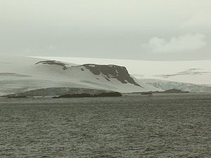
Krakra Bluff
Encyclopedia

South Bay, Livingston Island
South Bay is a wide bay indenting for the south coast of Livingston Island in the South Shetland Islands, Antarctica. The bay is lying northwest of False Bay and east of Walker Bay, and is entered between Hannah Point and Miers Bluff....
, Livingston Island in the South Shetland Islands
South Shetland Islands
The South Shetland Islands are a group of Antarctic islands, lying about north of the Antarctic Peninsula, with a total area of . By the Antarctic Treaty of 1959, the Islands' sovereignty is neither recognized nor disputed by the signatories and they are free for use by any signatory for...
, Antarctica. The area was visited by early 19th century sealers
Seal hunting
Seal hunting, or sealing, is the personal or commercial hunting of seals. The hunt is currently practiced in five countries: Canada, where most of the world's seal hunting takes place, Namibia, the Danish region of Greenland, Norway and Russia...
operating from nearby Johnsons Dock
Johnsons Dock
Johnsons Dock is a sheltered 500 m wide cove indenting for 900 m the southeast coast of South Bay, Livingston Island in the South Shetland Islands, Antarctica. Entered north of Ballester Point. Surmounted by Charrúa Ridge on the northeast...
.
The feature is named after the Bulgaria
Bulgaria
Bulgaria , officially the Republic of Bulgaria , is a parliamentary democracy within a unitary constitutional republic in Southeast Europe. The country borders Romania to the north, Serbia and Macedonia to the west, Greece and Turkey to the south, as well as the Black Sea to the east...
n bolyar (boyar)
Boyar
A boyar, or bolyar , was a member of the highest rank of the feudal Moscovian, Kievan Rus'ian, Bulgarian, Wallachian, and Moldavian aristocracies, second only to the ruling princes , from the 10th century through the 17th century....
and warrior Krakra of Pernik
Krakra of Pernik
Krakra of Pernik , also known as Krakra Voevoda or simply Krakra, was an 11th-century feudal lord in the First Bulgarian Empire whose domain encompassed 36 fortresses in what is today southwestern Bulgaria, with his capital at Pernik...
(10-11th Century).
Location
The bluff is located at 62°38′24"S 60°33′27"W which is 2.1 km east of Ustra PeakUstra Peak
Ustra Peak is a rocky peak of 195 m on the coast of Walker Bay, Livingston Island in the South Shetland Islands, Antarctica...
, and 5.1 km west of Ereby Point
Ereby Point
Ereby Point is a point lying 4.5 mi east-northeast of Hannah Point along the north side of South Bay, Livingston Island in the South Shetland Islands, Antarctica. The name Erebys Bay was applied to South Bay on a 1825 chart by James Weddell, Ereby Point was applied by the UK-APC in 1961 in...
.
Maps
- L.L. Ivanov et al. Antarctica: Livingston Island and Greenwich Island, South Shetland Islands. Scale 1:100000 topographic map. Sofia: Antarctic Place-names Commission of Bulgaria, 2005.
- L.L. Ivanov. Antarctica: Livingston Island and Greenwich, Robert, Snow and Smith Islands. Scale 1:120000 topographic map. Troyan: Manfred Wörner Foundation, 2009.

