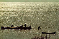
Lagoa Mirim
Encyclopedia

Spanish language
Spanish , also known as Castilian , is a Romance language in the Ibero-Romance group that evolved from several languages and dialects in central-northern Iberia around the 9th century and gradually spread with the expansion of the Kingdom of Castile into central and southern Iberia during the...
) is a large estuarine
Estuary
An estuary is a partly enclosed coastal body of water with one or more rivers or streams flowing into it, and with a free connection to the open sea....
lagoon
Lagoon
A lagoon is a body of shallow sea water or brackish water separated from the sea by some form of barrier. The EU's habitat directive defines lagoons as "expanses of shallow coastal salt water, of varying salinity or water volume, wholly or partially separated from the sea by sand banks or shingle,...
which extends from southern Rio Grande do Sul
Rio Grande do Sul
Rio Grande do Sul is the southernmost state in Brazil, and the state with the fifth highest Human Development Index in the country. In this state is located the southernmost city in the country, Chuí, on the border with Uruguay. In the region of Bento Gonçalves and Caxias do Sul, the largest wine...
state in Brazil
Brazil
Brazil , officially the Federative Republic of Brazil , is the largest country in South America. It is the world's fifth largest country, both by geographical area and by population with over 192 million people...
into eastern Uruguay
Uruguay
Uruguay ,officially the Oriental Republic of Uruguay,sometimes the Eastern Republic of Uruguay; ) is a country in the southeastern part of South America. It is home to some 3.5 million people, of whom 1.8 million live in the capital Montevideo and its metropolitan area...
. Lagoa Mirim is separated from the Atlantic Ocean
Atlantic Ocean
The Atlantic Ocean is the second-largest of the world's oceanic divisions. With a total area of about , it covers approximately 20% of the Earth's surface and about 26% of its water surface area...
by a sandy, partially barren isthmus
Isthmus
An isthmus is a narrow strip of land connecting two larger land areas usually with waterforms on either side.Canals are often built through isthmuses where they may be particularly advantageous to create a shortcut for marine transportation...
.
Lagoa Mirim is about 108 miles (173.8 km) long by 6 to 22 miles (35.4 km) wide. It is more irregular in outline than its larger neighbor to the north, Lagoa dos Patos
Lagoa dos Patos
Lagoa dos Patos is the second largest lagoon in Latin America and the biggest in Brazil. It is located in the state of Rio Grande do Sul, southern Brazil. It is 174 miles long, has a maximum width of 44 miles , and a total area of 3,803 sq. mi....
, and discharges into the latter through São Gonçalo Channel
São Gonçalo Channel
The São Gonçalo Channel is a navigable channel connecting two large coastal lagoons, Lagoa Mirim and Lagoa dos Patos, in the state of Rio Grande do Sul in southern Brazil. At its eastern end, it separates the municipalities of Rio Grande to the south from Pelotas to the north....
, which is navigable by small boats. Lagoa Mirim has no direct connection to the Atlantic, but the Rio Grande, a tidal channel about 24 miles (38.6 km) long which connects Lagoa dos Patos to the Atlantic, affords an entrance to the navigable inland waters of both lagoons and several small ports. The southern part of the lake lies in Uruguayan territory, but its navigation, as determined by treaty, belongs exclusively to Brazil.
Both lakes are the remains of an ancient depression in the coastline shut in by sand beaches built up by the combined action of wind and current. They are at the same level as the ocean, but their waters are affected by the tides and are brackish only a short distance above the Rio Grande outlet.
The Jaguarão/Yaguarón River
Jaguarão River
The Jaguarão or Yaguarón River is a Brazilian and Uruguayan river.- Location :It forms the border between Uruguay and Rio Grande do Sul state in southernmost Brazil....
, which forms part of the Brazil-Uruguay boundary line, empties into Lagoa Mirim, and is navigable 26 miles (41.8 km) up to and beyond the twin towns of Jaguarão
Jaguarão
Jaguarão is a town in the southern Brazilian state of Rio Grande do Sul located on the shores of the Jaguarão River bordering Uruguay.Is there a place of Battle of Jaguarão-External links:*...
(Brazil) and Rio Branco
Río Branco, Uruguay
Río Branco is a city in the Cerro Largo Department of northeastern Uruguay. It is located on the border with Brazil, at the east end of Route 26, about east-southeast of the department capital city of Melo...
(Uruguay).
See also
- Topography and hydrography of Uruguay

