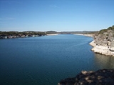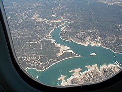
Lake Travis
Encyclopedia

Reservoir
A reservoir , artificial lake or dam is used to store water.Reservoirs may be created in river valleys by the construction of a dam or may be built by excavation in the ground or by conventional construction techniques such as brickwork or cast concrete.The term reservoir may also be used to...
on the Colorado River
Colorado River (Texas)
The Colorado River is a river that runs through the U.S. state of Texas; it should not be confused with the much longer Colorado River which flows from Colorado into the Gulf of California....
in central Texas
Texas
Texas is the second largest U.S. state by both area and population, and the largest state by area in the contiguous United States.The name, based on the Caddo word "Tejas" meaning "friends" or "allies", was applied by the Spanish to the Caddo themselves and to the region of their settlement in...
in the United States
United States
The United States of America is a federal constitutional republic comprising fifty states and a federal district...
. The reservoir was formed in 1942 by the construction of Mansfield Dam
Mansfield Dam
Mansfield Dam is a dam located at across a canyon at Marshall Ford on the Colorado River, northwest of Austin, Texas. Construction of the dam began in 1937 and was completed in 1941 as a joint project by the Lower Colorado River Authority and the United States Bureau of Reclamation...
on the western edge of Austin, Texas
Austin, Texas
Austin is the capital city of the U.S. state of :Texas and the seat of Travis County. Located in Central Texas on the eastern edge of the American Southwest, it is the fourth-largest city in Texas and the 14th most populous city in the United States. It was the third-fastest-growing large city in...
by the Lower Colorado River Authority
Lower Colorado River Authority
The Lower Colorado River Authority or LCRA is a nonprofit public utility that was created in November 1934 by the Texas Legislature. LCRA's mission is to protect people, property and the environment by providing public services for more than one million people in Central and Southeast Texas...
. Lake Travis has the largest storage capacity of the seven reservoirs known as the Highland Lakes
Texas Highland Lakes
The Texas Highland Lakes is a chain of seven reservoirs in Central Texas formed by several dams on the Colorado River. This portion of the river winds southeast from its headwaters near the border of Texas and New Mexico to Matagorda Bay and the Gulf of Mexico...
, and stretches 65 miles (105 km) upriver from western Travis County
Travis County, Texas
As of 2009, the U.S. census estimates there were 1,026,158 people, 320,766 households, and 183,798 families residing in the county. The population density was 821 people per square mile . There were 335,881 housing units at an average density of 340 per square mile...
in a highly serpentine course into southern Burnet County
Burnet County, Texas
Burnet County is a county located on the Edwards Plateau in the U.S. state of Texas. As of 2000, the population was 34,147. The 2008 Census Bureau Estimate was 44,488. Its county seat is Burnet. Burnet is named for David Gouverneur Burnet, the first president of the Republic of Texas...
to Max Starcke Dam, southwest of the town of Marble Falls
Marble Falls, Texas
Marble Falls is a city in Burnet County, Texas, United States. The population was 4,959 at the 2000 census.Marble Falls is about northwest of Austin and north of San Antonio...
. The Pedernales River
Pedernales River
The Pedernales River is a tributary of the Colorado River, approximately long, in central Texas in the United States. It drains an area of the Edwards Plateau, flowing west to east across the Texas Hill Country west of Austin...
, a major tributary of the Colorado River, flows into the lake from the southwest in western Travis County. The lake is used for flood control, water supply, electrical power generation and recreation.
The other reservoirs on the Colorado River are Lake Buchanan, Inks Lake
Inks Lake
Inks Lake is a reservoir on the Colorado River in the Texas Hill Country in the United States. The reservoir was formed in 1938 by the construction of Inks Dam by the Lower Colorado River Authority. Located near Burnet, Texas, the lake serves to provide flood control in tandem with Lake Buchanan...
, Lake LBJ
Lake LBJ
Lake Lyndon B. Johnson is a reservoir on the Colorado River in the Texas Hill Country in the United States. The reservoir was formed in 1950 by the construction of Granite Shoals Dam by the Lower Colorado River Authority. The Colorado River and the Llano River meet in the northern portion of the...
, Lake Marble Falls
Lake Marble Falls
Lake Marble Falls is a reservoir on the Colorado River in the Texas Hill Country in the United States. The reservoir was formed in 1951 by the construction of Max Starcke Dam by the Lower Colorado River Authority. Originally named Marble Falls Dam, the dam was renamed in 1962 for Max Starcke, the...
, Lake Austin
Lake Austin
Lake Austin is a reservoir on the Colorado River in Austin, Texas in the United States. The reservoir was formed in 1939 by the construction of Tom Miller Dam by the Lower Colorado River Authority....
, and Lady Bird Lake.
Recreational uses
Because of its volume, the lake serves as the primary floodFlood
A flood is an overflow of an expanse of water that submerges land. The EU Floods directive defines a flood as a temporary covering by water of land not normally covered by water...
control reservoir of the Highland Lake chain. The level of the lake can therefore vary dramatically, depending on the amount of rainfall in the Colorado River basin upstream. Despite this, the lake furnishes one of the most desired locations in the region for outdoor recreation, including fishing, boating, swimming, scuba diving, picnicking and camping. Lake Travis is generally considered one of the clearest lakes in Texas. It is a vital water supply for the nearby city of Austin, Texas and the surrounding metropolitan area.
Fish populations
Lake Travis has been stocked with several species of fish intended to improve the utility of the reservoir for recreational fishing. Fish present in Lake Travis include largemouth bassLargemouth bass
The largemouth bass is a species of black bass in the sunfish family native to North America . It is also known as widemouth bass, bigmouth, black bass, bucketmouth, Potter's fish, Florida bass, Florida largemouth, green bass, green trout, linesides, Oswego bass, southern largemouth...
, guadalupe bass
Guadalupe bass
The Guadalupe bass is a rare species of fish endemic to the U.S. state of Texas, where it also is the official state fish. It is restricted to creeks and rivers , and was formerly listed as vulnerable, but IUCN currently considers the data insufficient to determine its status...
, white bass
White bass
The white bass or sand bass The white bass or sand bass The white bass or sand bass (MoroneIt is the state fish of Oklahoma.- Range :White bass are distributed widely across the United States, particularly in the midwest. They are very abundant in Pennsylvania and the area around Lake Erie...
, striped bass
Striped bass
The striped bass is the state fish of Maryland, Rhode Island, South Carolina, and the state saltwater fish of New York, Virginia, and New Hampshire...
, catfish
Catfish
Catfishes are a diverse group of ray-finned fish. Named for their prominent barbels, which resemble a cat's whiskers, catfish range in size and behavior from the heaviest and longest, the Mekong giant catfish from Southeast Asia and the second longest, the wels catfish of Eurasia, to detritivores...
and sunfish
Centrarchidae
The sunfishes are a family of freshwater ray-finned fish belonging to the order Perciformes. The type genus is Centrarchus . The family's 27 species includes many fishes familiar to North Americans, including the rock bass, largemouth bass, bluegill, pumpkinseed, and crappies...
.
In spring 2008 there were several reports of leeches residing in Lake Travis. The leeches are generally harmless to humans but can be a nuisance.
Lake levels
Lake Travis is considered "full" (at maximum desired capacity) when the lake's water level is at 681 feet (207.6 m) above mean sea level (msl). Above 681 feet (207.6 m), flood control gates are opened under the direction of the U.S. Army Corps of Engineers. The historic high level on the lake was 710.4 feet (216.5 m) above msl on December 25, 1991. The historic low was 614.2 feet (187.2 m) above msl on August 14, 1951. The extreme drought of 2008-2009 brought the lake to its fourth lowest level at 629.97 feet (192 m) above msl on September 11, 2009. The second lowest level was 615.02 feet (187.5 m) above msl on November 8, 1963. Due to the drought of 2011 levels have gone as low as 626 feet, making it the third lowest level ever .External links
- Texas-Size Drought Dries Up Lake Travis National Public Radio, June 29, 2011

