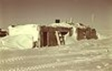
Leffingwell Camp Site
Encyclopedia
The Leffingwell Camp Site, located on a barrier island of the Arctic coast of Alaska, was used by polar explorer and geologist Ernest de Koven Leffingwell
in the Anglo-American Polar Expedition of 1906–1908, which aimed to explore the Beaufort Sea
. The expedition's ship, the Duchess of Bedford, was allowed to become locked in ice which eventually destroyed it.
The camp site was chosen before the ship was locked in ice, and was not merely the nearest landfall. The site was used by Leffingwell over several years, beyond the end of that expedition.
Leffingwell created the first accurate map of a section of Alaskan coastline. He was the first to scientifically describe permafrost and to pose theories about permafrost which have largely proven true. He accurately identified the oil potential of the area, including assessing that it was not, in his day, technologically or economically feasible to develop it.
Following the destruction of the Duchess of Bedford, Leffingwell "returned to civilization in the fall of 1908, as the guest of Capt. George B. Leavitt
." Leffingwell subsequently named Narwhal Island for the name of Capt. Leavitt's vessel, the steam New Bedford, Massachusetts
-based whaler Narwhal, and bestowed the name of the Maine
-born Captain, who married an Inuit woman and settled at Barrow, on Leavitt Island off the Alaska North Slope
.
The historic integrity of the camp was diminished in the 1930s when some structure was removed by a salvager.
The camp was declared a National Historic Landmark
in 1978.
It is located on Flaxman Island, 58 miles west of Barter Island on the Arctic Coast of Alaska.
Ernest de Koven Leffingwell
Ernest de Koven Leffingwell was an arctic explorer, geologist and Spanish-American War veteran.During the period from 1906 to 1914, Leffingwell spent 9 summers and 6 winters on the Arctic coast of Alaska, making 31 trips by dog sled and/or small boats. He created the first accurate map of a large...
in the Anglo-American Polar Expedition of 1906–1908, which aimed to explore the Beaufort Sea
Beaufort Sea
The Beaufort Sea is a marginal sea of the Arctic Ocean, located north of the Northwest Territories, the Yukon, and Alaska, west of Canada's Arctic islands. The sea is named after hydrographer Sir Francis Beaufort...
. The expedition's ship, the Duchess of Bedford, was allowed to become locked in ice which eventually destroyed it.
The camp site was chosen before the ship was locked in ice, and was not merely the nearest landfall. The site was used by Leffingwell over several years, beyond the end of that expedition.
Leffingwell created the first accurate map of a section of Alaskan coastline. He was the first to scientifically describe permafrost and to pose theories about permafrost which have largely proven true. He accurately identified the oil potential of the area, including assessing that it was not, in his day, technologically or economically feasible to develop it.
Following the destruction of the Duchess of Bedford, Leffingwell "returned to civilization in the fall of 1908, as the guest of Capt. George B. Leavitt
George Baker Leavitt, Sr.
Capt. George Baker Leavitt, Sr. was a Maine-born mariner who captained several whaling vessels out of New Bedford, Massachusetts. The steam whalers captained by Leavitt were active in the whaling fishery off the Alaska North Slope, where Leavitt met and married an Inuk woman...
." Leffingwell subsequently named Narwhal Island for the name of Capt. Leavitt's vessel, the steam New Bedford, Massachusetts
New Bedford, Massachusetts
New Bedford is a city in Bristol County, Massachusetts, United States, located south of Boston, southeast of Providence, Rhode Island, and about east of Fall River. As of the 2010 census, the city had a total population of 95,072, making it the sixth-largest city in Massachusetts...
-based whaler Narwhal, and bestowed the name of the Maine
Maine
Maine is a state in the New England region of the northeastern United States, bordered by the Atlantic Ocean to the east and south, New Hampshire to the west, and the Canadian provinces of Quebec to the northwest and New Brunswick to the northeast. Maine is both the northernmost and easternmost...
-born Captain, who married an Inuit woman and settled at Barrow, on Leavitt Island off the Alaska North Slope
Alaska North Slope
The Alaska North Slope is the region of the U.S. state of Alaska located on the northern slope of the Brooks Range along the coast of two marginal seas of the Arctic Ocean, the Chukchi Sea being on the western side of Point Barrow, and the Beaufort Sea on the eastern.The region contains the...
.
The historic integrity of the camp was diminished in the 1930s when some structure was removed by a salvager.
The camp was declared a National Historic Landmark
National Historic Landmark
A National Historic Landmark is a building, site, structure, object, or district, that is officially recognized by the United States government for its historical significance...
in 1978.
It is located on Flaxman Island, 58 miles west of Barter Island on the Arctic Coast of Alaska.

