Lighthouses in Puerto Rico
Encyclopedia

In 1869 the Spanish government
Spanish Empire
The Spanish Empire comprised territories and colonies administered directly by Spain in Europe, in America, Africa, Asia and Oceania. It originated during the Age of Exploration and was therefore one of the first global empires. At the time of Habsburgs, Spain reached the peak of its world power....
approved the first plan for Puerto Rico
Puerto Rico
Puerto Rico , officially the Commonwealth of Puerto Rico , is an unincorporated territory of the United States, located in the northeastern Caribbean, east of the Dominican Republic and west of both the United States Virgin Islands and the British Virgin Islands.Puerto Rico comprises an...
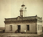
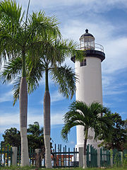
in order to serve the ships that sail through its waters. The lighthouses are located in prominent and isolated areas with good visibility towards the sea. The classification system of the lighthouses of Puerto Rico was based on the characteristics of the lens, and the structure. The lights of the first and second order have a wider light to warn ships of the proximity to land, followed by the minor lights, whose scope was limited to smaller harbors and bays and to connect the primary lights in the system.
In 1898, the United States acquired the lighthouses of Puerto Rico as a result of the Spanish American War. In 1900, the United States Lighthouse Board
United States Lighthouse Board
The United States Lighthouse Board was the agency of the US Federal Government that was responsible for the upkeep and maintenance of all lighthouses in the United States...
acquired responsibility for the aids to navigation. The lights are maintained by the Coast Guard since 1939.
In 1981, the lighthouses of Puerto Rico were listed in the National Register of Historic Places
National Register of Historic Places
The National Register of Historic Places is the United States government's official list of districts, sites, buildings, structures, and objects deemed worthy of preservation...
. In 2000, they were included by the Puerto Rican government in the National Register of Historic Properties of Puerto Rico.
The Coast Guard has been transferring responsibility of the lighthouses to local government and conservation organizations. Some of the lighthouses have been fully restored and are open to the public. In 2001, under the National Historic Lighthouse Preservation Act
National Historic Lighthouse Preservation Act
The National Historic Lighthouse Preservation Act of 2000 is American legislation creating a process for the transfer of federally-owned lighthouses into private hands...
, Cape San Juan Light
Cape San Juan Light
Cape San Juan Light is a historic lighthouse located on the northeastern part of the highest point of Cape San Juan in Fajardo, Puerto Rico. The lighthouse was constructed in 1880 and was officially lit on May 2, 1882...
became the first lighthouse to be transfer to a non-governmental organization in Puerto Rico.

List of Lighthouses in Puerto Rico


| Name | Municipality | Established | Tower height in meters (ft) |
Focal plane in meters (ft) |
Current status | Current condition |
|---|---|---|---|---|---|---|
| Los Morrillos Light | Cabo Rojo Cabo Rojo, Puerto Rico Cabo Rojo is a municipality situated on the southwest coast of Puerto Rico and forms part of the San Germán–Cabo Rojo metropolitan area as well as the larger Mayagüez–San Germán–Cabo Rojo Combined Statistical Area.... |
1882 | 12 m (40 ft.) | 37 m (121 ft) | Active | Restored for tourism |
| Punta Higuero Light Punta Higuero Light Punta Higuero Light, also known as Faro de Punta Higuero, is an historic lighthouse located in Rincón, Puerto Rico. The original building was built in 1892 by the Spanish government and was rebuilt in 1922 by the U.S Coast Guard.... |
Rincón Rincón, Puerto Rico Rincón is a municipality of Puerto Rico founded in 1771 by Don Luis de Añasco . It is located in the Western Coastal Valley, west of Añasco and Aguada. Rincón is spread over 8 wards and Rincón Pueblo... |
1892 | 21 m (69 ft) | 27 m (90 ft) | Active | It has been fully restored and is part of the El Faro Park, a tourist and recreation center. |
| Punta Borinquen Light Punta Borinquen Light Punta Borinquen Light is a lighthouse located in the old Ramey Air Force Base in Aguadilla, Puerto Rico. The station was established in 1889 by the Spanish government. With the opening of the Panama Canal in 1914, the lighthouse would become "the most important aid to navigation on the route from... |
Aguadilla Aguadilla, Puerto Rico Aguadilla , founded in 1775 by Luis de Córdova, is a city located in the northwestern tip of Puerto Rico bordered by the Atlantic Ocean to the north and west, north of Aguada, and Moca and west of Isabela. Aguadilla is spread over 15 wards and Aguadilla Pueblo... |
1892 | 18 m (60 ft) | 89 m (292 ft) | Active | Operational |
| Arecibo Light Arecibo Light Arecibo Light is a historic lighthouse located in the city of Arecibo, Puerto Rico. It is also known as "Morrillo's Lighthouse" because it is location on top of a rocky mountain known as Punta Morrillo. The lighthouse was constructed and was lit on 1898... |
Arecibo Arecibo, Puerto Rico Arecibo is a municipality in the northern midwest coast of Puerto Rico and located by the Atlantic Ocean, north of Utuado and Ciales; east of Hatillo; and west of Barceloneta, and Florida. Arecibo is spread over 18 wards and Arecibo Pueblo... |
1898 | 14 m (46 ft) | 36 m (120 ft) | Active | Restored for tourism |
| El Morro or Port San Juan Light El Morro or Port San Juan Light El Morro or Port San Juan Light, also known as Faro de Morro or Faro del Castillo del Morro or Puerto San Juan Light, is a lighthouse atop the walls of Fort San Felipe del Morro in Old San Juan. It's the first lighthouse built in Puerto Rico.The first Port San Juan Lighthouse was built in 1846 and... |
San Juan San Juan, Puerto Rico San Juan , officially Municipio de la Ciudad Capital San Juan Bautista , is the capital and most populous municipality in Puerto Rico, an unincorporated territory of the United States. As of the 2010 census, it had a population of 395,326 making it the 46th-largest city under the jurisdiction of... |
1846 | 15.5 m (51 ft) | 55 m (181 ft) | Active | Restored for tourism |
| Cape San Juan Light Cape San Juan Light Cape San Juan Light is a historic lighthouse located on the northeastern part of the highest point of Cape San Juan in Fajardo, Puerto Rico. The lighthouse was constructed in 1880 and was officially lit on May 2, 1882... |
Fajardo Fajardo, Puerto Rico Fajardo is a small city in Puerto Rico located in the east region of the island, bordering the Atlantic Ocean, north of Ceiba and east of Luquillo.Fajardo is spread over 7 wards and Downtown Fajardo , which serves as the administrative center of the city... |
1880 | 14 m (45 ft) | 79 m (260 ft) | Active | Restored for tourism |
| Guánica Light Guánica Light Guánica Light was a historic lighthouse located in the town of Guánica, Puerto Rico in the Guánica State Forest. It was first lit in 1893 and deactivated on 1950... |
Guanica Guánica, Puerto Rico Guánica is a municipality in southwestern Puerto Rico located on southern coast, bordering the Caribbean Sea, south of Sabana Grande, east of Lajas, and west of Yauco. It is part of the Yauco Metropolitan Statistical Area.... |
1893 | N/A | N/A | Inactive | Ruins |
| Cardona Island Light Cardona Island Light Cardona Island Light is the only 6th order lighthouse in Puerto Rico with a cylindrical attached tower. The light is located on Cardona Island, a small island on the west side of the entrance to the harbor of Ponce, Puerto Rico. It was listed in the U.S... |
Ponce Ponce, Puerto Rico Ponce is both a city and a municipality in the southern part of Puerto Rico. The city is the seat of the municipal government.The city of Ponce, the fourth most populated in Puerto Rico, and the most populated outside of the San Juan metropolitan area, is named for Juan Ponce de León y Loayza, the... |
1889 | 11 m (36 ft) | 14 m (46 ft) | Active | Good |
| Caja de Muertos Light Caja de Muertos Light Caja de Muertos Light, is an 1887 lighthouse in Ponce, Puerto Rico, that is unique amongst all other lighthouses in Puerto Rico for its unusual Lorraine cross, double-arm, T-type shape structure. The historic lighthouse is located in Caja de Muertos, an uninhabited island off the coast of Ponce,... |
Ponce Ponce, Puerto Rico Ponce is both a city and a municipality in the southern part of Puerto Rico. The city is the seat of the municipal government.The city of Ponce, the fourth most populated in Puerto Rico, and the most populated outside of the San Juan metropolitan area, is named for Juan Ponce de León y Loayza, the... |
1887 | 19 m (63 ft) | 91 m (297 ft) | Active | Restored for tourism |
| Punta de las Figuras Light | Arroyo Arroyo, Puerto Rico Arroyo is a municipality located along the southern coast of Puerto Rico and bordered by the Caribbean Sea, east of the municipality of Guayama and northwest of the municipality of Patillas. Arroyo is spread over 5 wards and Arroyo Pueblo... |
1893 | 15 m (50 ft) | N/A | Inactive | Restored for tourism |
| Punta Tuna Light Punta Tuna Light Punta Tuna Light is a historic lighthouse located in the southeast of the town of Maunabo, Puerto Rico on a sharp promontory at the southeastern most point of the island. It was first lit in 1892 and automated in 1989. The light was a third order lighthouse that served as primary light connecting... |
Maunabo Maunabo, Puerto Rico Maunabo is a municipality of Puerto Rico located in the southeastern coast, northeast of Patillas and south of Yabucoa. Maunabo is spread over 8 wards and Maunabo Pueblo . It is part of the San Juan-Caguas-Guaynabo Metropolitan Statistical Area.The Mayor of the town is Jorge L. Márquez Pérez... |
1892 | 15 m (49 ft) | 34 m (111 ft) | Active | Restored for tourism |
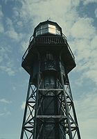
| Mona Island Light Mona Island Light Mona Island Light, also known as Faro de la Isla de la Mona, is a historic lighthouse located on the island of Mona, Puerto Rico, in the Mona Passage between Puerto Rico and the Dominican Republic. It is the only lighthouse built of iron and steel in Puerto Rico... |
Mayagüez Mayagüez, Puerto Rico Mayagüez is the eighth-largest municipality of Puerto Rico. Originally founded as "Nuestra Señora de la Candelaria" it is also known as "La Sultana del Oeste" , "Ciudad de las Aguas Puras" , or "Ciudad del Mangó"... (Mona Island) |
1900 | 16 m (52 ft) | N/A | Inactive | Its condition is considered dire. Unless restored soon, many considered the lighthouse lost. |
| Punta Mulas Light Punta Mulas Light Punta Mulas Light, also known as Faro de Vieques, is a historic lighthouse located in the west shore of Vieques, an island-municipality of Puerto Rico. It was first lit in 1896 and automated in 1949. Punta Mulas Light was the second lighthouse built on Vieques after the Puerto Ferro Light. The... |
Vieques Vieques, Puerto Rico Vieques , in full Isla de Vieques, is an island–municipality of Puerto Rico in the northeastern Caribbean, part of an island grouping sometimes known as the Spanish Virgin Islands... |
1896 | 10 m (32 ft) | 21 m (68 ft.) | Active | Restored for tourism |
| Puerto Ferro Light Puerto Ferro Light Puerto Ferro Light, also known as Faro de Puerto Ferro, is a historic lighthouse located in the Vieques, Puerto Rico. The light was first lit in 1896. It is one of the last minor or local lights to be built by the Spanish government. The light was of crucial importance to cross the Vieques Passage... |
Vieques Vieques, Puerto Rico Vieques , in full Isla de Vieques, is an island–municipality of Puerto Rico in the northeastern Caribbean, part of an island grouping sometimes known as the Spanish Virgin Islands... |
1896 | N/A | N/A | Inactive | Abandoned and deteriorating rapidly |
| Culebrita Island Light Culebrita Isla Culebrita is a small island off the eastern coast of Culebra, Puerto Rico and is part of the Puerto Rico Archipielago. Together with Cayo Botella off the northwestern point, it belongs to the barrio Frailes of Culebra. It is a nature reserve and home of one of the oldest lighthouse in the... |
Culebra Culebra, Puerto Rico Isla Culebra is an island-municipality of Puerto Rico originally called Isla Pasaje and Isla de San Ildefonso. It is located approximately east of the Puerto Rican mainland, west of St. Thomas and north of Vieques. Culebra is spread over 5 wards and Culebra Pueblo... |
1886 | 13 m (43 ft) | 93 m (305 ft) | Active | In Ruins |
| Cabras Island Light Cabras Island Light Isla Cabras Light, also known as Faro de Isla Cabras, was a lighthouse located in an island in the Vieques Passage near Ceiba, Puerto Rico. It is the only lighthouse completely built and planned by the U.S. government in Puerto Rico.The light was first lit on 1902... |
Ceiba Ceiba, Puerto Rico Ceiba is a small town in northeast Puerto Rico. It is named after the famous Ceiba tree. Ceiba is located in the east coast of the island, bordering the Atlantic Ocean, north of Naguabo, south of Fajardo, and east of Río Grande. It is located about one hour's driving distance from San Juan... |
1908 | N/A | N/A | Destroyed | Abandoned in 1965 and destroyed in 1966 |
External links
- Inventory of Historic Light Stations: Puerto Rico Lighthouses, United States National Park Service Maritime Heritage Program
- Presidential Proclamation annexing lighthouses, 30 June 1903.
- Doomsday Lights of Puerto Rico

