
Liscannor
Encyclopedia
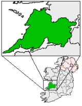
Liscannor is a coastal village in County Clare
, Ireland
. Lying on the west coast of Ireland
, on Liscannor Bay
, the village is located on the R478 road between Lahinch
, to the east, and Doolin
, to the north. The Cliffs of Moher
are about 5 km (3.1 mi) west of the village. Between Lahinch and Liscannor lies the small village of Moymore.
– the O’Connors. Corcomroe was one of five ancient divisions into which the County of Clare was divided. The four others were:
Some say Liscannor takes its name from the old castle beside the local National School; “Lis” meaning a “fort” and “Cannor” a corruption of the name “Connor”. Others say that it is derived from “Lis”, a “fort”, “cean” a “head or headland” and “or” (uir) meaning “slaughter”.
The village of Liscannor was said not to exist before the yea 1775. In a statistical survey of the district made about 1810 we are informed that at this latter date there were nearly 200 houses in it, and about ten of them had flag roofs. It is of interest that though Liscannor was not in existence until relatively recently it was in existence before Ennistymon was built up. Almost all the county about Ennistymon save for a few gentlemen’s residences and their demesnes was up to the early 19th century covered with woods mainly of oak and ash.
Baoth Bronach (king of ancient Corcomroe) gave the site for the church. It is said the inhabitants of the place, at the time, pointed out a spot on the strand, below the church, which they called Saint MacCreehy’s ”bed”.
Further out again is said to be the submerged church and town of Kilstapheen. Whether this Atlantis type village actually exists it is on record that shortly after the time of MacCreehy there was a tidal wave/earthquake that was responsible for the loss of some two thousand people on the Miltown Coast (source: Liscannor & District Survey, Clare Champion, May 16, 1953). Could this have submerged a coastal village also? In 1839 men said at Lahinch that the golden key of the enchanted island of Kilstapheen lay under Conan’s (one of Finn mac Cumhail warriors) tomb.
The Well itself is in the lower ground, the ‘Ula íochtarach’ or lower sanctuary, enclosed in a little house full of votive offerings such as holy pictures, rosaries, medals and so forth left by pilgrims. Small items which people carry around with them, such as pens, biros and combs, are commonly found also as offerings at wells.
This site has a particularly mysterious atmosphere which may be felt at once by the pilgrims as they enter the grove and hears the gentle lapping of the water in the background. Something of the ancient ‘Nemeton’ (modern Irish neimheadh)- the outdoor Celtic Sanctuary - is, perhaps, to be experienced here.
Many pilgrims from all over County Clare and from the Aran Islands came to Liscannor. There were four different Pattern Days on which large groups attended:
He married in 1816, to Margaret, daughter of Peter Long of Waterford. Cornelius was
He retired 1857 and died the same year. Various local memoirs tell of Cornelius O’Brien’s conversion to Catholicism but nowhere is there confirmation of this. After lying in state before the front door of Birchfield House, his coffin was taken to St. Brigid’s Cemetery followed by thousands of mourners in a mile-long funeral procession. Here the burial rites were read by his great friend, Most. Rev. Dr. Fallon, Bishop of Kilfenora. Then the remains were laid to rest in a temporary tomb pending the completion of the family vault.
Local recollections of Cornelius O’Brien hold no hint of kindness or generosity. However records of the time are more favourable. The Lewis Topographical Dictionary, 1837, refers to Birchfield – “The residence of Cornelius O’Brien who has much improved his estate and the condition of his tenantry by the erection of neat slated cottages and farm buildings and by other judicious arrangements; - a holy well dedicated to St. Brigid and much resorted to by the peasantry, which, at Mr. O’Brien’s expense, has been surrounded by tasteful plantations and rustic seats.” Nowhere is it mentioned of the rack-renting and evictions so common in other parts of Clare. O’Brien’s work for the poor is praised by Rev. J. Sheehan, P.P., Ennistymon and the Clare Journal paid this tribute to him in his obituary: -
“As a landlord, no man was held in greater love and esteem by his tenantry. They clung to him in many a well-fought field of contention and carried him triumphant through every contest.”
As well as Birchfield Estate remnants of Cornelius’ time in Liscannor can be found at St. Brigid’s Well, O Brien’s Monument and O Brien’s Tower at the Cliffs of Moher. All of the above information is thanks to the research of Henry Comber.
In the past the harbour was a busy hub of activity with numerous fishing vessels as well as a location to export locally quarried Liscannor Stone and to receive in supplies e.g. coal. However historical documents note that due to the silting of the harbour, ships could only carry approximately 380 tonnes into port. At low tides ships had to be winched into harbour. A currach would bring the rope out to the ship. There was often rivalry between boats to be the first to the ship.
The harbour life boat was a large heavy wooden rowing boat, manned by members of the Coastguard Station (behind the Lower Quay). John P Holland’s father was “Head Boatman”. It was raised and lowered by winch in the boat house.
Locally quarried flag was cut and polished beside the harbour and winched onto ships by steam crane. These slabs were transported to various British cities (Glasgow, Manchester, etc.) for use as pavement slabs. The haulage company who transported these flags was called ‘Watsons’.
Coal was delivered directly to Liscannor up until the mid 1960’s for Griffins coal yard in Ennistymon. However in the mid 1960s a boat ran aground just outside the harbour and sank. The insurance became too expensive, and coal was then delivered to Clarecastle and subsequently delivered to Ennistymon for distribution. The harbour was built in 1825-31 for £2,900, of which £2,000 was a government grant.
, inventor of the modern submarine
, was born in Liscannor at Castle Street (now renamed Holland Street) on February 29, 1840, in the coastguard’s station in Liscannor. Holland attended St. Macreehy’s National School and probably spent a number of years in the Christian Brothers School in Ennistymon. His father died in the 1840s, and the family moved to Limerick in 1853. Holland was fascinated by the sea, and in particular with models of underwater vessels. In 1873, he moved to America, where he continued to teach and design his submarine. His motivation was that one day his vessels might sink British warships. The Irish Republican Brotherhood
financed Holland's one-man model and continued with the necessary finance until the launching in 1881 of the Fenian Ram. This submarine was 31 feet (9.4 m) long with a 19 tons displacement and could carry a three-man crew. The Fenian Ram "the intended scourge of the British Navy", never saw warfare, but survives intact in the museum in Patterson, New Jersey. After many near hits, the Liscannor man finally perfected his design with the launching of the Holland in May 1897; this was to provide the prototype for the first mass-produced submarines. John Holland, the father of the modern submarine, died in August 1914, a few days before the outbreak of World War I, in which his perfected underwater weapons played a major role. Today, a headstone, commemorating his career, presented (1977) to the town by the U.S. Navy, can be viewed outside the local community centre.
take their name from an old fort that once stood on Hags Head. T. J. Westropp refers to it as Moher Ui Ruis or Moher Ui Ruidhin. It still stood in 1780. The present tower near the site of the old fort was built by the British as a lookout tower during the Napoleonic Wars. The Cliffs stretch for 8 km and rise over 200 metres above the Atlantic Ocean. The Cliffs are one of Ireland's top visitor attractions and are one of the best examples of cliff-nesting seabird colonies in Ireland. The area was designated as a Refuge for Fauna in 1988 and as a Special Protection Area for Birds (SPA) under the EU Birds Directive in 1989. Included within the designated site are the cliffs, the cliff-top maritime grassland and heath, and a 200-metre zone of open water directly in front of the cliffs to protect part of the birds' feeding area. The designation covers 200 hectares and highlights the area's importance for wildlife.
. They decided to magically turn themselves into horses and galloped to Kilcornan, where they hid out in the Kilcornan Caves. As time went by there was no sign of the legendary Tuatha Dé Danann until one day seven foals emerged from the caves. They were frightened by the bright light of day and galloped along the edge of the Cliffs of Moher in fear. Legend says they galloped straight over the cliffs at the point known as Aillenasharragh which is the Irish for “Leap of the Foals”…
So legendary was his bravery that St McCreehy was also needed to slay a demon dragon (called a bruckee). In actual fact the Bruckee was more than likely a bear but over time became exaggerated into a dragon. The Bruckee on ‘MacCreehy’s tomb’ in Kilmacreehy church, along the shore of Liscannor Bay has long pointed ears, large eyes and huge jaws blunt-ended, but bristling with vicious pointed teeth.
Liscannor Gaa Club was reformed in 1985 as a separate entity after players from the area had played with The St Michaels team for a number of years.
Liscannor were immediately successful and were promoted to Intermediate ranks after winning the Junior title in their first year after reforming in 1985. Liscannor also won the league title in 1985. In fact the team were only beaten once in league and championship fare when losing to our near neighbours Doolin in a league game.
An intermediate title followed in 1988 but the effects of emigration and a dwindling population meant that Liscannor were to revert to the Intermediate grade after one year at Senior level.
Despite reaching a number of finals it would be 12 years later in 2000 before Liscannor returned to the Senior Grade.
We have since enjoyed our must successful era in the club with Senior league titles being won in 2000 and 2001 and 2006.
In 2002 we reached the Senior County final against Kilmurray Ibrickane after a great run of games through the group stages and knockout phase.
Unfortunately we were to lose that final but the club remains competitive at Senior level having reached a number of Senior league and championship semi finals since 2002.
The strength of our club and depth of talented players can also be seen in how competitive our Junior team has been since it was set up by John Murphy in the late nineties.
A Mc Namara cup and a North Clare championship were won in 1998 and we have contested a number of league finals in the interim. This team is a vital stepping stone for our juvenile players between underage football and Senior competitions.
County Clare
-History:There was a Neolithic civilisation in the Clare area — the name of the peoples is unknown, but the Prehistoric peoples left evidence behind in the form of ancient dolmen; single-chamber megalithic tombs, usually consisting of three or more upright stones...
, Ireland
Republic of Ireland
Ireland , described as the Republic of Ireland , is a sovereign state in Europe occupying approximately five-sixths of the island of the same name. Its capital is Dublin. Ireland, which had a population of 4.58 million in 2011, is a constitutional republic governed as a parliamentary democracy,...
. Lying on the west coast of Ireland
Ireland
Ireland is an island to the northwest of continental Europe. It is the third-largest island in Europe and the twentieth-largest island on Earth...
, on Liscannor Bay
Liscannor Bay
Liscannor Bay is a bay on the west coast of Ireland in County Clare. Hag's Head provides the northern border for the bay and Cream Point is the southern boundary...
, the village is located on the R478 road between Lahinch
Lahinch
Lahinch or Lehinch is a village on Liscannor Bay, on the northwest coast of County Clare, in northern Munster, Ireland. It lies on the N67 national secondary road....
, to the east, and Doolin
Doolin
Doolin is a coastal village in County Clare, Ireland, on the Atlantic coast. It borders the spa town of Lisdoonvarna. It is a noted centre of traditional Irish music, which is played nightly in its pubs, making it a popular tourist destination. There are numerous nearby archaeological sites, many...
, to the north. The Cliffs of Moher
Cliffs of Moher
The Cliffs of Moher are located in the parish of Liscannor at the south-western edge of the Burren area near Doolin, which is located in County Clare, Ireland....
are about 5 km (3.1 mi) west of the village. Between Lahinch and Liscannor lies the small village of Moymore.
History
The area around Liscannor belonged in former times to the Chieftains of CorcomroeCorcomroe
Corcomroe is the anglicised form of the tuath of Corco Modhruadh in the north of County Clare on the west coast of Ireland. It is also the name of the obsolete barony which covers the south-western half of this tuath...
– the O’Connors. Corcomroe was one of five ancient divisions into which the County of Clare was divided. The four others were:
- Corcovaskin whose chiefs were of the O’Donnells and McMahons
- Ui-Cormaic was inhabited by the tribes of the O’Hehirs
- Ui-Fearmaic was the territory corresponding to the barony of Inchiquin and inhabited by the ODeas and the O’Quinns
- Ui-Caisin or Clancuilen was occupied by the powerful clan of the MacNamaras including the baronies of upper and lower Bunratty.
Some say Liscannor takes its name from the old castle beside the local National School; “Lis” meaning a “fort” and “Cannor” a corruption of the name “Connor”. Others say that it is derived from “Lis”, a “fort”, “cean” a “head or headland” and “or” (uir) meaning “slaughter”.
The village of Liscannor was said not to exist before the yea 1775. In a statistical survey of the district made about 1810 we are informed that at this latter date there were nearly 200 houses in it, and about ten of them had flag roofs. It is of interest that though Liscannor was not in existence until relatively recently it was in existence before Ennistymon was built up. Almost all the county about Ennistymon save for a few gentlemen’s residences and their demesnes was up to the early 19th century covered with woods mainly of oak and ash.
Kilmacreehy Church and Graveyard
Cill MacCreiche (Kilmacreehy) Church is probably one of the most ancient ecclesiastical ruins in County Clare. The old church of St. MacCreiche goes back to the sixth century. The church consisted of a nave and a chancel with a porch on the south side. On the west gable was a bell chamber , a feature common to churches not only in the district, but all over Clare. They occur both in Kildysart and Quin.Baoth Bronach (king of ancient Corcomroe) gave the site for the church. It is said the inhabitants of the place, at the time, pointed out a spot on the strand, below the church, which they called Saint MacCreehy’s ”bed”.
Further out again is said to be the submerged church and town of Kilstapheen. Whether this Atlantis type village actually exists it is on record that shortly after the time of MacCreehy there was a tidal wave/earthquake that was responsible for the loss of some two thousand people on the Miltown Coast (source: Liscannor & District Survey, Clare Champion, May 16, 1953). Could this have submerged a coastal village also? In 1839 men said at Lahinch that the golden key of the enchanted island of Kilstapheen lay under Conan’s (one of Finn mac Cumhail warriors) tomb.
St. Brigid’s Well
Dabhach Bhríde is found near the Cliffs of Moher in an area of great scenic beauty, and behind the well on a higher level, to which steps lead, is an ancient cemetery in which the Uí Bhrian, the Kings of Dál gCais, are buried. There is a large cross here and a circular path around it, and part of the Rite of the Holy Well is performed in this area known as the ‘Ula Uachtarach’ or upper sanctuary.The Well itself is in the lower ground, the ‘Ula íochtarach’ or lower sanctuary, enclosed in a little house full of votive offerings such as holy pictures, rosaries, medals and so forth left by pilgrims. Small items which people carry around with them, such as pens, biros and combs, are commonly found also as offerings at wells.
This site has a particularly mysterious atmosphere which may be felt at once by the pilgrims as they enter the grove and hears the gentle lapping of the water in the background. Something of the ancient ‘Nemeton’ (modern Irish neimheadh)- the outdoor Celtic Sanctuary - is, perhaps, to be experienced here.
Many pilgrims from all over County Clare and from the Aran Islands came to Liscannor. There were four different Pattern Days on which large groups attended:
- St Brigid’s Eve
- Garland Saturday
- Garland SundayGarland SundayReek Sunday , is the annual national pilgrimage of Ireland. On the last Sunday of the month of July, pilgrims climb Ireland's holiest mountain, Croagh Patrick in County Mayo, traditionally in their bare feet. The pilgrimage has taken place annually for around 1,500 years...
- The Feast of the Assumption of the Blessed Virgin Mary into Heaven, on August 15.
The Spanish Armada
At least 30 ships of Philip of Spain’s mighty armada, sent to invade England in the summer of 1588, perished along the coast of Ireland, mainly along the western seaboard. The oar-powered galleass Zuñiga anchored off-shore at Liscannor with a broken rudder, having found a gap in the Cliffs of Moher. The ship came under surveillance by the sheriff of Clare and by crown forces and had to withdraw to their ship. One captive was taken and sent for interrogation. The Zuñiga escaped the coast with favorable winds, moored at le Havre, and finally made it home to Naples in the following year.Cornelius O'Brien
Cornelius O’Brien was the third son of Henry and Helen O’Brien, of Ennis, County Clare. He was born in Birchfield, (originally Beaghy but angliscised to Birchfield) Liscannor in 1782. The estate is first mentioned in an inquisition of 1625 as the property of Thomas O’Cahill whose family name is preserved in the neighbouring townland of Caherycahill.He married in 1816, to Margaret, daughter of Peter Long of Waterford. Cornelius was
- a solicitor in Ireland from 1811,
- a magistrate for Clare,
- a Liberal in favour of the Repeal of the Union with Ireland,
- Sat for Clare from 1832 to 1847 when he was an unsuccessful candidate. Regained seat July 1852.
He retired 1857 and died the same year. Various local memoirs tell of Cornelius O’Brien’s conversion to Catholicism but nowhere is there confirmation of this. After lying in state before the front door of Birchfield House, his coffin was taken to St. Brigid’s Cemetery followed by thousands of mourners in a mile-long funeral procession. Here the burial rites were read by his great friend, Most. Rev. Dr. Fallon, Bishop of Kilfenora. Then the remains were laid to rest in a temporary tomb pending the completion of the family vault.
Local recollections of Cornelius O’Brien hold no hint of kindness or generosity. However records of the time are more favourable. The Lewis Topographical Dictionary, 1837, refers to Birchfield – “The residence of Cornelius O’Brien who has much improved his estate and the condition of his tenantry by the erection of neat slated cottages and farm buildings and by other judicious arrangements; - a holy well dedicated to St. Brigid and much resorted to by the peasantry, which, at Mr. O’Brien’s expense, has been surrounded by tasteful plantations and rustic seats.” Nowhere is it mentioned of the rack-renting and evictions so common in other parts of Clare. O’Brien’s work for the poor is praised by Rev. J. Sheehan, P.P., Ennistymon and the Clare Journal paid this tribute to him in his obituary: -
“As a landlord, no man was held in greater love and esteem by his tenantry. They clung to him in many a well-fought field of contention and carried him triumphant through every contest.”
As well as Birchfield Estate remnants of Cornelius’ time in Liscannor can be found at St. Brigid’s Well, O Brien’s Monument and O Brien’s Tower at the Cliffs of Moher. All of the above information is thanks to the research of Henry Comber.
Liscannor Harbour
The harbour currently has a number of fishing vessels moored there as well as smaller boats using it is a launching site for sea fishing/recreational sports. During Summer months there is also a ferry service to the bas eof the Cliffs of Moher as well as to the Aran Islands.In the past the harbour was a busy hub of activity with numerous fishing vessels as well as a location to export locally quarried Liscannor Stone and to receive in supplies e.g. coal. However historical documents note that due to the silting of the harbour, ships could only carry approximately 380 tonnes into port. At low tides ships had to be winched into harbour. A currach would bring the rope out to the ship. There was often rivalry between boats to be the first to the ship.
The harbour life boat was a large heavy wooden rowing boat, manned by members of the Coastguard Station (behind the Lower Quay). John P Holland’s father was “Head Boatman”. It was raised and lowered by winch in the boat house.
Locally quarried flag was cut and polished beside the harbour and winched onto ships by steam crane. These slabs were transported to various British cities (Glasgow, Manchester, etc.) for use as pavement slabs. The haulage company who transported these flags was called ‘Watsons’.
Coal was delivered directly to Liscannor up until the mid 1960’s for Griffins coal yard in Ennistymon. However in the mid 1960s a boat ran aground just outside the harbour and sank. The insurance became too expensive, and coal was then delivered to Clarecastle and subsequently delivered to Ennistymon for distribution. The harbour was built in 1825-31 for £2,900, of which £2,000 was a government grant.
John P Holland
John Philip HollandJohn Philip Holland
John Philip Holland was an Irish engineer who developed the first submarine to be formally commissioned by the U.S...
, inventor of the modern submarine
Submarine
A submarine is a watercraft capable of independent operation below the surface of the water. It differs from a submersible, which has more limited underwater capability...
, was born in Liscannor at Castle Street (now renamed Holland Street) on February 29, 1840, in the coastguard’s station in Liscannor. Holland attended St. Macreehy’s National School and probably spent a number of years in the Christian Brothers School in Ennistymon. His father died in the 1840s, and the family moved to Limerick in 1853. Holland was fascinated by the sea, and in particular with models of underwater vessels. In 1873, he moved to America, where he continued to teach and design his submarine. His motivation was that one day his vessels might sink British warships. The Irish Republican Brotherhood
Irish Republican Brotherhood
The Irish Republican Brotherhood was a secret oath-bound fraternal organisation dedicated to the establishment of an "independent democratic republic" in Ireland during the second half of the 19th century and the start of the 20th century...
financed Holland's one-man model and continued with the necessary finance until the launching in 1881 of the Fenian Ram. This submarine was 31 feet (9.4 m) long with a 19 tons displacement and could carry a three-man crew. The Fenian Ram "the intended scourge of the British Navy", never saw warfare, but survives intact in the museum in Patterson, New Jersey. After many near hits, the Liscannor man finally perfected his design with the launching of the Holland in May 1897; this was to provide the prototype for the first mass-produced submarines. John Holland, the father of the modern submarine, died in August 1914, a few days before the outbreak of World War I, in which his perfected underwater weapons played a major role. Today, a headstone, commemorating his career, presented (1977) to the town by the U.S. Navy, can be viewed outside the local community centre.
Cliffs of Moher
The Cliffs of MoherCliffs of Moher
The Cliffs of Moher are located in the parish of Liscannor at the south-western edge of the Burren area near Doolin, which is located in County Clare, Ireland....
take their name from an old fort that once stood on Hags Head. T. J. Westropp refers to it as Moher Ui Ruis or Moher Ui Ruidhin. It still stood in 1780. The present tower near the site of the old fort was built by the British as a lookout tower during the Napoleonic Wars. The Cliffs stretch for 8 km and rise over 200 metres above the Atlantic Ocean. The Cliffs are one of Ireland's top visitor attractions and are one of the best examples of cliff-nesting seabird colonies in Ireland. The area was designated as a Refuge for Fauna in 1988 and as a Special Protection Area for Birds (SPA) under the EU Birds Directive in 1989. Included within the designated site are the cliffs, the cliff-top maritime grassland and heath, and a 200-metre zone of open water directly in front of the cliffs to protect part of the birds' feeding area. The designation covers 200 hectares and highlights the area's importance for wildlife.
Hags Head
There are two versions as to how Hags Head got its name;- The Hag was named ‘Mal’ and pursued Cuchillin to Loop Head, sprang after him to Diarmuid and Grainne’s Rock and she was dashed to pieces in attempting to spring back again. Her blood reddened the sea of Moher and Malbay its name.
- Oh Hags Head there are tow large rock protrusions. That nearer the castle is in the shape of a woman’s head, giving rise to the second explanation “the rock has assumed the shape of a seated woman, the Sphinx like head looking eternally westward to the setting sun.”
Aillenasharragh - “Leap of the Foals”
Legend has it that when St. Patrick introduced Christianity to Ireland there was anger amongst the Tuatha Dé DanannTuatha Dé Danann
The Tuatha Dé Danann are a race of people in Irish mythology. In the invasions tradition which begins with the Lebor Gabála Érenn, they are the fifth group to settle Ireland, conquering the island from the Fir Bolg....
. They decided to magically turn themselves into horses and galloped to Kilcornan, where they hid out in the Kilcornan Caves. As time went by there was no sign of the legendary Tuatha Dé Danann until one day seven foals emerged from the caves. They were frightened by the bright light of day and galloped along the edge of the Cliffs of Moher in fear. Legend says they galloped straight over the cliffs at the point known as Aillenasharragh which is the Irish for “Leap of the Foals”…
The Sunken City of Kilstipheen
Legend says that the ancient of city Kilstipheen (Cill Stíopháin, St. Stephen’s church) sank into the depths of Liscannor Bay due to a ghostly tsunami which occurred when the then chieftain lost a golden key in battle. This key was used to open the finest castle in the city. The city now cannot be restored to its former splendor until this lost key can be found. One legend has it that it is under an ogham gravestone on Mount Callan. Another legend says that the key was thrown into the depths of small lake on the same mountain and yet another that one day a fisherman will hook the golden key from the bottom of the ocean thus restoring the city to the surface. Folklore says that Kilstipheen, with its golden roofed palaces, ornate churches and spiraling towers can sometimes be seen shining below the surface of the waters as you look south to Miltown Malbay from Liscannor. It also says that once every seven years it rises above the surface of the waves but with if you spot the ancient city it is foretold that you will not survive the seven years until it surfaces again.Mal the auld Hag
There once was an old hag named Mal who was adept in the dark arts of witchcraft. She fell in love with the legendary Cú Chulainn but her love was not returned. She chased him across the island of Ireland until they reached Loop Head in South Clare. Cú who had extraordinary strength and agility leapt from the Head onto the nearest island. Mal, using her magic, leapt after him so Cú jumped back to the mainland. Again Mal followed him but her jump fell short and she was dashed against the cliffs. Her blood reddened the water all the way from Loop Head to the Cliffs of Moher. Thus is how Malbay of Milltown Malbay got its name and her face can still be seen at Hags Head where the cliffs resemble an old hag looking out to sea.St. McCreehy – the Demon Slayer of Liscannor
There is an old church and graveyard as you travel to Liscannor from Lahinch called Kilmacreehy (the church of McCreehy). The parish also takes its name from this saint. Legend has it that a monstrous eel burst forth from the depths of Liscannor Bay to feast on the corpses laid to rest at the graveyard. St McCreehy tackled this great beast and slew it after a long fight. A carving of the eel was present until recently at the old ruins.So legendary was his bravery that St McCreehy was also needed to slay a demon dragon (called a bruckee). In actual fact the Bruckee was more than likely a bear but over time became exaggerated into a dragon. The Bruckee on ‘MacCreehy’s tomb’ in Kilmacreehy church, along the shore of Liscannor Bay has long pointed ears, large eyes and huge jaws blunt-ended, but bristling with vicious pointed teeth.
St. Brigid's Church
St Brigid’s Church in Liscannor was built in 1858 and last year celebrated its 150th anniversary on the Feast of Christ the King to celebrate 150 years of faith. 150 roses were taken by each family in the aprish and placed on the roads and mass paths which the current and previous residents of the parish talked to their place of worship for a century and a half. As the windows are only on one side of the church it is called “The Church that winks at God”.Moymore Church
The church of Moymore was built in 1877, on an elevated site overlooking the bay. There was no church previously at this location. Before that the people of the area attended Mass in a small thatched chapel a quarter mile to the east in Caheraderry (Derry).Derry Church
The Caheraderry (Derry) church probably dates from the 17th century penal times, built either to facilitate travelling friars or possibly as an out-chapel or hermitage for Kilmacreehy Church. It is possible that the church contained a small loft where the priest lived, as in Toomullin Church in Doolin. The ten perches of adjacent land belonging to the church would seem to indicate that there was a priest in residence who used this as a garden. Beside the ruins stand two small one-room attached cottages. According to local tradition, one of these cottages was a sheebeen known as Gleeson’s and the other a schoolhouse, where a hedge-schoolmaster taught.Liscannor GAA
Liscannor won a county title in 1940 but this team was a combined team from the North Clare area.Liscannor Gaa Club was reformed in 1985 as a separate entity after players from the area had played with The St Michaels team for a number of years.
Liscannor were immediately successful and were promoted to Intermediate ranks after winning the Junior title in their first year after reforming in 1985. Liscannor also won the league title in 1985. In fact the team were only beaten once in league and championship fare when losing to our near neighbours Doolin in a league game.
An intermediate title followed in 1988 but the effects of emigration and a dwindling population meant that Liscannor were to revert to the Intermediate grade after one year at Senior level.
Despite reaching a number of finals it would be 12 years later in 2000 before Liscannor returned to the Senior Grade.
We have since enjoyed our must successful era in the club with Senior league titles being won in 2000 and 2001 and 2006.
In 2002 we reached the Senior County final against Kilmurray Ibrickane after a great run of games through the group stages and knockout phase.
Unfortunately we were to lose that final but the club remains competitive at Senior level having reached a number of Senior league and championship semi finals since 2002.
The strength of our club and depth of talented players can also be seen in how competitive our Junior team has been since it was set up by John Murphy in the late nineties.
A Mc Namara cup and a North Clare championship were won in 1998 and we have contested a number of league finals in the interim. This team is a vital stepping stone for our juvenile players between underage football and Senior competitions.
See also
- List of towns and villages in Ireland
External links
- Liscannor History - at Clare Library
- Comment on the harbour in 1901