
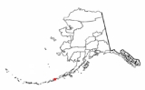
List of Aleutian Islands
Encyclopedia
Major groups in the Aleutian Islands are listed from east to west, and islands within each group are listed alphabetically. The Aleut
names are given in brackets.
Fox Islands

Islands of Four Mountains (Uniiĝun)
Andreanof Islands (Niiĝuĝin tanangis)
Rat Islands (Qax̂um tanangis)
Near Islands (Sasignan Tanangin)
Commander Islands (Russia
Aleut language
Aleut is a language of the Eskimo–Aleut language family. It is the heritage language of the Aleut people living in the Aleutian Islands, Pribilof Islands, and Commander Islands. As of 2007 there were about 150 speakers of Aleut .- Dialects :Aleut is alone with the Eskimo languages in the...
names are given in brackets.
Fox IslandsFox Islands (Alaska)The Fox Islands are a group of islands in the eastern Aleutian Islands of the U.S. state of Alaska. The Fox Islands are the closest to mainland North America in the Aleutian chain, and just east of Samalga Pass and the Islands of Four Mountains group....
- Adugak IslandAdugak IslandAdugak Island is a small island in the Fox Islands group in the Aleutian Islands of southwestern Alaska. It is about long and is located off the northwest coast of Umnak Island...
- Aiktak Island (Ugangax)Aiktak IslandAiktak Island is one of the Krenitzin Islands, a subgroup of the Fox Islands in the eastern Aleutian Islands in the U.S. state of Alaska. It is 1.3 miles long and is located 38 miles east of Akutan Island. Aiktak is an Aleut name transcribed by Captain Tebenkov in 1852 as "Ostrov Aikhtak." R. H...
- Akun Island (Akungan)Akun IslandAkun Island is one of the Fox Islands subgroup of the Aleutian Islands in Aleutians East Borough of southwestern Alaska, USA. It lies east of Akutan Island and southwest of Unimak Island across the Unimak Pass. The Krenitzin Islands lie to its south and southeast across the Avatanak Strait...
- Akutan Island (Akutanax̂)Akutan IslandAkutan Island is an island in the Fox Islands group of the eastern Aleutian Islands in the U.S. state of Alaska. The island is approximately 18 mi in length. It contains the Mount Akutan volcano, which had a major lava eruption in 1979...
- Amak Island (Amax)Amak IslandAmak Island is an uninhabited island in Aleutians East Borough, Alaska, USA. The island lies north of the western tip of the Alaska Peninsula, and northwest of the mainland city of Cold Bay. The island's land area is and its maximum elevation is...
- Amaknak Island (Amaxnax̂)Amaknak IslandAmaknak Island or Umaknak Island is an islet in Unalaska Bay, northeast of Unalaska Island in the Fox Islands group of the Aleutian Islands in southwest Alaska. The Dutch Harbor area of Unalaska, Alaska is on Amaknak Island...
- Amukta Island (Amuux̂tax̂)
- Ananiuliak IslandAnangula IslandAnangula Island is a small island in the Fox Islands group of the Aleutian Islands of southwestern Alaska...
- Avatanak Island (Agutanax̂)Avatanak IslandAvatanak Island is the second-largest of the Krenitzin Islands, a subgroup of the Fox Islands in the eastern Aleutian Islands in the U.S. state of Alaska. It lies southeast of Akun Island, across the Avatanak Strait...
- Baby IslandsBaby IslandsThe Baby Islands are a group of small islands located about northeast of Unalga Island in the Fox Islands group of the Aleutian Islands of southwestern Alaska. The group consists of five islands ranging from 980 to 3280 feet long and several smaller islets. The islands are uninhabited and none of...
- Bird Island (Kitnamax)
- Bogoslof Island (Aĝasaaĝux̂)Bogoslof IslandBogoslof Island or Agasagook Island is the summit of a largely submarine stratovolcano located in the Bering Sea in the U.S. state of Alaska, behind the main Aleutian volcanic arc. It has a land area of and is unpopulated. The peak elevation of the island is...
- Breadloaf Island (Taanĝiinax̂)
- Buck Island (Ukdax̂sxix)
- Caton Island (Qagan Unimgix̂)
- Chagulak Island (Chugssĝinax̂)Chagulak IslandChagulak Island is a small, uninhabited volcanic island in the Islands of Four Mountains group in the Aleutian Islands of southwestern Alaska, United States. The -wide island consists of a single cone that reaches an elevation of 3,747 ft...
- Deer Island (Animin)
- Derbin IslandDerbin IslandDerbin Island is located in the Krenitzin Islands, a subgroup of the Fox Islands in the eastern Aleutian Islands, Alaska. Derbin is a small island and is situated near the southwestern shore of Tigalda Island. It was named in 1935 by the U.S. Coast and Geodetic Survey because of its proximity to...
- Dushkot Island (Duxsxan)
- Egg Island (Ugalĝa)
- Emerald Island
- Expedition Island (Guchiganang)
- Fire IslandFire Island (Aleutian Islands)Fire Island is located in the eastern Aleutian Islands at . It emerged in 1883, forming a companion island to Bogoslof Island. Originally, this Fire Island was named New Bogoslof ....
- Gargoyle Island
- Gull Island
- Hog Island (Uknadax)
- Kaligagan Island (Qisxagan)
- Kigul Island (Kiigalux̂)
- Krenitzin IslandsKrenitzin IslandsThe Krenitzin Islands are a group of small islands located in the eastern portion of the Fox Islands group of the eastern Aleutian Islands, Alaska. The Krenitizins are situated between Unalaska Island to the southwest and Unimak Island to the northeast...
(group of islands) - Kudiakof Island
- Ogangen Island
- Ogchul Island (Uxchalux̂)
- Pancake Rock (Kaduuĝix̂ Tanax̂)Pancake RockPancake Rock is an island in the Fox Islands group in the eastern Aleutian Islands, Alaska. It is approximately across and is located about off the west coast of Umnak Island....
- Peter Island
- Poa Island (Saduuĝinax̂)Poa IslandPoa Island is an islet located about off the south coast of Akun Island in the Fox Islands group of the eastern Aleutian Islands, Alaska. The island is long and reaches a maximum elevation of about above sea level. It was named for a genus of grasses in 1888 by the U.S. Bureau of Fisheries...
- Pustoi Island (Taĝilgadax)Pustoi IslandPustoi Island is an island in the Fox Islands group of the eastern Aleutian Islands, Alaska. It is 0.3 miles across and is located in Umnak Pass 2 mi north of Ship Rock off the northeast coast of Umnak Island...
- Rootok Island (Aayux̂tax̂)Rootok IslandRootok Island Rootok Island Rootok Island (also called Aektok, Aiaktak, Ouektock, Aiaiepta, Veniaminof, or Goloi (alt: Goly; "bare") is the smallest member of the Krenitzin Islands, a subgroup of the Fox Islands in the eastern Aleutian Islands in Alaska, United States. The island's common spelling...
- Round Island (Imlichin)Round Island (Aleutian Islands)Round Island is a 0.1-mile-wide island in the Krenitzin Islands, a subgroup of the Fox Islands group of the Aleutian Islands in the U.S. state of Alaska. It is located 0.5 miles south of Ugamak Island at ....
- Samalga Island (Samalĝa)Samalga IslandSamalga Island is the westernmost island in the Fox Islands group of the eastern Aleutian Islands, Alaska. It is long and is situated at the southwestern tip of Umnak Island. It has a land area of and is uninhabited...
- Sanak Island (Sanaĝax)
- Sedanka Island (Sidaanax̂)Sedanka IslandSedanka Island is an island in the Fox Islands group of the eastern Aleutian Islands, Alaska. It is long and is situated off the northeast coast of Unalaska Island. It has a land area of and no permanent population.-References:...
- Sushilnoi Island (Tanĝimax)
- Tangik Island (Tan'gax̂)
- Tanginak Island
- Tigalda Island (Qigalĝan)Tigalda IslandTigalda Island is one of the Krenitzin Islands, a subgroup of the Fox Islands in the eastern Aleutian Islands, Alaska. Tigalda is located about east of Akutan Island, is long and has an area of about . Tigalda is an Aleut name published by Captain Lutke . It was previously called "Kagalga" by...
- Ugamak Island (Ugangax̂)Ugamak IslandUgamak Island is one of the Krenitzin Islands, a subgroup of the Fox Islands group of the eastern Aleutian Islands, Alaska. Ugamak is an Aleut word transcribed by Father Veniaminov which, according to R. H. Geoghegan, may mean "ceremony island". It is long and is located east of Akutan Island...
- Umnak Island (Unmax)
- Unalaska Island (Nawan-Alaxsxa)Unalaska IslandUnalaska is an island in the Fox Islands group of the Aleutian Islands in the U.S. state of Alaska, at . The island has a land area of . The city of Unalaska, Alaska, covers part of the island and all of neighboring Amaknak Island where the Port of Dutch Harbor is located...
- Unalga Island (Unalĝa)Unalga IslandUnalga Island is one of the Fox Islands subgroup of the Aleutian Islands of southwestern Alaska, USA. It lies just northeast of Unalaska Island and across Akutan Pass from Akutan Island to its northeast. It is the westernmost island in the Aleutians East Borough...
- Unimak Island (Unimax)Unimak IslandUnimak Island is the largest island in the Aleutian Islands chain of the U.S. state of Alaska. It is the easternmost island in the Aleutians and, with an area of 1,571.41 mi² , the ninth largest island in the United States and the 134th largest island in the world. It is home to Mount...
- Vsevidof Island (Uyagax̂)
- Wislow IslandWislow IslandWislow Island is an island in the Fox Islands group of the eastern Aleutian Islands in the U.S. state of Alaska. It is across and situated in Reese Bay midway between Capes Wislow and Cheerful on the north coast of Unalaska Island, 11.3 miles northwest of Dutch Harbor. It was named in 1888 by the...
Islands of Four Mountains (Uniiĝun)Islands of Four MountainsIslands of Four Mountains is an island grouping of the Aleutian Islands in Alaska, United States. The chain includes, from west to east, Amukta, Chagulak, Yunaska, Herbert, Carlisle, Chuginadak, Uliaga, and Kagamil Islands. This island chain is located between Amukta Pass and the Andreanof Islands...
- Amukta Island (Amuux̂tax̂)
- Chagulak Island (Chugaaĝinax̂)Chagulak IslandChagulak Island is a small, uninhabited volcanic island in the Islands of Four Mountains group in the Aleutian Islands of southwestern Alaska, United States. The -wide island consists of a single cone that reaches an elevation of 3,747 ft...
- Chuginadak Island (Tanax̂ Angunax̂)Chuginadak IslandChuginadak Island is the largest island in the Islands of Four Mountains subgroup of the Aleutian archipelago. Chuginadak is an Aleutian name published by Captain Tebenkov in an 1852 map...
- Carlisle Island (Kigalĝa)Carlisle IslandCarlisle Island is an island in the Islands of Four Mountains subgroup of the Aleutian archipelago. It is across the Carlisle Pass from Chuginadak Island and is northeast of Herbert Island. Carlisle Island has as diameter of and is dominated by the conical stratovolcano of the same...
- Herbert Island (Chiĝulax)Herbert IslandHerbert Island is an island in the Islands of Four Mountains subgroup of the Aleutian archipelago. It is from Chuginadak Island, separated by the Chuginadak Pass...
- Kagamil Island (Qagaamila)Kagamil IslandKagamil Island , in the Islands of Four Mountains subgroup of the Aleutian archipelago, is north of Chuginadak Island and south of Uliaga Island. It is in length and up to in width. The southern half of the island is dominated by the Kagamil Volcano, which has two summits: one is above sea...
- Uliaga Island (Ulaĝa)Uliaga IslandUliaga Island is the northernmost member of the Islands of the Four Mountains group in the Aleutian Islands of southwestern Alaska...
- Yunaska Island (Yunax̂sxa)Yunaska IslandYunaska is the largest of the Islands of Four Mountains group in the Aleutian Islands of southwestern Alaska, United States. It has a land area of 66.834 sq mi and no population at the 2000 census....
Andreanof Islands (Niiĝuĝin tanangis)Andreanof IslandsThe Andreanof Islands are a group of islands in the Aleutian Islands in southwest Alaska. They are located between Amchitka Pass and the Rat Islands group to the west, and Amukta Pass and the Islands of Four Mountains group to the east, at about 52° North and 172°57' to 179°09' West. The islands...
- Adak Island (Adaax)Adak IslandAdak Island is an island near the western extent of the Andreanof Islands group of the Aleutian Islands in Alaska. Alaska's southernmost town, Adak, is located on the island...
- Agligadak Island (Aĝligadax)
- Amatigis Islands
- Amatignak Island (Amatignax̂)Amatignak IslandAmatignak Island is a member of the Delarof Islands , in Alaska's Aleutian archipelago. The south-most point of Alaska is on this island, as well as the highest western longitude of the United States and North America....
- Amlia Island (Amlax)
- Anagaksik Island (Anagaxsax̂)
- Argonne Island
- Asuksak Island (Hasux̂sax̂)
- Atka Island (Atx̂ax̂)Atka IslandAtka Island is the largest island in the Andreanof Islands of the Aleutian Islands of Alaska. The island is east of Adak Island. It is long and wide with a land area of , making it the 22nd largest island in the United States. The northeast of Atka Island contains the Korovin volcano which...
- Aziak Island (Haazax)Aziak IslandAziak Island is a small island in the Andreanof Islands group in the Aleutian Islands of southwestern Alaska...
- Barbara Island
- Black Island
- Bobrof Island (Walĝa)Bobrof IslandBobrof Island is one of the Andreanof Islands subgroup of the Aleutian Islands in southwestern Alaska, USA. Bobrof Island is a small, uninhabited island about north and west of Kanaga Island, and northeast of Cape Sudak on Tanaga Island...
- Bolshoi Island (Tanax̂ Angunax̂)
- Box Island
- Castle Island
- Chaika Rock (Hasax̂sax̂)
- Channel Island
- Chisak Island (Hatmax)
- Chugul Island (Chiĝulax̂)
- Cone Island
- Cormorant Island
- Crone Island
- Delarof Islands (Naahmiĝun tanangis)Delarof IslandsThe Delarof Islands are a group of small islands at the extreme western end of the Andreanof Islands group in the central Aleutian Islands, Alaska...
- Dora Island
- Eddy Island (Ugidaagamax)
- Egg Island (Ugalĝa)
- Elf Island
- Fenimore Rock (Taxchisax̂)
- Gareloi Island (Anangusix̂)Gareloi IslandGareloi is a volcanic island in the Delarof Islands of the Aleutian Islands of Alaska. It is located between the Tanaga Pass and the Amchitka Pass....
- Gramp Rock
- Great Sitkin Island (Stitxinax̂̂)Great Sitkin IslandGreat Sitkin Island is a volcanic island in the Andreanof Islands of the Aleutian Islands of Alaska. The island covers a total area of and lies slightly north of a group islands which are located between Adak Island and Atka Island....
- Green Island (Hmiikaayaĝus)Green Island- In Africa :* Green Island , in the Gulf of Suez* Green Island , in the Red Sea - In Asia :* Green Island, Hong Kong, Hong Kong SAR, People's Republic of China...
- Igitkin Island (Igitxix̂)Igitkin IslandIgitkin Island is a small island located in an area between Adak Island and Atka Island among other small islands. The island belongs to the Andreanof Islands of the Aleutian Islands of Alaska.-References:...
- Ikiginak Island (Ikiiĝinax̂)
- Ilak Island (Iilax̂)Ilak IslandIlak Island is a small island in the eastern Delarof Islands, Aleutian Islands of Alaska.Ilak island is only across. Its highest point is .Its name was recorded by Commodore Joseph Billings as "Illuk," and published by Lt...
- Ina Island
- Kagalaska Island (Qigalaxsix̂)Kagalaska IslandKagalaska Island is an island in the Andreanof Islands of the Aleutian Islands of Alaska.The island is in length and wide. It is separated from Adak Island to the west by Kagalaska Strait which is approximately wide at its narrowest point...
- Kanaga Island (Kanaga)Kanaga IslandKanaga Island is a part of the Andreanof Islands group of the Aleutian Islands in Alaska. The island measures roughly 30 miles long and between 4 and 8 miles wide with an area of 142 sq mi , making it the 42nd largest island in the United States...
- Kanu Island (Yunax̂)
- Kasatochi Island (Qanan-tanax)Kasatochi IslandKasatochi Island also known as Kasatochi volcano is an active stratovolcano and one of the Andreanof Islands subgroup of the Aleutian Islands of southwestern Alaska, USA.-Geography:...
- Kavalga Island (Qawalĝa
- Koniuji Island (Tanĝimax)Koniuji IslandKoniuji Island is one of the Andreanof Islands subgroup of the Aleutian Islands of southwestern Alaska, USA. It lies northwest of Atka Island and east of Kasatochi Island...
- Little Tanaga Island (Tanagax̂)Little Tanaga IslandLittle Tanaga Island is an island located in the Andreanof Islands of the Aleutian Islands of Alaska. It lies between Kagalaska Island and Umak Island.-References:...
- North Island (Chihngax̂)
- Ogliuga Island (Aglaga)
- Oglodak Island (Ungluudâ)Oglodak IslandOglodak Island is an island in the US State of Alaska. It is located in the Aleutians West Census Area, which encompasses most of the Aleutian Island chain. The island is currently uninhabited and has an area of roughly one and a half square mile....
- Plum Island
- Ringgold Island (Tanam Aduu)
- Sadatanek Island (Sadan-tanax̂)
- Sagchudak Island (Saĝuugax̂)Sagchudak IslandSagchudak Island is a small island in the Andreanof Islands group in the Aleutian Islands of southwestern Alaska. The roughly rectangular island is approximately long and 0.6 mi wide and lies about off the southern coast of Atka Island...
- Sagigik Island (Amlagim Saĝuugaa)
- Salt Island (Uladax)
- Sea Parrot Island
- Seguam Island (Saĝuugamax)Seguam IslandSeguam Island is a small volcanic island in the Andreanof Islands group in the Aleutian Islands of Alaska. The island is mountainous and oval shaped with a land area of . It is long and wide. The 2000 census reported a population of one person....
- Silak Island (Silax̂
- Skagul Island (Sxaĝulax̂
- South Island
- Staten Island (Iluuĝix̂ Tanax̂)
- Tag Island (Tagachaluĝis)
- Tagadak Island (Tanadax)
- Tagalak Island (Tagalax̂)Tagalak IslandTagalak Island is an island located in the central area of the Andreanof Islands of the Aleutian Islands of Alaska. West of the island lies Chugul.-References:...
- Tanadak Island (Tanaadax̂)
- Tanaga Island (Tanax̂ax)Tanaga IslandTanaga Island is an island in the western Andreanof Islands, in the southwest part of the Aleutian Islands, Alaska. The island has a land area of , making it the 33rd largest island in the United States. Its highest point is volcano Mount Tanaga at ....
- Tanaklek Island (Tanaqlax̂)
- The Signals
- The Three Sisters
- Tidgituk Island (Aakutanas)
- Ugidak Island (Qagan-tanax̂)
- Ulak Island (Uulax)Ulak IslandUlak Island is an island in the Delarof Islands subgroup of the Andreanof Islands in the Aleutian Islands chain of Alaska.Ulak is roughly 4 mi northwest of Amatignak Island.- External Links :*...
- Umak Island (Uhmax̂)Umak IslandUmak Island is an island lying in a group of small islands situated between Adak Island and Atka Island in the Andreanof Islands group of the Aleutian Islands of Alaska.-References:...
- Unalga Island (Unalĝa)Unalga IslandUnalga Island is one of the Fox Islands subgroup of the Aleutian Islands of southwestern Alaska, USA. It lies just northeast of Unalaska Island and across Akutan Pass from Akutan Island to its northeast. It is the westernmost island in the Aleutians East Borough...
- Uyak Island (Uuyax)
- Whip Island
Rat Islands (Qax̂um tanangis)Rat IslandsThe Rat Islands are a volcanic group of islands in the Aleutian Islands in southwest Alaska, between Buldir Island and the Near Islands group to its west, and Amchitka Pass and the Andreanof Islands group to its east, at about ....
- Amchitka Island (Amchixtax̂)
- Bird Rock
- Davidof Island (Qanan-tanax)Davidof IslandDavidof Island is an island in the Rat Islands archipelago of the Western Aleutian Islands, Alaska. Davidof Island is irregular in shape with a north-south length of 2 miles and a greatest width of 0.7 mile. The high point in the south part is 1,074 feet, and the summit in the north part is 922...
- Khvostof Island (Atanax̂)Khvostof IslandKhvostof Island is an island in the Rat Islands archipelago of the Western Aleutian Islands, Alaska.-References:...
- Kiska Island (Qisxa)
- Little Kiska Island (Kangxhix̂)
- Little Sitkin Island (Sitignax̂)Little Sitkin IslandLittle Sitkin Island is a volcanic island in the Rat Islands archipelago of the Western Aleutian Islands, Alaska, about three miles east of Davidof Island. Great Sitkin Island lies 185 mi further east in the Andreanof Islands.Little Sitkin is roughly circular and about 6 miles in diameter...
- Pyramid Island
- Rat Island (Hawadax)Rat Island (Alaska)Rat Island is an island in the Rat Islands archipelago of the western Aleutian Islands in the U.S. state of Alaska. The island has a land area of 10.3126 sq mi and no permanent population...
- Segula Island (Chiĝulax̂)Segula IslandSegula Island is an island in the Rat Islands archipelago of the western Aleutian Islands, Alaska. It consists of a Holocene stratovolcano, called Segula Volcano.Segula Island is three to four miles in diameter, and is located about east of Kiska Island...
- Semisopochnoi Island (Unyax)Semisopochnoi IslandSemisopochnoi Island is part of the Rat Islands group in the western Aleutian Islands of Alaska. The island is uninhabited and provides an important nesting area for maritime birds. The island is of volcanic origin, containing several volcanoes including Mount Cerberus...
- Tanadak Island (Tanaadax̂)
Near Islands (Sasignan Tanangin)Near IslandsThe Near Islands or Sasignan Islands are the smallest and westernmost group of the Aleutian Islands in southwestern Alaska.-Geography:The largest of the Near Islands are Attu and Agattu...
- Agattu Island (Angatux̂)
- Alaid Island (Igingiinax̂)Alaid Island (Alaska)Alaid Island is the westernmost of the Semichi Islands, a subgroup of the Near Islands group that lies at the extreme western end of the Aleutian Islands, Alaska.-References:...
- Attu Island (Atan)Attu IslandAttu is the westernmost and largest island in the Near Islands group of the Aleutian Islands of Alaska, making it the westernmost point of land relative to Alaska and the United States. It was the site of the only World War II land battle fought on the incorporated territory of the United States ,...
- Cooper IslandsCooper IslandsThe Cooper Islands are a group of small islands located 1.6 km off the northeast coast of Attu Island. They extend 0.48 km into the Bering Sea. The islands were named in July 1855 for the schooner USS Fenimore Cooper by Lt. William Gibson, USN....
- Gibson IslandsGibson IslandsThe Gibson Islands are a group of small islands that extend for 0.3 mi into the mouth of Chichagof Harbor on the northeast side of Attu Island in the Aleutians West Census Area of the U.S. state of Alaska. The islands were named in July 1855 by the North Pacific Surveying Expedition for Lt....
- Hammerhead Island
- Hodikof IslandHodikof IslandHodikof Island is a tiny 0.1-mi-long satellite of Attu Island in the Near Islands at the extreme western end of the Aleutian Islands, Alaska. Its name is derived from Hodikof Point, and it lies in Sarana Bay on the east side of Attu. The seaward extension of Hodikof Island is known as Hodikof...
- Kennon IslandKennon IslandKennon Island is a 0.3-mi-long satellite of Attu Island in the Near Islands group at the extreme western end of the Aleutian Islands, Alaska. It is located 0.5 mi off the east side of Attu in Chichagof Bay. It was named by Lt. William Gibson in July 1855 for Lt. Beverley Kennon, U.S. Navy. ...
- Kohl Island
- Loaf IslandLoaf IslandLoaf Island is a small satellite of Attu Island in the Near Islands group at the extreme western end of the Aleutian Islands, Alaska. Loaf Island is situated in Massacre Bay on the southeast side of Attu. It was named by the U.S. Army during its occupation of Attu during World War II....
- Lotus Island
- Nizki Island (Avayax̂)Nizki IslandNizki Island is an uninhabited island in the Aleutian Islands in the U.S. state of Alaska. Located at , it is the middle island of the Semichi Islands group of the Near Islands. Flanked by Shemya to the east and Alaid to the west, three-mile-long Nizki is periodically joined to Alaid by a sand spit...
- Peaked Island
- Savage IslandSavage Island (Alaska)Savage Island is a small island in the Near Islands group of the Aleutian Islands in the U.S. state of Alaska. A satellite island of Attu Island, it is situated at in Temnac Bay on the south side of Attu. It was named by the U.S. Army during its occupation of Attu during World War II....
- Semichi Islands (Samiyan)Semichi IslandsThe Semichi Islands are a cluster of small islands in the Near Islands group of the Aleutian Islands, Alaska. They are located southeast of Attu Island and northeast of Agattu Island, near...
- Shemya Island (Samiyax̂)
Commander Islands (Russia )
)
- Bering IslandBering IslandBering Island is located off the Kamchatka Peninsula in the Bering Sea. At long by wide, it is the largest of the Commander Islands with the area of ....
- Medny IslandMedny IslandMedny Island , is the second largest island in the Komandorski Islands east of Russia...