
List of Atlanta neighborhoods
Encyclopedia
| Note: many unincorporated communities in DeKalb County DeKalb County, Georgia DeKalb County is a county located in the U.S. state of Georgia. The population of the county was 691,893 at the 2010 census. Its county seat is the city of Decatur. It is bordered to the west by Fulton County and contains roughly 10% of the city of Atlanta... adjacent to Atlanta, including Brookhaven Brookhaven, Georgia Brookhaven is an unincorporated community located on the western edge of DeKalb County, Georgia, United States, directly northeast of Atlanta. Most of the area was formerly incorporated as the city of North Atlanta, which disincorporated during the 1960s... , Druid Hills Druid Hills, Georgia Druid Hills is a community which includes both a census-designated place in unincorporated DeKalb County, Georgia, United States, as well as a neighborhood of the city of Atlanta. The CDP's population was 14,568 at the 2010 census... CDP Census-designated place A census-designated place is a concentration of population identified by the United States Census Bureau for statistical purposes. CDPs are delineated for each decennial census as the statistical counterparts of incorporated places such as cities, towns and villages... , and North Druid Hills North Druid Hills, Georgia North Druid Hills, known alternatively as Briarcliff, is an unincorporated community and census-designated place in DeKalb County, Georgia, United States. The population was 18,947 at the 2010 census. The center of the area is the intersection of Briarcliff and North Druid Hills roads... , use "Atlanta" in their postal address but are not part of the City of Atlanta. See DeKalb County DeKalb County, Georgia DeKalb County is a county located in the U.S. state of Georgia. The population of the county was 691,893 at the 2010 census. Its county seat is the city of Decatur. It is bordered to the west by Fulton County and contains roughly 10% of the city of Atlanta... |
Neighborhoods
The City of AtlantaAtlanta, Georgia
Atlanta is the capital and most populous city in the U.S. state of Georgia. According to the 2010 census, Atlanta's population is 420,003. Atlanta is the cultural and economic center of the Atlanta metropolitan area, which is home to 5,268,860 people and is the ninth largest metropolitan area in...
is divided into of 242 neighborhoods officially defined by the city. These "neighborhoods" are a mix of
- traditional neighborhoods
- subdivisions or groups of subdivisions
- housing projects
- core areas such as Downtown and Midtown
The neighborhoods are divisions of 25 neighborhood planning unit
Neighborhood planning unit
The Neighborhood Planning Unit is a neighborhood-scale governmental structure used in the city of Atlanta, Georgia.The system was established in 1974 by Atlanta's first black mayor, Maynard Holbrook Jackson...
s or NPUs, which are "citizen advisory councils that make recommendations to the Mayor and City Council on zoning, land use, and other planning issues".
Districts
The term "district" in Atlanta is generally used for small areas within the official neighborhoods. DowntownDowntown Atlanta
Downtown Atlanta is the first and largest of the three financial districts in the city of Atlanta. Downtown Atlanta is the location of many corporate or regional headquarters, city, county, state and federal government facilities, sporting facilities, and is the central tourist attraction of the city...
and Midtown
Midtown Atlanta
Midtown is the second largest financial district in the city of Atlanta, Georgia, situated between the commercial and financial districts of Downtown and SoNo to the south and the affluent residential and commercial district of Buckhead to the north...
Atlanta each contain a number of districts. Another example is Little Five Points
Little Five Points
Little Five Points is a district of Atlanta, Georgia, United States, 2½ miles east of downtown. It was established in the early 1900s as the commercial district for the adjacent Inman Park and Candler Park neighborhoods to the west and east...
, which sits on the border of 3 official neighborhoods.
In addition, Atlanta has various other divisions such as business improvement district
Business improvement district
A business improvement district is a defined area within which businesses pay an additional tax or fee in order to fund improvements within the district's boundaries. Grant funds acquired by the city for special programs and/or incentives such as tax abatements can be made available to assist...
s, police patrol zones, and in the unique case of Buckhead
Buckhead (Atlanta)
Buckhead is the uptown district of Atlanta, Georgia, United States, comprising approximately the northern one-fifth of the city. Buckhead is a major commercial and financial center of the Southeast, and it is the third-largest business district in Atlanta, behind Downtown and Midtown...
, a "community". Most of Atlanta north of I-75 and I-85 is part of the "Buckhead Community".
Areas
Although all of Atlanta is officially divided into Neighborhood Planning Units, it is more common in the news media to refer to the larger areas of the city in one of three ways:- Downtown, Midtown, and most of the central, east-central, west-central neighborhoods are referred to by their names, as these are well known throughout the Atlanta metro area, and most contain regional "destinations", such as the Zoo in Grant Park, or the shops and restaurants in Virginia Highland (other examples include East Lake, East Atlanta, Ormewood, Bankhead, and Kirkwood, though they are not limited to these).
- Buckhead neighborhoods are referred to collectively as Buckhead – this covers the entire northern fifth of the city (north of I-75 and I-85)
- Other areas are generally referred to as part of either "Northwest", "Southwest", or "Southeast Atlanta". However, "East Atlanta" refers to a small neighborhood with is part of the 'W' group NPU and does not have the same connotation as the other directional descriptors.
Neighborhoods (by area)
The city lies in two counties in Georgia: primarily in FultonFulton County, Georgia
Fulton County is a county located in the U.S. state of Georgia. Its county seat is Atlanta, the state capital since 1868 and the principal county of the Atlanta metropolitan area...
, and partly in DeKalb
DeKalb County, Georgia
DeKalb County is a county located in the U.S. state of Georgia. The population of the county was 691,893 at the 2010 census. Its county seat is the city of Decatur. It is bordered to the west by Fulton County and contains roughly 10% of the city of Atlanta...
to the east.
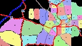
- Numbers to the right of the neighborhood indicate its position on the map above
- "n" is a link to the corresponding neighborhood association
- "h" indicates a link to the homepage of the corresponding historic district (if the neighborhood is one)
Intown Atlanta
Intown AtlantaIntown Atlanta
Intown Atlanta is a term very frequently used in metro Atlanta to designate an area containing parts of the City of Atlanta and bordering communities...
includes Downtown, Midtown, as well as other older east-central neighborhoods
Downtown
Downtown AtlantaDowntown Atlanta
Downtown Atlanta is the first and largest of the three financial districts in the city of Atlanta. Downtown Atlanta is the location of many corporate or regional headquarters, city, county, state and federal government facilities, sporting facilities, and is the central tourist attraction of the city...
n is a neighborhood that contains the following sub-districts:
- Castleberry HillCastleberry HillCastleberry Hill is a neighborhood in central Atlanta, Georgia located adjacent to and southwest of the Central Business District. It is a federally recognized historic district since 1985 and became a City of Atlanta Landmark District in 2006...
n h - Centennial HillCentennial HillCentennial Hill is an urban district located at the northern edge of Downtown Atlanta, Georgia. The name was originally coined by Hines Interests and applied only to their planned development in the area. Although the development was never started and the land later sold, the name remained and...
- Fairlie-PoplarFairlie-PoplarThe Fairlie-Poplar Historic District is part of the central business district in downtown Atlanta. It is named for the two streets that cross at its center, northeast-only Fairlie and southeast-only Poplar. Fairlie-Poplar is immediately north of Five Points, the definitive centerpoint and...
district h - Five PointsFive Points (Atlanta)Five Points is a district of Atlanta, Georgia, United States, the primary reference for the downtown area. The name refers to the convergence of Marietta Street, Edgewood Avenue, Decatur Street, and two legs of Peachtree Street Five Points is a district of Atlanta, Georgia, United States, the...
district - Hotel DistrictHotel DistrictThe Hotel District is a neighborhood in Downtown Atlanta, Georgia, United States, located north of Five Points. The district's name is derived from it being the home to many hotels, one of them being the famous Westin Peachtree Plaza Hotel....
h - Peachtree CenterPeachtree CenterPeachtree Center is a multi-block neighborhood located in Downtown Atlanta, Georgia. Most of the buildings that make up the district were designed by Atlanta architect John C. Portman, Jr.. Many of the buildings are connected by a network of enclosed pedestrian sky bridges...
- SoNoSoNo (Atlanta)SoNo is an urban sub-district of Downtown Atlanta, Georgia, part of Midtown. Much of the area originally consisted of slum areas such as Buttermilk Bottom, which were razed for urban redevelopment projects in the 1960s...
n - South DowntownSouth DowntownSouth Downtown is an urban sub-district of Downtown Atlanta, Georgia, United States, north of I-20, east of Castleberry Hill, south of Five Points, and west of I-85. According to CAP/ADID, South Downtown is one of the oldest sections of Downtown Atlanta...
Midtown
MidtownMidtown Atlanta
Midtown is the second largest financial district in the city of Atlanta, Georgia, situated between the commercial and financial districts of Downtown and SoNo to the south and the affluent residential and commercial district of Buckhead to the north...
, as defined by the Midtown Alliance, consists of these neighborhoods:
- The MidtownMidtown AtlantaMidtown is the second largest financial district in the city of Atlanta, Georgia, situated between the commercial and financial districts of Downtown and SoNo to the south and the affluent residential and commercial district of Buckhead to the north...
neighborhood proper which contains the districts: - Atlantic StationAtlantic StationAtlantic Station is a large brownfield redevelopment project at the northwestern edge of Midtown Atlanta, Georgia. Atlantic Station is being master developed by AIG Global Real Estate and local development partner Jacoby Development, Inc...
n - Eastern Home ParkHome Park (Atlanta)Home Park is a neighborhood of Atlanta, north of Georgia Tech roughly between 10th Street, Northside Drive , 16th Street, and I-75/85 in Atlanta, Georgia...
- Georgia TechGeorgia Institute of TechnologyThe Georgia Institute of Technology is a public research university in Atlanta, Georgia, in the United States...
and Technology SquareTechnology SquareTechnology Square, commonly called Tech Square, is a mixed-use district on the block of Fifth Street between the Downtown Connector and Spring Street in Atlanta, Georgia. Announced in 2000 and opened in 2003, the district was built over previously vacant surface parking lots and has contributed to... - Loring HeightsLoring HeightsLoring Heights is a neighborhood of just over 300 homes located in Midtown Atlanta, nestled between Peachtree Street, Northside Drive, and Atlantic Station. The neighborhood provides relatively easy access to I-75/85, GA 400, and I-285.-External links:*...
n - Sherwood ForestSherwood Forest (Atlanta)Sherwood Forest is a neighborhood of Atlanta, Georgia, bordered by the Ansley Park neighborhood on the south and east, and on the northwest by the Downtown Connector across which is the Brookwood Hills neighborhood. It was established in 1949. It is one of the most affluent neighborhoods of the...
n
West Midtown (also known as Westside)
West Midtown is an unofficial area whose definition varies, and includes:- Berkeley ParkBerkeley ParkBerkeley Park is a neighborhood located in northwest Atlanta, Georgia, located within Midtown West.The neighborhood was established in 1921 and was for a time considered a part of Underwood Hills...
- BlandtownBlandtownBlandtown is a neighborhood of the West Midtown area of Atlanta, Georgia. It is located along either side of Huff Road from Howell Mill Road west to Marietta Blvd. It was one of the first black settlements around Atlanta after the Civil War...
- Western Home ParkHome Park (Atlanta)Home Park is a neighborhood of Atlanta, north of Georgia Tech roughly between 10th Street, Northside Drive , 16th Street, and I-75/85 in Atlanta, Georgia...
- Knight Park/Howell StationHowell StationKnight Park-Howell Station, also known as Howell Station Historic District orKnight Park Historic District, is a historic neighborhood in West Midtown, Atlanta, Georgia. Almost all buildings in the area were destroyed in the American Civil War, in Sherman's March to the Sea, so all buildings in...
- Marietta Street ArteryMarietta Street ArteryMarietta Street Artery is an officially defined neighborhood of the city of Atlanta, Georgia, part of the West Midtown area of Atlanta, also known as the "Westside"....
Sometimes Bolton and Hills Park are also included (see below: Northwestern Atlanta)
East Side
- Ansley ParkAnsley ParkAnsley Park is an affluent residential neighborhood in Atlanta, Georgia, located just east of Midtown and west of Piedmont Park. One of the first suburban neighborhoods in the city designed for automobiles, it features wide, winding roads rather than the grid pattern typical of older streetcar...
n - Atkins ParkAtkins ParkAtkins Park is an intown neighborhood of Atlanta, Georgia, nestled in the southeast corner of Virginia Highland neighborhood west of Briarcliff Avenue and north of Ponce de Leon Avenue . It consists of just three streets:* St. Louis Place...
n - CabbagetownCabbagetown (Atlanta)Cabbagetown is a neighborhood in Atlanta, Georgia located south of Inman Park, east of Oakland Cemetery, north of Grant Park and west of Reynoldstown. It includes Cabbagetown District, a historic district listed on the U.S...
n h - Candler ParkCandler ParkCandler Park is a 55-acre city park located at 585 Candler Park Drive NE, in Atlanta, Georgia. It is named after Coca-Cola magnate Asa Griggs Candler, who donated this land to the city in 1922...
- Druid HillsDruid Hills, GeorgiaDruid Hills is a community which includes both a census-designated place in unincorporated DeKalb County, Georgia, United States, as well as a neighborhood of the city of Atlanta. The CDP's population was 14,568 at the 2010 census...
(partly in City of Atlanta) - East AtlantaEast AtlantaEast Atlanta is a neighborhood of Atlanta, Georgia in the eastern portion of the city. The term "East Atlanta" is frequently misused to refer to the entire eastern portion of the city located in DeKalb County, roughly 10% of Atlanta's area annexed in 1909...
- East LakeEast Lake (Atlanta)East Lake is a neighborhood of Atlanta, Georgia, situated in DeKalb County.It is the eastern-most of the 238 neighborhoods in the City of Atlanta . East Lake is bordered by:* Knox St./Pharr Rd. and the Decatur neighborhood of Oakhurst to the north;* 1st St...
- EdgewoodEdgewood (Atlanta)Edgewood is a neighborhood located on the east side of Atlanta, Georgia, United States, located approximately three miles east of downtown Atlanta.-History:...
- Grant ParkGrant Park (Atlanta)Grant Park refers to the oldest city park in Atlanta, Georgia, United States, as well as the Victorian neighborhood surrounding it.-Park:Grant Park is the fourth-largest in the city, behind Chastain Park, Freedom Park and Piedmont Park...
n h - Home Park n
- Inman ParkInman ParkInman Park was planned in the late 1880s by Joel Hurt, a civil engineer and real-estate developer who intended to create a rural oasis connected to the city by the first of Atlanta's electric streetcar lines. The East Atlanta Land Company acquired and developed more than 130 acres east of the city...
n h - KirkwoodKirkwood (Atlanta)Kirkwood is a neighborhood in eastern Atlanta, Georgia that was designed by architect, Will Saunders. It is situated entirely in DeKalb County and near Lake Claire, East Lake, and Oakhurst. Kirkwood is bound on the north by DeKalb Avenue and on the south by Memorial Drive...
- Lake ClaireLake Claire (Atlanta)Lake Claire is a neighborhood in eastern Atlanta, Georgia, United States, comprising approximately 1,200 homes. It is entirely in the DeKalb County side of the city, east of Candler Park, north of Kirkwood, west of Decatur, and south of Druid Hills....
- Lindridge-Martin ManorLindridge-Martin ManorLindridge/Martin Manor is an intown neighborhood of Atlanta, Georgia. It consists mostly of the single-family homes located off of Lindbergh Drive in between I-85 and Cheshire Bridge Road. In addition, it includes a small commercial area of three streets west of I-85 bounded by Peachtree Creek,...
n - Morningside-Lenox ParkMorningside-Lenox ParkMorningside/Lenox Park is a residential neighborhood in Atlanta, Georgia founded in 1931. It is located north of Virginia-Highland, east of Ansley Park and west of Druid Hills...
n - OaklandOakland (Atlanta)Oakland is an officially recognized neighborhood of Atlanta consisting of only four blocks...
- Old Fourth WardOld Fourth WardThe Old Fourth Ward, often abbreviated The Fourth Ward or O4W, is a neighborhood stretching east from Downtown Atlanta, Georgia. The Old Fourth Ward is one of the city's most rapidly gentrifying neighborhoods, but is also one of the city's most eclectic, containing a burgeoning nightlife district...
n - Ormewood ParkOrmewood ParkOrmewood Park is a neighborhood located east-southeast within the Downtown Atlanta area of Atlanta, Georgia. Ormewood Park is east of Grant Park, south of Reynoldstown, west of East Atlanta, and north of East Confederate Street....
n - Piedmont HeightsPiedmont Heights (Atlanta)Piedmont Heights is a neighborhood of Atlanta, Georgia, founded in the early 20th century. It is located between the BeltLine on the west across which is the Sherwood Forest neighborhood, I-85 on the north across which is an industrial area , and Piedmont Avenue/Road and Morningside-Lenox Park on...
n - Poncey-HighlandPoncey-HighlandPoncey-Highland is a neighborhood on the east side of Atlanta, Georgia, located south of Virginia-Highland. It so named because it is near the intersection of east/west Ponce de Leon Avenue and north/southwest North Highland Avenue. This Atlanta neighborhood was established between 1905 and 1930,...
n - ReynoldstownReynoldstownReynoldstown is a historic neighborhood on the east side of Atlanta, Georgia, located between the Cabbagetown and Edgewood neighborhoods, north of Memorial Drive...
n - SummerhillSummerhill (Atlanta)Summerhill is a neighborhood directly south of Downtown Atlanta between the Atlanta Zoo and Turner Field. It is bordered by the neighborhoods of Grant Park, Mechanicsville, and Peoplestown. Summerhill is one of 26 Atlanta neighborhoods making up the Atlanta Neighborhood Planning Unit system...
- Sweet AuburnSweet AuburnThe Sweet Auburn Historic District is a historic African-American neighborhood along Auburn Avenue in Atlanta, Georgia. The name Sweet Auburn was coined by John Wesley Dobbs, referring to the "richest Negro street in the world". The Sweet Auburn district includes:*the Martin Luther King, Jr...
h - Virginia-HighlandVirginia-HighlandVirginia-Highland is a neighborhood of Atlanta, Georgia, founded in the early 20th century as a streetcar suburb. It is named after the intersection of Virginia Avenue and North Highland Avenue, the heart of a busy commercial district at the center of the neighborhood. The neighborhood is famous...
n - Little Five PointsLittle Five PointsLittle Five Points is a district of Atlanta, Georgia, United States, 2½ miles east of downtown. It was established in the early 1900s as the commercial district for the adjacent Inman Park and Candler Park neighborhoods to the west and east...
(non-residential district located at the juncture of the Inman ParkInman ParkInman Park was planned in the late 1880s by Joel Hurt, a civil engineer and real-estate developer who intended to create a rural oasis connected to the city by the first of Atlanta's electric streetcar lines. The East Atlanta Land Company acquired and developed more than 130 acres east of the city...
and Candler ParkCandler ParkCandler Park is a 55-acre city park located at 585 Candler Park Drive NE, in Atlanta, Georgia. It is named after Coca-Cola magnate Asa Griggs Candler, who donated this land to the city in 1922...
neighborhoods)
Southeastern Atlanta
- Amal Heights
- Benteen ParkBenteen ParkBenteen Park is a neighborhood in southeast Atlanta, Georgia, bounded on the west by Boulevard and the Chosewood Park neighborhood, on the north by Boulevard Heights, on the east by Custer/McDonough/Gulce and on the south by Atlanta Federal Prison, which also lies in the Benteen Park...
- Betmar LaVilla
- Blair Villa/Poole Creek
- Boulevard Heights
- Browns Mill Park
- Chosewood ParkChosewood ParkChosewood Park is a neighborhood in southeast Atlanta, Georgia. It is located south of Peoplestown and Grant Park, west of Boulevard Heights and Benteen Park, northwest of Thomasville Heights and the Atlanta federal penitentiary, and northeast of South Atlanta and Lakewood Heights...
- Custer/McDonough/Guice
- Englewood Manor (AHAAtlanta Housing AuthorityAtlanta Housing Authority is organized under Georgia law to develop, acquire, lease and operate affordable housing for low-income families. Today, AHA is the largest housing agency in Georgia and one of the largest in the nation, serving approximately 50,000 people.-AHA model:In 1996, AHA created...
property demolished 2008) - Glenrose Heights
- High Point
- JoylandJoyland (Atlanta)Joyland is a neighborhood of small, single family homes in southeast Atlanta, Georgia and site of a former 1921 amusement park built for African Americans....
- Lakewood
- Lakewood HeightsLakewood Heights (Atlanta)Lakewood Heights is a neighborhood in southeast Atlanta. It is bounded by:* the Betmar LaVilla, the Villages at Carver, and South Atlanta neighborhoods on the north,* the Chosewood Park neighborhood on the northeast,...
- Leila Valley (AHAAtlanta Housing AuthorityAtlanta Housing Authority is organized under Georgia law to develop, acquire, lease and operate affordable housing for low-income families. Today, AHA is the largest housing agency in Georgia and one of the largest in the nation, serving approximately 50,000 people.-AHA model:In 1996, AHA created...
property demolished 2008) - Norwood Manor
- Orchard Knob
- Polar Rock
- Rebel Valley Forest
- Rosedale Heights
- South AtlantaSouth AtlantaAlthough many Atlantans may refer to the south side of Atlanta, Georgia as "South Atlanta", South Atlanta is in fact an officially defined neighborhood of the city of Atlanta within the south side, and one rich in African-American history...
- South River Gardens
- State Facility
- Swallow Circle/Baywood
- The Villages at Carver
- Thomasville Heights (AHAAtlanta Housing AuthorityAtlanta Housing Authority is organized under Georgia law to develop, acquire, lease and operate affordable housing for low-income families. Today, AHA is the largest housing agency in Georgia and one of the largest in the nation, serving approximately 50,000 people.-AHA model:In 1996, AHA created...
property demolished 2010-11) - Tuxedo Park
- Woodland Hills
Southwestern Atlanta
Also informally known as Cascade or SWATs- Adair ParkAdair ParkThis article includes information collected from the National Park Service website, which, as a U.S. government publication, is in the public domain.Adair Park is a residential neighborhood located southwest of downtown Atlanta...
h - Adams Park
- AdamsvilleAdamsville (Atlanta)Adamsville is a predominantly African-American neighborhood on the west side of Atlanta, Georgia. It's located where I-20 and I-285 meet on the west side.Entertainers Killer Mike, Bone Crusher, and Stevie-the-Steve-Man Corby are from Adamsville....
- Arlington Estates
- Ashley Courts
- Ashview Heights
- Atlanta University Center
- Audubon Forest
- Audubon Forest West
- Baker Hills
- Bakers Ferry
- Beecher Hills
- Ben HillBen Hill (Atlanta)Ben Hill is a neighborhood in the southwestern part of Atlanta, Georgia, United States. Ben Hill is a predominantly black community with many black-owned businesses.-Location:Ben Hill is located within the city limits of Southwest Atlanta...
- Ben Hill Acres
- Ben Hill Forest
- Ben Hill Pines
- Ben Hill Terrace
- Boulder Park
- Brentwood
- Briar Glen
- Bush Mountain
- Butner/Tell
- Campbellton Road
- Capitol View
- Capitol View ManorCapitol View ManorCapitol View Manor is a small community in Southwest Atlanta that was named for the excellent view of the Georgia State Capitol building. Its boundaries include I-75/85 to the east, the Beltline to the north, Metropolitan Parkway to the west, and Atlanta Technical College to the south.-Early...
- Carroll Heights
- Cascade Avenue/Road
- Cascade Green
- Cascade HeightsCascade HeightsCascade Heights is an affluent predominantly African-American neighborhood in southwest Atlanta. Along with Sandtown and other portions of unincorporated South Fulton County, the area has a reputation as having a high concentration of the African-American elite in the city.Cascade Heights, or...
- Chalet Woods
- Collier HeightsCollier HeightsCollier Heights, commonly referred to as "The Historic Collier", is a neighborhood in the City of Atlanta, Georgia, nestled in the southwest corner of Atlanta. Collier Heights is bordered to the west by Fairburn Road, the east by Hamilton E. Holmes Drive, the north by Donald L. Hollowell Highway,...
- Deerwood
- East Ardley Road
- Elmco Estates
- Fairburn
- Fairburn Heights
- Fairburn Road/Wisteria Lane
- Fairburn Tell
- Fairburn Mays
- Fairway Acres
- Florida Heights
- Fort McPherson
- Fort Valley
- Green Acres Valley
- Green Forest Acres
- Greenbriar
- Greenbriar Village
- Hammond Park
- Harland Terrace
- Harris Chiles
- Heritage Valley
- Horseshoe Community
- Huntington
- Ivan Hill
- Just UsJust Us (Atlanta)Just Us is the smallest of the official neighborhoods of Atlanta, consisting of only two streets. It began as the "Fountain Drive-Morris Brown Drive Community Club" in the late 1940s, and evolved into its present name today during the early 1950s. It was established as the first black owned,...
- Kings Forest
- Lake Estates
- Laurens Valley
- Magnum Manor
- Mays
- Meadowbrook Forest
- MechanicsvilleMechanicsville (Atlanta)Mechanicsville is a neighborhood of Atlanta, Georgia. It sits in the shadow of both downtown Atlanta and Turner Field. The neighborhood is bounded by:* I-20 on the north, across which is Castleberry Hill and Downtown Atlanta...
- Mellwood
- Midwest Cascade
- Mt. Gilead Woods
- Niskey Cove
- Niskey Lake
- Oakcliff
- Oakland CityOakland City (Atlanta)Oakland City is a neighborhood in southwestern Atlanta, Georgia, just southwest across the BeltLine from West End and Adair Park.Oakland City was incorporated as a city in 1894 and annexed to Atlanta in 1910....
- Old Fairburn Village
- Old Gordon
- Pamond Park
- PeoplestownPeoplestownPeoplestown is a Victorian streetcar-era neighborhood just south of Turner Field and central Atlanta. It is bounded by:* Ormond Street and the Summerhill neighborhood on the north,* Hill Street and the Grant Park neighborhood on the east,...
- PerkersonPerkerson (Atlanta)The Perkerson neighborhood is located in Southwest Atlanta, Georgia in NPU-X...
- Peyton Forest
- PittsburghPittsburgh (Atlanta)Pittsburgh is a neighborhood of Atlanta, Georgia, founded in 1883 as a black working-class suburb alongside the Pegram rail shops. It was named Pittsburgh because the industrial area reminded one of Pittsburgh, Pennsylvania and its famous steel mills...
- Princeton Lakes
- Regency Trace
- Ridgecrest Forest
- Rue Royal
- Sandlewood Estates
- Southwest
- Sylvan HillsSylvan HillsSylvan Hills is a neighborhood in southwest Atlanta, Georgia.-Boundaries:The neighbourhood is bordered on the north by Deckner Avenue, on the south by Langford Parkway , to the east by Metropolitan Avenue and on the west by Murphy Avenue....
- Tampa Park
- Underwood Hills
- Venetian Hills
- West EndWest End (Atlanta)The West End neighborhood of Atlanta is on the National Register of Historic Places and can be found southwest of Castleberry Hill, east of Westview, west of Adair Park Historic District, and just north of Oakland City...
h - West Manor
- Westhaven
- WestviewWestview (Atlanta)Westview is a historic intown neighborhood located in southwest Atlanta, Georgia. It is named for the Westview Cemetery that borders the neighborhood to the northwest...
- Westwood Terrace
- Wildwood
- Wildwood Forest
- Wilson Mill Meadows
- Wisteria Gardens
Northwestern Atlanta
- Almond Park
- Atlanta Industrial Park
- BankheadBankhead (Atlanta)Bankhead is an Atlanta, Georgia neighborhood located west of downtown Atlanta. It's surrounded by Grove Park to the west, Washington Park and Hunter Hills to the South, Midtown West to the East and Northeast . It is also flanked by Rockdale to the Northwest. At its center is MARTA's Bankhead...
- Bankhead CourtsBankhead CourtsBankhead Courts was a government housing complex located in northwest Atlanta, Ga. Bankhead courts was the location of the famous Atlanta child murders of the 1970s. In 2010, Bankhead Courts was demolished....
(AHAAtlanta Housing AuthorityAtlanta Housing Authority is organized under Georgia law to develop, acquire, lease and operate affordable housing for low-income families. Today, AHA is the largest housing agency in Georgia and one of the largest in the nation, serving approximately 50,000 people.-AHA model:In 1996, AHA created...
property demolished 2010) - Bankhead/Bolton
- Bolton
- Bolton Hills
- Bowen Apartments
- Brookview Heights
- Carey Park
- Carver Hills
- Center HillCenter Hill (Atlanta)Center Hill is a neighborhood located in northwest Atlanta, Georgia. Center Hill is centered around Donald L. Hollowell Highway, Hamilton E. Holmes Drive, and Simpson Road.-Public:Williams Elementary SchoolBenjamin S. Carson Honors Preparatory School...
- Chattahoochee
- Dixie Hills
- English AvenueEnglish Avenue (Atlanta)The English Avenue is a neighborhood of Atlanta just west of the Georgia Dome and Downtown Atlanta. It is bordered:* on the east by Gray St., the Southern Railway North Avenue Yards Historic District and Downtown Atlanta...
- English Park
- Grove ParkGrove Park (Atlanta)Grove Park is a northwest Atlanta, inside-the-perimeter neighborhood bounded by:* Center Hill on the west* Dixie Hills, West Lake, and Hunter Hills on the south* Bankhead on the east* Almond Park, West Highlands and Rockdale to the north- History :...
- Harvel Homes
- Hills Park
- Hunter HillsHunter HillsHunter Hills is a neighborhood located west of downtown Atlanta, Georgia, United States. Its motto, "One Community, One Family", has been its cornerstone since 2001. The neighborhood is encompassed in the 30314 zip code. Hunter Hills shares borders with Mozley Park, Dixie Hills and West Lake...
- Knight Park/Howell Station h
- Monroe Heights(45)
- Mozley ParkMozley ParkMozley Park is a typical early 20th-century residential neighborhood, located approximately three miles west of downtown Atlanta. The community is named after the original landowner, Dr...
h - Penelope Neighbors
- RiversideRiverside (Atlanta)Riverside is an intown neighborhood located in northwest Atlanta, Georgia. It is so named because it is situated along the Chattahoochee River.-Location:...
- Rockdale
- Scotts Crossing
- Vine City
- Washington Park h
- West Highlands (includes Perry Homes)
- West LakeWest Lake (MARTA station)West Lake is an at-grade metro station on the Blue Line of the Metropolitan Atlanta Rapid Transit Authority rail system. It serves the area near Westview Cemetery. The station is located between West Lake & Anderson Avenues in West Atlanta...
- Whittier Mill VillageWhittier Mill VillageWhittier Mill is a historic district in the far northwest corner of the city of Atlanta. The mill and the adjacent village were founded in 1895. The area is a good example of a Southern mill and village. Only remnants of the mill remain...
Buckhead
- Ardmore
- Argonne Forest
- Arden/Habersham
- BrookhavenBrookhaven (Atlanta)Brookhaven is an unincorporated community located on the western edge of DeKalb County, Georgia, United States, directly northeast of Atlanta. Most of the area was formerly incorporated as the city of North Atlanta, which disincorporated during the 1960s...
- Buckhead ForestBuckhead ForestBuckhead Forest is a neighborhood of 165 homes in the Buckhead Community of Atlanta, Georgia.It is bounded by:* Peachtree Road and Buckhead Village on the southeast* Roswell Road and South Tuxedo Park on the west...
- Brandon
- Brookwood
- Brookwood HillsBrookwood HillsBrookwood Hills is an historic neighborhood located in intown Atlanta, Georgia, USA, north of Midtown and south-southwest of Buckhead. Home to about 1000 people, it was founded in the early 1920s by Benjamin Franklin Burdett and his son, Arthur...
- Buckhead ForestBuckhead ForestBuckhead Forest is a neighborhood of 165 homes in the Buckhead Community of Atlanta, Georgia.It is bounded by:* Peachtree Road and Buckhead Village on the southeast* Roswell Road and South Tuxedo Park on the west...
- Castlewood
- Channing Valley (also includes Memorial Park)
- Chastain Park
- Collier HillsCollier HillsCollier Hills is an historic residential neighborhood in Atlanta, Georgia. The neighborhood was founded in 1941. Collier Hills rests on the border between the Buckhead district of Atlanta and the Midtown district of Atlanta...
(also includes Brookwood HillsBrookwood HillsBrookwood Hills is an historic neighborhood located in intown Atlanta, Georgia, USA, north of Midtown and south-southwest of Buckhead. Home to about 1000 people, it was founded in the early 1920s by Benjamin Franklin Burdett and his son, Arthur...
) - Colonial Homes
- East Chastain Park
- Garden HillsGarden HillsGarden Hills is an Atlanta, Georgia neighborhood between Peachtree and Piedmont Roads, bordered on the north by Pharr Road and on the south by Lindbergh Road. In 1987 the neighborhood was given historic district status by the city of Atlanta....
- Haynes Manor
- Historic Brookhaven
- Kingswood
- Lindbergh/Morosgo
- Margaret MitchellMargaret Mitchell (Atlanta neighborhood)Margaret Mitchell is a neighborhood in the Buckhead Community, in the northwest part of the city of Atlanta, Georgia. It is bounded by Moore's Mill Road on the south, I-75 on the east, and the Paces neighborhood on the west....
- Mount Paran/Northside
- Mount Paran Parkway
- North BuckheadNorth BuckheadNorth Buckhead is a neighborhood in the Buckhead Community, at the northern edge of the city of Atlanta, Georgia and is one of Atlanta's most affluent neighborhoods.It is bounded by:* Roswell Road and the East Chastain Park neighborhood on the west...
- PacesPaces (Atlanta)Paces is a neighborhood of Atlanta. It is part of the Buckhead district and located in the far northwest corner of the city. Paces is bounded on the northwest by the Chattahoochee River, which is also the Cobb/Fulton county line...
- Peachtree Heights East
- Peachtree Heights West
- Peachtree HillsPeachtree HillsPeachtree Hills is a neighborhood in the Buckhead Community of Atlanta, Georgia.It is bordered by Peachtree Road on the west, and the MARTA north-south rail line separates it from Lindbergh on the east...
- Peachtree ParkPeachtree ParkPeachtree Park is a neighborhood in the Buckhead Community of Atlanta, Georgia.It is bounded by:* Peachtree Road and North Buckhead on the northwest* Georgia 400 and Lenox Square and Pine Hills on the east...
- Pine HillsPine Hills (Atlanta)Pine Hills is a neighborhood of Atlanta, Georgia and also part of the Buckhead Community, located in north east Atlanta on the eastern part of Buckhead. It is roughly bounded by Buford Highway to the south, the railway to the north, Lenox Road to the west and East Roxboro Road to the east...
- Pleasant Hill
- Randall Mill
- Ridgedale Park
- Springlake
- South Tuxedo Park
- Tuxedo Park
- Underwood Hills
- West Paces Ferry/Northside
- Westminister/Milmar
- West Peachtree Battle (Known as Wesley Battle by city government)
- Whitewater Creek
- Wildwood
- Woodfield
- Wyngate
External links
- http://www.atlantaga.gov/government/planning/npu_system.aspx
- List of Atlanta Neighborhood Associations